|
|
Post by topshot on Aug 28, 2015 11:31:50 GMT -8
My wife has indicated she'd like to join us (the boys and I) on our vacation next year but is not in very good shape (she had trouble going uphill in the Smokies) so I'm looking at two possibilities, one of which is to obviously minimize the elevation gain or at least the steepness of the gain as she can do fine on level or little grade. Thus, I'm trying to find a long loop (or out and back if need be) with few to no steep passes that stays up high a fair bit in NM, CO or WY. What are your suggestions?
I made a separate post about the other possibility.
And, yes, I'll be trying to encourage her to increase her fitness level but that's not worked out in the past. LOL
|
|
BigLoad
Trail Wise!
Pancakes!
Posts: 12,939  Member is Online
|
Post by BigLoad on Aug 28, 2015 11:50:43 GMT -8
The laws of erosion and topology dictate that nothing can stay mostly above the treeline for very long. Even the crest of a range will have a lot of ups and downs, usually more than a traverse along the side, where you can trade the ups and downs for much longer ins and outs.
|
|
|
|
Post by topshot on Aug 28, 2015 12:03:21 GMT -8
I was just trying to indicate my desire to not be in trees most of the day.  Ideas I have are the Beartooth Plateau as I've read it's quite large and being a plateau should be "relatively" flat and the north central Wind River Range where you can stay at 9500-10500 for a good size loop. I've been to the latter twice. The few other places I've been so far would not be suitable. |
|
desert dweller
Trail Wise!
Power to the Peaceful...Hate does not create.
Posts: 6,291
|
Post by desert dweller on Aug 28, 2015 13:38:52 GMT -8
Kings Peak area in the Uinta Mountains of northern Utah has several lakes right at treeline. It's about a 11 mile walk in.
|
|
|
|
Post by swimswithtrout on Aug 28, 2015 17:30:52 GMT -8
Ideas I have are the Beartooth Plateau as I've read it's quite large and being a plateau should be "relatively" flat and the north central Wind River Range where you can stay at 9500-10500 for a good size loop. I've been to the latter twice. Both are "relatively" flat, but the BT Plateau is actually quite small, by comparison, maybe 10 mi W X 30 mi long , and is essentially all off trail hiking, over some pretty harsh terrain. Figure on 5-6 mi a day max. Starting from Island Lk, W of Cooke City, just off the Beartooth Hwy gives you the most bang for the buck for a short out/back. For extended hiking above timberline in the Winds, your best bet would the spectacular loop (that would require a shuttle) starting from Elkhart Park TH, to Island Lk, Jean Lk, Elbow Lk, Summit Lk, the No Names and Cutthroat Lks and than down the slope to the Glimpse Lk TH or the New Fork Lks TH. That should give you the longest expanse of tundra I can think of in the Winds, without a "significant" pass crossing and would fit the bill perfectly if you can swing the shuttle. |
|
BigLoad
Trail Wise!
Pancakes!
Posts: 12,939
Member is Online
|
Post by BigLoad on Aug 28, 2015 18:06:50 GMT -8
One alpine realm one can reach with the most air and least misery is the Wallowa Mountains in eastern OR (Eagle Cap Wilderness). The approaches are long, gradual glacier valleys, and there is a nice loop hike between lakes near the treeline that you can easily stretch into a couple days.
|
|
|
|
Post by swimswithtrout on Aug 28, 2015 18:36:28 GMT -8
the BT Plateau is actually quite small, by comparison, maybe 10 mi W X 30 mi long , and is essentially all off trail hiking, over some pretty harsh terrain. Figure on 5-6 mi a day max. Looking north from "midway" of the plateau. 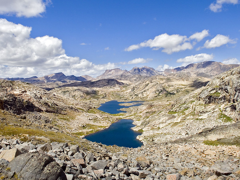 Looking south from "midway" but a bit compressed by using my tele-lens 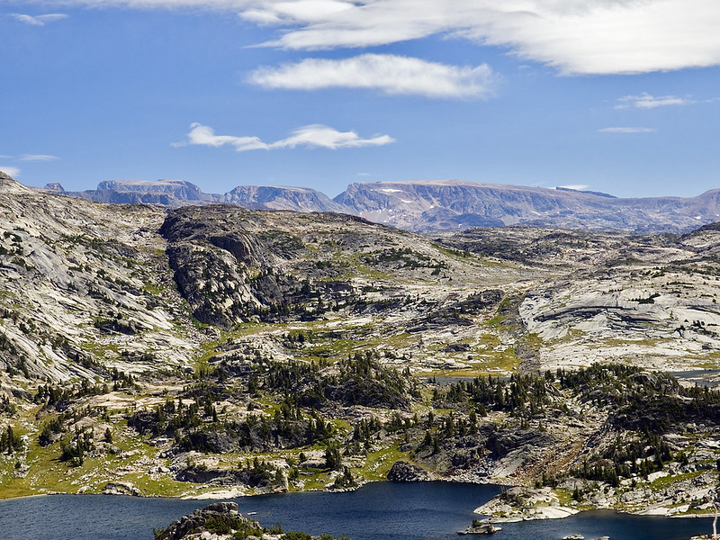 This is what it looks like, from down in the pits, with my ever suffering wife as scale model. 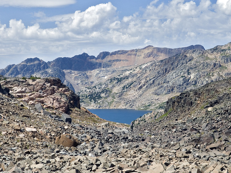 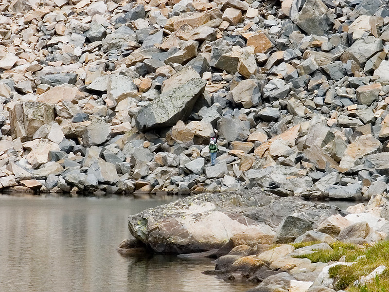 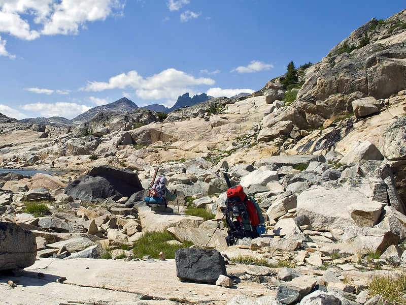 |
|
BigLoad
Trail Wise!
Pancakes!
Posts: 12,939
Member is Online
|
Post by BigLoad on Aug 28, 2015 18:50:43 GMT -8
Crossing that talus would be a grind.
|
|
|
|
Post by topshot on Aug 28, 2015 19:19:32 GMT -8
Crossing that talus would be a grind. I would have a blast there! Thanks for those pics, SWT. But definitely not for my wife so scratch that one. I guess the pics I was thinking of are more toward the Tetons maybe? It was a huge grassy plateau. Will have to see if I can find that trip report again. ETA: Pretty sure it was the Buffalo Plateau in the Teton Wilderness. |
|
|
|
Post by swimswithtrout on Aug 28, 2015 20:52:40 GMT -8
I guess the pics I was thinking of are more toward the Tetons maybe? It was a huge grassy plateau. Will have to see if I can find that trip report again. ETA: Pretty sure it was the Buffalo Plateau in the Teton Wilderness. Yes, that's DC's country and I believe Dorf has posted a few TR's from there. He has the photos on his FB page as well. But I'd rather be on a plateau, in the mountains rather than gazing at them 30-40 mi away.  |
|
|
|
Post by hikerjer on Aug 29, 2015 12:43:47 GMT -8
I'd suggest the Lake Plateau in the Absoraka-Beartooth Wilderness in southern Montana. Still very high but a little more gentle than SWT's area (although that's my favorite country) and it has plenty of trails and lakes to keep you and your wife happy
|
|
Deleted
Deleted Member
Posts: 0
|
Post by Deleted on Aug 30, 2015 7:58:56 GMT -8
The Flattops and the cabins at Trappers Lake allow for lots of loops and fairly reasonable hiking once you get to the top. Getting to the lake is a bit of a chore but it's just a long dirt road. A sedan would is all u need.
|
|
idahobob
Trail Wise!
many are cold, but few are frozen
Posts: 198
|
Post by idahobob on Nov 16, 2015 12:20:18 GMT -8
I'd second the recommendation to the Uintas. You start out pretty high, but the elevation gain is pretty minimal. The altitude itself takes some getting used to, so the better fitness level the easier the trip. Our Uinta trip report. Another place that has minimal elevation gain, but maximum alpine scenery is the Titcombe Basin in the Wind Rivers. Again, it starts high, and stays high, with little elevation gain. Titcombe Basin trip report. Another low elevation gain trip: Saddlebag Lake area from Tuollomne Pass. and another; Horseshoe Meadows at the extreme southern end of the Sierra. |
|
walkswithblackflies
Trail Wise!
Resident terrorist-supporting eco-freak bootlicker
Posts: 6,934
|
Post by walkswithblackflies on Nov 17, 2015 9:19:37 GMT -8
|
|
|
|
Post by Lamebeaver on Nov 18, 2015 7:42:49 GMT -8
You've gotten some good suggestions, but what your asking for is difficult for the following reasons
1. Spending 5-7 days above treeline without crossing difficult terrain or significant gains is hard to find
2. Ditto with loop trips, typically the first 1/2 of the trip is heading up, and then the 2nd half is heading down.
3. If you're not in shape, caring a pack at 12K ft on even a gradual grade you will feel the altitude
4. In the summer, I would be concerned about lightning spending all that time above tree line. Some of the previous respondents have done trips like this, but the have a lot of experience picking campsites to minimize the risk.
My suggestion would be to backpack in to a base camp and then do various day-trips from there. If you wife gets tires, she can simply hike back (downhill) to camp. Hiking is also a lot easier if you're not carrying a full pack, with several days food.
|
|
 Image Credit / Coolkat