Deleted
Deleted Member
Posts: 0
|
Post by Deleted on Apr 3, 2016 17:29:50 GMT -8
Hello!
I'm embarking on a five-week road trip from the East to West coast, hitting as many nights outside as I can. My last big stop before I swing up to my new home in the Pacific NW is Great Basin NP. I'll be there in late August. I'm a beginner, looking for any tips on good two-night trips. Many thanks!
|
|
|
|
Post by High Sierra Fan on Apr 3, 2016 18:28:18 GMT -8
|
|
zeke
Trail Wise!
Peekaboo slot 2023
Posts: 9,886 
|
Post by zeke on Apr 4, 2016 4:54:40 GMT -8
I have been to Great Basin twice, bu both times were car camping and day hiking. Lehman cave is worth the tour., and it will be good to get into the cool air in Aug.
|
|
bp2go
Trail Wise!
California
Posts: 1,329
|
Post by bp2go on Apr 4, 2016 6:48:51 GMT -8
I'm recalling my favorite trip in Nevada: driving Hwy 50, across state. It's (was?) the "Loneliest Road in America" and I loved it! I had the sense of being one of the first people to cross just after the Ice Age, fully expecting to come across prehistoric beasts foraging! The views in any direction were devoid of any indication that there were any other humans on this planet. Sunny weather but distant virga and even snow falling on distant peaks of the basin and range topography. It was beautiful. Here are some Google terms to search; Nevada Hwy 50 map ( a page of hits with highlights of the road) Nevada Ruby Mountains (a surprising high-mountain range worth knowing about)
Sunset magazine suggests a three-day trip with points of interest:
Timelapse ( a curious video of the drive shown in nine minutes! Spoiler: it looks like it isn't so lonely anymore)
Nevada Bristlecone Pines (A first place to look as you enter Nevada from the east)
Be advised: it's 300+ miles and maybe only one or two gas stations. It's worth the drive. |
|
Westy
Trail Wise!
Diagnosed w/Post-Trail Transition Syndrome
Posts: 1,960
|
Post by Westy on Apr 4, 2016 7:00:24 GMT -8
I was thinking:
Overland Trail Loop Hike - Ruby's 2 nights - Intro to the Ruby's
Mount Moriah Wilderness - Northern Snakes - 2 Nights - 40 acre table above 11,000'
Hike Wheeler Peak - GBNP - Car Camp, Day Hike - 13,000' is 13,000' - has 13 environments from salt flats to alpine
Baker Creek Trailhead Loop Hike - Overnighter - Easy loop showcasing Great Basin environment - 2 peaks to bag
Ibapah Peak - Deep Creeks, UT - 2 nights - Might say it's a middle of no where awesomeness check.
Notch Peak, House Range, UT - Car Camp, day hike, 4,000 foot cliff from summit to valley
|
|
whistlepunk
Trail Wise!
I was an award winning honor student once. I have no idea what happened...
Posts: 1,446
|
Post by whistlepunk on Apr 4, 2016 7:29:59 GMT -8
Do not know if the trail has reopened but the Lexington Arch was pretty cool.
The access road and trailhead were closed after a wildfire a few years ago, preventing soil disturbance until recovery.
|
|
whistlepunk
Trail Wise!
I was an award winning honor student once. I have no idea what happened...
Posts: 1,446
|
Post by whistlepunk on Apr 4, 2016 7:33:17 GMT -8
I drive hwy 50 frequently. I do not consider it lonely. Hwy 6 from Tonopah to Ely is lonelier -- 118 miles with no services or facilities of any kind.
|
|
Deleted
Deleted Member
Posts: 0
|
Post by Deleted on Apr 4, 2016 21:32:32 GMT -8
I'm headed to Nevada in July! GBNP is nice - went into Lehman Caves which is pretty. Eureka & Austin are towns on U.S. 50, Ely not far from GBNP, then Fallon on the west side - to Carson City, finally on to Lake Tahoe!
|
|
whistlepunk
Trail Wise!
I was an award winning honor student once. I have no idea what happened...
Posts: 1,446
|
Post by whistlepunk on Apr 5, 2016 8:16:41 GMT -8
Fill up with gas in Ely and you should make it easily to Fallon. Both are good sized cities with full range of services. Eureka and Austin are small towns with only a couple of gas stations, which may or may not be open when you visit. A lot of open space inbetween. Rest areas every once in a while. I like the drive.
50 gets enough traffic so even if something unfortunate happens (mechanical breakdown, et al) another car will be by in a few minutes. Cell phone coverage is spotty. The reputation of loneliest road in America is undeserved. I have been on more desolate highways.
|
|
rebeccad
Trail Wise!
Writing like a maniac
Posts: 12,685 
|
Post by rebeccad on Apr 9, 2016 15:39:30 GMT -8
I drive hwy 50 frequently. I do not consider it lonely. Hwy 6 from Tonopah to Ely is lonelier -- 118 miles with no services or facilities of any kind. Exactly. US 50 glommed the title for publicity, but 6 has always been lonelier. On 50, there is reliable gas in Ely and Fallon as noted, and I'm pretty sure the stations in Austin and Eureka pump 24/7, though I won't swear to it. There is official camping at GBNP, Bob Scott, and Hickison Petroglyphs (worth stopping to take a look at), but there is also legal unofficial camping atop pretty much each pass as you cross the ranges. Carry your own water. Or if you need a shower, the KOA in Ely actually has decent tent sites. The RV parks in Fallon are gawdawful for tenters; go on to the Sierra. In GBNP: I will second the recommendation of car-camping and hiking. We finally climbed Wheeler Peak last summer, and it was good. From the same TH or nearby there is also a loop through the bristlecones. The caves are also good, with 60 and 90 minute tours. There are "low" and high campgrounds; the lowest is just below 8000' and the highest at the TH to the bristlecones and Wheeler Peak, something like 10,000'+. Here's a possible approach: blow in mid-day and nab a site at one of the 3 lower campgrounds, and an afternoon cave tour (I think you may be able to reserve by phone? Look into it--depending on day of the week etc. they aren't always available at the last minute). It will be hot out, so that will be a nice place for the afternoon. Second day, move camp up to the high campground (you'll be in a position to get a site before they fill, something we've never managed). Hike the bristlecone forest in the late afternoon, or even the a.m. if you are fast enough getting up there (or aren't into photography and don't care if the light is good). It's high enough the heat will be okay, and you can spend the day doing a little acclimatizing. Next morning, hit the peak trail early, so you beat the crowds and can enjoy the good light. Assuming you start early and are reasonably brisk, you'll be back down by mid-day (it's an 8 or 9 mile RT but a substantial climb). Pick up an ice-cream cookie sandwich at the Visitor's Center as a reward and continue west. |
|
whistlepunk
Trail Wise!
I was an award winning honor student once. I have no idea what happened...
Posts: 1,446
|
Post by whistlepunk on Apr 9, 2016 18:11:22 GMT -8
We should also note the town of Baker, closest to GBNP, is not much either.
The stretch of Hwy 50 from Delta, UT to the state line is also desolate. No services.
There is a gas station/cafe/mini mart/motel/RV park right on the state line and hwy 50 (Literally! The line goes through the middle of the building.)
|
|
bp2go
Trail Wise!
California
Posts: 1,329
|
Post by bp2go on Apr 10, 2016 6:12:44 GMT -8
Reading these "updated" tips on Hwy 50 makes me think I really hit it right to drive it 15+ years ago! That drive is one of my favorite mental videos because it was so lonely that day! I had been in Tucson for their Mariachi event. It was 100°, I was loving it. I decided to drive home by heading up into Utah for a visit to Bryce, but as I went farher north, the weather was changing, and when I got to Wheeler Peak the snow was changing my plan!
Driving off across Nevada was my option, and it was a wonderful experience. Beautiful wild landscape with clear air and unspoiled views of the rolling basin and range topography, with distant snowy Sierra ahead as my goal. A wonderful day.
I notice that @aliasgrace79 has not returned even once to see if she has any replies! I hope she does eventually find the help. And whatever road she chooses, I hope her cross-country drive is as memorable.
|
|
rebeccad
Trail Wise!
Writing like a maniac
Posts: 12,685
|
Post by rebeccad on Apr 10, 2016 9:04:57 GMT -8
Steve, 50 isn't as lonely as 6, but still--last summer our boys were driving it very early in their learning-to-drive period and there were lots of jokes about the difficulty of "watching 3 cars ahead" as they'd been instructed, given that they couldn't even see one car ahead. It ain't I5.
50 is our route of choice between SF and the Front Range (50 to I70). We have done it probably 20+ times in either direction, in addition to all the variations. You do want to pay attention to gas levels across there, but I don't think you could do on 50 what my husband did alongside 6 back in 93 when he blew a head gasket out there. He stripped down and took a bath on the side of the road, with no fear anyone would come along and catch him at it!
|
|
Westy
Trail Wise!
Diagnosed w/Post-Trail Transition Syndrome
Posts: 1,960
|
Post by Westy on Apr 11, 2016 10:06:42 GMT -8
Authentic Great Basin Lonely Road

|
|
rebeccad
Trail Wise!
Writing like a maniac
Posts: 12,685
|
Post by rebeccad on Apr 11, 2016 12:32:09 GMT -8
Ah. Our efforts in 2011 to drive a lonelier road led to this: 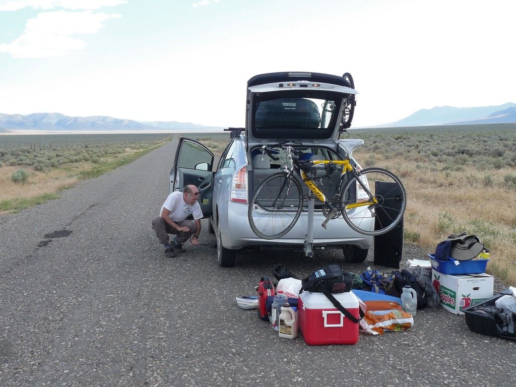 Which in turn led to this bit of road-side camping (on a different lonelier road; we were just holing up to wait until shops in Fallon would open and we could get a new tire): 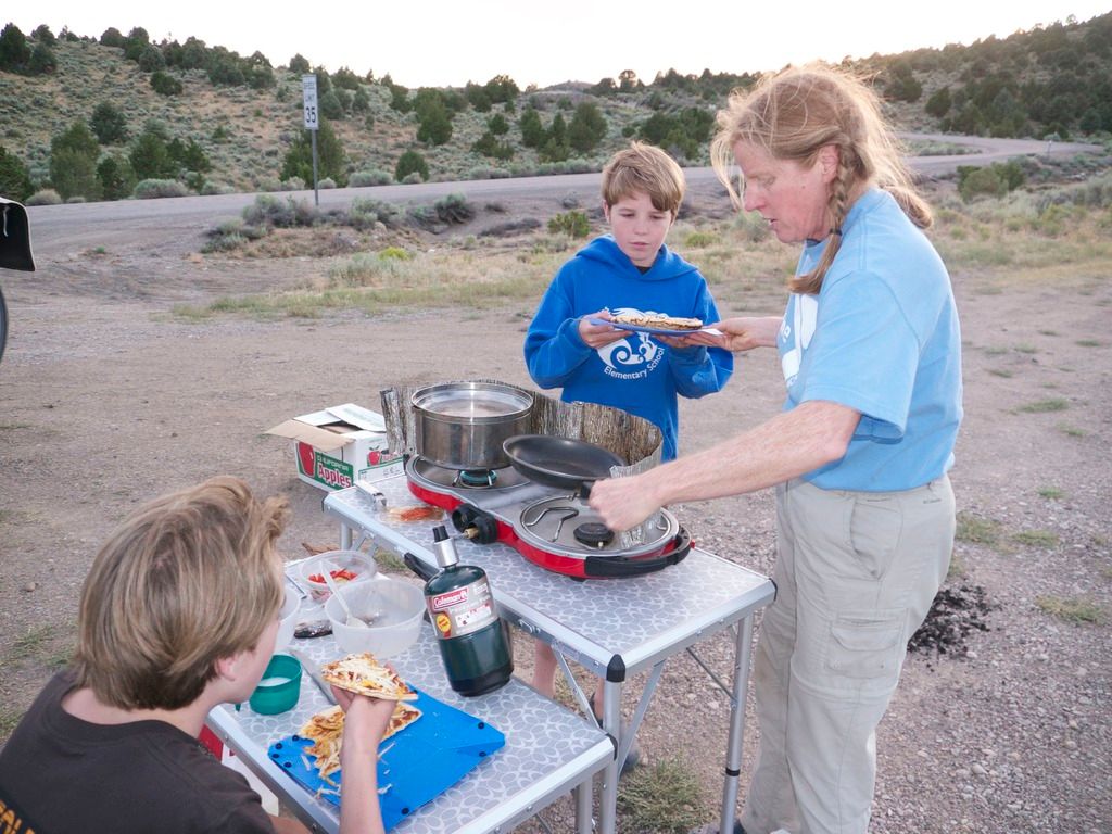 |
|
 Image Credit / Coolkat


