|
|
Post by greeny on Aug 9, 2016 18:35:12 GMT -8
Anyone been in the northern end of the JMT since August 1st? Any snow left (like in the Lyell Glacier area)? How stressed are the water sources?
|
|
rebeccad
Trail Wise!
Writing like a maniac
Posts: 12,685 
|
Post by rebeccad on Aug 9, 2016 20:43:32 GMT -8
We were just in around 1000 Island Lakes 2 weeks ago--came out July 25. Water sources still fine, but snow was pretty nearly gone from all but the most shaded spots. Smaller creeks and run-off rivulets were dry in places. I'd go out on a limb and guess that major water sources are fine, but don't count on a stream every 100 yards. July 23, from Davis Peak looking over Davis Lake to Donohue Pass. You can see it's pretty snow-free. 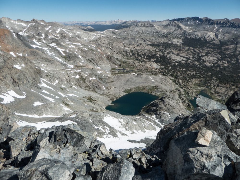 Same day. This is either Lyell Peak or a neighbor. Of course, the glacier is on the other side out of sight, but you can see that snow is sparse. We did have to cross some snowfields climbing North Glacier Pass, but not much.  |
|
|
|
Post by greeny on Aug 9, 2016 22:10:53 GMT -8
Then I'm guessing the few river crossings are pretty lightweight?
|
|
almostthere
Trail Wise!
putting on my hiking shoes....
Posts: 696
|
Post by almostthere on Aug 11, 2016 6:41:22 GMT -8
There are bridges...
Stream crossings should be easy.
|
|
|
|
Post by High Sierra Fan on Aug 11, 2016 20:40:31 GMT -8
At this point in flow anything looking daunting just takes a bit of patience: upstream or downstream will be a better crossing. A big log or more rocks.
Rafting season is over in the Valley. Flow is waning.
Intermittent streams are drying.
|
|
 Image Credit / Coolkat


