Dolly Sods traverse (West Virginia, 6/18/'16)
Jun 19, 2016 12:44:38 GMT -8
rwtb123 and melsdad like this
Post by GaliWalker on Jun 19, 2016 12:44:38 GMT -8
June 18, 2016: Dolly Sods traverse
Route:
- Going out: Red Creek Trail > Blackbird Knob Trail > Upper Red Creek Trail > Dobbins Grade Trail > Beaver View Trail > Raven Ridge Trail
- Coming in: Rocky Ridge Trail > Blackbird Knob Trail > Big Stonecoal Trail > Rocky Point Trail > Lion's Head > Rocky Point Trail > Big Stonecoal Trail > Red Creek Trail
Stats:
- Distance: 22.5mi
- Elevation gain: ~3,550ft
- Hiking/photography time: 11hr 40min
- Total trip time (house-house): 19.5hrs
With summer almost upon us it was time to make a Dolly Sods visit. So what if I'd hiked all the trails on my loop in the past? The forecast was for a beautiful sunny day, and there would be plenty of daylight hours available to take my time and linger through the entire area.
I left Pittsburgh at 2:30am, already licking my chops at the opportunity to spend the entire day photographing and hiking. I got a bit of a surprise when I reached the Red Creek Trailhead: even though it was a little shy of 6:00am the parking lot was overflowing. I'd never seen so many people at a trailhead in West Virginia before. Pretty soon I realized that I had picked the day of the Highlands Sky 40 Mile Trail Run, and that I would be combing ultramarathoners out of my hair in Upper Dolly Sods. (Thankfully, the ultras had to head up Flatrock/Roaring Plains first and by the time I met up with them they were well strung out and no real bother.)
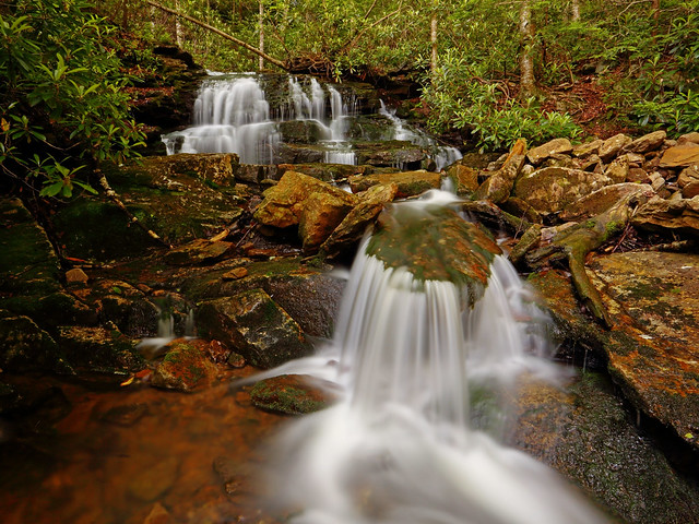
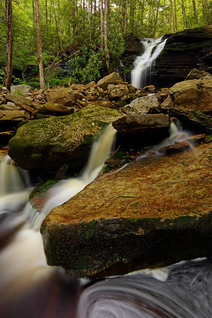
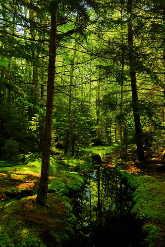
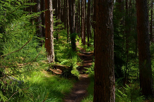
A quiet start beside scenic Red Creek was the complete antithesis of the mob scene at the trailhead. Within the first 10min I was in another world, with only the beautiful stream and lush green forest for company. The creeks and dense forest are the defining features of the lower Dolly Sods region. The lonesome hiking continued until I reached the first crossing of Red Creek. Numerous backpackers were camped here, as expected, but it remained quiet and serene. I made the short side trip to Red Creek Falls first, before embarking on the ford of Red Creek.
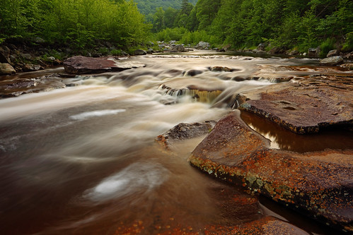
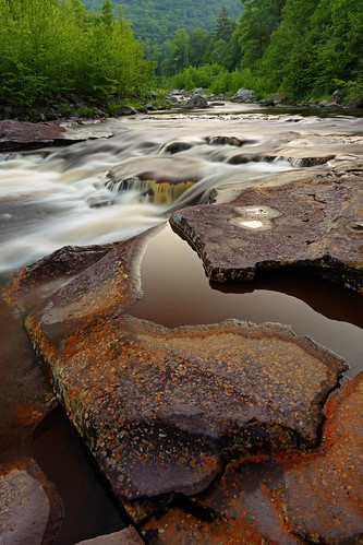
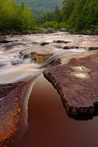
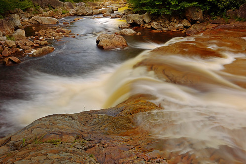
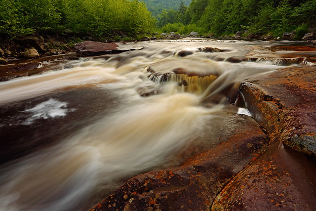
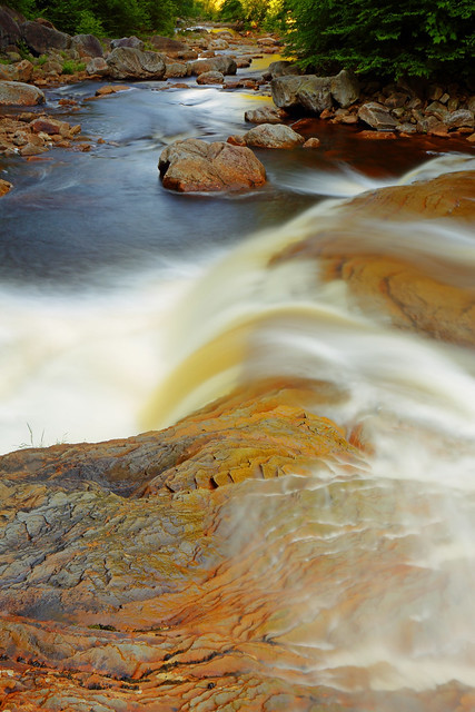
Red Creek Falls
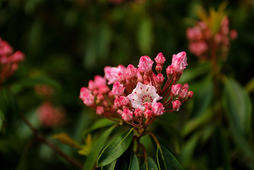
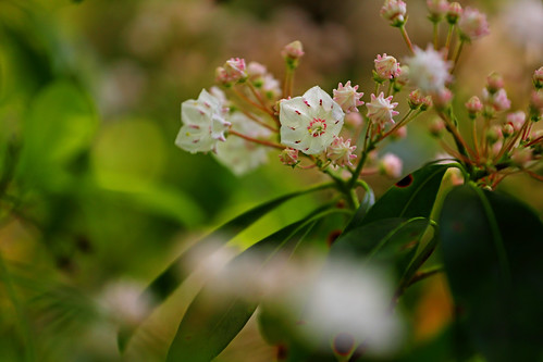
The sun dappled forest was really beautiful. After a rock hopped crossing of Red Creek at the Forks there was a particularly beautiful spot, which was quite magical. June is a fantastic time for Dolly Sods' mountain laurel display. From this point onwards a sustained showing would entertain me throughout my upper Dolly Sods ramblings.
Magic spot
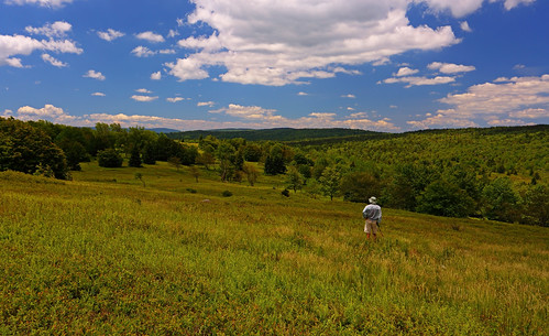
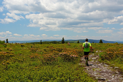
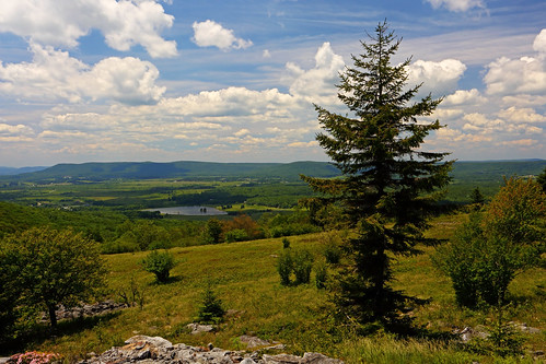
After the Forks a short climb took me out of lower Dolly Sods, to deposit me in upper Dolly Sods. I feasted on the dramatically open terrain and views galore. Upon hitting Raven Ridge I began to run into the ultras I had conveniently forgotten all about. However, it was such a gorgeous day and they were strung out enough that it wasn't an issue at all.
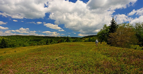
GaliWalker wandering through Dolly Sods
Ultras
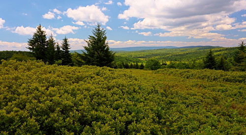
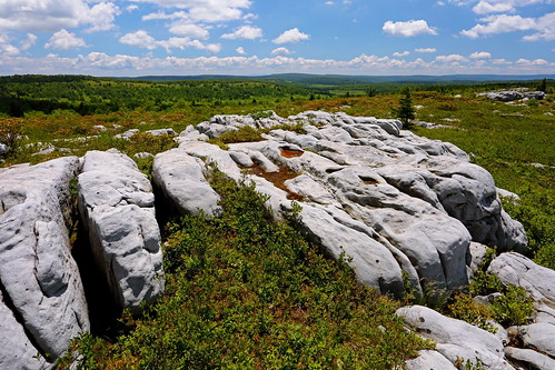
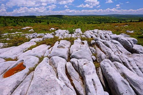
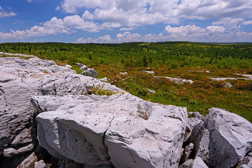
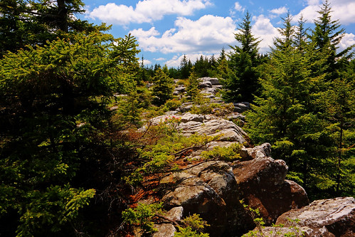
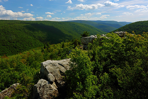
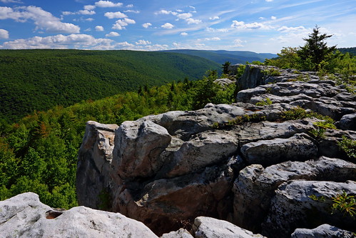
The 3mi long Rocky Ridge section is one of my favorites in Dolly Sods. Interesting rock formations, sustained views and a mountain laurel extravaganza kept the enjoyment level in overdrive.
On the return via the Big Stonecoal Trail, I was pleased to see that despite taking my time and not letting my photography take much of a back seat to the hiking, I still had enough left in the tank (both time and energy level wise) to tuck in the 1.6mi side trip to Lion's Head, for one final set of views.

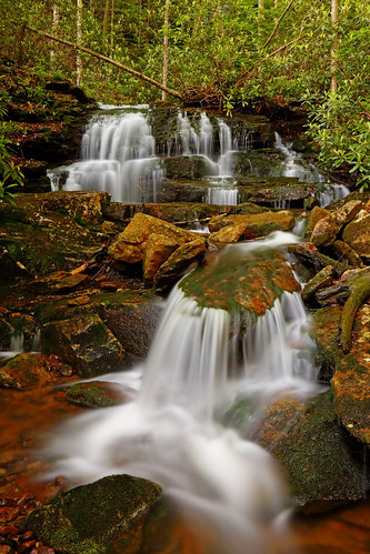
After Lion's Head, it was a steep descent alongside Stonecoal Run, a final crossing of Red Creek, and then a level walk back to the car. What a magnificent day!
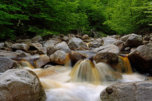
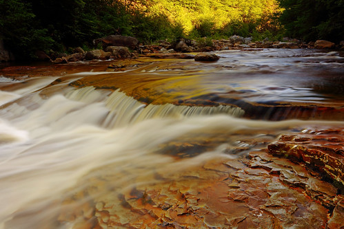
Stonecoal Run
Route:
- Going out: Red Creek Trail > Blackbird Knob Trail > Upper Red Creek Trail > Dobbins Grade Trail > Beaver View Trail > Raven Ridge Trail
- Coming in: Rocky Ridge Trail > Blackbird Knob Trail > Big Stonecoal Trail > Rocky Point Trail > Lion's Head > Rocky Point Trail > Big Stonecoal Trail > Red Creek Trail
Stats:
- Distance: 22.5mi
- Elevation gain: ~3,550ft
- Hiking/photography time: 11hr 40min
- Total trip time (house-house): 19.5hrs
With summer almost upon us it was time to make a Dolly Sods visit. So what if I'd hiked all the trails on my loop in the past? The forecast was for a beautiful sunny day, and there would be plenty of daylight hours available to take my time and linger through the entire area.
I left Pittsburgh at 2:30am, already licking my chops at the opportunity to spend the entire day photographing and hiking. I got a bit of a surprise when I reached the Red Creek Trailhead: even though it was a little shy of 6:00am the parking lot was overflowing. I'd never seen so many people at a trailhead in West Virginia before. Pretty soon I realized that I had picked the day of the Highlands Sky 40 Mile Trail Run, and that I would be combing ultramarathoners out of my hair in Upper Dolly Sods. (Thankfully, the ultras had to head up Flatrock/Roaring Plains first and by the time I met up with them they were well strung out and no real bother.)
A quiet start beside scenic Red Creek was the complete antithesis of the mob scene at the trailhead. Within the first 10min I was in another world, with only the beautiful stream and lush green forest for company. The creeks and dense forest are the defining features of the lower Dolly Sods region. The lonesome hiking continued until I reached the first crossing of Red Creek. Numerous backpackers were camped here, as expected, but it remained quiet and serene. I made the short side trip to Red Creek Falls first, before embarking on the ford of Red Creek.
Red Creek Falls
The sun dappled forest was really beautiful. After a rock hopped crossing of Red Creek at the Forks there was a particularly beautiful spot, which was quite magical. June is a fantastic time for Dolly Sods' mountain laurel display. From this point onwards a sustained showing would entertain me throughout my upper Dolly Sods ramblings.
Magic spot
After the Forks a short climb took me out of lower Dolly Sods, to deposit me in upper Dolly Sods. I feasted on the dramatically open terrain and views galore. Upon hitting Raven Ridge I began to run into the ultras I had conveniently forgotten all about. However, it was such a gorgeous day and they were strung out enough that it wasn't an issue at all.
GaliWalker wandering through Dolly Sods
Ultras
The 3mi long Rocky Ridge section is one of my favorites in Dolly Sods. Interesting rock formations, sustained views and a mountain laurel extravaganza kept the enjoyment level in overdrive.
On the return via the Big Stonecoal Trail, I was pleased to see that despite taking my time and not letting my photography take much of a back seat to the hiking, I still had enough left in the tank (both time and energy level wise) to tuck in the 1.6mi side trip to Lion's Head, for one final set of views.
After Lion's Head, it was a steep descent alongside Stonecoal Run, a final crossing of Red Creek, and then a level walk back to the car. What a magnificent day!
Stonecoal Run