

Post by GaliWalker on May 22, 2016 7:37:01 GMT -8
Return to Haystack Knob (West Virginia, 5/21/16)
Hiking/photography stats: ~20.5mi, ~4000ft elevation gain, 10.75hrs
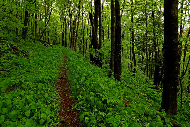
Moisture...everywhere and all the time - that was the overriding theme of this hike. Non-stop rain, mist, damp vegetation and watery/muddy trails were the culprits, dogging my every move. On the plus side, the lush greenery on display was incredible and mist provided a special, intimate atmosphere.
Haystack Knob is a bump near the south end of the Roaring Plains high-altitude plateau. Just five months ago, during the short winter months, I made my first trip to this viewpoint. That time my approach led me to the southern-most point of Haystack Knob. The views to the south, east and west were great, but the one to the north was partly filtered, and not quite what I had seen photos of. Even at the time I realized that I needed to work my way further north along the Knob, but what looked like difficult to penetrate brush and fewer available daylight hours made me abandon this plan. So, with the longer summer days it was high time that I made a return visit to finish what I'd started.
The day began with a 2:30am start from the house. The drive was slow because of heavy rainfall, so it was 6:30am by the time I got on the Flatrock Run Trail. It was still raining - and would do so throughout the day, sometimes quite heavily. I decided to go with knee high gaiters for wet brush, and not the rain pants. I should have worn both!
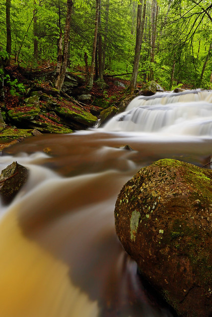
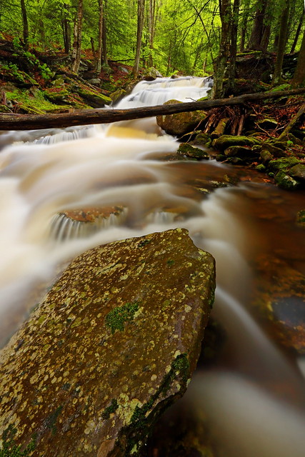
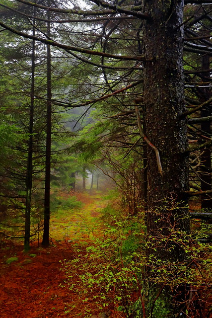
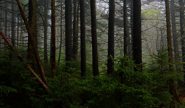
The Flatrock Run Trail was a wet and muddy mess. Large parts of it had water flowing down, so the hike up was akin to working my way through a creek. All that water had an upside too: Flatrock Run, my boisterous companion, was chock full of scenic cascades and waterfalls. The forest was incredibly green and dramatic mist hung amongst the trees.

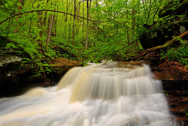
The way up to the Flatrock and Roaring Plains plateau went smoothly, except for the big production that was the crossing of the Right Fork of Flatrock Run. The usual crossing had a lot of swift water, and since it's just above a sequence of cascading waterfalls (totaling more than 100ft, at least) which aren't advisable to tumble down, I decided to hunt for an easier option upstream. I was able to find one involving a log and a scramble up a large boulder.

Roaring Plains was an even soggier mess than the lower elevations. There were no views, except those of the inside of a cloud. I knew then that even if I made it to Haystack Knob I wouldn't see what I'd come for.

I took the railroad grade continuation of the Roaring Plains Trail until I had wrapped around Mt Porte Crayon. Last time I'd stuck to the railroad grade until I was just below Haystack Knob. This time, I took the side trail up the hillside, which I presume is the route most people take. Up top I intersected a gravel road running through some pretty meadows.

I took a left on the gravel road. The map I had seemed to indicate that this road would run very close to the west end of Haystack Knob, at which point it would be a simple task to make my way up. However, two thirds of the way there, near a meadow the road made a sharp right turn. There was the barest impression of a grassy trail continuing through the meadow, which appeared to be the way to go. Unfortunately, thick mist had everything shrouded behind a veil of secrecy.
I decided to stick to the gravel road. Three quarters of a mile later, standing beside the wireless tower of the adjacent Green Knob, I knew I'd taken the wrong option. (Actually, it had been apparent to me within the first half-mile that I was on the wrong path, but I decided I might as well visit Green Knob while I was at it.) No biggie, because the little jaunt had been quick and scenic.
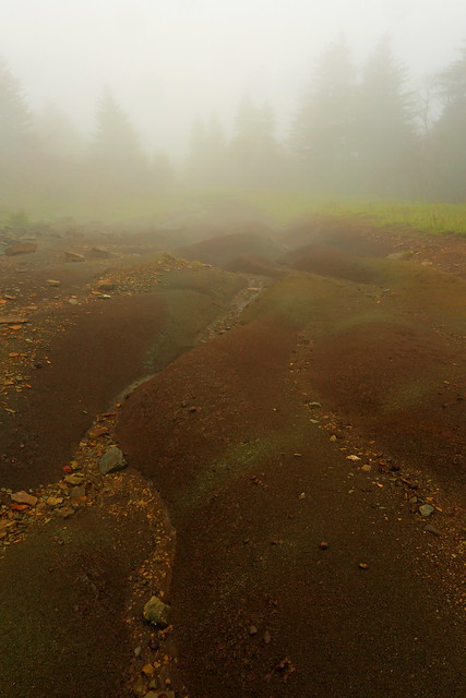
I retraced my steps to the junction I'd noted earlier and took the barely there grassy trail. In a few dozen yards this had become quite prominent and looked every bit the "Jeep Trail" that was marked on my map. Near the jump off spot for the final climb for Haystack Knob there was an interesting complex of erosion patterns in the trail. These distracted me for a while, before I was able to drag myself away and finish the deal.
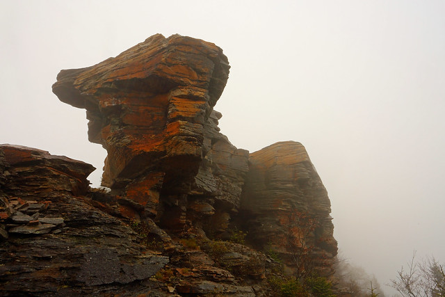
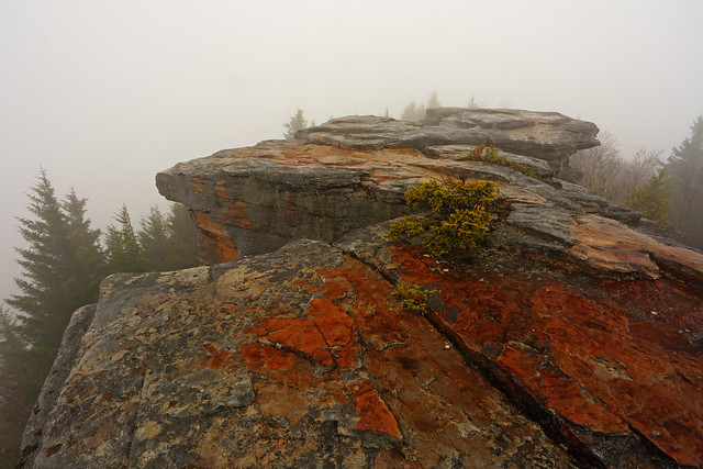
This part of Haystack Knob sported a different, and much nicer rock outcrop than the one I'd stood on previously. I'm sure it sported fantastic views, but all I got to experience was the thickest mist of the day, driving rain and wet rock. I took a few snaps and got off the outcrop.
The hike back was straightforward and quite uneventful.
Hiking/photography stats: ~20.5mi, ~4000ft elevation gain, 10.75hrs
Moisture...everywhere and all the time - that was the overriding theme of this hike. Non-stop rain, mist, damp vegetation and watery/muddy trails were the culprits, dogging my every move. On the plus side, the lush greenery on display was incredible and mist provided a special, intimate atmosphere.
Haystack Knob is a bump near the south end of the Roaring Plains high-altitude plateau. Just five months ago, during the short winter months, I made my first trip to this viewpoint. That time my approach led me to the southern-most point of Haystack Knob. The views to the south, east and west were great, but the one to the north was partly filtered, and not quite what I had seen photos of. Even at the time I realized that I needed to work my way further north along the Knob, but what looked like difficult to penetrate brush and fewer available daylight hours made me abandon this plan. So, with the longer summer days it was high time that I made a return visit to finish what I'd started.
The day began with a 2:30am start from the house. The drive was slow because of heavy rainfall, so it was 6:30am by the time I got on the Flatrock Run Trail. It was still raining - and would do so throughout the day, sometimes quite heavily. I decided to go with knee high gaiters for wet brush, and not the rain pants. I should have worn both!
The Flatrock Run Trail was a wet and muddy mess. Large parts of it had water flowing down, so the hike up was akin to working my way through a creek. All that water had an upside too: Flatrock Run, my boisterous companion, was chock full of scenic cascades and waterfalls. The forest was incredibly green and dramatic mist hung amongst the trees.
The way up to the Flatrock and Roaring Plains plateau went smoothly, except for the big production that was the crossing of the Right Fork of Flatrock Run. The usual crossing had a lot of swift water, and since it's just above a sequence of cascading waterfalls (totaling more than 100ft, at least) which aren't advisable to tumble down, I decided to hunt for an easier option upstream. I was able to find one involving a log and a scramble up a large boulder.
Roaring Plains was an even soggier mess than the lower elevations. There were no views, except those of the inside of a cloud. I knew then that even if I made it to Haystack Knob I wouldn't see what I'd come for.
I took the railroad grade continuation of the Roaring Plains Trail until I had wrapped around Mt Porte Crayon. Last time I'd stuck to the railroad grade until I was just below Haystack Knob. This time, I took the side trail up the hillside, which I presume is the route most people take. Up top I intersected a gravel road running through some pretty meadows.
I took a left on the gravel road. The map I had seemed to indicate that this road would run very close to the west end of Haystack Knob, at which point it would be a simple task to make my way up. However, two thirds of the way there, near a meadow the road made a sharp right turn. There was the barest impression of a grassy trail continuing through the meadow, which appeared to be the way to go. Unfortunately, thick mist had everything shrouded behind a veil of secrecy.
I decided to stick to the gravel road. Three quarters of a mile later, standing beside the wireless tower of the adjacent Green Knob, I knew I'd taken the wrong option. (Actually, it had been apparent to me within the first half-mile that I was on the wrong path, but I decided I might as well visit Green Knob while I was at it.) No biggie, because the little jaunt had been quick and scenic.
I retraced my steps to the junction I'd noted earlier and took the barely there grassy trail. In a few dozen yards this had become quite prominent and looked every bit the "Jeep Trail" that was marked on my map. Near the jump off spot for the final climb for Haystack Knob there was an interesting complex of erosion patterns in the trail. These distracted me for a while, before I was able to drag myself away and finish the deal.
This part of Haystack Knob sported a different, and much nicer rock outcrop than the one I'd stood on previously. I'm sure it sported fantastic views, but all I got to experience was the thickest mist of the day, driving rain and wet rock. I took a few snaps and got off the outcrop.
The hike back was straightforward and quite uneventful.