

Mount Washington, New Hampshire (Aug 17, 2023)
Aug 20, 2023 10:28:31 GMT -8
burntfoot, driftwoody, and 1 more like this
Post by GaliWalker on Aug 20, 2023 10:28:31 GMT -8
Mount Washington, New Hampshire (Aug 17, 2023)
The last time I hiked up Mount Washington, in New Hampshire's White Mountains, was eleven years ago as part of the Presidential Traverse. It had been a gorgeous hike, and despite the touristy nature of Mount Washington itself – there's a road and a cog railway that allows easier access – I'd been most impressed by the surroundings and the ruggedness of the terrain. I'd long wanted to make a return trip, which finally happened a few days ago. I only had the fitness and time to do the standard route up the mountain via Tuckerman Ravine.
I left my basecamp in Massachusetts at 2am, hoping to be on the trail around 6am. A nap along the way meant that it was 6:45am by the time I started hiking. A fine misty rain was falling; the insistent type, which soaks you in minutes if you ignore it, so I put on my rain gear. I'd stupidly forgotten my camera, which had been eating away at me for the last hour of the drive when I noticed, but the rain meant that I wouldn't have been able to do much with it anyway. The iPhone would have to do.
The first 0.4mi to the Crystal Cascade overlook was relatively easy going, after which the route became the typical rocky suffer-fest that is the standard White Mountain 'trail'. The 2.4mi and 1800ft of elevation gain walk to the Hermit Lake shelters was straight forward. There was a nice view of the Tuckerman Ravine headwall from near the shelters. Given the rainy start, I wasn't surprised to see the upper reaches of Mount Washington swathed in opaque mist.
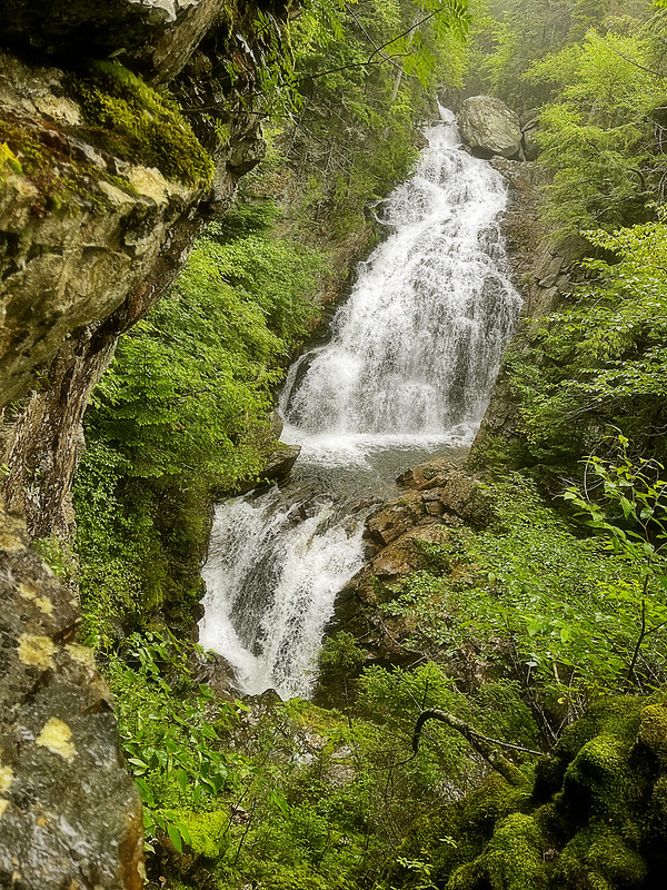
Crystal Cascade

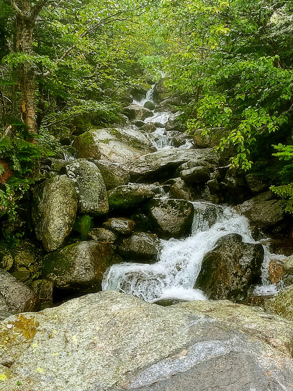
Typical White Mountains trail

Tuckerman Ravine headwall, shrouded in mist
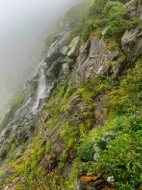
I had made relatively good time up to the Hermit Lake shelter. The next mile took me an hour though, as the rugged trail climbed 1500ft to the top of the Tuckerman Ravine headwall. While there were no distant views to speak of, streams tumbled down the cliff beside me, and flowers, bejeweled with raindrops, sparkled in the misty rain. I had plenty of time to admire the intimate surroundings, as I huffed and puffed my way upwards.


The final 0.8mi and 1000ft of elevation gain began with a ramble through gorgeous alpine terrain: grasses, laden with beads of raindrops, and sporting islands of decorative boulders and patches of flowers, made for an intoxicating mix. The trail was a talus escalator. Pretty soon the talus took over the entirety of the landscape. Large cairns led the way uphill. It was a grind, but eventually it was over and I was up top. With the lack of views from the summit, and unsightly human constructs – a parking lot, various buildings and construction paraphernalia – there was nothing to take photos of, so I just toddled over to the visitor center and decompressed over a cup of coffee.


Follow the cairns
I had initially planned to detour past the Lake of the Clouds hut, and then take the Lion Head Trail on the way down, but with the wet and slippery conditions, decided to stick with the known challenges of the Tuckerman Ravine Trail.
Stats: 8.2mi, 4250ft gain, 7.75hrs (including 1hr at the summit). It rained for 6hrs of the hike.
The last time I hiked up Mount Washington, in New Hampshire's White Mountains, was eleven years ago as part of the Presidential Traverse. It had been a gorgeous hike, and despite the touristy nature of Mount Washington itself – there's a road and a cog railway that allows easier access – I'd been most impressed by the surroundings and the ruggedness of the terrain. I'd long wanted to make a return trip, which finally happened a few days ago. I only had the fitness and time to do the standard route up the mountain via Tuckerman Ravine.
I left my basecamp in Massachusetts at 2am, hoping to be on the trail around 6am. A nap along the way meant that it was 6:45am by the time I started hiking. A fine misty rain was falling; the insistent type, which soaks you in minutes if you ignore it, so I put on my rain gear. I'd stupidly forgotten my camera, which had been eating away at me for the last hour of the drive when I noticed, but the rain meant that I wouldn't have been able to do much with it anyway. The iPhone would have to do.
The first 0.4mi to the Crystal Cascade overlook was relatively easy going, after which the route became the typical rocky suffer-fest that is the standard White Mountain 'trail'. The 2.4mi and 1800ft of elevation gain walk to the Hermit Lake shelters was straight forward. There was a nice view of the Tuckerman Ravine headwall from near the shelters. Given the rainy start, I wasn't surprised to see the upper reaches of Mount Washington swathed in opaque mist.
Crystal Cascade
Typical White Mountains trail
Tuckerman Ravine headwall, shrouded in mist
I had made relatively good time up to the Hermit Lake shelter. The next mile took me an hour though, as the rugged trail climbed 1500ft to the top of the Tuckerman Ravine headwall. While there were no distant views to speak of, streams tumbled down the cliff beside me, and flowers, bejeweled with raindrops, sparkled in the misty rain. I had plenty of time to admire the intimate surroundings, as I huffed and puffed my way upwards.
The final 0.8mi and 1000ft of elevation gain began with a ramble through gorgeous alpine terrain: grasses, laden with beads of raindrops, and sporting islands of decorative boulders and patches of flowers, made for an intoxicating mix. The trail was a talus escalator. Pretty soon the talus took over the entirety of the landscape. Large cairns led the way uphill. It was a grind, but eventually it was over and I was up top. With the lack of views from the summit, and unsightly human constructs – a parking lot, various buildings and construction paraphernalia – there was nothing to take photos of, so I just toddled over to the visitor center and decompressed over a cup of coffee.
Follow the cairns
I had initially planned to detour past the Lake of the Clouds hut, and then take the Lion Head Trail on the way down, but with the wet and slippery conditions, decided to stick with the known challenges of the Tuckerman Ravine Trail.
Stats: 8.2mi, 4250ft gain, 7.75hrs (including 1hr at the summit). It rained for 6hrs of the hike.