

Snake Hill, Coopers Rock State Forest (WV, 10/31/'20)
Nov 1, 2020 10:01:27 GMT -8
nickhowes likes this
Post by GaliWalker on Nov 1, 2020 10:01:27 GMT -8
Snake Hill WMA and Coopers Rock State Forest (West Virginia, Oct/31/2020)
Looking for new destinations, I picked the Snake Hill Wildlife Management Area and Coopers Rock State Forest (North), the first to sample some new views, and the second to coax as much out of the remaining fall foliage as I could. I whiffed on both targets, but still managed to have fun.
Snake Hill WMA
Stats: 4mi, 500ft elevation gain, 2hrs
Snake Hill WMA is located on the west side of the Cheat River, opposite the east side's Raven Rock, which features the best views I've seen in Coopers Rock State Forest. The former's four viewpoints offered a slightly different take on views I'd previously enjoyed from Raven Rock. I got to the trailhead for Snake Hill around 6:15am. It was totally dark, with not even the hint of brightness I'd expected a half hour before sunrise. The reason for this became apparent as soon as I began to hike: my headlamp's beam was picking up thick fog. It seemed like half of the Cheat River was AWL from its watercourse.
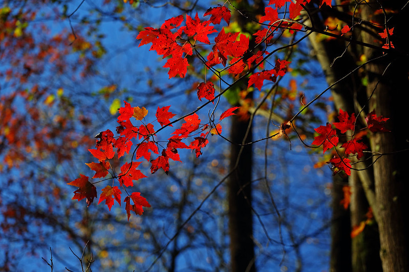
I reached the first viewpoint, Cheat View, about 20min after starting. Visibility was maybe 20yds. I wandered to the nearby second and third viewpoints, and then onwards to the Table Rock viewpoint – which was treed and not really a vista – to fog and yet more fog. After a return to Cheat View, just to confirm that conditions hadn't changed – they hadn't – I admitted defeat and began the walk back to the car. And then, the fog god decided to throw me a bone. Just before I got to the parking lot I was left awestruck by this lone tree glowing in full autumnal splendor in the diffuse morning light.


Coopers Rock State Forest (North)
Stats: 10.5mi, 1050ft elevation gain, 5.25hrs
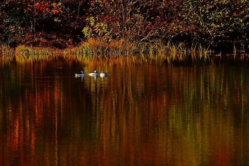
I had selected a lollipop loop hike along the northern trails of Coopers Rock State Forest. I'd hiked the southern section many times before, but never done anything in the northern part. I began with taking pictures of Coopers Rock Lake (aka Trout Pond, aka Messinger Lake). Fishermen thronged the lake shores, so I had to be careful to shoot around them.


Happy Halloween!


Buffleheads on Coopers Rock Lake

There's really nothing special about the hike itself, because the forest walk mostly featured trees that were bare of leaves. In some spots the canopy had some nice color, but it was high up so not really a factor in the enjoyment stakes.


Swishing through the leaves (selfie)
My route: I left Coopers Rock Lake on the Glade Run Trail. I picked up the Lick Run Trail, hiked 1mi on Route 73, and then hiked the Virgin Hemlock Trail (which was pretty cool, I must confess). I then hiked Triune Trail, then Ken's Run Trail, and then down Chestnut Ridge Road back to Glade Run Trail. I took this one back to the car.
Looking for new destinations, I picked the Snake Hill Wildlife Management Area and Coopers Rock State Forest (North), the first to sample some new views, and the second to coax as much out of the remaining fall foliage as I could. I whiffed on both targets, but still managed to have fun.
Snake Hill WMA
Stats: 4mi, 500ft elevation gain, 2hrs
Snake Hill WMA is located on the west side of the Cheat River, opposite the east side's Raven Rock, which features the best views I've seen in Coopers Rock State Forest. The former's four viewpoints offered a slightly different take on views I'd previously enjoyed from Raven Rock. I got to the trailhead for Snake Hill around 6:15am. It was totally dark, with not even the hint of brightness I'd expected a half hour before sunrise. The reason for this became apparent as soon as I began to hike: my headlamp's beam was picking up thick fog. It seemed like half of the Cheat River was AWL from its watercourse.
I reached the first viewpoint, Cheat View, about 20min after starting. Visibility was maybe 20yds. I wandered to the nearby second and third viewpoints, and then onwards to the Table Rock viewpoint – which was treed and not really a vista – to fog and yet more fog. After a return to Cheat View, just to confirm that conditions hadn't changed – they hadn't – I admitted defeat and began the walk back to the car. And then, the fog god decided to throw me a bone. Just before I got to the parking lot I was left awestruck by this lone tree glowing in full autumnal splendor in the diffuse morning light.
Coopers Rock State Forest (North)
Stats: 10.5mi, 1050ft elevation gain, 5.25hrs
I had selected a lollipop loop hike along the northern trails of Coopers Rock State Forest. I'd hiked the southern section many times before, but never done anything in the northern part. I began with taking pictures of Coopers Rock Lake (aka Trout Pond, aka Messinger Lake). Fishermen thronged the lake shores, so I had to be careful to shoot around them.
Happy Halloween!
Buffleheads on Coopers Rock Lake
There's really nothing special about the hike itself, because the forest walk mostly featured trees that were bare of leaves. In some spots the canopy had some nice color, but it was high up so not really a factor in the enjoyment stakes.
Swishing through the leaves (selfie)
My route: I left Coopers Rock Lake on the Glade Run Trail. I picked up the Lick Run Trail, hiked 1mi on Route 73, and then hiked the Virgin Hemlock Trail (which was pretty cool, I must confess). I then hiked Triune Trail, then Ken's Run Trail, and then down Chestnut Ridge Road back to Glade Run Trail. I took this one back to the car.