

Post by GaliWalker on Sept 8, 2020 10:16:14 GMT -8
Bear Meadows – Greenlee Mountain loop
Rothrock State Forest (Pennsylvania, Sep/6/2020)
A 3hr drive from Pittsburgh had me at the Bear Meadows Natural Area, located in Pennsylvania's Rothrock State Forest, around 6:30am. 10min later I was on the trail. The hike began by skirting clockwise around Bear Meadows, through dense rhododendron thickets. The meadow looked beautiful, but in order to explore it properly one needed to be prepared for squelching through boggy terrain. I made a couple of halfhearted attempts to try and get a decent photo but ended up having to be satisfied with mental pictures only.
After having circled around three quarters of the meadow, I left it on the Lonberger Trail. This passed through more open forest and some beautiful fern fields as it contoured around the northeastern end of Greenlee Mountain. Most of the hike, to date, had been flat or moderately downhill. It remained mostly level as I picked up the Three Bridges Trail, but then steepened significantly as I transitioned to the Old Laurel Run Trail. A rocky mile later I was standing atop Greenlee Mountain's spine.

Lonberger Trail (selfie)
The next 2.5mi or so consisted of extremely rocky travel along the Mid State Trail. At 327mi the Mid State Trail, which cuts across the state from Maryland to New York, is Pennsylvania's longest. This stretch along Greenlee Mountain was particularly scenic. Numerous vistas provided sweeping views of the neighboring ridges and valleys, from the northeast to the southwest. The best viewpoint was the final one, Indian Wells, which served up a lovely view of Bear Meadows. I was particularly happy with this sight because of my failure to get a nice photo of the meadow earlier in the hike.

Tom Thwaite's memorial

Looking at Bear Meadows (selfie)

Turkey vulture

Hiking through talus (selfie)

Indian Wells vista (selfie)

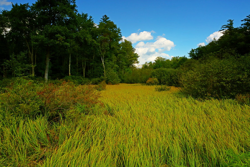
Bear Meadows

Rocky trail
Nearly three quarters of a mile later the trail took a nosedive off the mountain, back to the Bear Meadows Trail and familiar terrain. A right turn on this and I was soon back at my car
Grasses
Stats: 13.5mi, 1825ft gain, 7.5hr
Rothrock State Forest (Pennsylvania, Sep/6/2020)
A 3hr drive from Pittsburgh had me at the Bear Meadows Natural Area, located in Pennsylvania's Rothrock State Forest, around 6:30am. 10min later I was on the trail. The hike began by skirting clockwise around Bear Meadows, through dense rhododendron thickets. The meadow looked beautiful, but in order to explore it properly one needed to be prepared for squelching through boggy terrain. I made a couple of halfhearted attempts to try and get a decent photo but ended up having to be satisfied with mental pictures only.
After having circled around three quarters of the meadow, I left it on the Lonberger Trail. This passed through more open forest and some beautiful fern fields as it contoured around the northeastern end of Greenlee Mountain. Most of the hike, to date, had been flat or moderately downhill. It remained mostly level as I picked up the Three Bridges Trail, but then steepened significantly as I transitioned to the Old Laurel Run Trail. A rocky mile later I was standing atop Greenlee Mountain's spine.
Lonberger Trail (selfie)
The next 2.5mi or so consisted of extremely rocky travel along the Mid State Trail. At 327mi the Mid State Trail, which cuts across the state from Maryland to New York, is Pennsylvania's longest. This stretch along Greenlee Mountain was particularly scenic. Numerous vistas provided sweeping views of the neighboring ridges and valleys, from the northeast to the southwest. The best viewpoint was the final one, Indian Wells, which served up a lovely view of Bear Meadows. I was particularly happy with this sight because of my failure to get a nice photo of the meadow earlier in the hike.
Tom Thwaite's memorial
Looking at Bear Meadows (selfie)
Turkey vulture
Hiking through talus (selfie)
Indian Wells vista (selfie)
Bear Meadows
Rocky trail
Nearly three quarters of a mile later the trail took a nosedive off the mountain, back to the Bear Meadows Trail and familiar terrain. A right turn on this and I was soon back at my car
Grasses
Stats: 13.5mi, 1825ft gain, 7.5hr