

Post by GaliWalker on Jun 22, 2020 5:58:51 GMT -8
Roaring Plains (West Virginia, June/22/2020)
The Roaring Plains is a 4000ft plateau in West Virginia's Monongahela National Forest. Dolly Sods, the far more popular sister, lies a stone's throw away to its north, on the other side of the pretty Red Creek valley. While the tops of both plateaus are mostly bare of trees, Roaring Plains' official trails carve corridors through head high shrubbery, which blocks the sweeping views that abound in Dolly Sods. That, coupled with the rugged nature of the trails, leads to the lesser popularity. That being said, Roaring Plains does have plenty of great viewpoints, it's just that these are tucked away along unofficial trails.
Route: South Prong Trail - Hidden Passage Trail - Canyon Rim Trail - Teepee Trail - Roaring Plains Trail - Boars Nest Trail
Stats: 13mi, 2400ft gain, 9.5hrs (total trip time: 16.25hrs)
This is a trip I'd done quite a few times before, but not for the past two years. Being lazy, I decided not to make the effort in finding something new and went back to ole tried and trusted. In continuation of that laziness, I'm going to keep the words sparse.
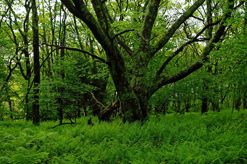
After leaving Pittsburgh at 3:15am, I began hiking down the South Prong Trail at 6:30am. In 0.3mi I crossed South Prong Red Creek in a calf deep wade. The climb up to the top of Roaring Plains went well, since I was nice and fresh.

South Prong Red Creek

Mountain laurel
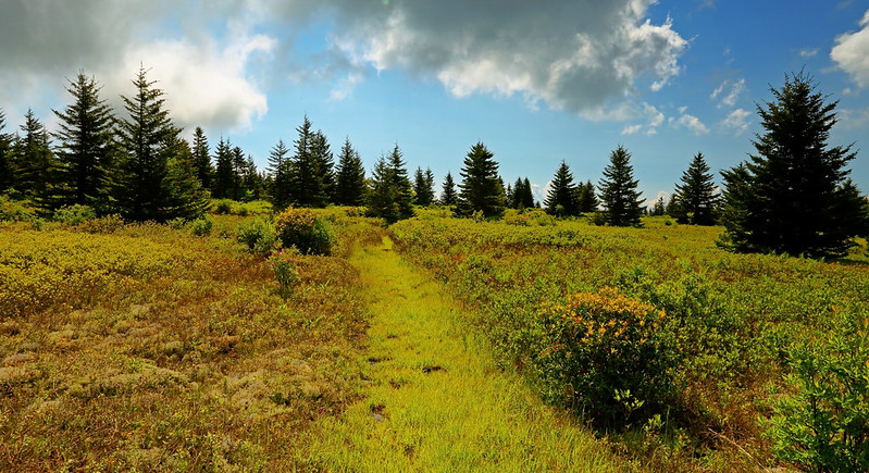
I picked up the unofficial Hidden Passage Trail and took this one to the pipeline swath that cuts across the Roaring Plains. The swath was a squishy and wet romp down to the entrance of the Canyon Rim Trail.

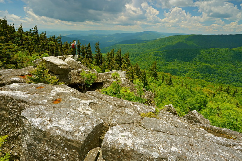
The Canyon Rim Trail was the most well defined I've ever seen it being, and there also seemed to be a lot more cairns marking its path. It was still slow going because of its ruggedness. The entire trail was littered with great views, the best one being The Point. This is a narrow corner of the Canyon Rim, providing 270° views, and was the highlight of the trip.


The Point

GaliWalker on The Point (selfie)


Bench (selfie)
I took the Teepee Trail cutoff, because all the freshness had long since left me, and I was tiring. Back on official trails, I made quick work of the Roaring Plains Trail, but slowed down quite a bit on the Boars Nest Trail, due to its watery nature up top, and then the steep descent off the Roaring Plains plateau.
I saw not a single other person on the entire hike.
The Roaring Plains is a 4000ft plateau in West Virginia's Monongahela National Forest. Dolly Sods, the far more popular sister, lies a stone's throw away to its north, on the other side of the pretty Red Creek valley. While the tops of both plateaus are mostly bare of trees, Roaring Plains' official trails carve corridors through head high shrubbery, which blocks the sweeping views that abound in Dolly Sods. That, coupled with the rugged nature of the trails, leads to the lesser popularity. That being said, Roaring Plains does have plenty of great viewpoints, it's just that these are tucked away along unofficial trails.
Route: South Prong Trail - Hidden Passage Trail - Canyon Rim Trail - Teepee Trail - Roaring Plains Trail - Boars Nest Trail
Stats: 13mi, 2400ft gain, 9.5hrs (total trip time: 16.25hrs)
This is a trip I'd done quite a few times before, but not for the past two years. Being lazy, I decided not to make the effort in finding something new and went back to ole tried and trusted. In continuation of that laziness, I'm going to keep the words sparse.
After leaving Pittsburgh at 3:15am, I began hiking down the South Prong Trail at 6:30am. In 0.3mi I crossed South Prong Red Creek in a calf deep wade. The climb up to the top of Roaring Plains went well, since I was nice and fresh.
South Prong Red Creek
Mountain laurel
I picked up the unofficial Hidden Passage Trail and took this one to the pipeline swath that cuts across the Roaring Plains. The swath was a squishy and wet romp down to the entrance of the Canyon Rim Trail.
The Canyon Rim Trail was the most well defined I've ever seen it being, and there also seemed to be a lot more cairns marking its path. It was still slow going because of its ruggedness. The entire trail was littered with great views, the best one being The Point. This is a narrow corner of the Canyon Rim, providing 270° views, and was the highlight of the trip.
The Point
GaliWalker on The Point (selfie)
Bench (selfie)
I took the Teepee Trail cutoff, because all the freshness had long since left me, and I was tiring. Back on official trails, I made quick work of the Roaring Plains Trail, but slowed down quite a bit on the Boars Nest Trail, due to its watery nature up top, and then the steep descent off the Roaring Plains plateau.
I saw not a single other person on the entire hike.