

Post by GaliWalker on Dec 17, 2015 10:09:08 GMT -8
Haystack Knob, West Virginia (Dec 16, 2015)
Haystack Knob, located at the southwestern tip of Roaring Plains, had been on my list of spots to visit for a couple of years. Since I was under the impression that the views would be similar to those I’d seen multiple times before, from the Roaring Plains’ Canyon Rim, I had relegated this hike to the basement of my to-do list. Well, yesterday, my earlier impression was revised – Haystack Knob is a great viewpoint, sporting a totally fresh perspective, at least for me. However, getting there was a lot harder than I’d been expecting. Furthermore, trying to tuck this one in as a dayhike, during the shorter days of December, was also a touch on the overly ambitious side.
I decided to access Roaring Plains via the Flatrock Run Trail. There are easier options, but I preferred the more aesthetic approach of starting at the very bottom and working my way up. In any case, I hadn’t hiked the Flatrock Run Trail for a few years. I reached the trailhead parking lot at first light, and began hiking by 6:55am. A 0.2mi road walk got me to the actual trailhead, nestled amongst farm houses. The first 0.5mi were a bit annoying, since I had to pass through farmland, serenaded all the while by the barking of dogs, but I was soon in the forest where things calmed down.
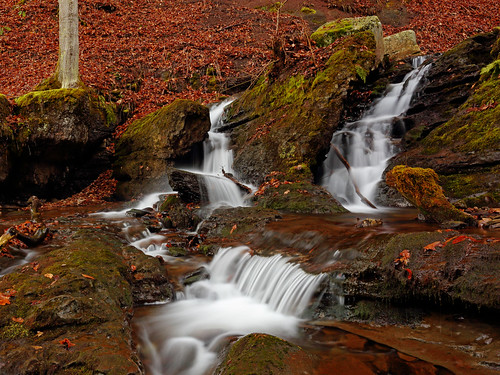
Even though the Flatrock Run Trail gains 2,200ft of elevation, there is nothing overly steep and the going is quite easy. The prettiest part of this trail was the first 2mi alongside cascading Flatrock Run. Even though I knew I had a long day ahead I couldn’t help making my way down to photograph one of the cascades, right at the 2mi mark.
Back on the trail it was mostly uneventful hiking until I intersected the Roaring Plains Trail, 5.7mi into the hike. A nice open knoll, sporting a hunter’s blind, offered the perfect spot to relax and take in the sights. Haystack Knob was visible to the south, including the route to it. From my perch, it looked quite a ways off.
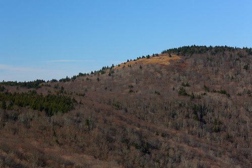
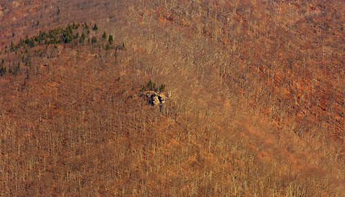
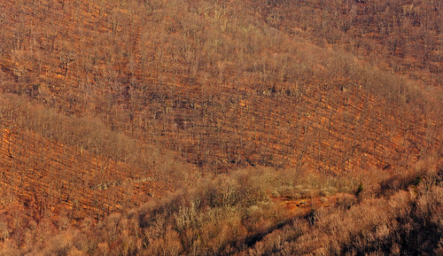
It was around 10:00am as I began the next leg of my trip. I picked up the grassy railroad grade continuation of the Roaring Plains Trail, and basically stuck to this for a little more than 3mi. About this point I left the railroad grade and began to make a rising traverse, aiming to intersect the northwest ridge of Haystack Knob. I overshot and ended up hitting the southeast ridge, a little below the rocky outcrop. A steep climb put me atop the promontory, 2hrs and an estimated 3.6mi after having left the Roaring Plains Trail. Great views of the Roaring Plains, including the Canyon Rim, North Fork Mountain and a host of other spots was the reward for my efforts.
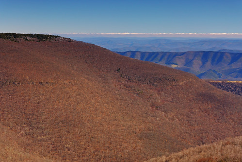
Roaring Plains Canyon Rim
Pt 4659'
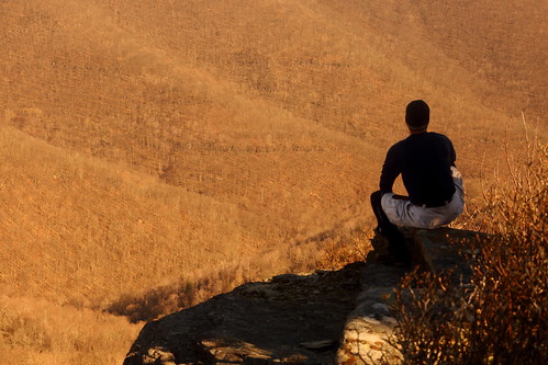
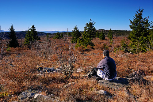
Self portrait
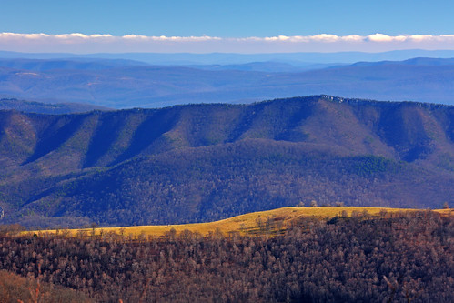
North Fork Mountain
After spending about a half hour atop Haystack Knob, I retraced my steps back down to the railroad grade and began the long walk back to Roaring Plains. A little while later I made a critical mistake: the railroad grade made a split which I had somehow not noticed on the approach. One fork went up, while the other descended gradually. After waffling for a bit, I took the lower fork. I think I continued on this one for about a mile before it was abundantly clear to me that I had selected the wrong option. I had descended all the way down to the North Fork of Long Run and right in front of me was a beautiful waterfall – no way would I have missed that!
Ok, I was in trouble. I had two options. Option 1 was to retrace my steps all the way back to the fork in the railroad grade, but this would add a further 2mi to my hike. As it was, I was going to need every ounce of daylight to make it back to the car in time, and those 2mi would mean I would be hiking about the last half hour in complete darkness. Now I cursed the decision to leave the headlamp in the car, just to shave off a tiny bit of weight. Never again! All I had for light was the torch on my iPhone. The second option was to cut straight up the hillside and intersect the railroad grade I should have been on. This one came with the slight possibility of getting even deeper into the mess. I bit the bullet and took the second option. 400ft of elevation gain later, adrenaline pumping, I intersected the trail I needed to be on and breathed a sigh of relief.
The rest of the hike was uneventful. I reached the car at 5:10pm, about a half hour before total darkness.
Estimated stats:
Distance: 19mi (including my unplanned 0.4mi detour, and the 0.4mi road walk to and from the parking lot to the trailhead)
Elevation gain: 4,070ft
Hiking time: 10.25hrs
Total trip time (house-house): 17.5hrs
Haystack Knob, located at the southwestern tip of Roaring Plains, had been on my list of spots to visit for a couple of years. Since I was under the impression that the views would be similar to those I’d seen multiple times before, from the Roaring Plains’ Canyon Rim, I had relegated this hike to the basement of my to-do list. Well, yesterday, my earlier impression was revised – Haystack Knob is a great viewpoint, sporting a totally fresh perspective, at least for me. However, getting there was a lot harder than I’d been expecting. Furthermore, trying to tuck this one in as a dayhike, during the shorter days of December, was also a touch on the overly ambitious side.
I decided to access Roaring Plains via the Flatrock Run Trail. There are easier options, but I preferred the more aesthetic approach of starting at the very bottom and working my way up. In any case, I hadn’t hiked the Flatrock Run Trail for a few years. I reached the trailhead parking lot at first light, and began hiking by 6:55am. A 0.2mi road walk got me to the actual trailhead, nestled amongst farm houses. The first 0.5mi were a bit annoying, since I had to pass through farmland, serenaded all the while by the barking of dogs, but I was soon in the forest where things calmed down.
Even though the Flatrock Run Trail gains 2,200ft of elevation, there is nothing overly steep and the going is quite easy. The prettiest part of this trail was the first 2mi alongside cascading Flatrock Run. Even though I knew I had a long day ahead I couldn’t help making my way down to photograph one of the cascades, right at the 2mi mark.
Back on the trail it was mostly uneventful hiking until I intersected the Roaring Plains Trail, 5.7mi into the hike. A nice open knoll, sporting a hunter’s blind, offered the perfect spot to relax and take in the sights. Haystack Knob was visible to the south, including the route to it. From my perch, it looked quite a ways off.
It was around 10:00am as I began the next leg of my trip. I picked up the grassy railroad grade continuation of the Roaring Plains Trail, and basically stuck to this for a little more than 3mi. About this point I left the railroad grade and began to make a rising traverse, aiming to intersect the northwest ridge of Haystack Knob. I overshot and ended up hitting the southeast ridge, a little below the rocky outcrop. A steep climb put me atop the promontory, 2hrs and an estimated 3.6mi after having left the Roaring Plains Trail. Great views of the Roaring Plains, including the Canyon Rim, North Fork Mountain and a host of other spots was the reward for my efforts.
Roaring Plains Canyon Rim
Pt 4659'
Self portrait
North Fork Mountain
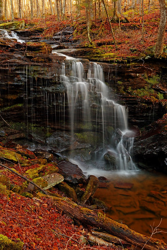
After spending about a half hour atop Haystack Knob, I retraced my steps back down to the railroad grade and began the long walk back to Roaring Plains. A little while later I made a critical mistake: the railroad grade made a split which I had somehow not noticed on the approach. One fork went up, while the other descended gradually. After waffling for a bit, I took the lower fork. I think I continued on this one for about a mile before it was abundantly clear to me that I had selected the wrong option. I had descended all the way down to the North Fork of Long Run and right in front of me was a beautiful waterfall – no way would I have missed that!
Ok, I was in trouble. I had two options. Option 1 was to retrace my steps all the way back to the fork in the railroad grade, but this would add a further 2mi to my hike. As it was, I was going to need every ounce of daylight to make it back to the car in time, and those 2mi would mean I would be hiking about the last half hour in complete darkness. Now I cursed the decision to leave the headlamp in the car, just to shave off a tiny bit of weight. Never again! All I had for light was the torch on my iPhone. The second option was to cut straight up the hillside and intersect the railroad grade I should have been on. This one came with the slight possibility of getting even deeper into the mess. I bit the bullet and took the second option. 400ft of elevation gain later, adrenaline pumping, I intersected the trail I needed to be on and breathed a sigh of relief.
The rest of the hike was uneventful. I reached the car at 5:10pm, about a half hour before total darkness.
Estimated stats:
Distance: 19mi (including my unplanned 0.4mi detour, and the 0.4mi road walk to and from the parking lot to the trailhead)
Elevation gain: 4,070ft
Hiking time: 10.25hrs
Total trip time (house-house): 17.5hrs


