talus
Trail Wise!
Posts: 560 
|
Post by talus on Oct 26, 2016 12:43:49 GMT -8
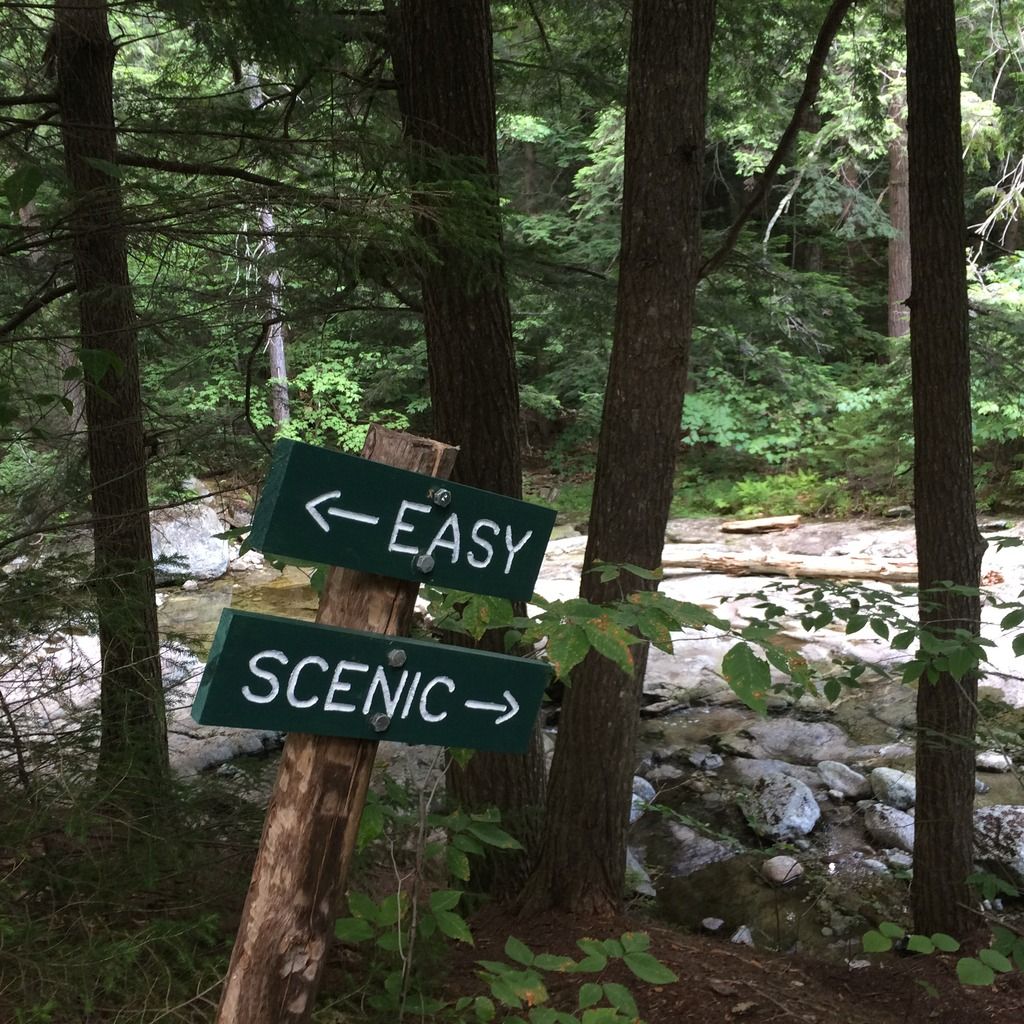
Last Friday six of us set out to hike the west loop of the Chuck Keiper Trail (CKT) in Central PA. The weather forecast was grim, but all the preparations had been made, so at least an attempt was required. It rained sideways in buckets while we waited for the rest of the group to show up, then magic happened: it stopped.  PA210714 PA210714 by richglasgow63, on Flickr The streams were swollen, but still passable:  PA210715 PA210715 by richglasgow63, on Flickr 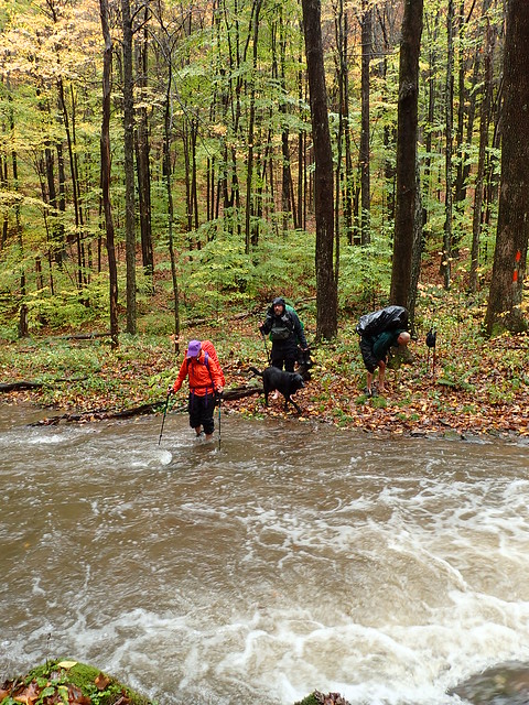 PA210716 PA210716 by richglasgow63, on Flickr |
|
talus
Trail Wise!
Posts: 560
|
Post by talus on Oct 26, 2016 12:49:09 GMT -8
|
|
talus
Trail Wise!
Posts: 560
|
Post by talus on Oct 26, 2016 12:52:18 GMT -8
|
|
talus
Trail Wise!
Posts: 560
|
Post by talus on Oct 26, 2016 12:54:07 GMT -8
|
|
talus
Trail Wise!
Posts: 560
|
Post by talus on Oct 26, 2016 12:54:28 GMT -8
More to come...
|
|
talus
Trail Wise!
Posts: 560
|
Post by talus on Oct 26, 2016 14:49:13 GMT -8
Back up on the ridges the brown ferns, red blueberry bushes and turning trees made for great views:  PA230814 PA230814 by richglasgow63, on Flickr Chilling on one of the few bridges:  PA230815 PA230815 by richglasgow63, on Flickr  PA230819 PA230819 by richglasgow63, on Flickr The whole group:  PA230822 PA230822 by richglasgow63, on Flickr Bog:  PA230826 PA230826 by richglasgow63, on Flickr Back to the start:  PA230833 PA230833 by richglasgow63, on Flickr All in all, a great trip. 31ish miles with some pretty good ups and downs. The trail, except for the deteriorating sidehill, was very well maintained and marked. |
|
|
|
Post by jmitch on Oct 26, 2016 17:48:13 GMT -8
Great photos.
|
|
ki0eh
Trail Wise!
Posts: 47
|
Post by ki0eh on Oct 31, 2016 6:49:36 GMT -8
Yowza! I don't think I saw streams on the CKT that high even when the KTA used to have a snowmelt/mud season meeting in Renovo.
|
|
ki0eh
Trail Wise!
Posts: 47
|
Post by ki0eh on Oct 31, 2016 6:54:53 GMT -8
Also, there was quite a lot of narrow sidehill dug "back in the day". KTA and other volunteers could use more help re-digging it.
|
|
talus
Trail Wise!
Posts: 560
|
Post by talus on Oct 31, 2016 11:25:10 GMT -8
Also, there was quite a lot of narrow sidehill dug "back in the day". KTA and other volunteers could use more help re-digging it. Re-doing that sidehill would be a massive job-and in some of the more remote parts of the trail, too. I'm sure many of those streams were almost dry the day before we hiked. |
|
|
|
Post by Coolkat on Apr 16, 2017 17:21:37 GMT -8
Thanks for this trip report, not sure how I missed it before.
|
|
|
|
Post by Coolkat on Apr 28, 2017 6:12:23 GMT -8
talus, where did you start your hike? Is there more than one option? I've ordered a map but it hasn't arrived yet.
|
|
talus
Trail Wise!
Posts: 560
|
Post by talus on Apr 28, 2017 14:24:00 GMT -8
We started at Fish Damn Vista trailhead. I'm sure there are other options, that start gets the hardest trail done early. Decent free maps here: CKT mapThe maps on the DCNR site are decent too. Map 1Map 2 |
|