Deleted
Deleted Member
Posts: 0
|
Post by Deleted on Aug 21, 2015 15:02:16 GMT -8
Thanks. It was one of my favorite Sierra hikes of all time and hard to take a bad photo, though the images can never do justice to that spectacular area.
Hope you have a great hike!
ps- All my years of sporadic postings here have apparently been deleted with the last (desperately needed) forum upgrade.
|
|
rebeccad
Trail Wise!
Writing like a maniac
Posts: 12,707 
|
Post by rebeccad on Aug 21, 2015 21:43:04 GMT -8
I just saw this...my husband, oldest son and I did the Black Rock Pass/Sawtooth Pass loop at the end of June. It was def. a bit of hard work, but the only parts that were really painful were climbing Black Rock and the descent from Sawtooth. The first day was long--we went over Timber Gap and down, then up to Pinto Lake. Something like 9 miles, with a lot of climbing. The next day it was a long slog to Black Rock pass, but not so bad except it was windy and rainy. We fled at top speed (not impressive for the spouse and me; Eldest Son was a lot faster) to Little 5 Lakes and had lunch and made camp. Third day was a short trip to Big 5, where we had a great camp, rested, explored, and rested some more. In the morning, we cut cross-country to the lowest lake to pick up the trail, then climbed to Columbine. That was one of the most spectacular camps we've had! Finally, fifth and last day was over Sawtooth Pass (easy from there) and down. It is the west side that is a sandy slog; that was easy to go down, but you continue to drop a very, very long way to Mineral King. For the record, parking a car there requires tarps or chicken wire to wrap it and protect it from marmots; this also means it takes extra time to hit the trail. We got the the ranger station about 9 a.m. (long, slow drive in, too!) to get our permit, and didn't hit the trail until 11, though some of that was due to the need to re-pack from car-camping mode. The car, wrapped and ready. The ranger lent us a roll of chicken wire, and we eked it out with tarps we had in the car. 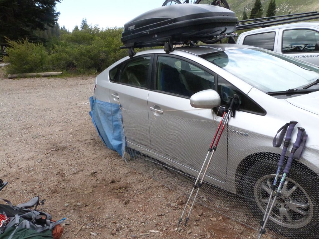 |
|
rebeccad
Trail Wise!
Writing like a maniac
Posts: 12,707
|
Post by rebeccad on Aug 21, 2015 21:48:01 GMT -8
A few more shots of the loop: Sunset from Pinto Lake camp  Looking up toward Black Rock Pass (somewhere on the ridge left of center) 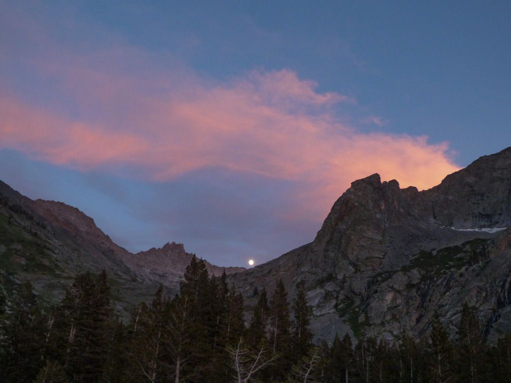 Arriving at Columbine Lake: 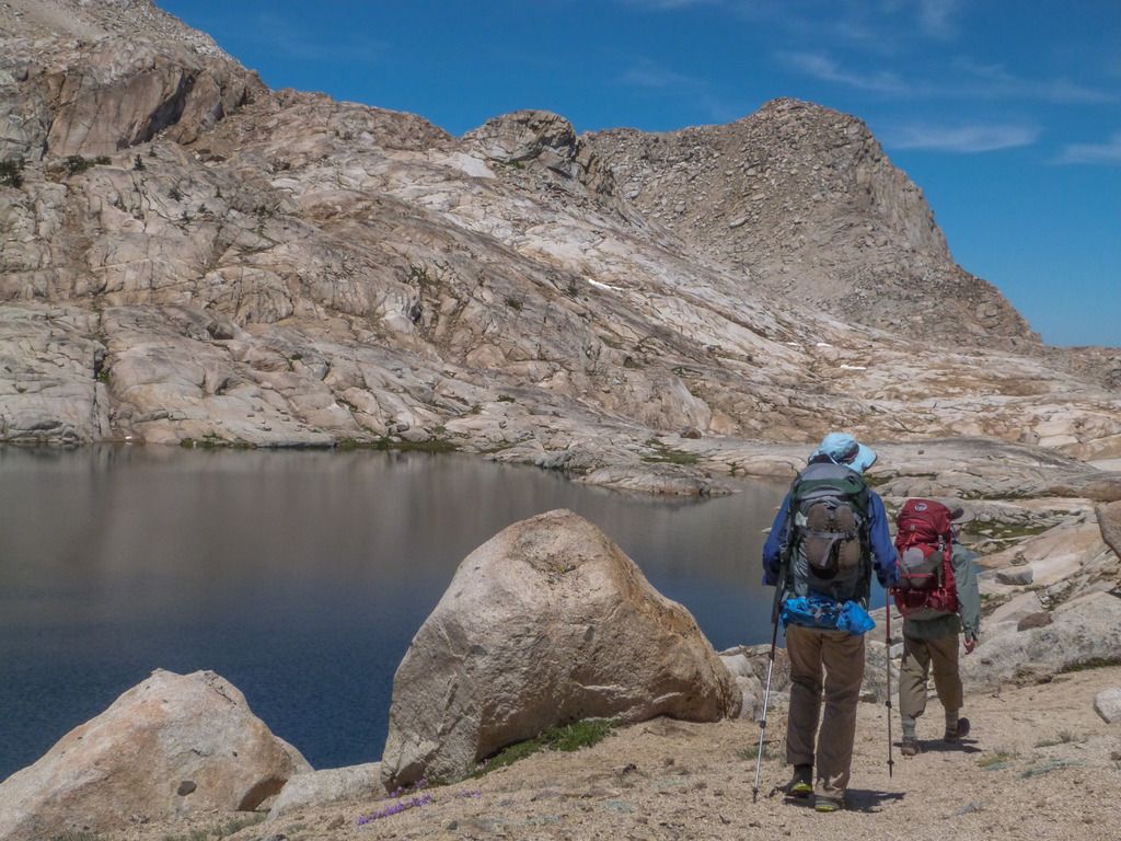 Evening at Columbine Lake 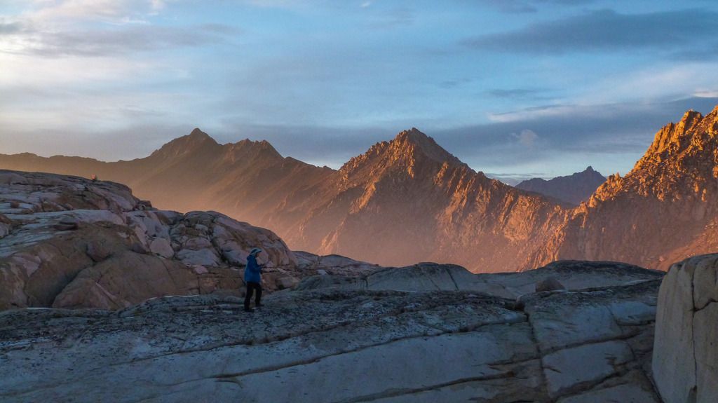 Sawtooth Pass: 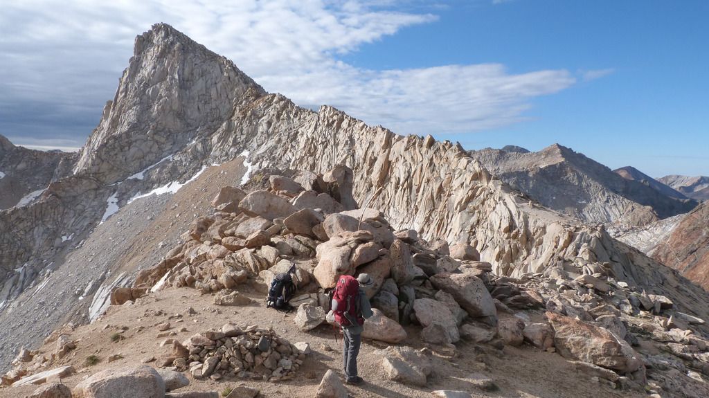 Descending the west side of Sawtooth Pass  |
|
tarol
Trail Wise!
Redding, CA
Posts: 582
|
Post by tarol on Aug 22, 2015 0:49:23 GMT -8
Do take a SPOT or PLB please, this fire season is crazy. I talked to a wife of a hiker who was trapped in the Lake Fire earlier this summer that burned in the San Gorgonio Wilderness. Because he had a PLB he was rescued, thankfully. Shudder to think what would've happened otherwise.
If you're flying into Fresno I'd definitely stay with a west-side trailhead. Right now smoke from the Rough Fire is mainly going south, so I'd actually look into doing a loop in Yosemite or northward. Have a few options in case conditions change or new fires start.
If you do hike out of Mineral King park across from the ranger station and hike the half mile or so to the trailhead. I've always had good luck parking there, no marmots. Whereas the upper parking lots have the marmot problems.
Anyway, let me know if you need any more info. I worked for SEKI also Sequoia NF and have hiked much of the area.
|
|
|
|
Post by quailhiker on Aug 23, 2015 5:34:57 GMT -8
We were able to change our permits to the Little Five and Big Five Lakes loop, going clockwise from Mineral King. The ranger we spoke with indicated there is a good chance the road to Cedar Grove won't reopen within the next two weeks, plus smoke will be an issue nonetheless, even if we came in to Rae Lakes from the east side. Hope smoke won't be too bad in the Mineral King area to the south. RebeccaD and tarol, thanks for the updates and suggestions. Never would have thought about "marmot vehicle protection."
Our thoughts on camp sites:
1. Black Rock Pass trail junction or Pinto Lake
2,3,4. Little Five or Big Five Lakes area. We'd plan to take two days wandering without full packs. To spend time in the Big Arroyo and Big Five Lakes area, would it make the most sense to set up base camp in the Little Five Lakes area? If so, any specific recommendations?
5. Columbine Lake
6. Monarch Lakes
Would anyone suggest alternative camp locations? Thanks again to all!
|
|
rebeccad
Trail Wise!
Writing like a maniac
Posts: 12,707
|
Post by rebeccad on Aug 23, 2015 9:20:02 GMT -8
Quailhiker, the camp sites sound good. If you are up for it, going on up to Pinto Lake the first night will make the climb over Black Rock pass more manageable (it's pretty long and hard). The junction is a pretty forest camp, but near the Pinto Lake bear box there are sites with great views (See the first couple of my photos above). There are a bunch of big sites near the bear box at Little 5 Lakes (at the trail junction), but the ranger tipped us off...if you have a bear can (or ursack) you can camp a short way down the trail to Big Arroyo, on the SE corner of that lake. We found a couple of nice spots, and more off the beaten track. That would give good access to the lower lakes and still be good for exploring Upper Little 5. To explore Big 5 Lakes, I would suggest moving your camp over there. It's short and easy; there is good camping between the 1st two lakes. Bug shouldn't be a problem by now, but if they are, we found nice camps (and used one) perched well above the lakes and way less buggy. There is a sort of a use trail up to the upper lakes, but it degenerated into swampy stuff pretty badly and we didn't go all the way. This shot is from our Big 5 Lakes camp area: 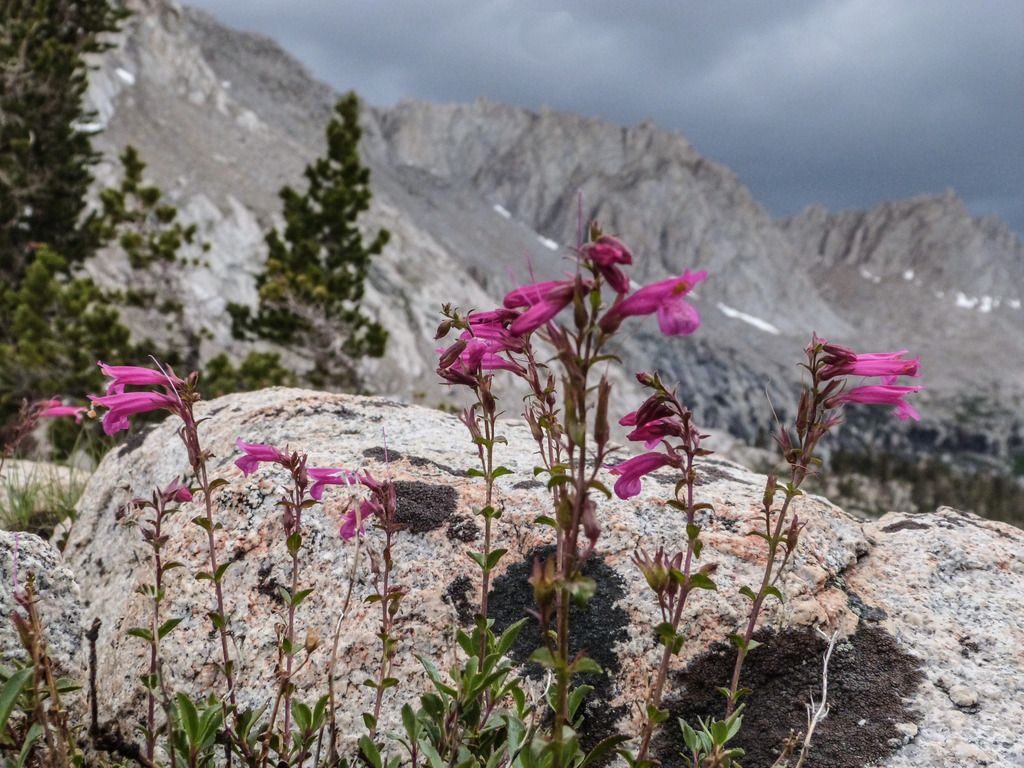 Finally, though Monarch lake is nice, unless your final day is mid-week (even this late in the year) you might want to go all the way out from Columbine. Or maybe climb to the upper lake there. It looked a bit of a zoo when we came out, and though that was July 4, the ranger said it's a very popular spot. Tarol is right--the ranger told us that parking by the ranger station would be the fall-back for marmot safety if we couldn't wrap the car. We weren't excited about an extra 1/2 mile, even without packs (and maybe even less so after hiking out from Columbine) so we took the extra effort. |
|
tarol
Trail Wise!
Redding, CA
Posts: 582
|
Post by tarol on Aug 23, 2015 9:32:45 GMT -8
I'd be prepared for smoke from the Rough Fire, and again please take a SPOT or PLB, but even then read their bit about helicopters. Not to scare anyone, but this fire season is unprecedented in many respects. The park just released this: ROUGH FIRE UPDATE: Wilderness permits cancelled for specific trailheads Sequoia and Kings Canyon National Parks is cancelling all wilderness permits that initiate in the Cedar Grove and Grant Grove areas due to trailheads being located in areas closed due to the Rough Fire. The parks are providing a refund of the permit fees. If requested, we will rearrange permits into other areas in the parks, or move them to a later date. It is important to note that hiking in wilderness areas in the parks does not provide the best experience right now—uncomfortable hiking with much smoke and little to no vistas. However, whether or not you go, where a trailhead is open and available is up to you. Some wilderness rangers are currently being reassigned to other areas of the parks due to poor air quality. Rangers in the Cedar Grove area are also being moved out. The park has limited staffing levels—and therefore very limited emergency response is available for the public. For example, with smoke, helicopters have not been able to fly into certain areas of the parks. In a worse-case scenario, an emergency could mean a litter-carry lasting several days per patient. There are two teams managing different sections of the Rough Fire. For more information about the Rough Fire, call 559-565-3704 or visit inciweb.nwcg.gov/incident/4456. In addition, there is a park-specific team managing how the Rough Fire affects employees and partners and communicating to the public how visitors could be impacted by the Rough Fire on a visit to Sequoia and Kings Canyon National Parks. |
|
|
|
Post by cahiker on Aug 25, 2015 13:02:53 GMT -8
I got back from 8 days in SEKI on Saturday, and the smoke was bad. We went to Ranger Lake, Cloud Canyon, Colby Lake, Deadman Canyon, Elizabeth Pass, Tablelands, Lodgepole and there was a regular pattern of it getting really smokey in the late afternoon and evening, then it cleared up in the middle of the night, was still nice in the early morning, and then by afternoon it was bad again. The smoke seemed to hang in the canyons and lower areas, while some of the higher, more open areas were OK. In the Mineral King area you'll be farther from the fire, but there could still be areas of heavy smoke, depending on weather and wind direction. I recommend some contingency plans. Even clothes I have washed still smell like smoke.
As far as your campsites 5 & 6, they are less than two hours apart. Going down the sandy pass is very fast (I hate to think what going up would be like!) We planned to camp at Columbine Lake on Labor Day weekend a couple of years ago, but moved on because it was so crowded. We found a really nice spot near Monarch Lake, but facing down towards the Central Valley, not the lake. This meant we were away from the crowds and exposed toilet (we were told it smelled when the wind shifted) and had a nice view of the sunset and city lights from our tent. The upside of the smoke is there could be some nice sunsets.
The campsites near Pinto Lake are mostly over by the creek, not the lake. They are fine, but typical creekside/forest campsites. There were a lot of pack animals in the meadow when we were there, which could be a plus or minus depending on your perspective. We liked all the Big Five and Little Five Lakes, so pick what is more convenient. One of the best things about the Little Five Lakes is the views, but if it's smoky, then you'll want short views to lakes, not long views to mountains.
Edit:
I forgot to mention that when we were at Mineral King on Labor Day weekend, the ranger told us that the marmot problems end in early summer (June/early July?) so we didn't need to take any precautions to wrap our car. We only saw one or two vehicles wrapped. It's always good to check with the ranger on current conditions, however.
|
|
 Image Credit / Coolkat


