

Post by GaliWalker on Jul 13, 2020 5:25:38 GMT -8
Canaan Mountain (West Virginia – July/12/2020)
For some reason, ever since the COVID-19 pandemic locked everything down I've been loath to pick new hiking destinations, preferring to revisit ole tried and trusted. This time, I decided to return to Canaan Mountain, in West Virginia's Monongahela National Forest.
I departed Pittsburgh at 2:50am. My destination, the Lindy Point trailhead at the edge of Blackwater Falls State Park, was about a 2.75hr drive away. Making multiple stops along the way to see if I could catch sight of comet NEOWISE – a stubborn cloud hung over the north-northeast, which made my attempts futile – meant that I only reached my destination a little after sunrise, and not before as I'd planned. Thankfully, the Lindy Point overlook is only 0.7mi away from the trailhead, so I was still able to catch some nice early morning light over the Blackwater River valley.


After my morning photography session, I headed back to the car and then continued down the Canaan Loop Road. This dirt road became increasingly rougher and muddier, even in the short 0.4mi that I was on it. I crossed the deeply red colored waters of Lindy Run and then took a left on the Lindy Run Trail. Thick rhododendron bushes, and at times muddy terrain, made for slow going, despite the gentle nature of the trail. In 1.8mi I intersected the maintained Plantation Trail, where I took a right turn.

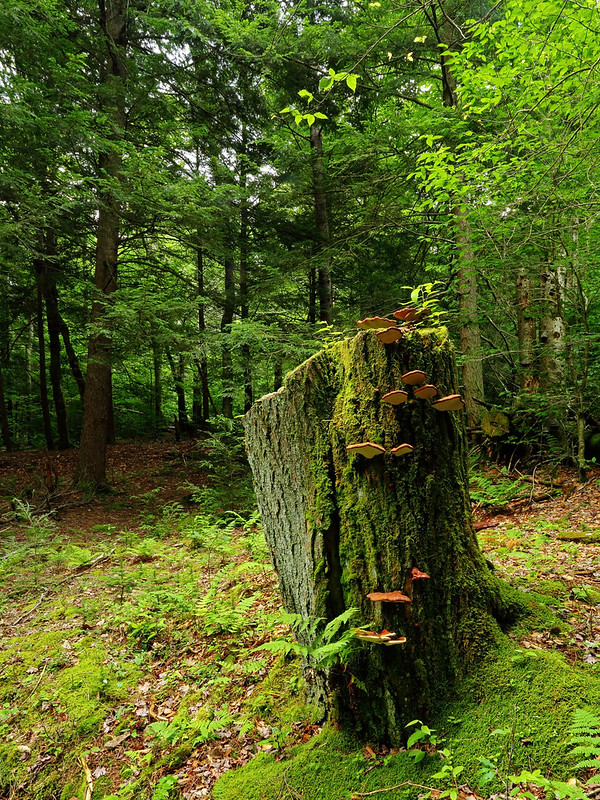
I made short work of the 1.3mi along the Plantation Trail, and then took a left on the Railroad Grade Trail. The 1.8mi along this was a delight. The forest was a remarkably vibrant green and the trail surface was soft without being muddy. The remaining hike would be a suffer-fest.

The Railroad Grade Trail deposited me onto the Canaan Loop Road. From here my car was 8.3mi away along the road. I began by walking CLR13 for 0.75mi downhill, beside pretty Red Run, and then uphill for 2.5mi to the Table Rock trailhead.

I took a left onto the Table Rock trail. It began pleasantly enough, rising gently to go over a hill. The last one-third was its usual extremely muddy self, but new (to me) social trails had sprung up that allow one to avoid the worst parts. The aptly named Table Top vista is one of my favorite viewpoints in the area: a largish rocky platform, it provides sweeping views of ridges and valleys.


I retraced my steps back to the Canaan Loop Road. My initial plan had been to take the Plantation Trail, but since it was beginning to rain I decided to wimp out and take the quicker option of walking the 5mi of dirt road back to my car instead.
Stats: 17.5mi, 9hrs
For some reason, ever since the COVID-19 pandemic locked everything down I've been loath to pick new hiking destinations, preferring to revisit ole tried and trusted. This time, I decided to return to Canaan Mountain, in West Virginia's Monongahela National Forest.
I departed Pittsburgh at 2:50am. My destination, the Lindy Point trailhead at the edge of Blackwater Falls State Park, was about a 2.75hr drive away. Making multiple stops along the way to see if I could catch sight of comet NEOWISE – a stubborn cloud hung over the north-northeast, which made my attempts futile – meant that I only reached my destination a little after sunrise, and not before as I'd planned. Thankfully, the Lindy Point overlook is only 0.7mi away from the trailhead, so I was still able to catch some nice early morning light over the Blackwater River valley.
After my morning photography session, I headed back to the car and then continued down the Canaan Loop Road. This dirt road became increasingly rougher and muddier, even in the short 0.4mi that I was on it. I crossed the deeply red colored waters of Lindy Run and then took a left on the Lindy Run Trail. Thick rhododendron bushes, and at times muddy terrain, made for slow going, despite the gentle nature of the trail. In 1.8mi I intersected the maintained Plantation Trail, where I took a right turn.
I made short work of the 1.3mi along the Plantation Trail, and then took a left on the Railroad Grade Trail. The 1.8mi along this was a delight. The forest was a remarkably vibrant green and the trail surface was soft without being muddy. The remaining hike would be a suffer-fest.
The Railroad Grade Trail deposited me onto the Canaan Loop Road. From here my car was 8.3mi away along the road. I began by walking CLR13 for 0.75mi downhill, beside pretty Red Run, and then uphill for 2.5mi to the Table Rock trailhead.
I took a left onto the Table Rock trail. It began pleasantly enough, rising gently to go over a hill. The last one-third was its usual extremely muddy self, but new (to me) social trails had sprung up that allow one to avoid the worst parts. The aptly named Table Top vista is one of my favorite viewpoints in the area: a largish rocky platform, it provides sweeping views of ridges and valleys.
I retraced my steps back to the Canaan Loop Road. My initial plan had been to take the Plantation Trail, but since it was beginning to rain I decided to wimp out and take the quicker option of walking the 5mi of dirt road back to my car instead.
Stats: 17.5mi, 9hrs
