Post by ashepabst on Oct 31, 2015 8:57:55 GMT -8
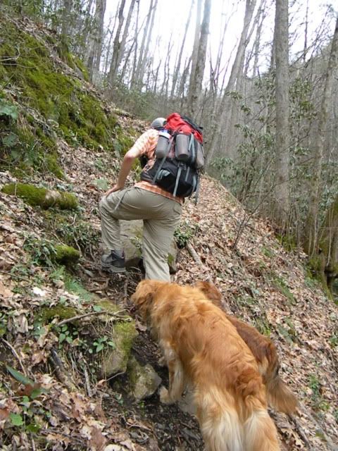
I drove up to Slickrock on the past rainy Wednesday morning. It must've rained the entire drive there but I started walking under blue, sunny skies. I was just underneath the gap above Ike Branch when my fortunes turned and the rains returned. But I did manage to get this shot off.

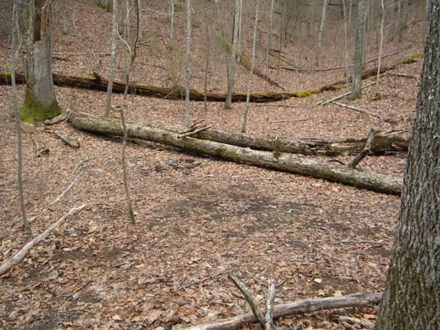
It was a bit too warm to hike in my shell, but I managed to stay mostly dry under an umbrella. On the downhill side of Ike Branch Tr I ran into a nasty blowdown. By the time I managed to work my way through it I was pretty well soaked. So I decided to call it a day and headed down to the river for camp.


I slept like a rock Wednesday night but awoke to an early morning rain that didn't quit until about 11. My original plan had long been ditched so I spent the morning hanging out in the hammock, reading the News-Sentinel and watching the rushing river go by. The first and only human of the trip wandered by about this time heading towards Farr Gap on the Benton MacKaye Tr. It was still drizzling so he didn't tary.
The modified plan was to head up Nichols Cove, which reconnects with Slickrock further upstream. And then I'd spend another night on the river and complete the lower Slickrock Trail on the way out on Friday.
On Thursday I was blessed with some dreamy backpacking weather... bright blue skies and just enough cool breeze to keep the sweat at bay. Nichols Cove is a lovely hollow, a medium and then small-sized creek. Like most in the surrounding wilderness areas, the trail is sometimes barely discernible single track with rough footing. It hugs and fords the creek most of the way until turning up ridge only to crest and spill back down the other side.
Back on Slickrock lovely cascades are ubiquitous, if you can find them through the jungle.


Continuing down the lowest leg of the Slickrock the pools get larger and still before eventually plopping onto the pond of Calderwood Lake. The trail then climbs about midway up the impossibly steep bluff towering above the Little Tennessee River Gorge. I was lucky enough to spot an eagle taking flight heading up river.


It was a bit too warm to hike in my shell, but I managed to stay mostly dry under an umbrella. On the downhill side of Ike Branch Tr I ran into a nasty blowdown. By the time I managed to work my way through it I was pretty well soaked. So I decided to call it a day and headed down to the river for camp.
I slept like a rock Wednesday night but awoke to an early morning rain that didn't quit until about 11. My original plan had long been ditched so I spent the morning hanging out in the hammock, reading the News-Sentinel and watching the rushing river go by. The first and only human of the trip wandered by about this time heading towards Farr Gap on the Benton MacKaye Tr. It was still drizzling so he didn't tary.
The modified plan was to head up Nichols Cove, which reconnects with Slickrock further upstream. And then I'd spend another night on the river and complete the lower Slickrock Trail on the way out on Friday.
On Thursday I was blessed with some dreamy backpacking weather... bright blue skies and just enough cool breeze to keep the sweat at bay. Nichols Cove is a lovely hollow, a medium and then small-sized creek. Like most in the surrounding wilderness areas, the trail is sometimes barely discernible single track with rough footing. It hugs and fords the creek most of the way until turning up ridge only to crest and spill back down the other side.
Back on Slickrock lovely cascades are ubiquitous, if you can find them through the jungle.
Continuing down the lowest leg of the Slickrock the pools get larger and still before eventually plopping onto the pond of Calderwood Lake. The trail then climbs about midway up the impossibly steep bluff towering above the Little Tennessee River Gorge. I was lucky enough to spot an eagle taking flight heading up river.