

Post by cweston on Aug 16, 2015 5:51:02 GMT -8
Whatcom Pass, North Cascades, Aug. 5-11, 2015
I love the North Cascades with a passion, fueled I’m sure partly by nostalgia (I hiked there regularly when I lived in Seattle in the 80s and 90s, and spent the fall there in 2008 as an artist-in-residence in Stehekin), but also because they are just so spectacular. I’ve been wanting to visit the Whatcom Pass area for decades, and it most definitely did not disappoint. Maybe I’ll return another year to try the originally planned off-trail aspect of this trip that didn’t work out this time. The lack of snow in the high country was kindof bizarre.
Huge Flickr album here (200 some pics)
Day -1: We drive 1200 miles from Manhattan, KS to Bozeman, MT. Ugh.
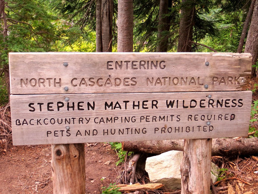
Day 0: It’s a little more reasonable driving day. We leave the freeway at Spokane and work our way over to the North Cascades Highway, which is spectacular as always. We arrive at the Marblemount ranger station for permits at 5:00 (they close at 6), get squared away, and then have a fantastic meal and beers at the North Fork Brewery near Deming. We camp at the trailhead a little after dark. It’s on!
Day 1. 10 miles, +2000 -3000
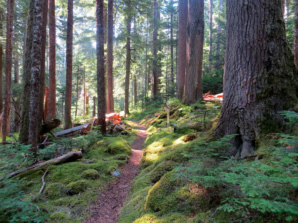
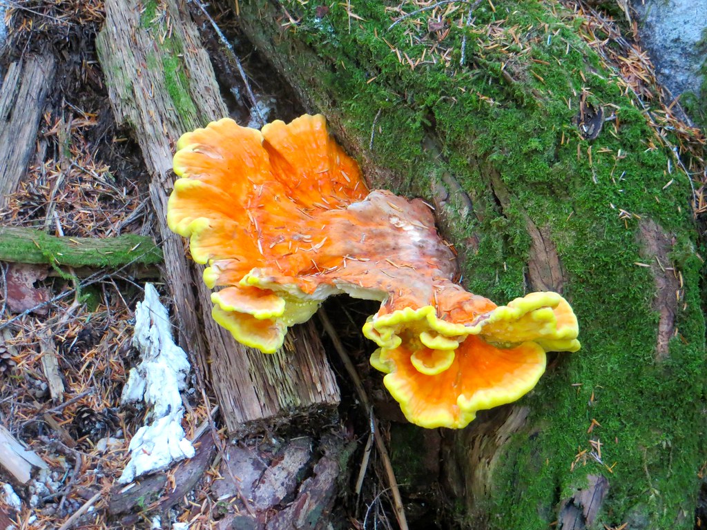
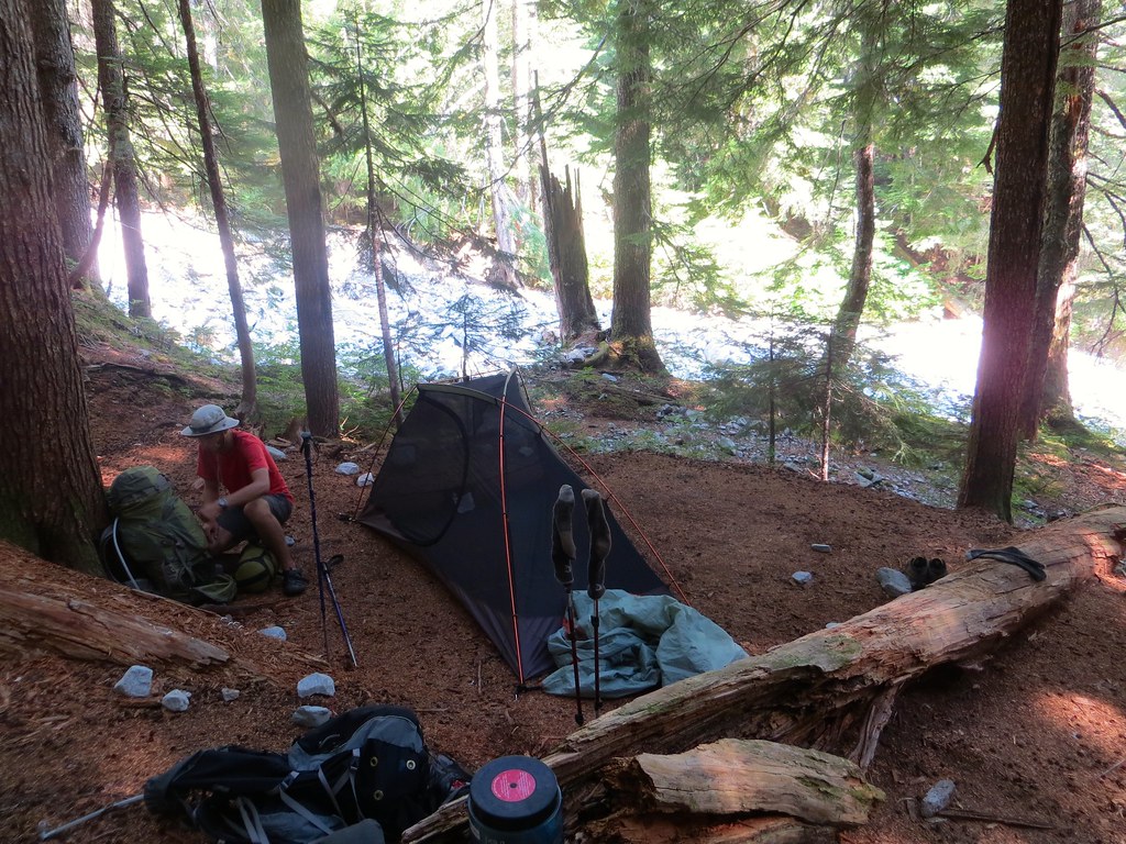
It’s a beautiful forest walk, climbing 4 miles to Hannegan Pass, then descending 6 more miles along the Chilliwack River to US Cabin Camp. It’s fairly cloudy, and by late morning it is drizzling. No mind—in this giant Douglas fir forest, it’s barely even detectable. By the last couple miles, we had our rain shells on and the brush was pretty wet. We make camp mid afternoon, and shorty after, it starts raining HARD, with no wind whatsoever. It continued to do this without break until about 4:00 am. Ugh. Major tent time. No dinner. We actually took some water through a couple seams of the fly (never happened with this tent before). This was the one type of weather I did not expect on this trip. Not many pictures this day.
 Untitled by cwes64, on Flickr
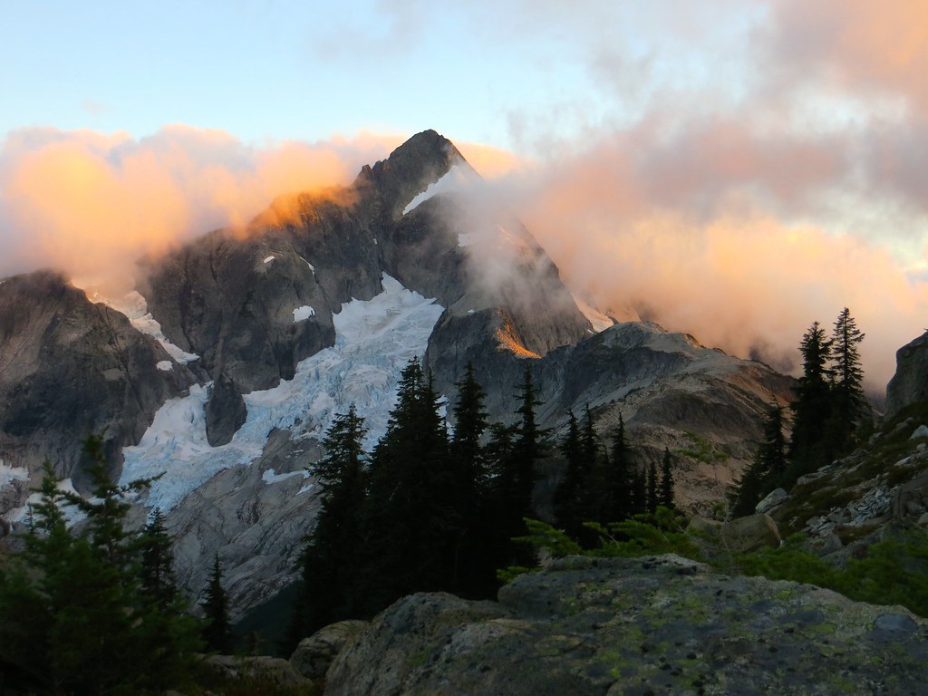
Day 2. Est. 9 miles, +3500
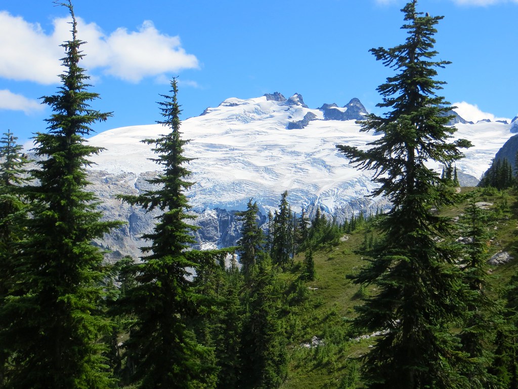
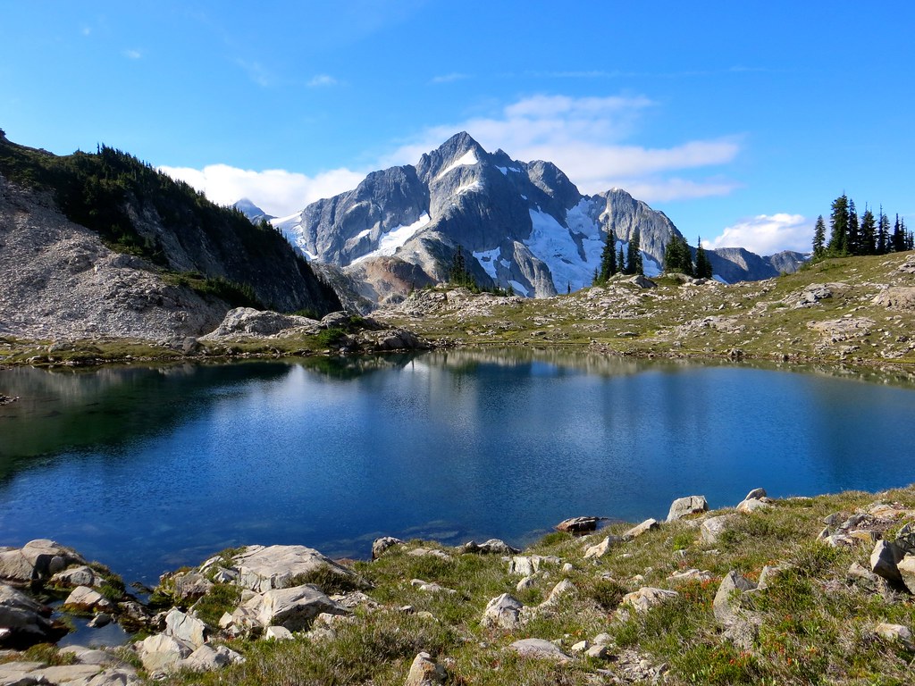
We awake to drizzle, which is a relief. We’re a little concerned about the weather, and take our time getting going. It’s a wet brushy mile down to the cable car crossing of the Chilliwack, then a long, gradual climb up Brush Creek to Whatcom Pass. By mid morning, the rain has stopped and the sky is gradually clearing. We took a ½ hour rest at Whatcom Pass, and then headed up the boot-built path to the north. This is super steep for the first 3/4 mile or so, but easy to follow. That took us to the ridge between Tapto Lakes and Middle Lakes at about 5800 ft. From there we headed east in beautiful open country & parkland trees to Middle Lakes. The views from here are staggering: several orders of magnitude better than at Whatcom Pass—it’s a shame the many people hike all the way to Whatcom Pass but miss the really great views that are only a mile away. We made camp near the lower Middle Lake around 4:00. The weather had been steadily improving (along with our spirits) and it was now mostly clear. After dinner, we watched the light change on Challenger and enjoyed a beautiful sunset.
 Untitled by cwes64, on Flickr
 Untitled by cwes64, on Flickr
 Untitled by cwes64, on Flickr
 Untitled by cwes64, on Flickr
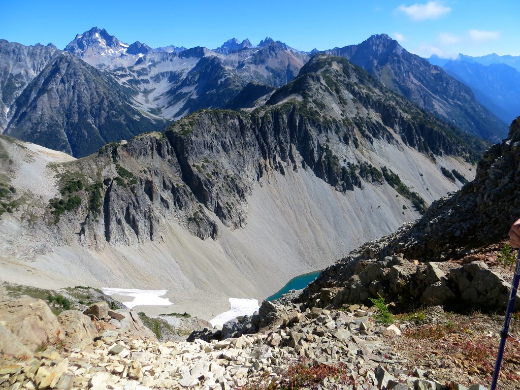
Day 3. Est 4-5 miles +/- 2500
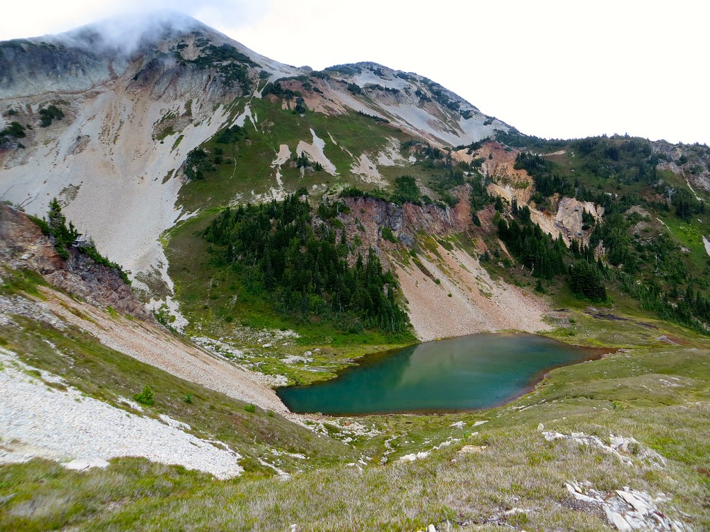
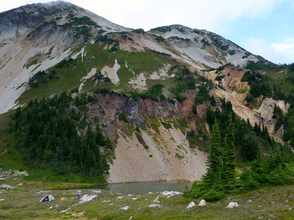
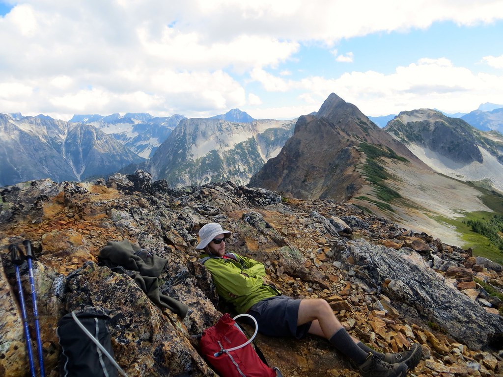
The goal today was to climb over the summit of the ridge dividing Middle Lakes from East Lakes, and then traverse “sublime ridge” around East Lakes and north to Cave Lake. We took what we later figured out was a tougher route than necessary, up a super-steep slope below the outlet of the lake, to Tiny Lake, and to the summit ridge. The travel was tough but the views were staggering: Challenger, Bear, Redoubt, Baker, Shuksan--everything. Unfortunately, my son had a headache this day and was generally a bit out of sorts. We eyed the planned route, thinking it was pretty exposed and that perhaps we were behind the clock a bit at this point (it was at least 5 miles of ridge scrambling to Cave Lake, with no other likely water source between here and there.) So, we decide to bag that route and return to Middle Lakes and basecamp there. On the way down, we saw the first of many bears. Once in camp, we saw a different bear. We swam, washed some clothes, and enjoyed a beautiful sunny afternoon in camp, which we made closer to the outlet of the Lower Middle Lake this time.
 Untitled by cwes64, on Flickr
 Untitled by cwes64, on Flickr
This was the planned ridge route
 Untitled by cwes64, on Flickr
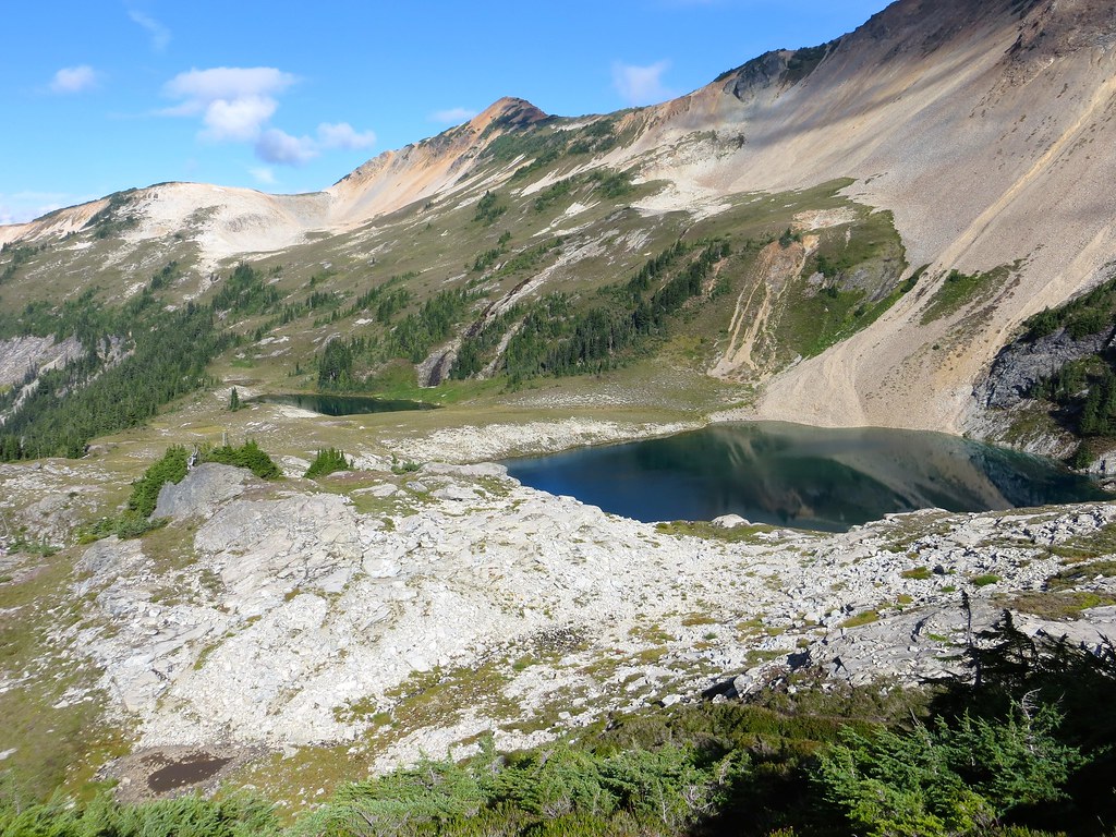
Middle Lakes
Day 4. Est 6 miles, +/- 2000
We scrambled Red Face Mountain. We climbed to the west and down to Tapto Lakes, which are extremely scenic. We were slightly surprised to find no one camped there. From the lower Tapto Lake, it is a very straightforward class 2 climb to Red Faced Mountain, with far more obvious route finding and far less steep travel than we had on our climb the day before. We hit the summit around 11:00 and lingered a good while, as the skies were becoming increasingly cloudy. We enjoyed another lazy afternoon in camp, but the weather was increasingly volatile, with gusty winds off and on. By early evening, we got a bit of rain, but just managed to get dinner eaten before it started.
 Untitled by cwes64, on Flickr
 Untitled by cwes64, on Flickr
 Untitled by cwes64, on Flickr
 Untitled by cwes64, on Flickr
Day 5. Rest Day.
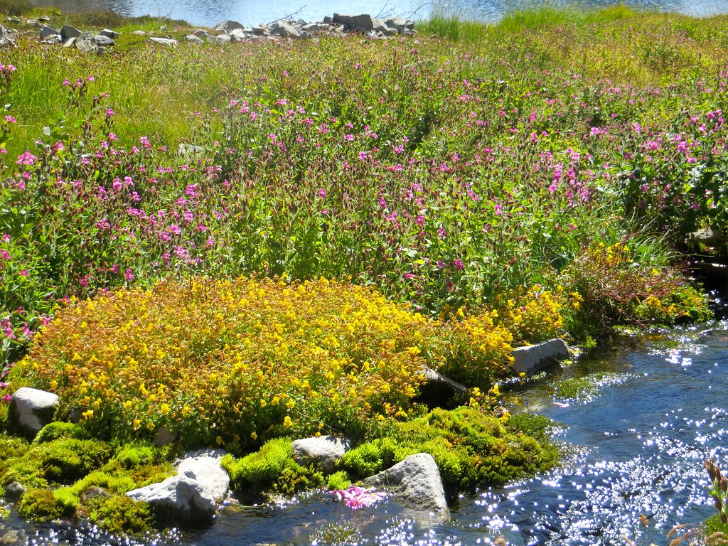
We putzed around the Middle Lakes basin, including the spectacular ¼ mile of creek draining the upper lake into the lower, which is rocky and stark at the top, but lush and full of moss and wildflowers as it descends to the lower lake. Bears pass through the vicinity of our camp so frequently that it’s barely even an event to see one: we watched two different bears walk to the lake and swim. (We also swam, in between bears.) We had Mary Jane’s Farms Thai Fusion for dinner, which was our favorite meal of the trip.
 Untitled by cwes64, on Flickr
 Untitled by cwes64, on Flickr
 Untitled by cwes64, on Flickr
 Untitled by cwes64, on Flickr
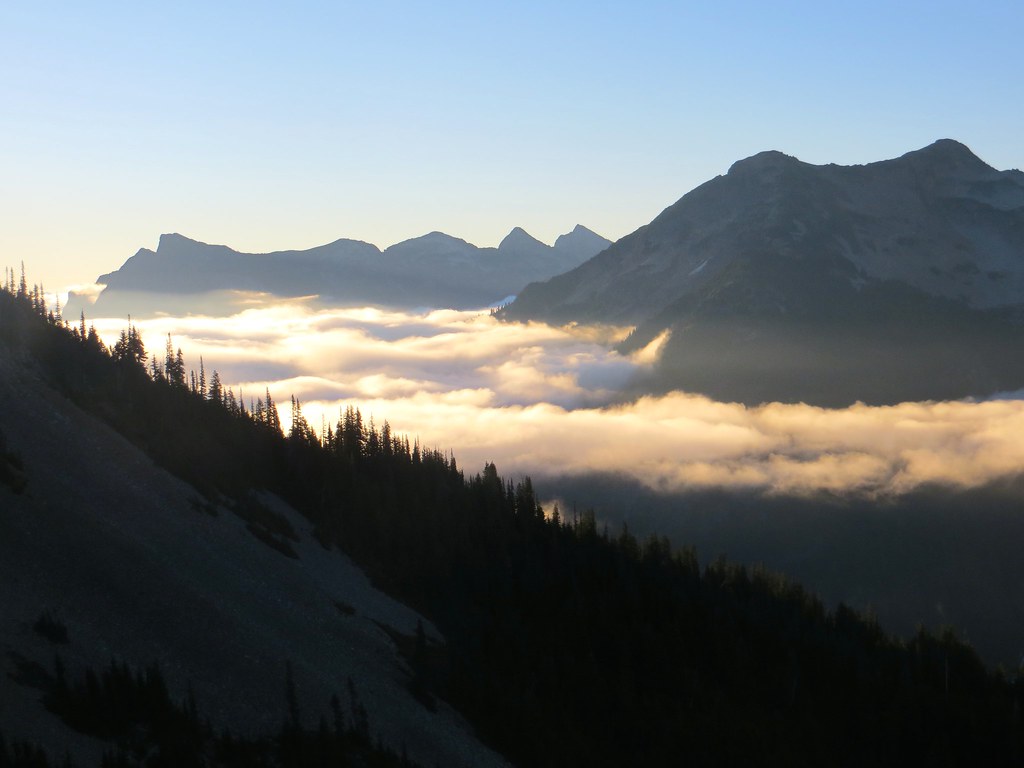
Day 6. 12 miles, +1000, -3500
Time to head back. We take in the last spectacular high-country views on the way back to the trail at Whatcom Pass. From there, it’s an uneventful forest walk on a beautiful day all the way to Copper Creek camp on the Chilliwack. Copper Creek is a very pleasant forest camp where some sunlight makes it in through the trees. We made camp about 2:30 and had a lovely nap in the tent with the fly off.
 Untitled by cwes64, on Flickr
 Untitled by cwes64, on Flickr
 Untitled by cwes64, on Flickr
Day 7. 7 miles, +/- 2000
It’s car day (and, more importantly, shower and beer day). So, we hike at a much faster pace today. The air is quite smoky from fires burning in the region, obscuring the views on this clear day. We are back at the car around 11:30. We hit the coin-operated showers at Silver Lake Park, and are stoked to return to North Fork Brewery. We are crushed to find that they do not open until 4:00. So we continue to Bellingham and lunch at Boundary Bay Brewpub, which has average beers (by craft brew standards), but pretty spectacular burgers. Thus begins the long but beautiful drive home, this time via Oregon, Idaho, Utah and Colorado.
I love the North Cascades with a passion, fueled I’m sure partly by nostalgia (I hiked there regularly when I lived in Seattle in the 80s and 90s, and spent the fall there in 2008 as an artist-in-residence in Stehekin), but also because they are just so spectacular. I’ve been wanting to visit the Whatcom Pass area for decades, and it most definitely did not disappoint. Maybe I’ll return another year to try the originally planned off-trail aspect of this trip that didn’t work out this time. The lack of snow in the high country was kindof bizarre.
Huge Flickr album here (200 some pics)
Day -1: We drive 1200 miles from Manhattan, KS to Bozeman, MT. Ugh.
Day 0: It’s a little more reasonable driving day. We leave the freeway at Spokane and work our way over to the North Cascades Highway, which is spectacular as always. We arrive at the Marblemount ranger station for permits at 5:00 (they close at 6), get squared away, and then have a fantastic meal and beers at the North Fork Brewery near Deming. We camp at the trailhead a little after dark. It’s on!
Day 1. 10 miles, +2000 -3000
It’s a beautiful forest walk, climbing 4 miles to Hannegan Pass, then descending 6 more miles along the Chilliwack River to US Cabin Camp. It’s fairly cloudy, and by late morning it is drizzling. No mind—in this giant Douglas fir forest, it’s barely even detectable. By the last couple miles, we had our rain shells on and the brush was pretty wet. We make camp mid afternoon, and shorty after, it starts raining HARD, with no wind whatsoever. It continued to do this without break until about 4:00 am. Ugh. Major tent time. No dinner. We actually took some water through a couple seams of the fly (never happened with this tent before). This was the one type of weather I did not expect on this trip. Not many pictures this day.
Untitled by cwes64, on FlickrDay 2. Est. 9 miles, +3500
We awake to drizzle, which is a relief. We’re a little concerned about the weather, and take our time getting going. It’s a wet brushy mile down to the cable car crossing of the Chilliwack, then a long, gradual climb up Brush Creek to Whatcom Pass. By mid morning, the rain has stopped and the sky is gradually clearing. We took a ½ hour rest at Whatcom Pass, and then headed up the boot-built path to the north. This is super steep for the first 3/4 mile or so, but easy to follow. That took us to the ridge between Tapto Lakes and Middle Lakes at about 5800 ft. From there we headed east in beautiful open country & parkland trees to Middle Lakes. The views from here are staggering: several orders of magnitude better than at Whatcom Pass—it’s a shame the many people hike all the way to Whatcom Pass but miss the really great views that are only a mile away. We made camp near the lower Middle Lake around 4:00. The weather had been steadily improving (along with our spirits) and it was now mostly clear. After dinner, we watched the light change on Challenger and enjoyed a beautiful sunset.
Untitled by cwes64, on FlickrUntitled by cwes64, on FlickrUntitled by cwes64, on FlickrUntitled by cwes64, on FlickrDay 3. Est 4-5 miles +/- 2500
The goal today was to climb over the summit of the ridge dividing Middle Lakes from East Lakes, and then traverse “sublime ridge” around East Lakes and north to Cave Lake. We took what we later figured out was a tougher route than necessary, up a super-steep slope below the outlet of the lake, to Tiny Lake, and to the summit ridge. The travel was tough but the views were staggering: Challenger, Bear, Redoubt, Baker, Shuksan--everything. Unfortunately, my son had a headache this day and was generally a bit out of sorts. We eyed the planned route, thinking it was pretty exposed and that perhaps we were behind the clock a bit at this point (it was at least 5 miles of ridge scrambling to Cave Lake, with no other likely water source between here and there.) So, we decide to bag that route and return to Middle Lakes and basecamp there. On the way down, we saw the first of many bears. Once in camp, we saw a different bear. We swam, washed some clothes, and enjoyed a beautiful sunny afternoon in camp, which we made closer to the outlet of the Lower Middle Lake this time.
Untitled by cwes64, on FlickrUntitled by cwes64, on FlickrThis was the planned ridge route
Untitled by cwes64, on FlickrMiddle Lakes
Day 4. Est 6 miles, +/- 2000
We scrambled Red Face Mountain. We climbed to the west and down to Tapto Lakes, which are extremely scenic. We were slightly surprised to find no one camped there. From the lower Tapto Lake, it is a very straightforward class 2 climb to Red Faced Mountain, with far more obvious route finding and far less steep travel than we had on our climb the day before. We hit the summit around 11:00 and lingered a good while, as the skies were becoming increasingly cloudy. We enjoyed another lazy afternoon in camp, but the weather was increasingly volatile, with gusty winds off and on. By early evening, we got a bit of rain, but just managed to get dinner eaten before it started.
Untitled by cwes64, on FlickrUntitled by cwes64, on FlickrUntitled by cwes64, on FlickrUntitled by cwes64, on FlickrDay 5. Rest Day.
We putzed around the Middle Lakes basin, including the spectacular ¼ mile of creek draining the upper lake into the lower, which is rocky and stark at the top, but lush and full of moss and wildflowers as it descends to the lower lake. Bears pass through the vicinity of our camp so frequently that it’s barely even an event to see one: we watched two different bears walk to the lake and swim. (We also swam, in between bears.) We had Mary Jane’s Farms Thai Fusion for dinner, which was our favorite meal of the trip.
Untitled by cwes64, on FlickrUntitled by cwes64, on FlickrUntitled by cwes64, on FlickrUntitled by cwes64, on FlickrDay 6. 12 miles, +1000, -3500
Time to head back. We take in the last spectacular high-country views on the way back to the trail at Whatcom Pass. From there, it’s an uneventful forest walk on a beautiful day all the way to Copper Creek camp on the Chilliwack. Copper Creek is a very pleasant forest camp where some sunlight makes it in through the trees. We made camp about 2:30 and had a lovely nap in the tent with the fly off.
Untitled by cwes64, on FlickrUntitled by cwes64, on FlickrUntitled by cwes64, on FlickrDay 7. 7 miles, +/- 2000
It’s car day (and, more importantly, shower and beer day). So, we hike at a much faster pace today. The air is quite smoky from fires burning in the region, obscuring the views on this clear day. We are back at the car around 11:30. We hit the coin-operated showers at Silver Lake Park, and are stoked to return to North Fork Brewery. We are crushed to find that they do not open until 4:00. So we continue to Bellingham and lunch at Boundary Bay Brewpub, which has average beers (by craft brew standards), but pretty spectacular burgers. Thus begins the long but beautiful drive home, this time via Oregon, Idaho, Utah and Colorado.


