amaruq
Trail Wise!
Call me Little Spoon
Posts: 1,264 
|
Post by amaruq on Sept 26, 2016 11:38:40 GMT -8
So I figured I would 'quickly' put together a trip report for my jaunt through Newfoundland’s Gros Morne National Park. A quick overview to start… There are two main backpacking routes, the Northern Traverse (formerly North Rim Traverse) and Long Range Traverse. To hike either separately the access is via a boat tour that drops hikers off at the end of Western Brook Pond. The former ends in the boat tour parking lot whereas the latter ends at the Gros Morne Mountain parking lot. To hike both as a continuous trip, a party starts out at the boat tour parking lot and finishes in the Gros Morne Mountain trail parking lot. We opted to do both traverses. We flew in to Deer Lake on August 6th, picked up the rental (a brown 2017 Kia Sportage, I didn’t know vehicles came in brown anymore) and made tracks for Corner Brook to pick up food, fuel, and a couple last minute implements. Then backtracked through Deer Lake and onward to Rocky Harbour. We checked into the Ocean View Hotel and proceeded to meander about the small town. That night the non-Newfie two of us were “Screeched in” at the hotel bar, which involves recital of traditional Newfie colloquialisms and cod kissing. 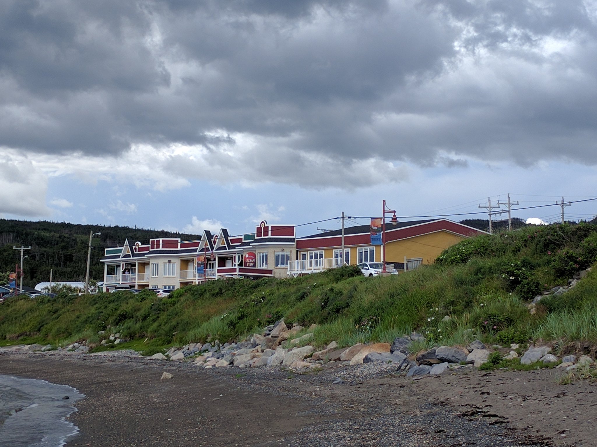 The Ocean View Hotel is a bright spot in an oft dreary locale. The Ocean View Hotel is a bright spot in an oft dreary locale.The following day, August 7th, we attended the orientation session at the Gros Morne NP Visitors’ Centre. We were told in advance there would be a navigational exam to ensure we were up to snuff and so we brought in our maps and compasses. About five hiking groups were assembled for the orientation, perhaps ten people in total. Luckily there was no such exam, however upon hearing our itinerary the other hikers expressed looks of pity and bewilderment at our perceived naiveté. The NP staff providing the orientation made sure to inform us that the turn-back rate for the Northern Traverse was not in our favour. Indeed, every local who we got to talking with – and there were many, because Newfies are a friendly folk – gave us the same look and asked us the same question: “Why?” 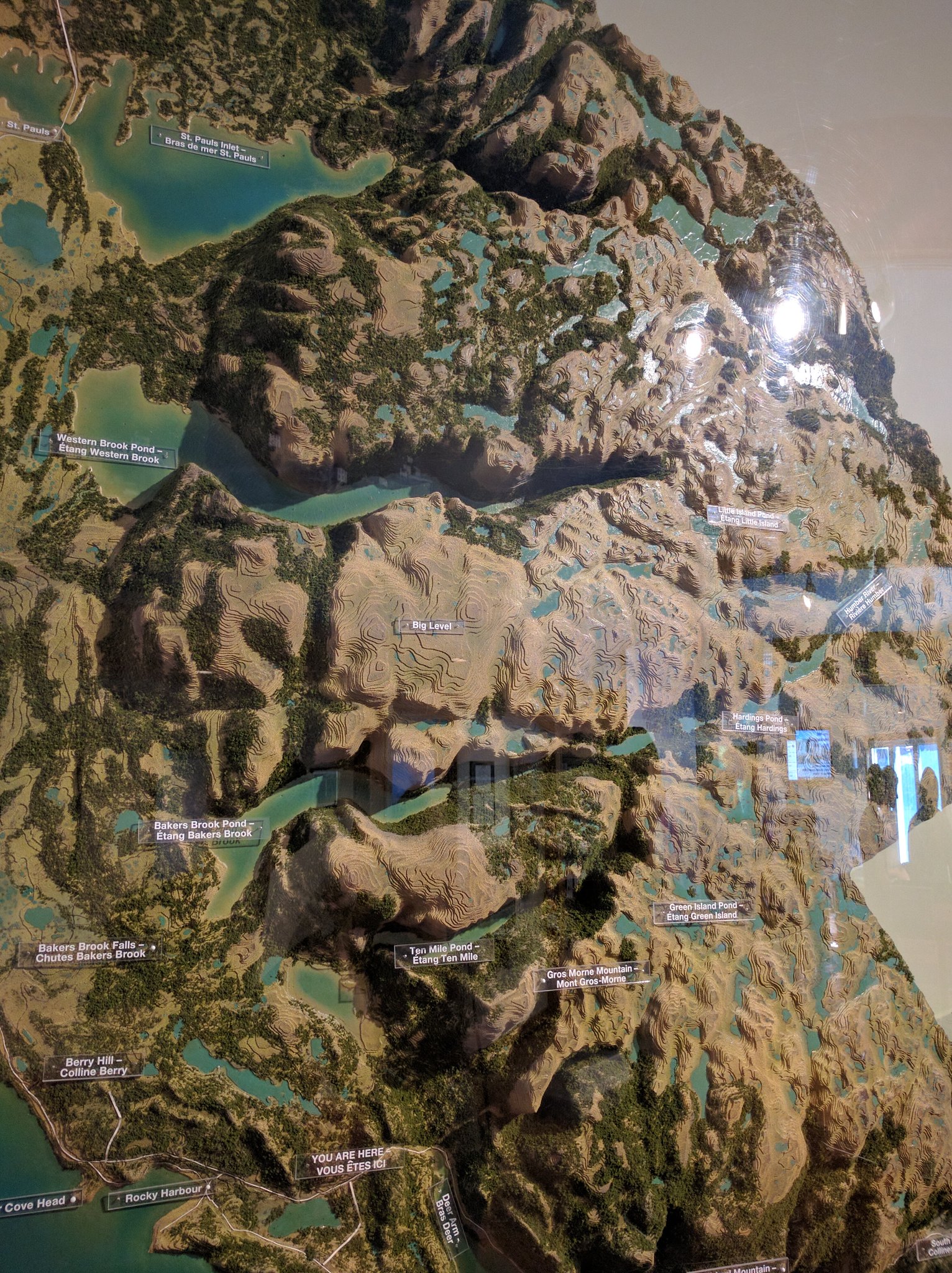 The Visitors' Centre has this neat 3D topo map with trails/routes that light up when their corresponding buttons are pressed. The Visitors' Centre has this neat 3D topo map with trails/routes that light up when their corresponding buttons are pressed.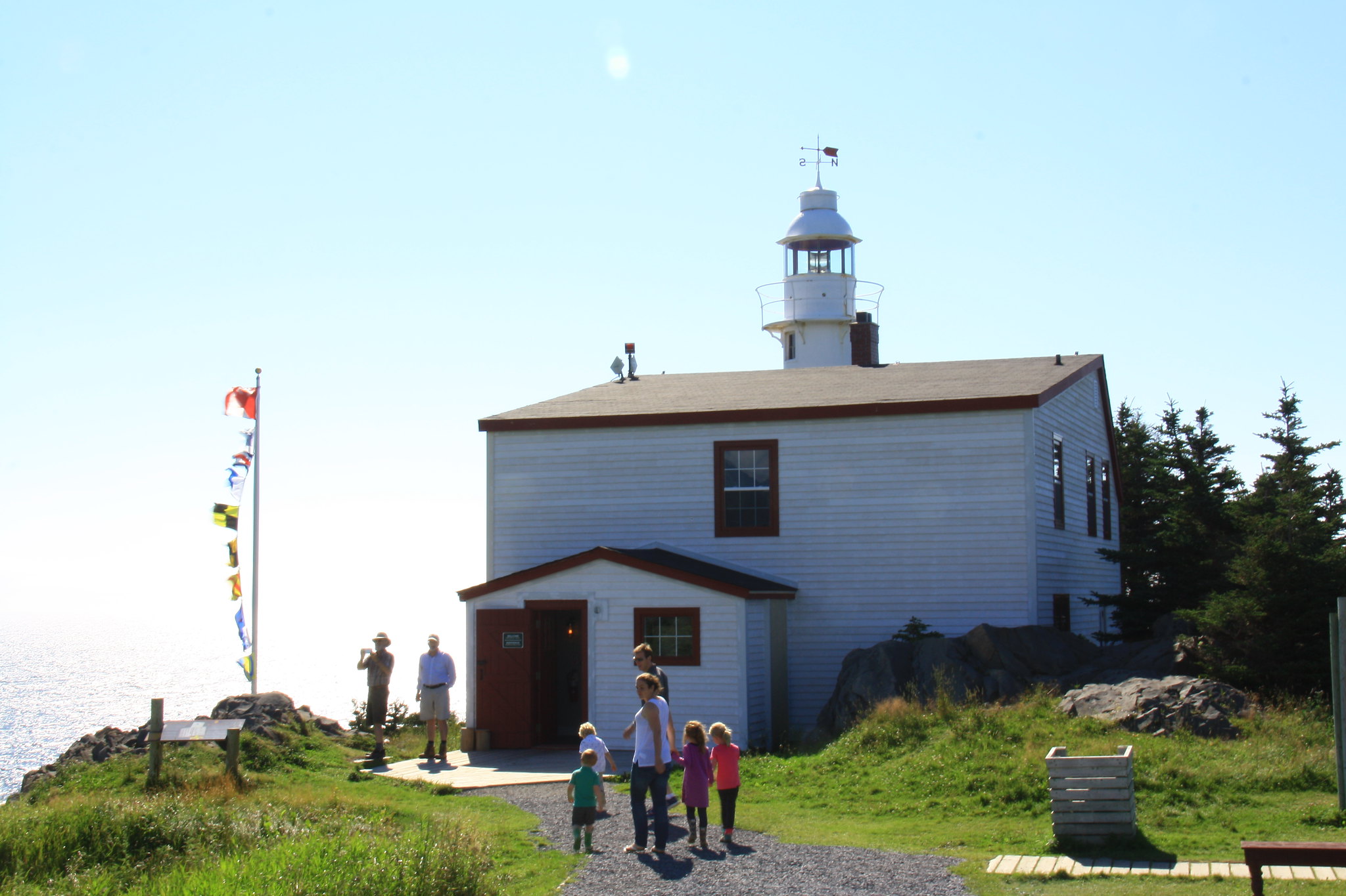 Lobster Head Cove Lighthouse, Rocky Harbour, NFLD Lobster Head Cove Lighthouse, Rocky Harbour, NFLD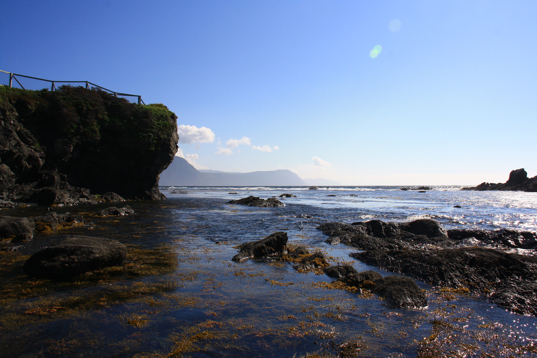 Views of Seaside Cliffs, Rocky Harbour, NFLD Views of Seaside Cliffs, Rocky Harbour, NFLD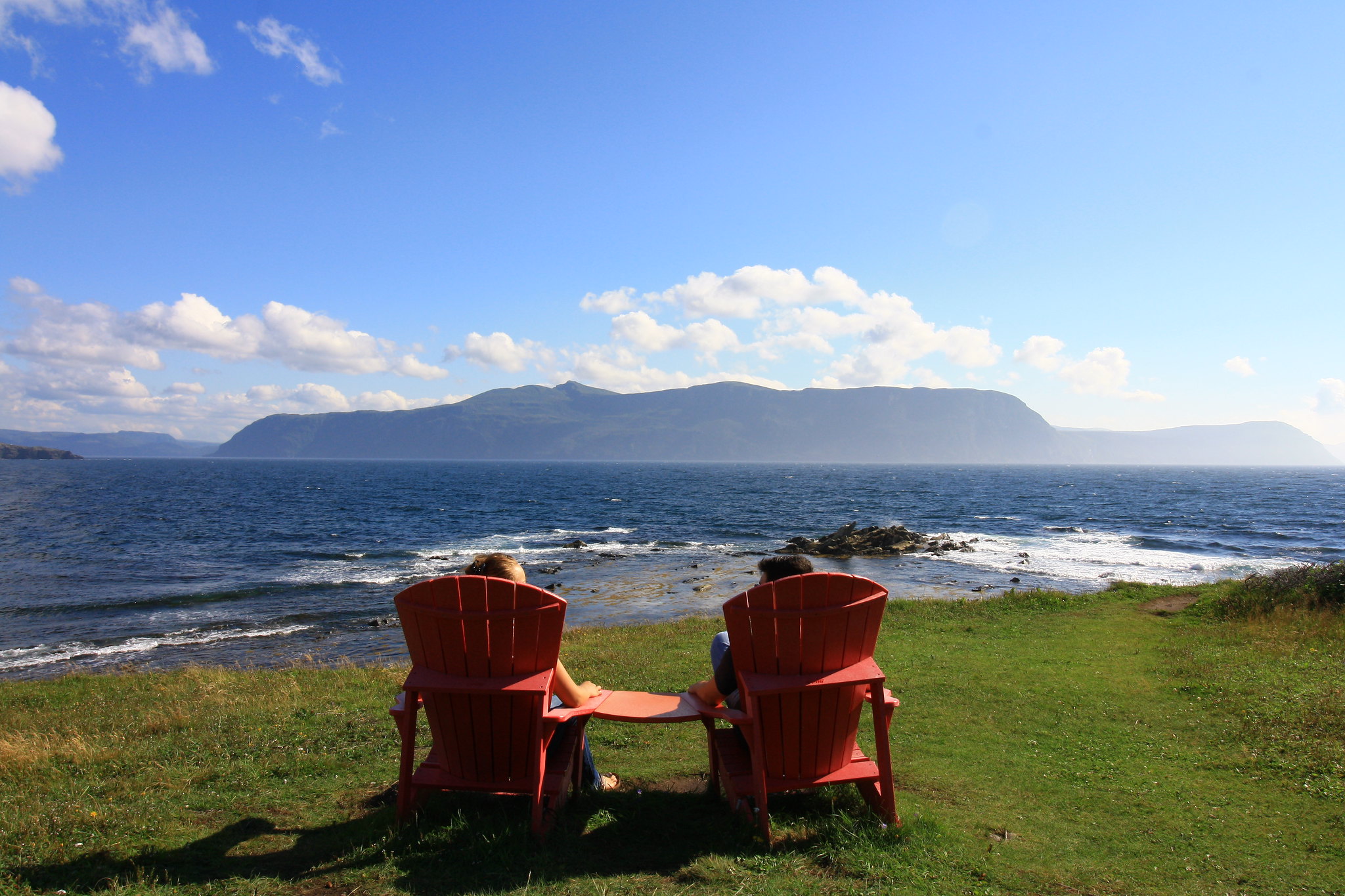 Canada Parks’ most recent marketing campaign: these red chairs. Canada Parks’ most recent marketing campaign: these red chairs.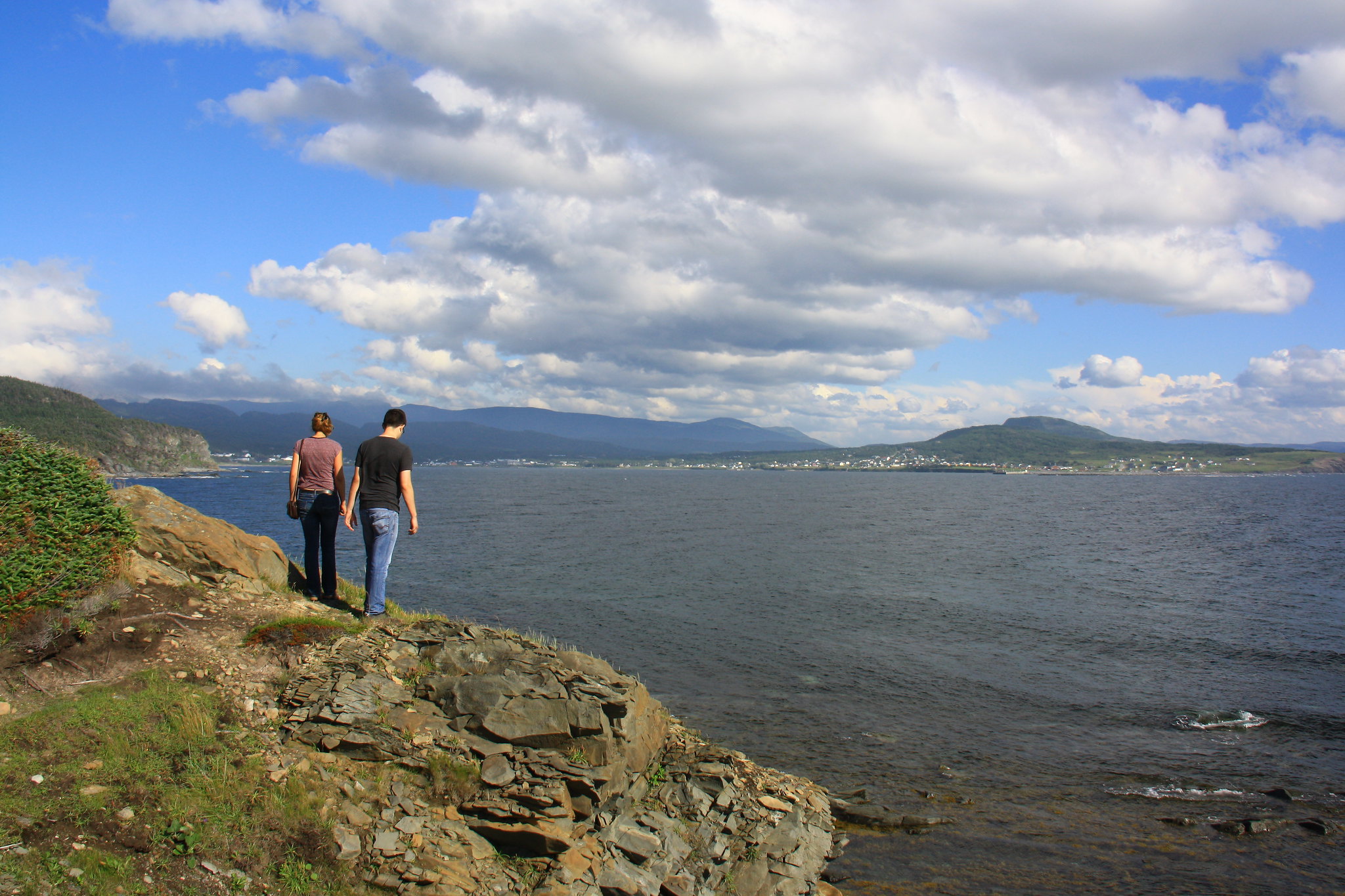 My two compatriots tempt fate looking back toward Rocky Harbour, NFLD. My two compatriots tempt fate looking back toward Rocky Harbour, NFLD.We arranged our backpacks that evening and ate until the sleep came easily. Subsequent days will be posted in the following posts, please hold for the end of the series :-) |
|
amaruq
Trail Wise!
Call me Little Spoon
Posts: 1,264
|
Post by amaruq on Sept 26, 2016 11:44:32 GMT -8
The morning of August 8th saw us stopping for a quick breakfast at the Fisherman’s Landing and getting some sandwiches for lunch to-go. We convinced a cab to meet us at the Gros Morne Mountain parking lot where we planned to stash our Kia for the following week and eventually found ourselves 35 minutes down the highway in the Western Brook Pond boat tour parking lot. 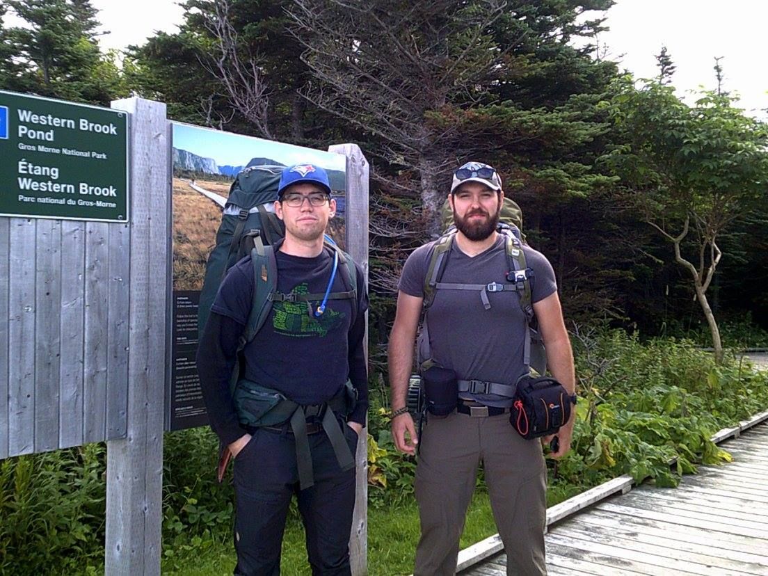 Ready for action... maybe. Ready for action... maybe.With the first 8ish km before us and more than 55km beyond that, we pulled on our backpacks and set off down the boardwalk beneath a blanket of cloud cover. The hike to the tour boat’s dock is something around 2km of very easy trail and boardwalks. It crosses vast plains of marshland with spectacular views of the day-two challenge looming off in the distance. 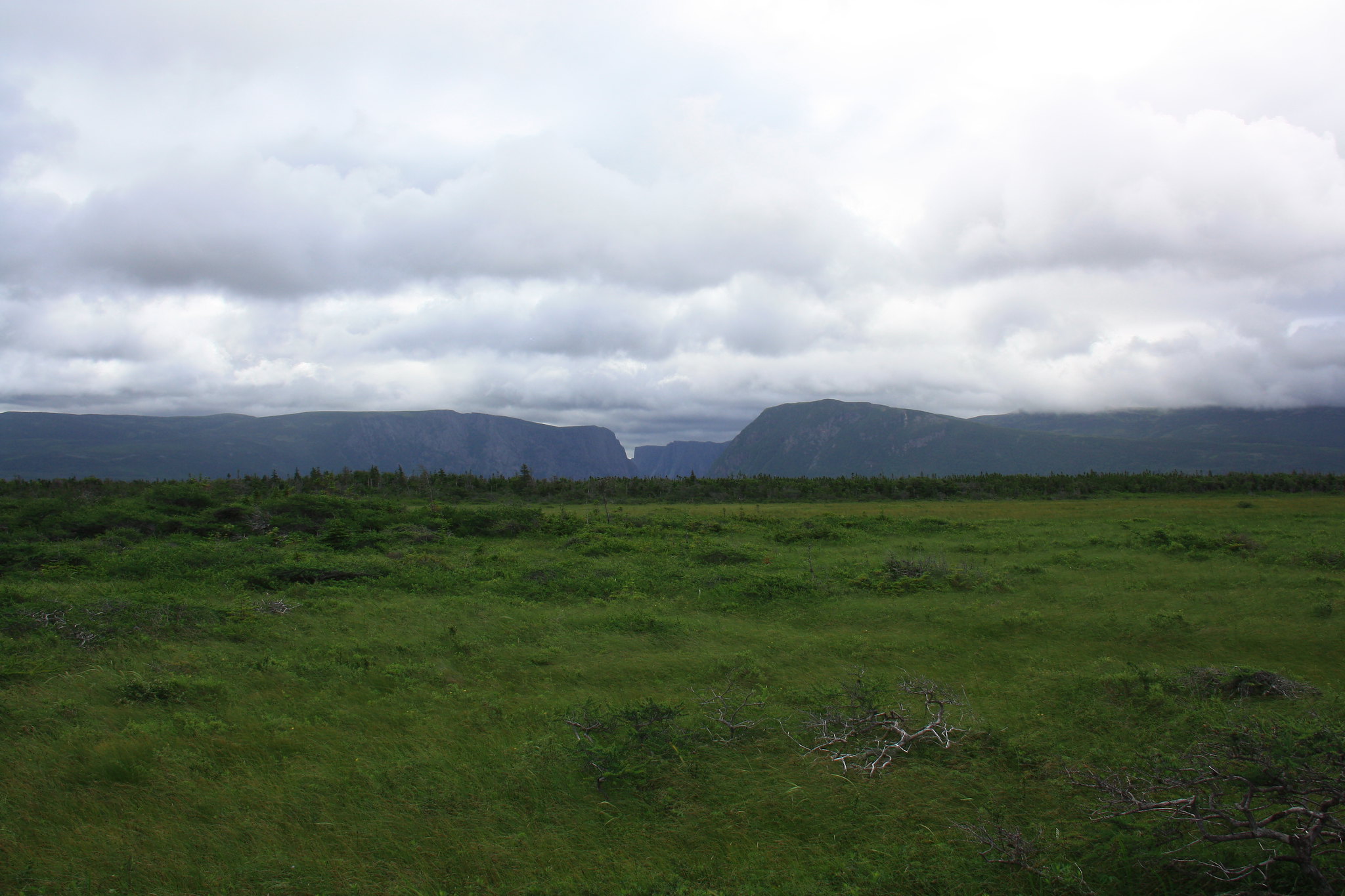 It doesn't look so bad now, but once you get to the base of it... It doesn't look so bad now, but once you get to the base of it... Easy hikin'. Easy hikin'.Eventually, we turned off the boat tour path and made our way on a more primitive trail toward the Western Brook Pond outflow. Although the routes contain dozens of easy stream crossings, this thigh-deep river crossing is swift and the slick riverstones tumble beneath each footstep. I set a route through the current and before long all three of us were on the far side drying the parts of our pants that hadn’t been rolled up far enough. 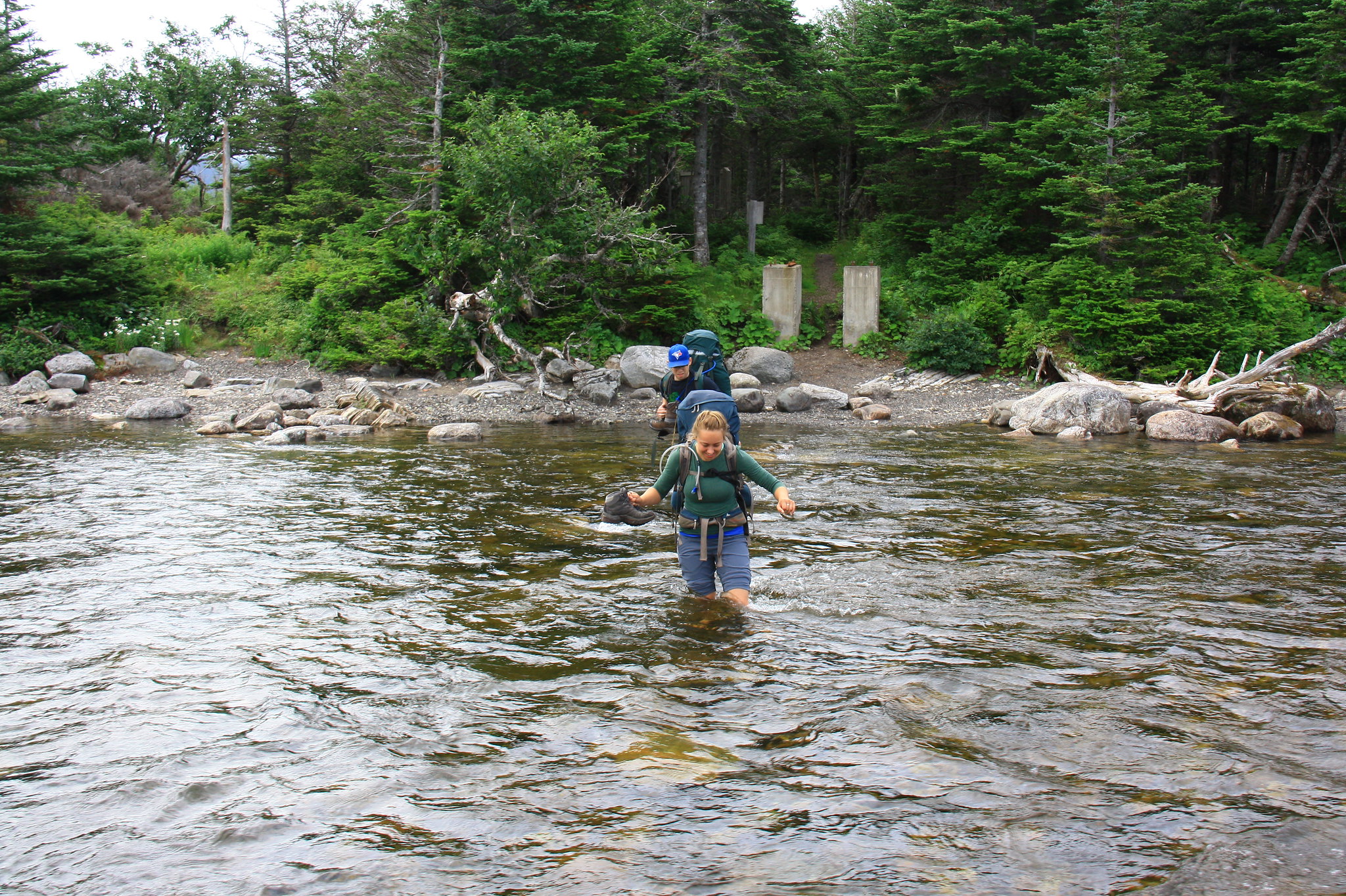 I told her most folk opt to undo the straps out of concerns for safety... I told her most folk opt to undo the straps out of concerns for safety...The remainder of this day’s hike was on ‘primitive’ trails that mainly followed the water’s edge, sometimes spilling out onto the pea-gravel beaches and making the hiking tedious. The mighty cliffs of Western Brook Pond grew with each step deeper into the ancient fjord until we found ourselves at the foot of an impressive vertical mass of rock. Rising 650m out of the water, the cliffs overshadow Toronto’s CN Tower (553m). My hiking partners were not exactly enthusiastic when I gifted this factoid to them. Luckily, this particular spot also happened to be the Snug Harbour campsite, our first night’s campsite. 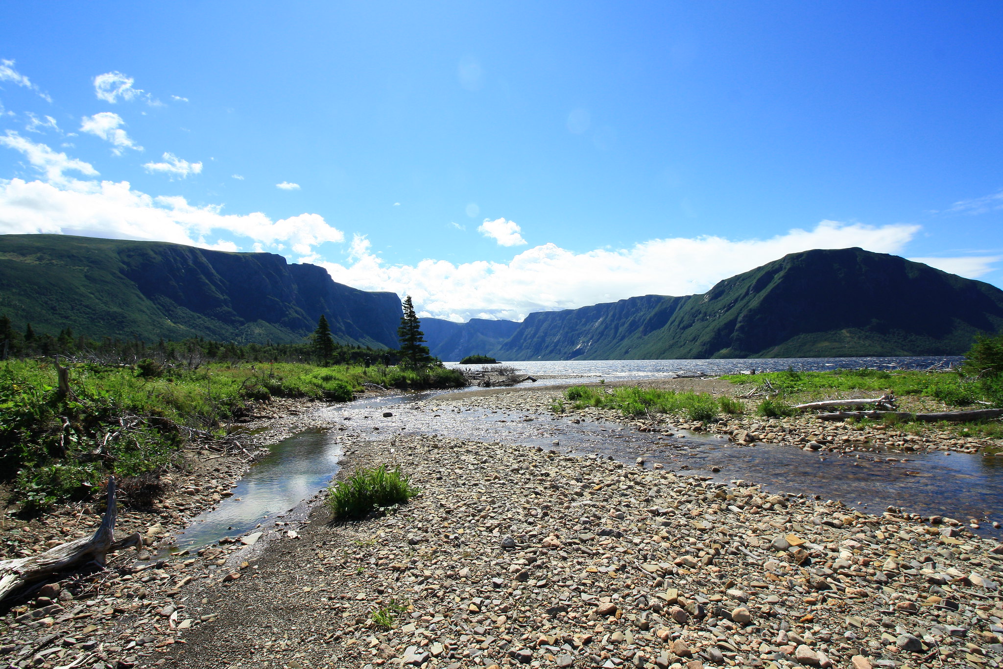 I eventually learned how to swap lenses on the fly. Eventually. I eventually learned how to swap lenses on the fly. Eventually.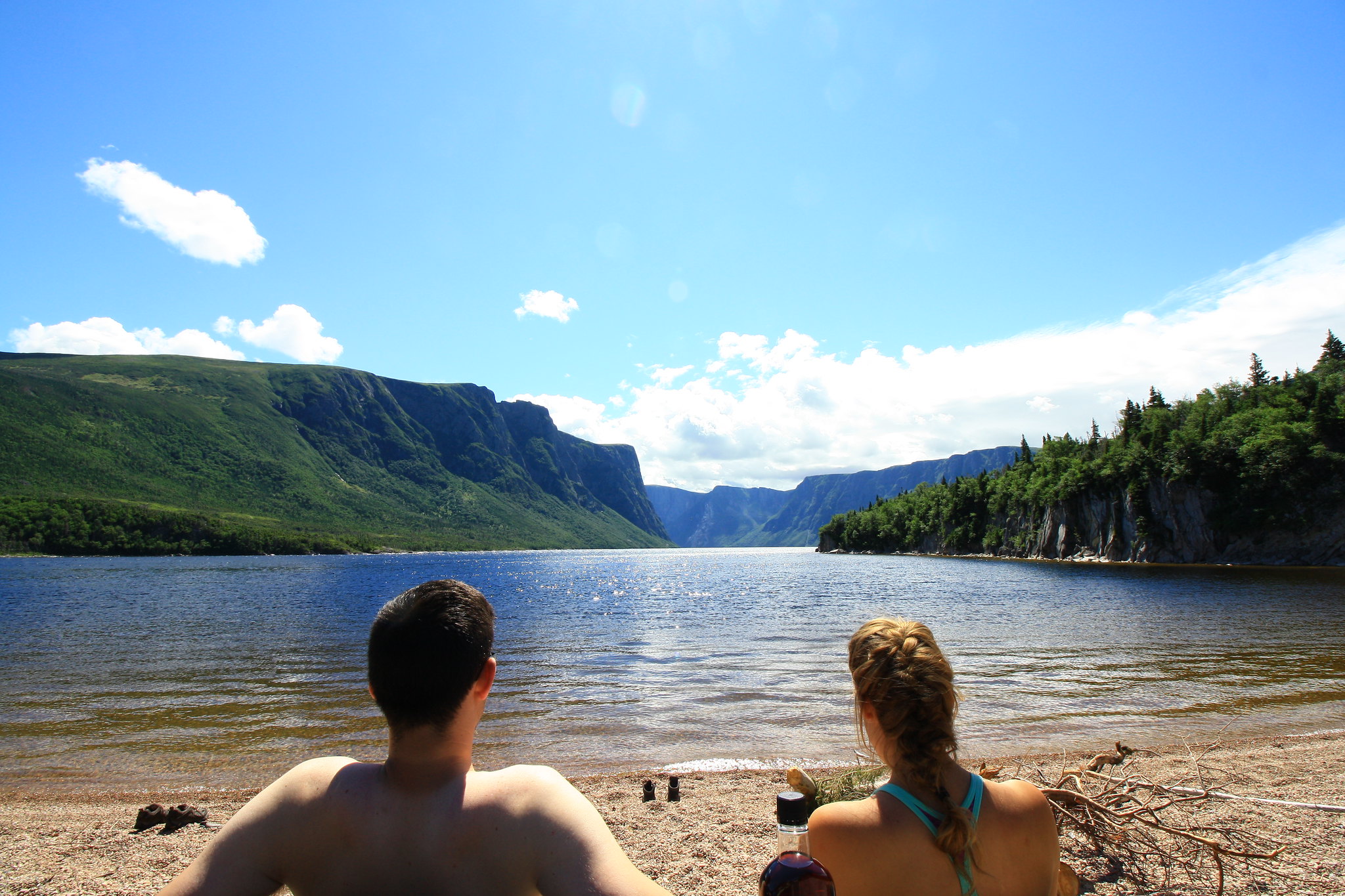 Not what we were expecting, but glad we got it. Not what we were expecting, but glad we got it.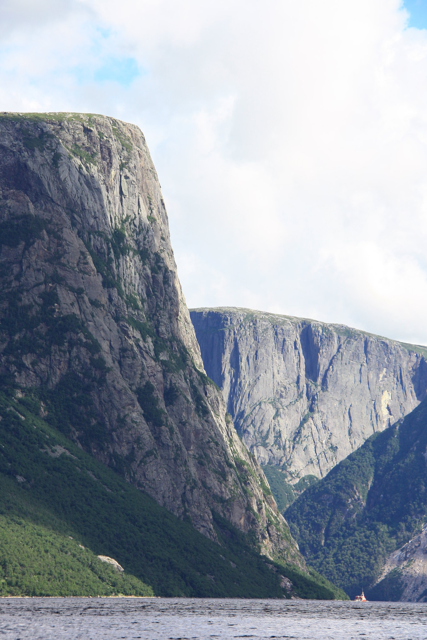 Note the relatively large tour boat near the toe of the cliff. It's not even over to it yet! Note the relatively large tour boat near the toe of the cliff. It's not even over to it yet!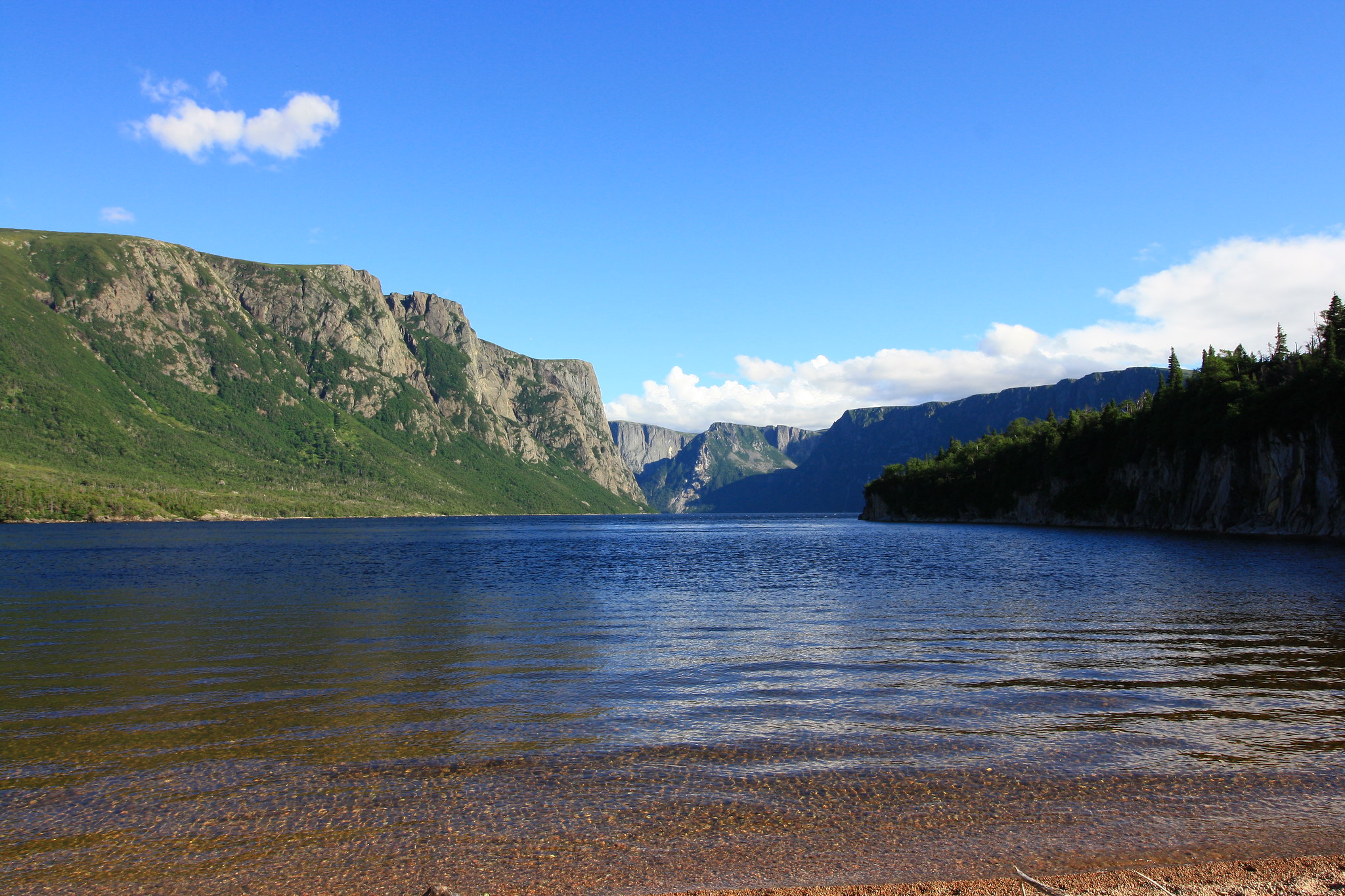 What a nice spot to camp. Sure beats most of Ontario. What a nice spot to camp. Sure beats most of Ontario.The rest of the day was spent swimming, reading, relaxing on the pea-gravel beach, and otherwise milling about in the now peeking sunshine. It was a half-rest-day prior to tackling the climb up to the plateau and our first taste of tuckamore the next day. |
|
amaruq
Trail Wise!
Call me Little Spoon
Posts: 1,264
|
Post by amaruq on Sept 26, 2016 11:55:32 GMT -8
August 9th began with the heaviest rains dumped on us all trip. We tore down the tent from the inside out, applied our rainwear and set out for the top of the hill. The climb was long and tiresome, and brought us our first taste of the tuckamore; twisted and stunted, super-dense though patchy forests of spruce/fir/balsam that are impassable save for narrow game trails, wide streams, and (my favorite) boulder-fields. Thankfully, the path up the side of the mountain is a reasonably-well-defined ‘primitive’ trail. 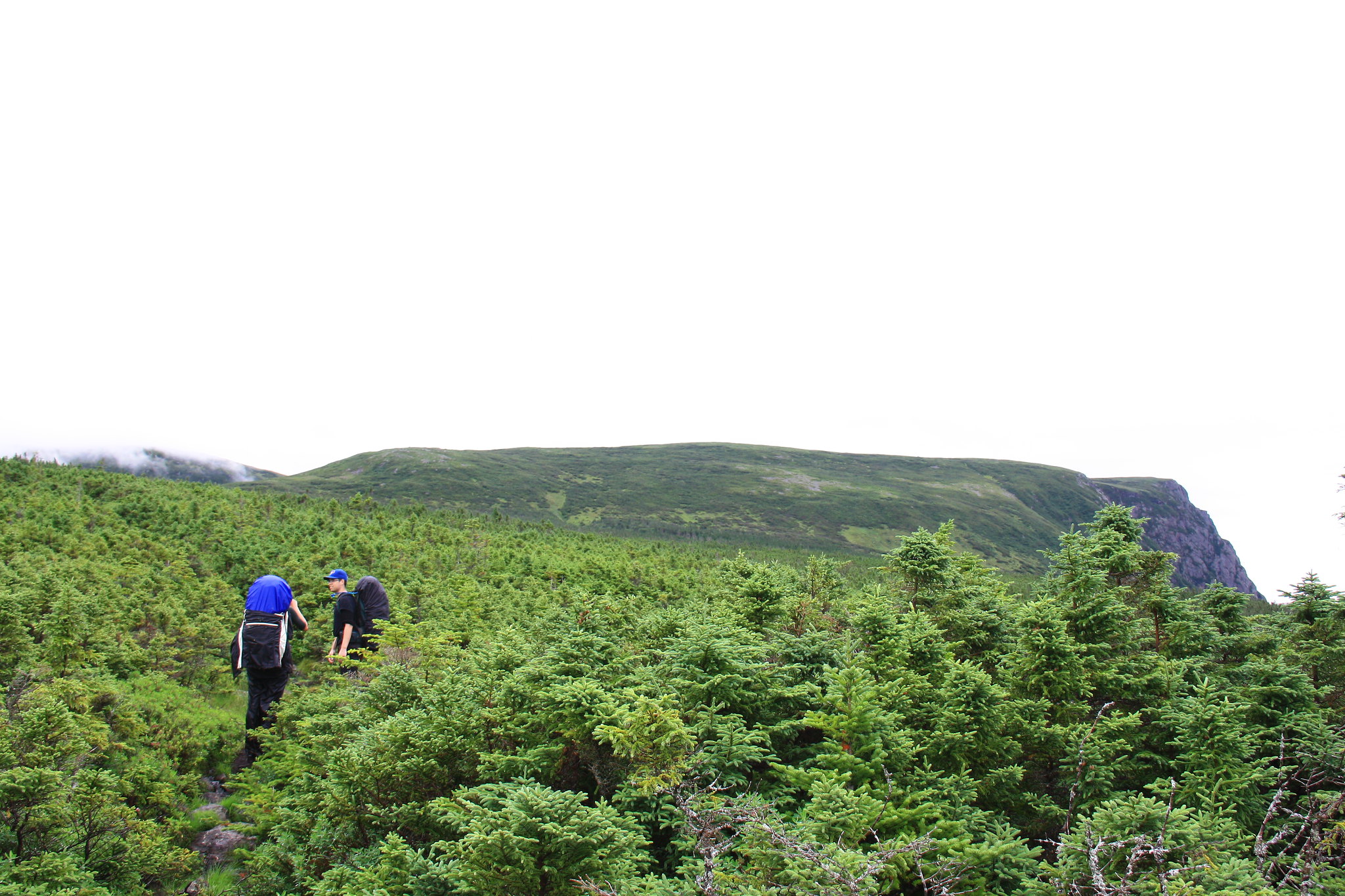 Upward bound, navigating the tuck'. Upward bound, navigating the tuck'. Everything was always damp. The NFLD way of life, I suppose. Everything was always damp. The NFLD way of life, I suppose.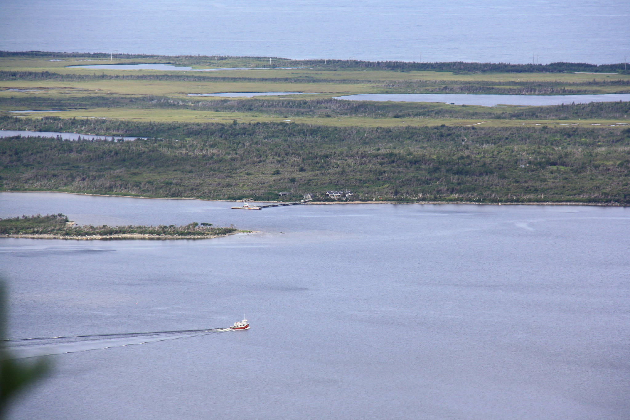 The tour boat doing its thang. The tour boat doing its thang.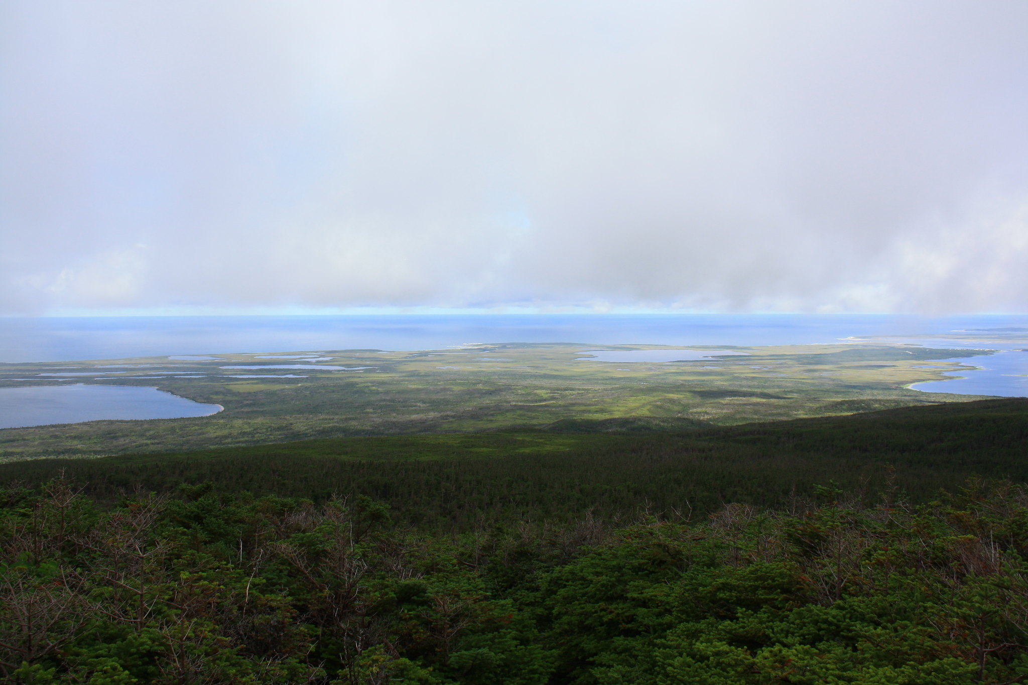 Views from about two-thirds the way up. Views from about two-thirds the way up.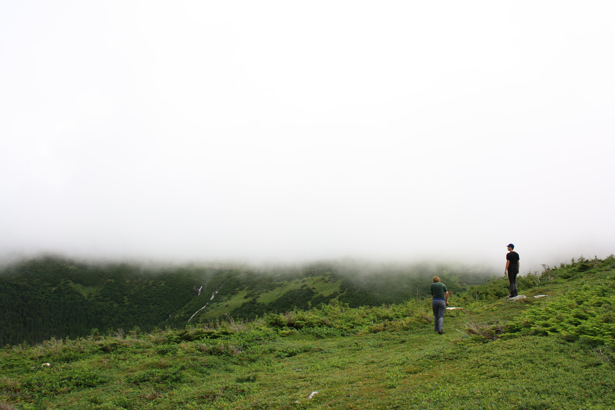 Head in the clouds. Head in the clouds.Near the top of the climb is a boulder which demarcates the beginning of the descent for any weary hikers travelling in the reverse direction. We stopped there for lunch after considering the options now that the trail had run its course and fog/clouds were playing peekaboo with our landmarks. This was no place to be navigating under reduced visibility, a point driven home by the park staff, though it was also no place to be setting up camp. And so we broke out the GPS, the park-supplied route map, and input the next waypoint. We maneuvered from waypoint to waypoint as best we could around, through, and over each thicket of tuckamore until the fog began to lift. Although never far beneath the cloudy ceiling, we were gifted visibility after an hour or so and were able to route-find by sight across the vast swaths of open tundra. 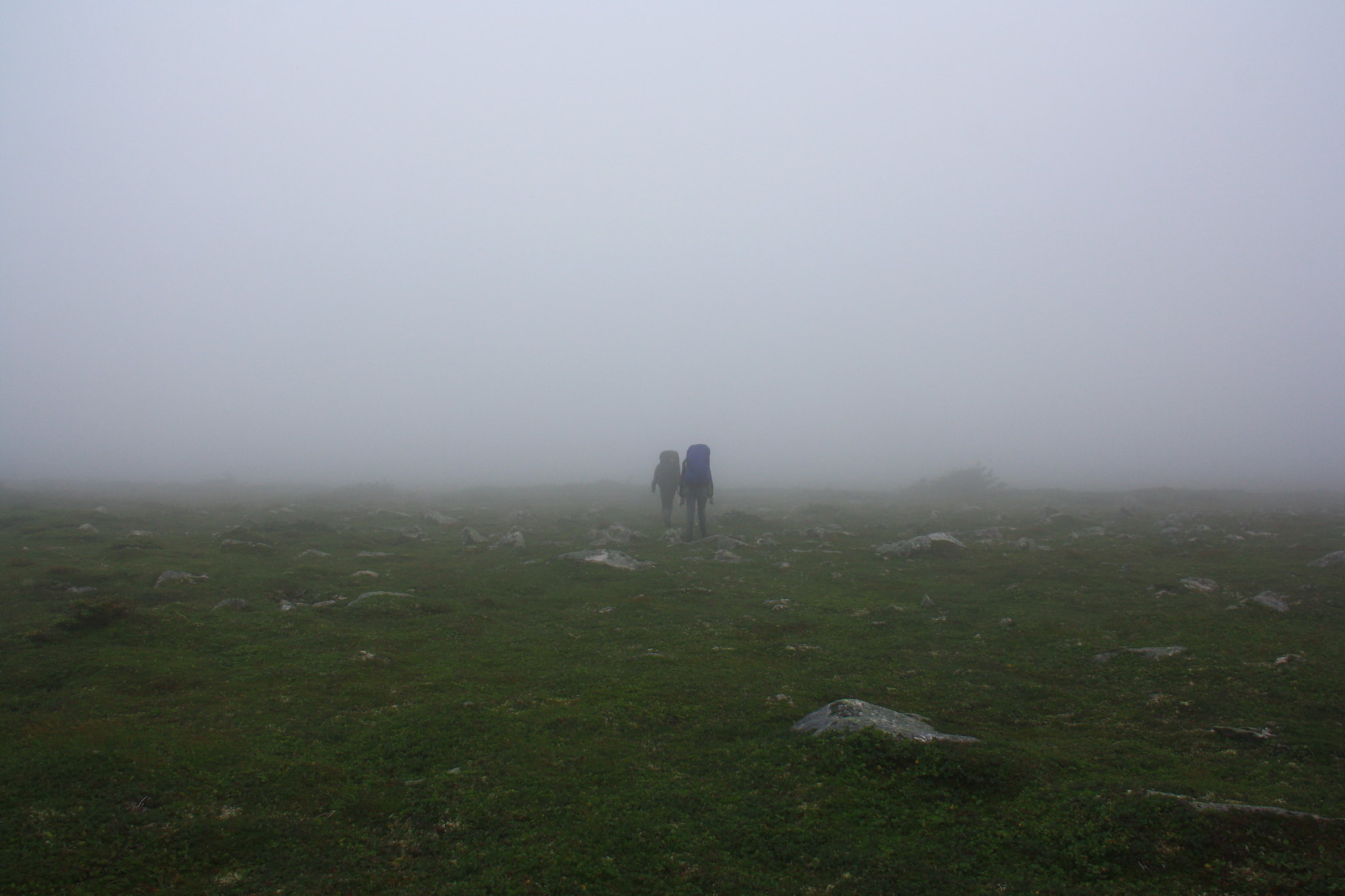 Into the unknown. Like creepers. Into the unknown. Like creepers.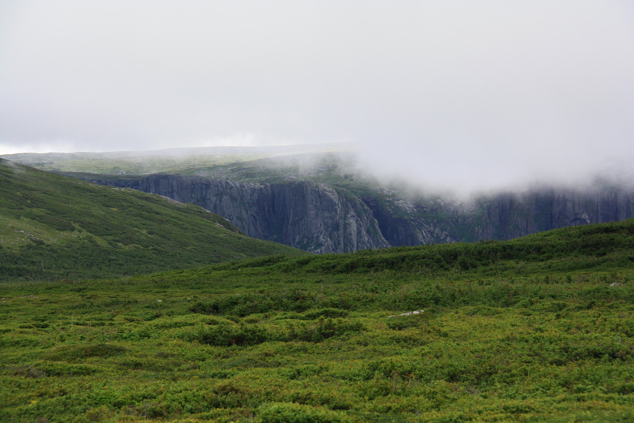 Never far from the Western Brook Pond gorge. Never far from the Western Brook Pond gorge.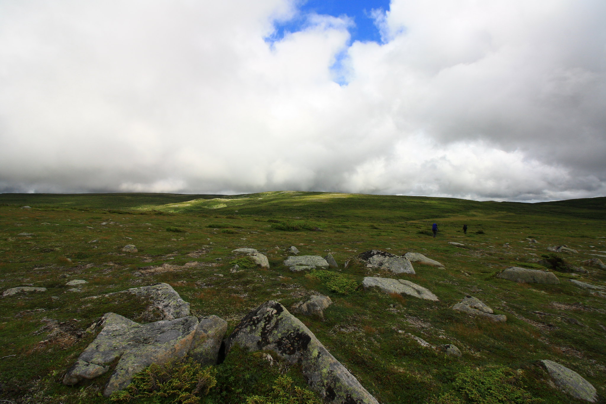 Eventual visibility. Not that there were a whole lot of landmarks to see. Eventual visibility. Not that there were a whole lot of landmarks to see.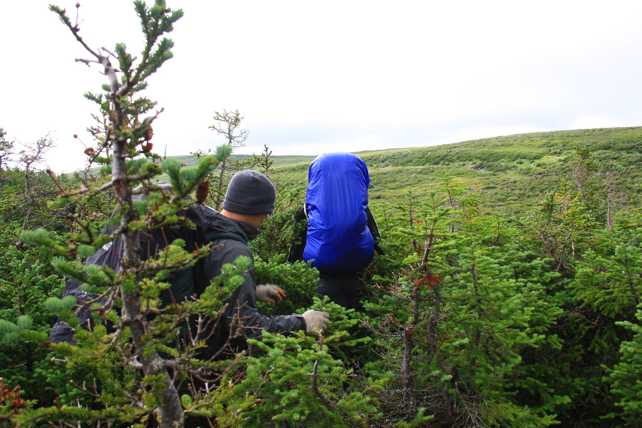 Pushing through the tuckamore. Pushing through the tuckamore.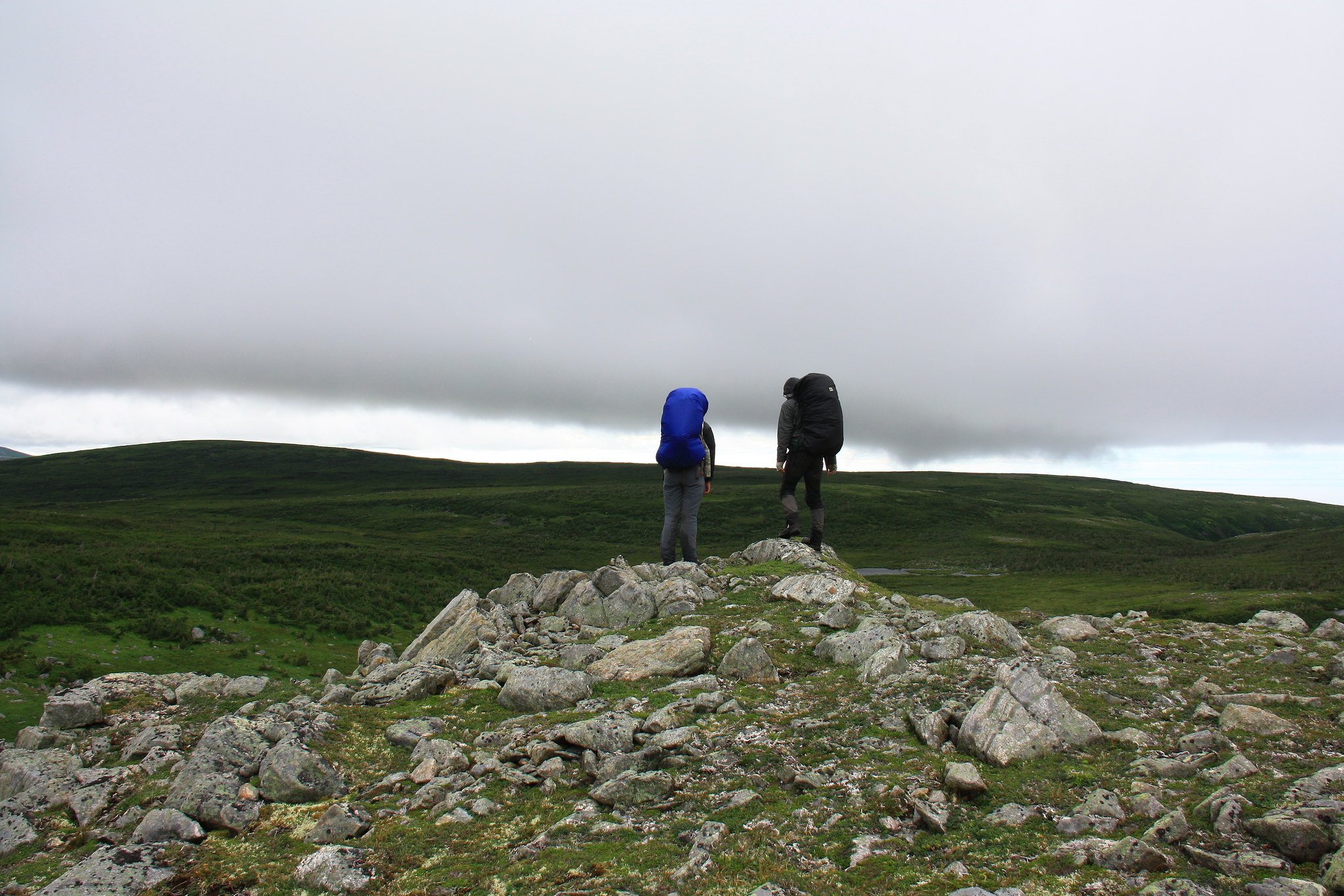 Surveying the next route through the forests of tuck'. Surveying the next route through the forests of tuck'.Atop the plateau, bakeapples – a sort of berry – sprouted by the hundreds. Not much to my liking, but they provided the other two with a plethora of mobile snacks. 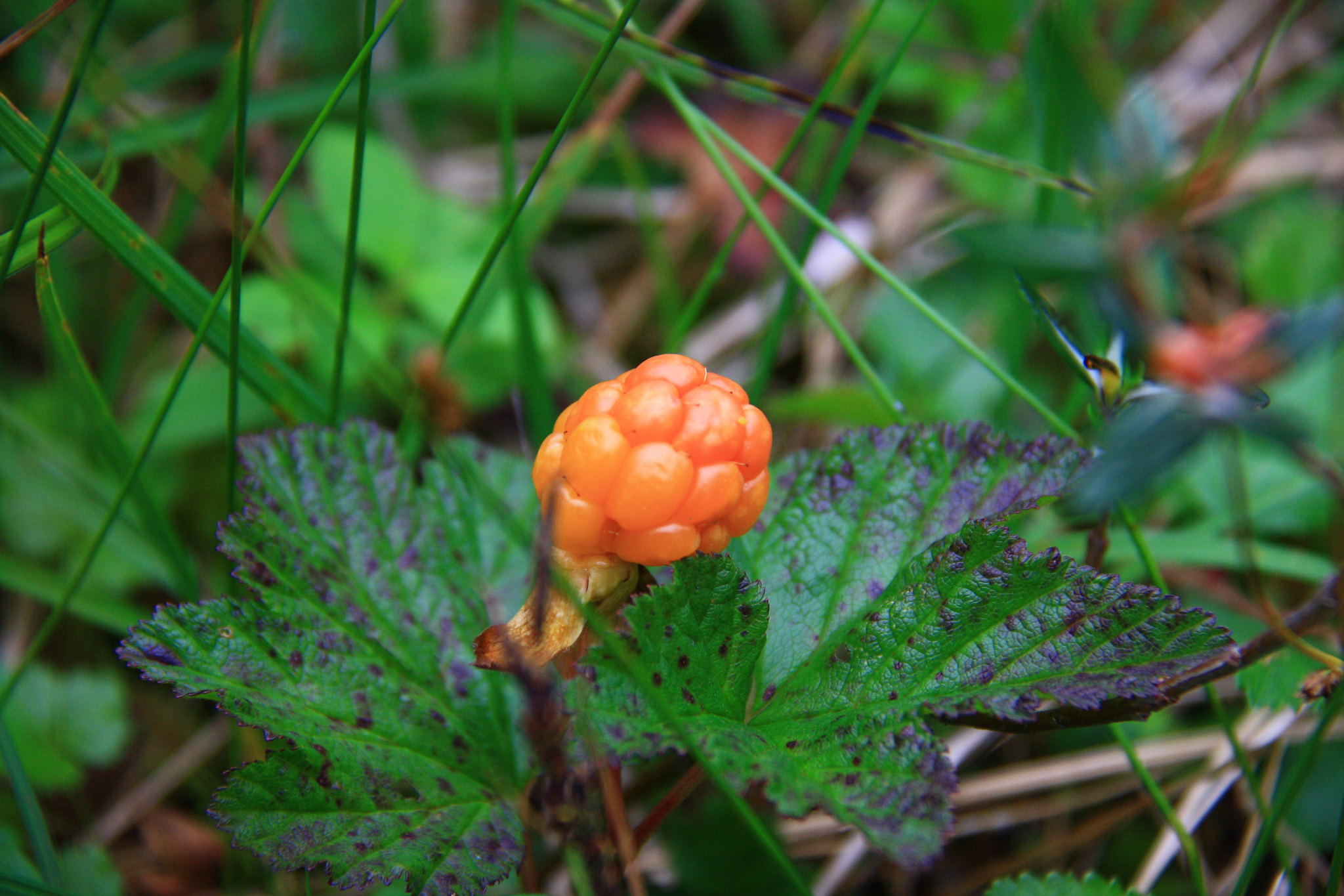 Bakeapples, A.K.A. cloudberries, among a number of other names. Bakeapples, A.K.A. cloudberries, among a number of other names.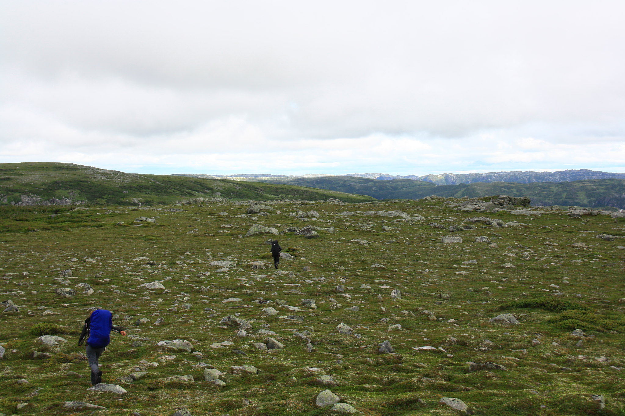 Rock-studded, pot-holed tundra. Rock-studded, pot-holed tundra.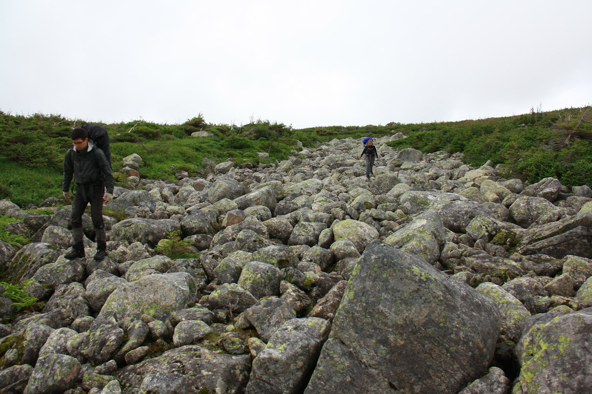 A boulder super-highway. Quickest way through the tuckamore. I'll never take glacial deposits for granite again. A boulder super-highway. Quickest way through the tuckamore. I'll never take glacial deposits for granite again. Spare tent pad kitchen. Spare tent pad kitchen.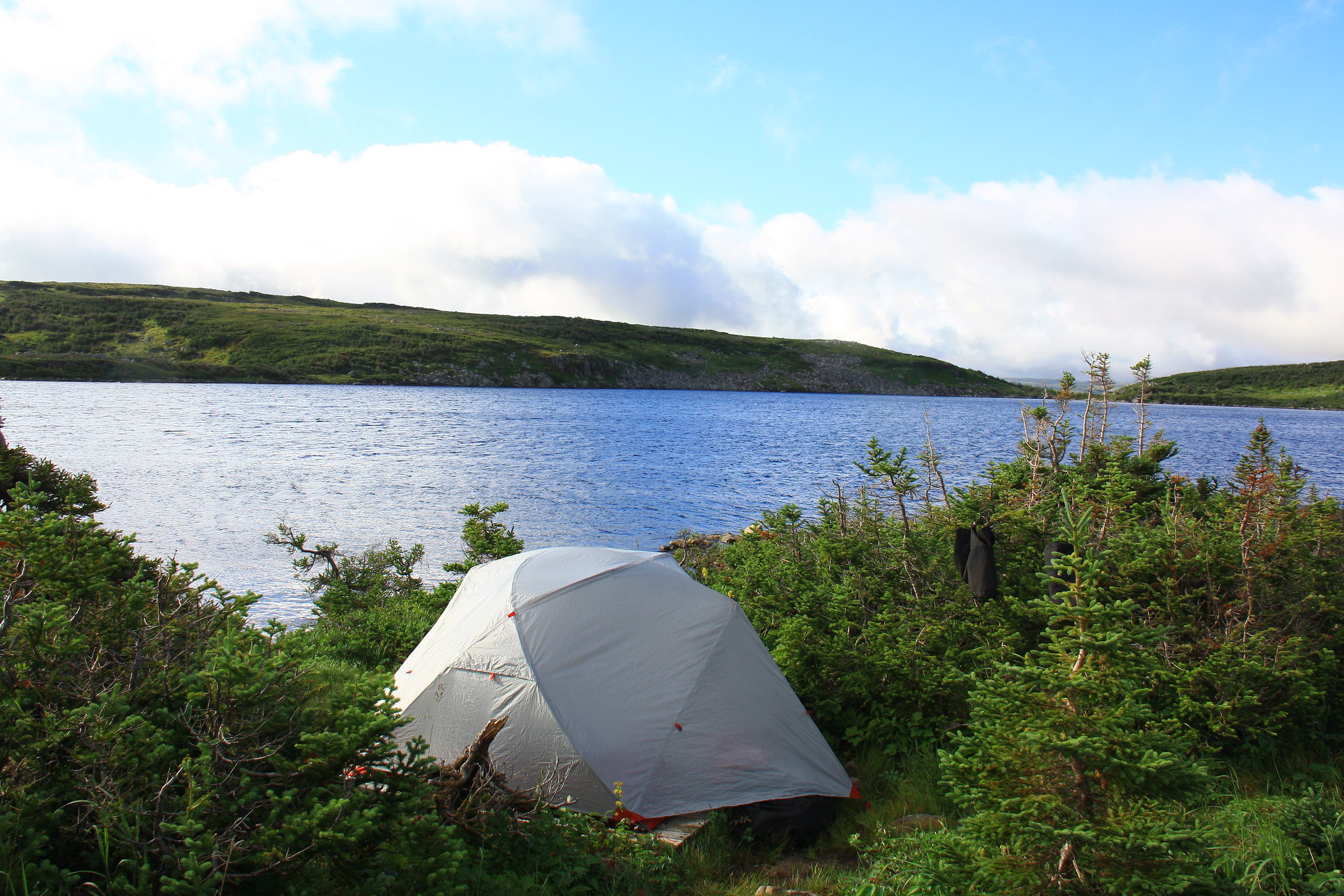 Home for the night. Although this was taken the next morning. Home for the night. Although this was taken the next morning.Whereas the first half of the day had been dominated by climbing, the second half had been dominated by what the park staff referred to as the Tuckamore Tangle. The worst we would see of the impenetrable vegetation throughout both traverses. And as cautioned by a tuckamore-experienced hiker at the orientation only two days prior, our pace did slow to approximately 1km/hr. Nevertheless, after a day that started with heavy rain, leading to high hills, and eventually ending with the grasping wrecks of trees tugging at any part of us they could grip we arrived at our second campsite with another 8ish kilometers behind us. 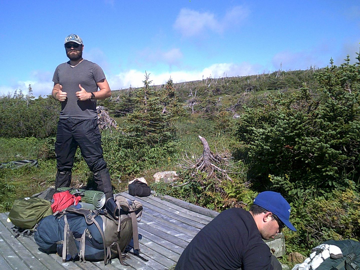 I'm pretty happy to be there. I'm pretty happy to be there.
|
|
amaruq
Trail Wise!
Call me Little Spoon
Posts: 1,264
|
Post by amaruq on Sept 26, 2016 12:04:57 GMT -8
A bluebird morning greeted us on August 10th and we dawdled through breakfast allowing ourselves to enjoy the morning sunshine. Now through the section of map labelled ‘ Tuckamore Tangle’ we anticipated easier and quicker hiking. We even relied on it, aiming to cover over 12km that day. Unfortunately we found this not to be true and continued to be dogged by the ever-present trees. The waypoints began to stretch out and – even with perfect visibility – the routes between them would only become apparent after fighting our way to the next point (clearly designed for traversing in the opposite direction). We eventually opted to shelve the waypoints and find our own way through to the next campsite, clinging to the exposed ridgelines where the fierce winds had scoured away any tuckamore, leaving bare rock and spongy moss tracks. 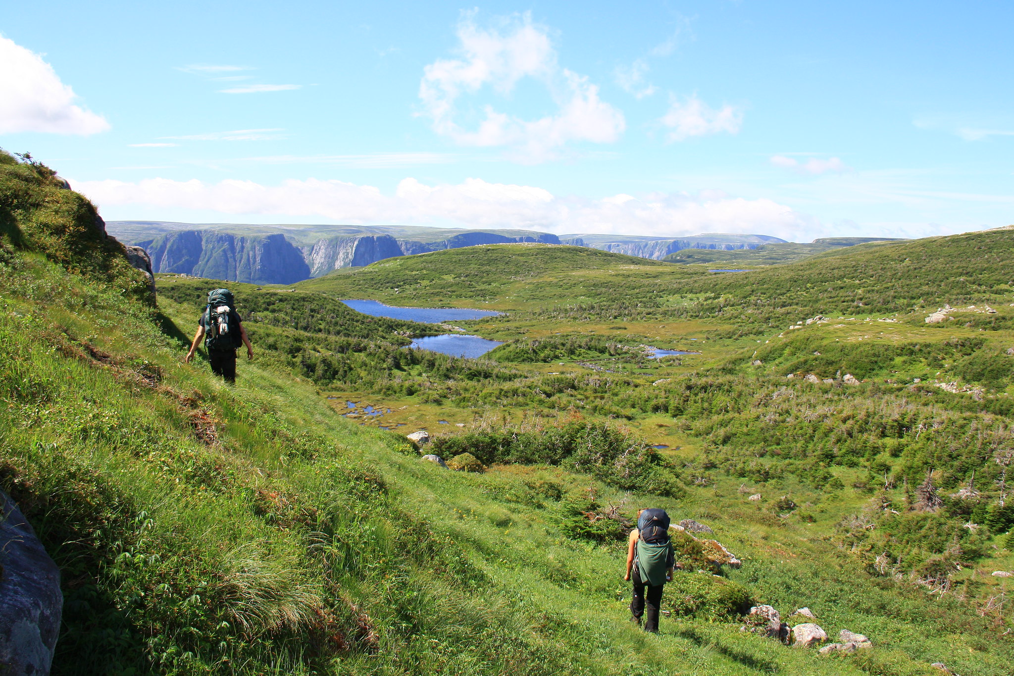 The Northern Traverse had incredible views almost the entire length. The Northern Traverse had incredible views almost the entire length.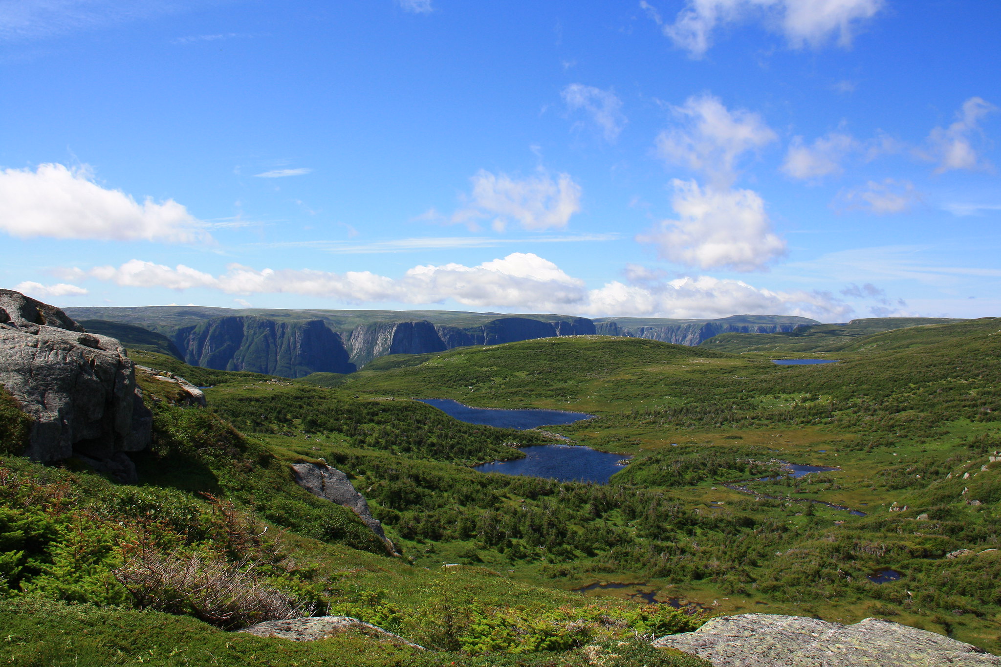 And still never far from the gorge. And still never far from the gorge.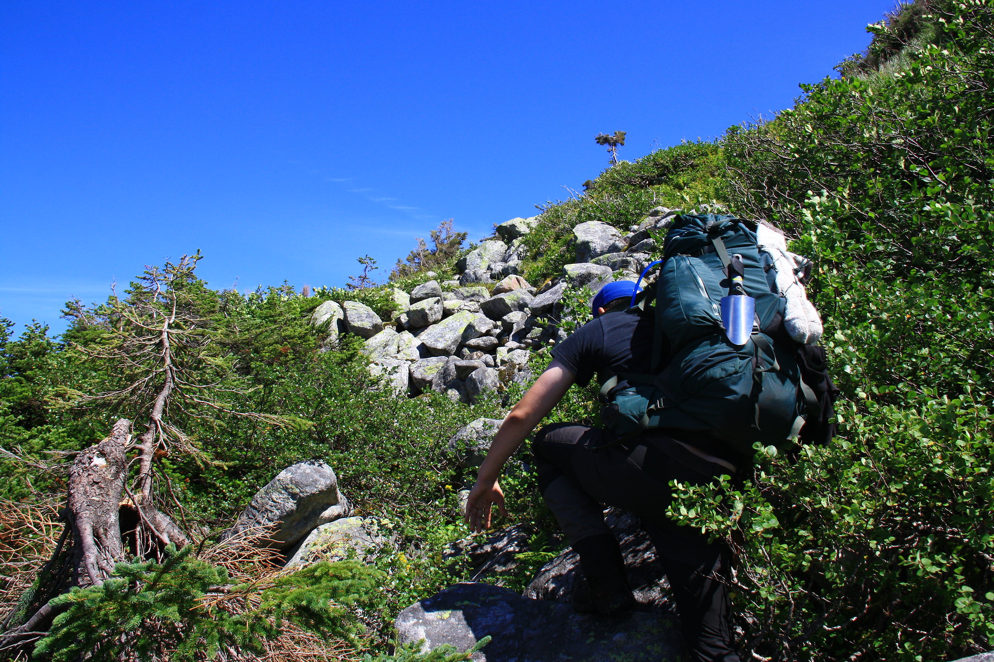 Clinging to any route we could find through the tuckamore that didn't involve brute-forcing through it. Clinging to any route we could find through the tuckamore that didn't involve brute-forcing through it.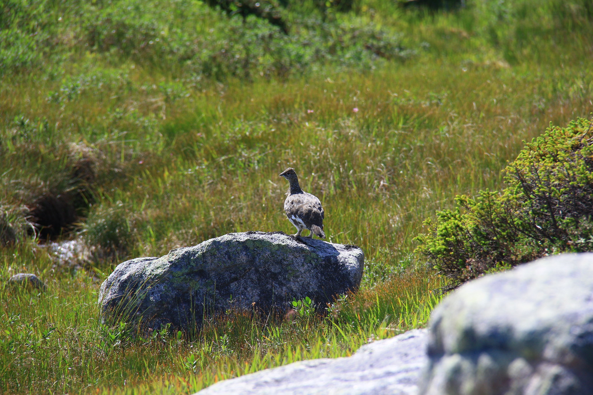 This rock ptarmigan caught the point man off guard and gave him a startle. I laughed. This rock ptarmigan caught the point man off guard and gave him a startle. I laughed.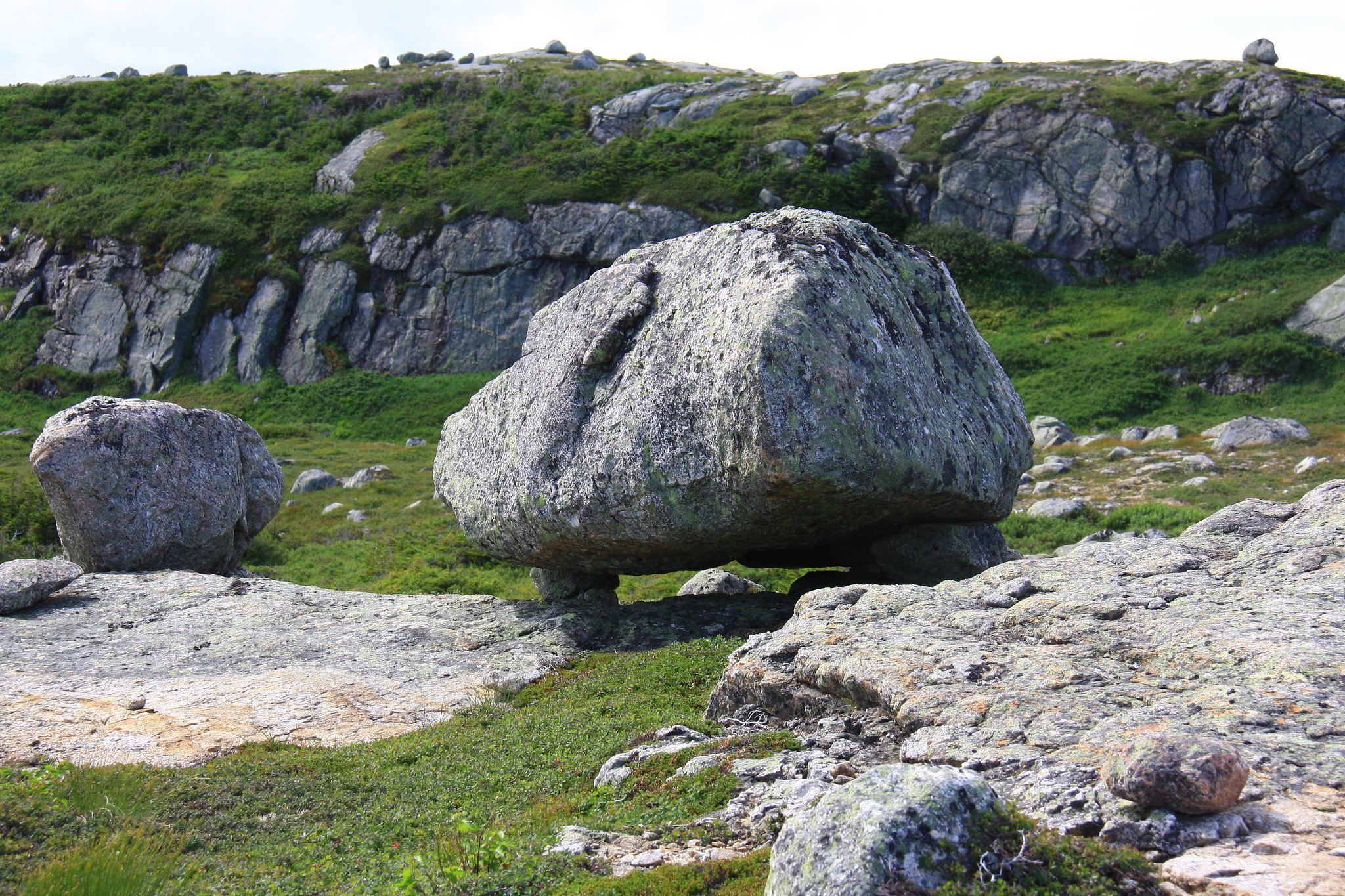 The cool thing about glacial deposits is you're never far from balancing stones either. The cool thing about glacial deposits is you're never far from balancing stones either.This proved effective, but it was too late. As the sun stood on its last legs we found ourselves looking out over a vast valley, an intermediary campsite situated somewhere below us. We made the decision to take up camp at the intermediary site, then skip our originally-planned campsite tomorrow carrying on to another intermediary site for tomorrow night. Due to the spacing between the remaining campsites, there was little room in the schedule to make up the lost time and we stood likely to extend our trip by a day overall. 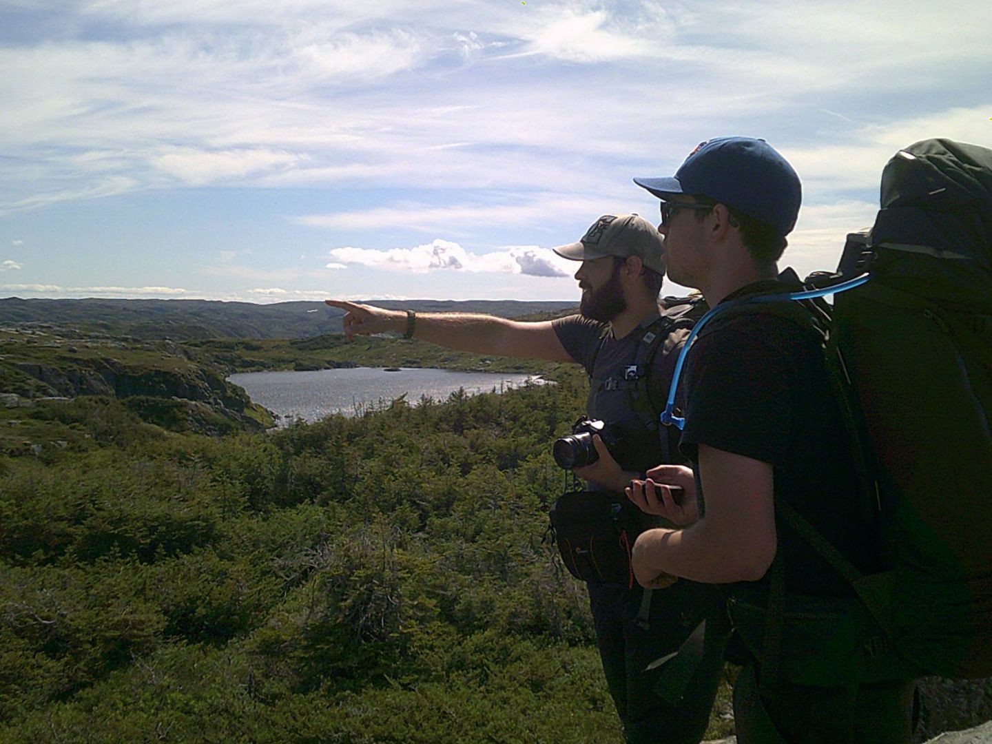 Using my 200mm zoom lens to help find routes through the tuckamore. Using my 200mm zoom lens to help find routes through the tuckamore.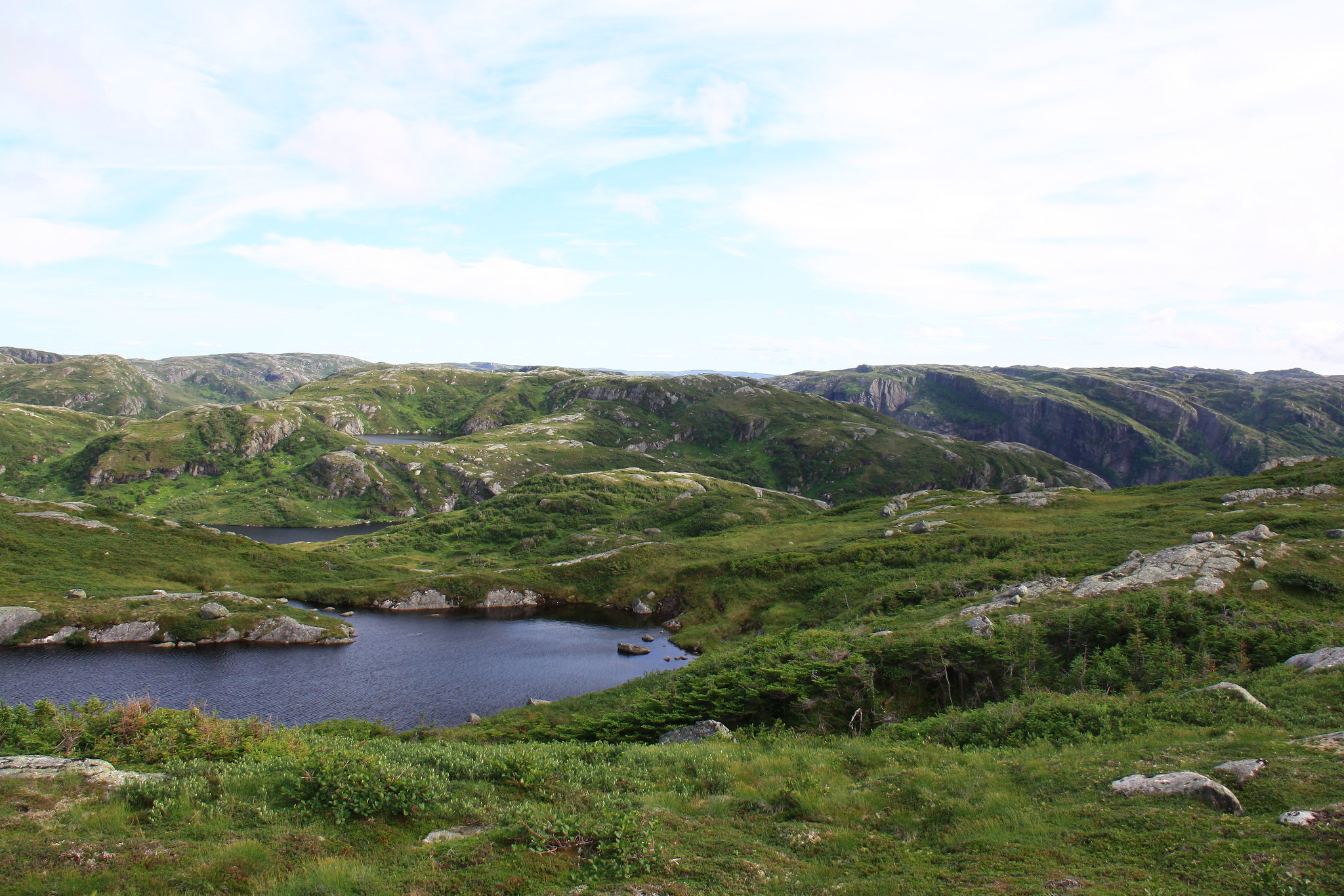 Lakes over lakes and a campsite somewhere in there. As viewed from atop the cliff. Lakes over lakes and a campsite somewhere in there. As viewed from atop the cliff.Back at our current position above the intermediary campsite where, upon examining our location, we discovered we were cliffed-out. We made a long detour to the East in order to find a narrow game path along a similarly narrow ledge down into the valley. With feet on lower terrain we found ourselves face-to-face with the horde of blackflies for the first time on this trip. I had my trusty head net, while another dowsed herself in DEET, and the third voted himself into setting up the bedding in the safety of the tent. 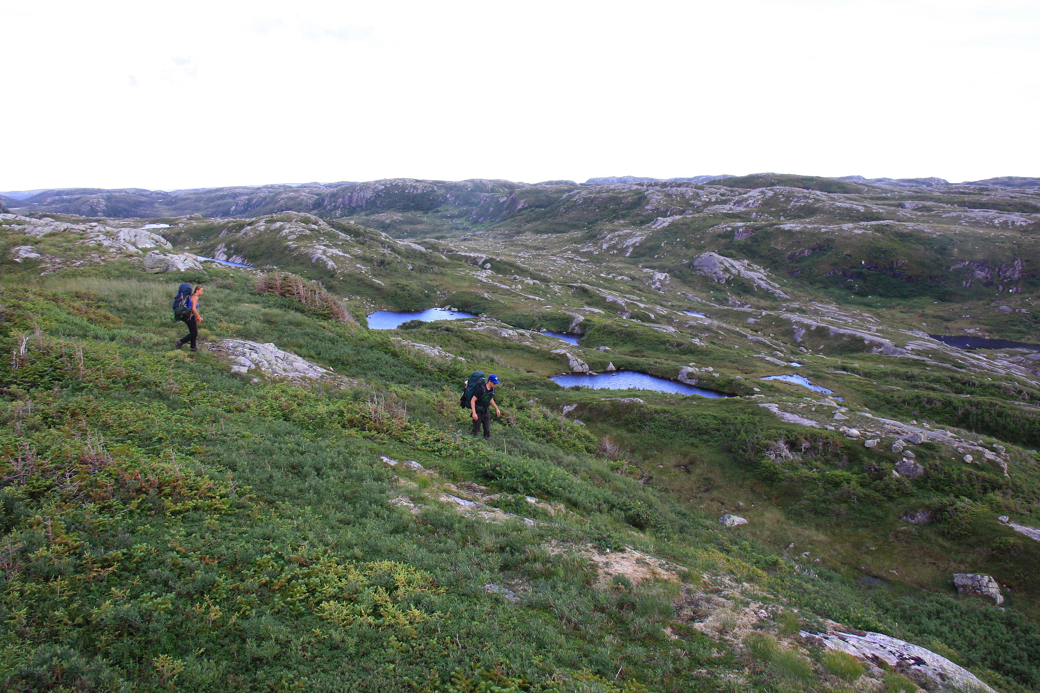 "This might be a way down...? Yeah, yeah it is. Barely." "This might be a way down...? Yeah, yeah it is. Barely."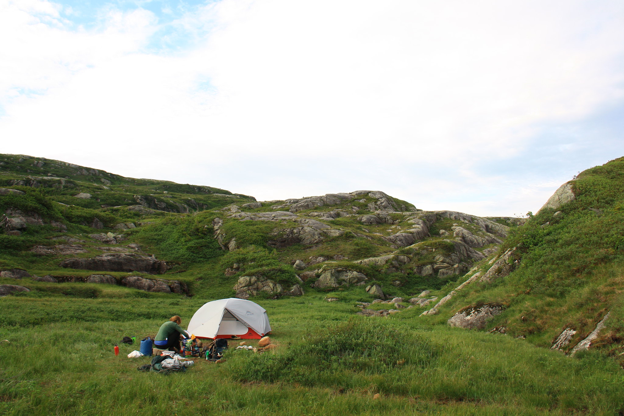 Not visible: the guy hiding in the tent. Not visible: the guy hiding in the tent.As we prepared dinner and drank to both the day’s successes and failures, another pair of hikers happened by us heading in the opposite direction. They set up at some distance to us only coming over to inquire as to the location of the loo. We didn’t know. Over our dinner we watched the poor fellow bounding up and down and across all the ridges overlooking us searching for his relief, but to no avail. After dinner one of our group, got up to go inspect the trail they’d come in on, the very one we’d be heading out on in the morning, and right there within view was the latrine. The poor guy had walked right by it earlier. We conveyed our intel over to them and he made a double-time dash across our site for the green plastic structure around the hill. As the red and violet patchwork sky slipped into darkness we retired to our tent with what felt like a paltry additional 8 kilometers in our wake. |
|
amaruq
Trail Wise!
Call me Little Spoon
Posts: 1,264
|
Post by amaruq on Sept 26, 2016 12:16:59 GMT -8
We awoke on August 11th to find our views replaced with a white blanket of cloud complete with intermittent periods of light, misty precipitation. By the time we had finished breakfast, the other campers had long vanished into the fog. We looked up at the climb before us and started down the trail. The precipitation had subsided leaving waterlogged vegetation and slick rock-slab slopes for us to contend with. One such location had the moss and underbrush stripped away from our position straight down to the lake, the telltale sign of an unlucky moose taking an unintentional dip. By the time we emerged at the top of the pass from the thick brush beneath we had been soaked through. However, with another pass-climb behind us we found ourselves staring at a wonderful sight. The ridge that separates the Northern Traverse from the Long Range Traverse. Situated above the end of the Western Brook Pond gorge, the ridge offers incredible views of the pond and its gorge. With renewed vigor, we set off down the back side of the pass and made our way across the soggy alpine tundra. I climbed the steep ridge at double-pace anxious to take in the grand view and, for once, found myself ahead of the other two. Once at the top we stopped for a long break and a group photo to celebrate the completion of the Northern Traverse – what we were told would be the hardest and most demanding leg of the entire trip. 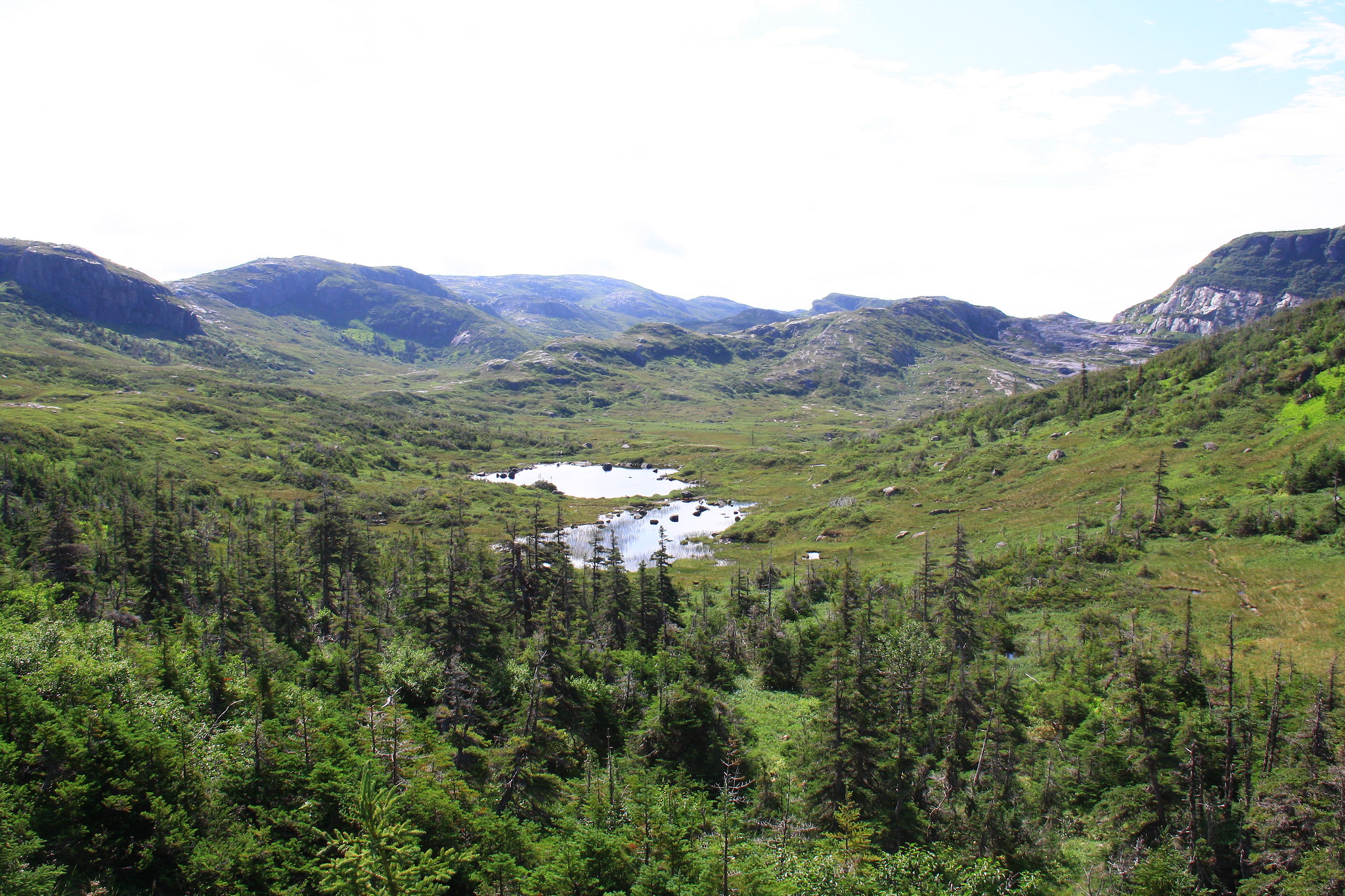 The finish line ridge is the one just right of center. The finish line ridge is the one just right of center.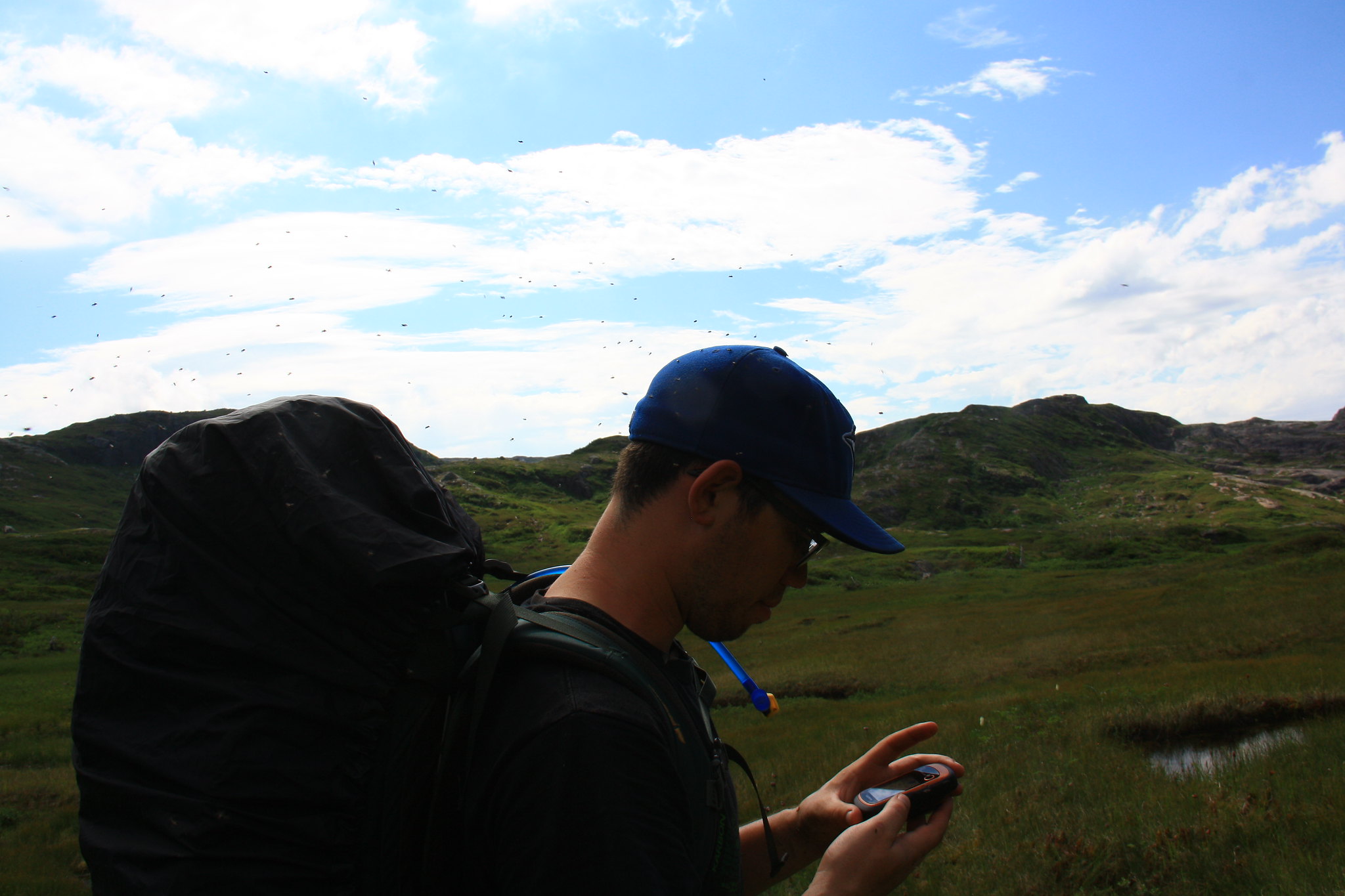 Our swarming friends never left us once until we found the ridge's winds. Our swarming friends never left us once until we found the ridge's winds.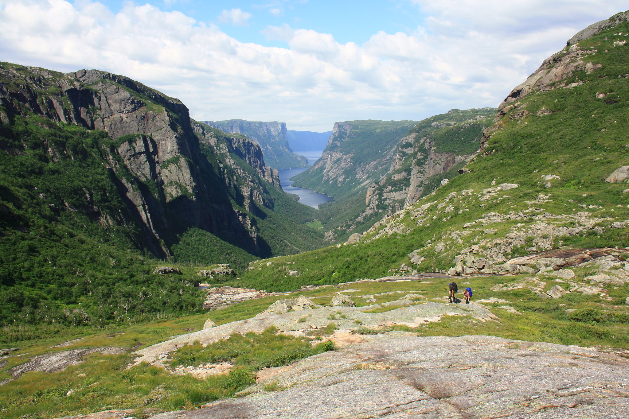 The classic view. I mean with the others in tow for once. The classic view. I mean with the others in tow for once. Tour boat making its way to the end of the pond. It did not stop to drop off any hikers. I still wonder if anyone on the boat, perhaps with a long enough lens, happened to spot us up there. Tour boat making its way to the end of the pond. It did not stop to drop off any hikers. I still wonder if anyone on the boat, perhaps with a long enough lens, happened to spot us up there.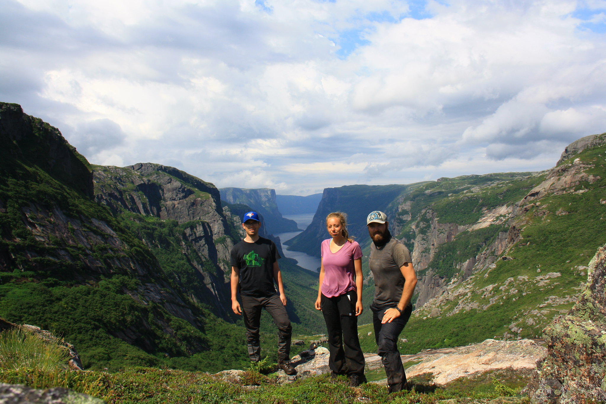 Obligatory group photo. Obligatory group photo.From there onward our pace quickened, accelerated by the easy hiking along the bare rock ridges and well beaten game (and likely hiker) trails. Given the lack of major elevation gain, the views through this area were not as spectacular as the Northern Traverse. We made good time to our originally planned third-night campsite and sat for lunch. We decided on a 4:00pm cut off for the following campsite, the one we were originally intending to skip on this day: if we arrived before, we would continue on to our originally planned fourth-night campsite; if we arrived after, we would stop for the night and all but guarantee the need for our extra day. We negotiated the barren and soggy Long Range Traverse with relative ease, taking care not to follow game trails too far off-route, navigating by map and sight more than GPS, and making good time to boot. By the time we settled down into the ultimatum campsite it was only 3:15pm and thus our settlement would only be a rest. 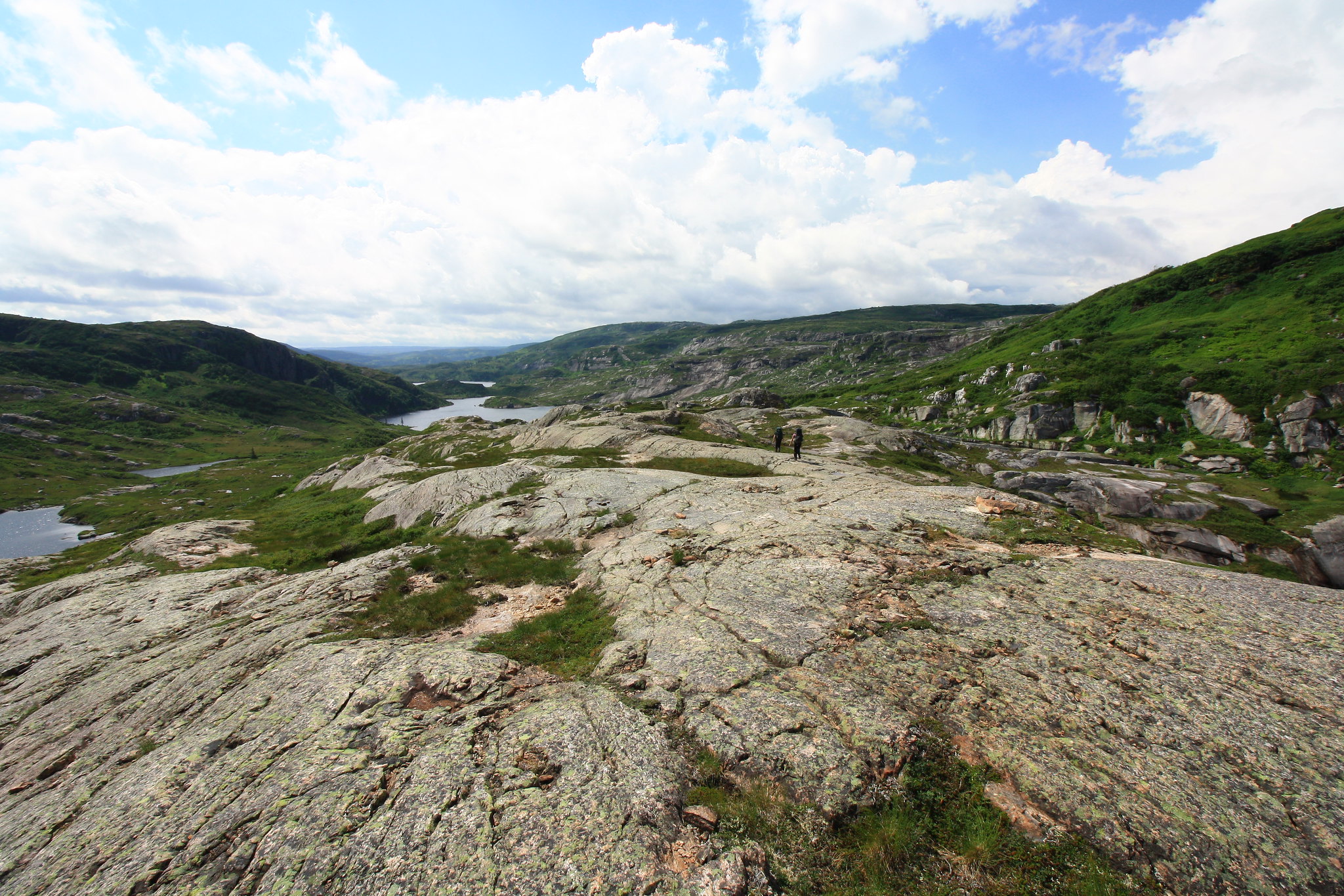 Pictured: Easier hiking. Not pictured: Much tuckamore. Pictured: Easier hiking. Not pictured: Much tuckamore.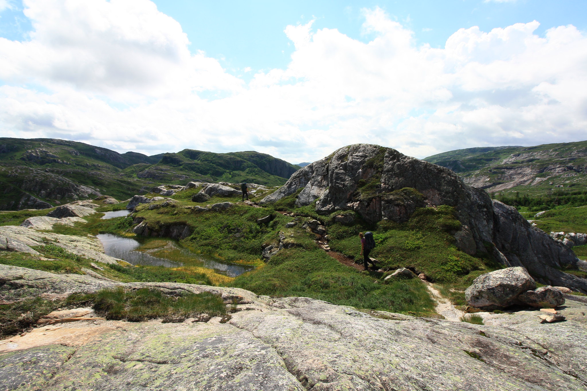 This was clearly the more well-traveled route. This was clearly the more well-traveled route.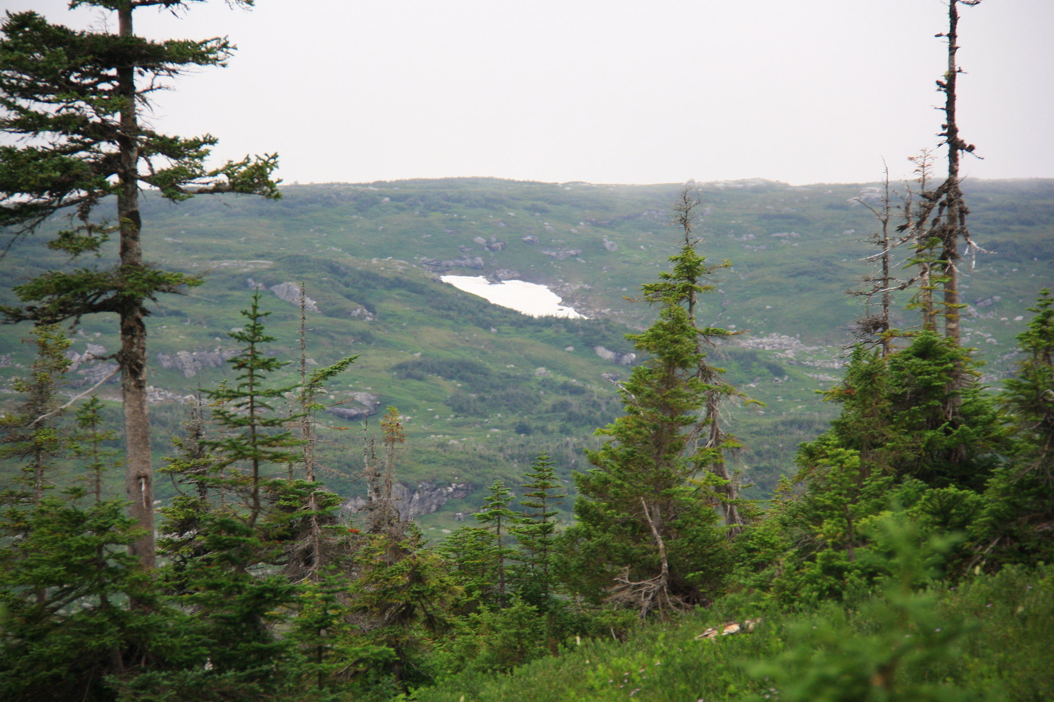 Mid-August and still snow-packed in some places. I would refer to these as Gros Morne glaciers for the remainder of the trip. Mid-August and still snow-packed in some places. I would refer to these as Gros Morne glaciers for the remainder of the trip.Our originally planned fourth-night campsite was now our goal and we were itching to get back on schedule. The descent from a high pass down towards the campsite’s lake brought into a view a large cabin with two large boats. Odd to see such a place so far removed from any reasonable access (though there are many lakes atop the plateau, the watercourses connecting them are not particularly conducive to boating). I figure it must be a ranger’s station. 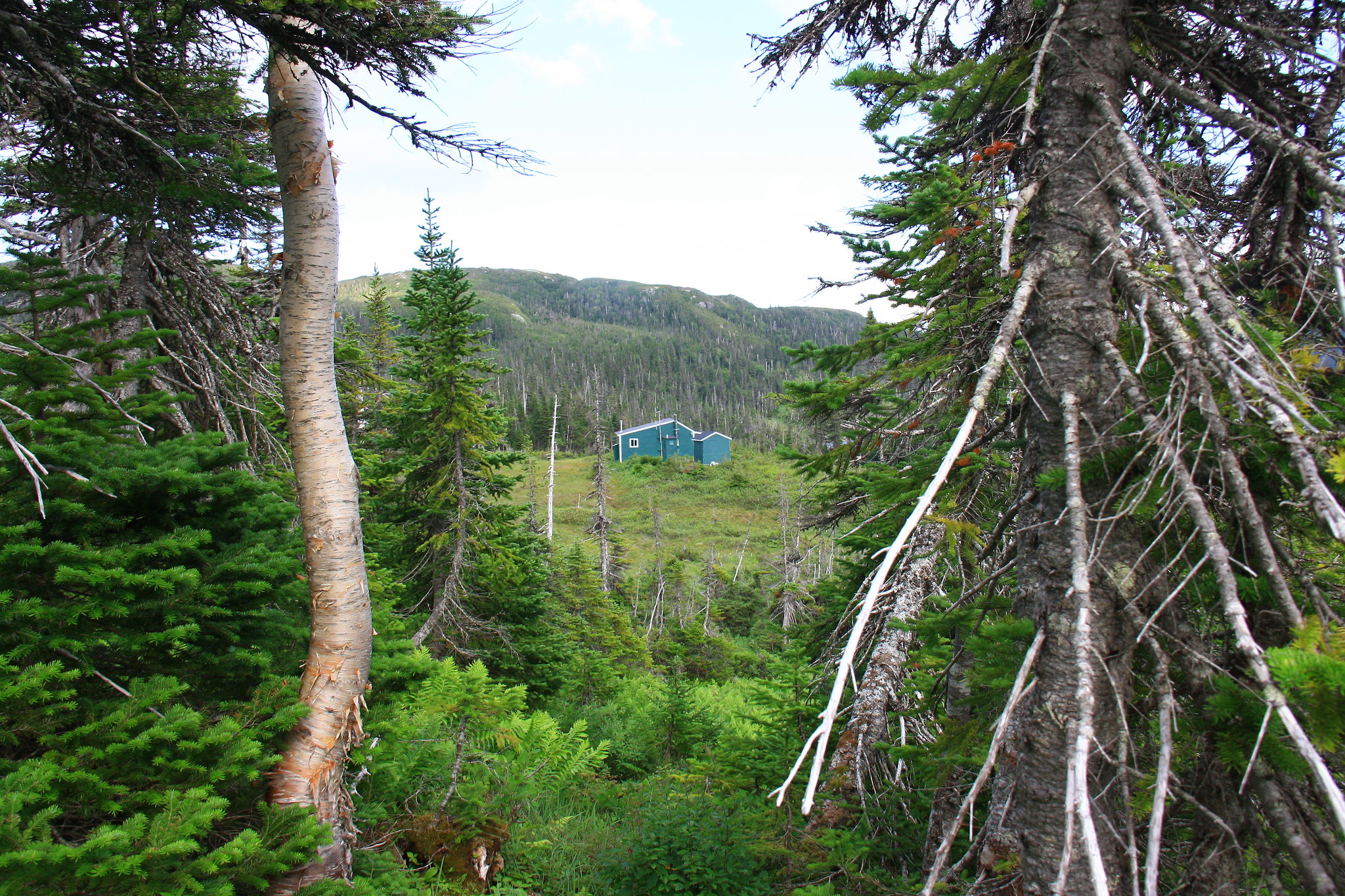 Awfully nice place for a ranger. Awfully nice place for a ranger.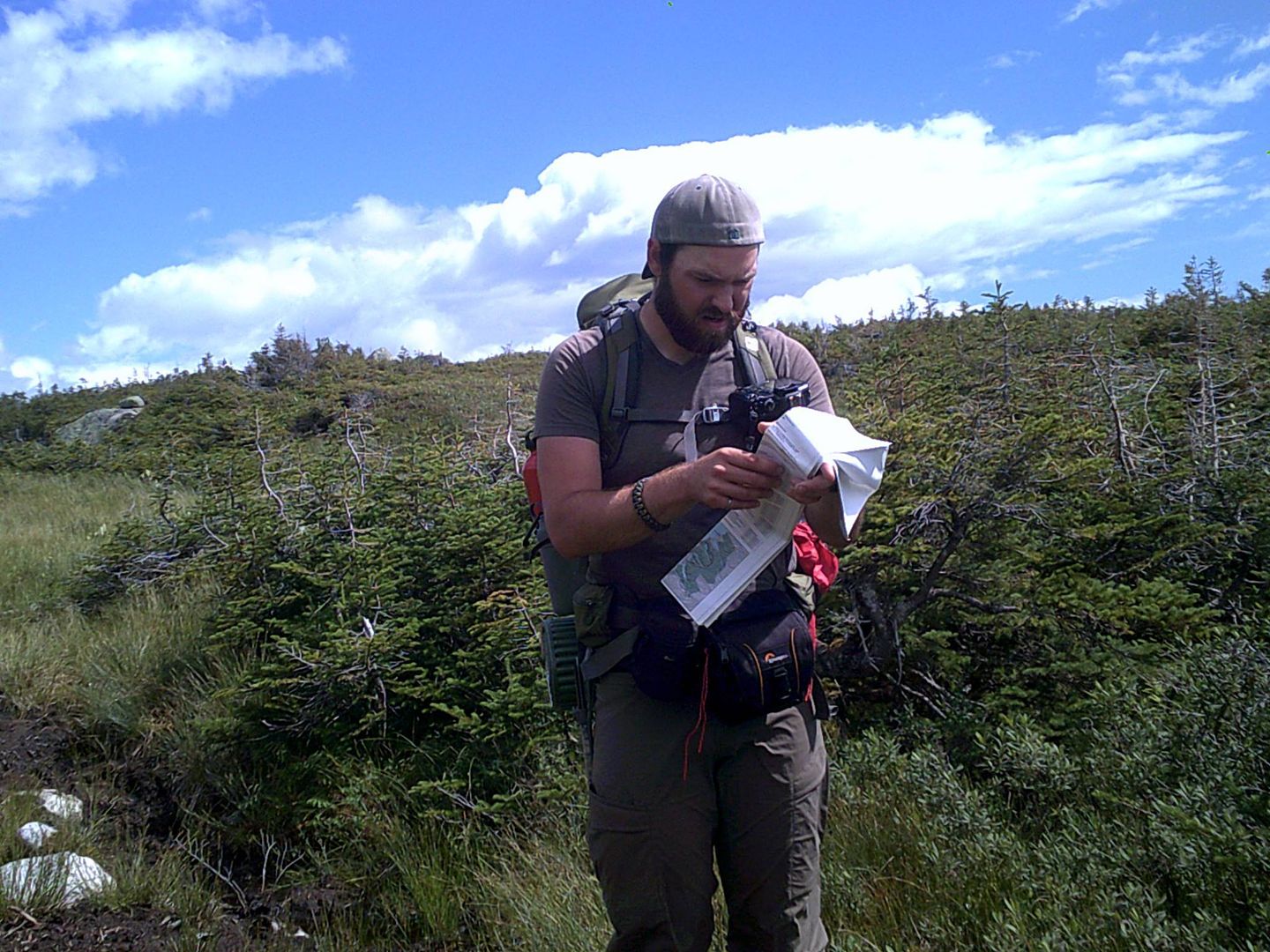 Candid shot of me trying to figure out why there's a cabin spoiling my unspoiled wilderness. Candid shot of me trying to figure out why there's a cabin spoiling my unspoiled wilderness.We rolled into camp after more than 12 kilometers and collapsed onto the nearest tent pad. Another pair of hikers on the next tent pad over – all of 10 feet away – chuckled and offered us some warm naan bread (which we devoured without hesitation). The menu that night was a traditional Newfie dish: salted cod. I passed on the cod and simply enjoyed the side dishes. I also attempted to bathe, but the lake was only about 8" deep for up to 500m out (according to the other couple there) so the bathing became targeted splashing at best. Sleep came easily that night. |
|
amaruq
Trail Wise!
Call me Little Spoon
Posts: 1,264
|
Post by amaruq on Sept 26, 2016 12:26:08 GMT -8
August 12th graced us with a mostly cloudy morning. By the time we rolled out of our tent, the other pair were already boots-on-the-trail. The day’s 7 kilometers of hiking was relatively straightforward and as we sat for a rest on the side of a hill a great bull moose wandered out into the clearing below us, stopping momentarily to throw us a passing gaze before trotting off into the tuckamore below. We watched in envious awe as the moose plodded effortlessly through the thick vegetation. This was our first and only moose sighting of the entire trip. 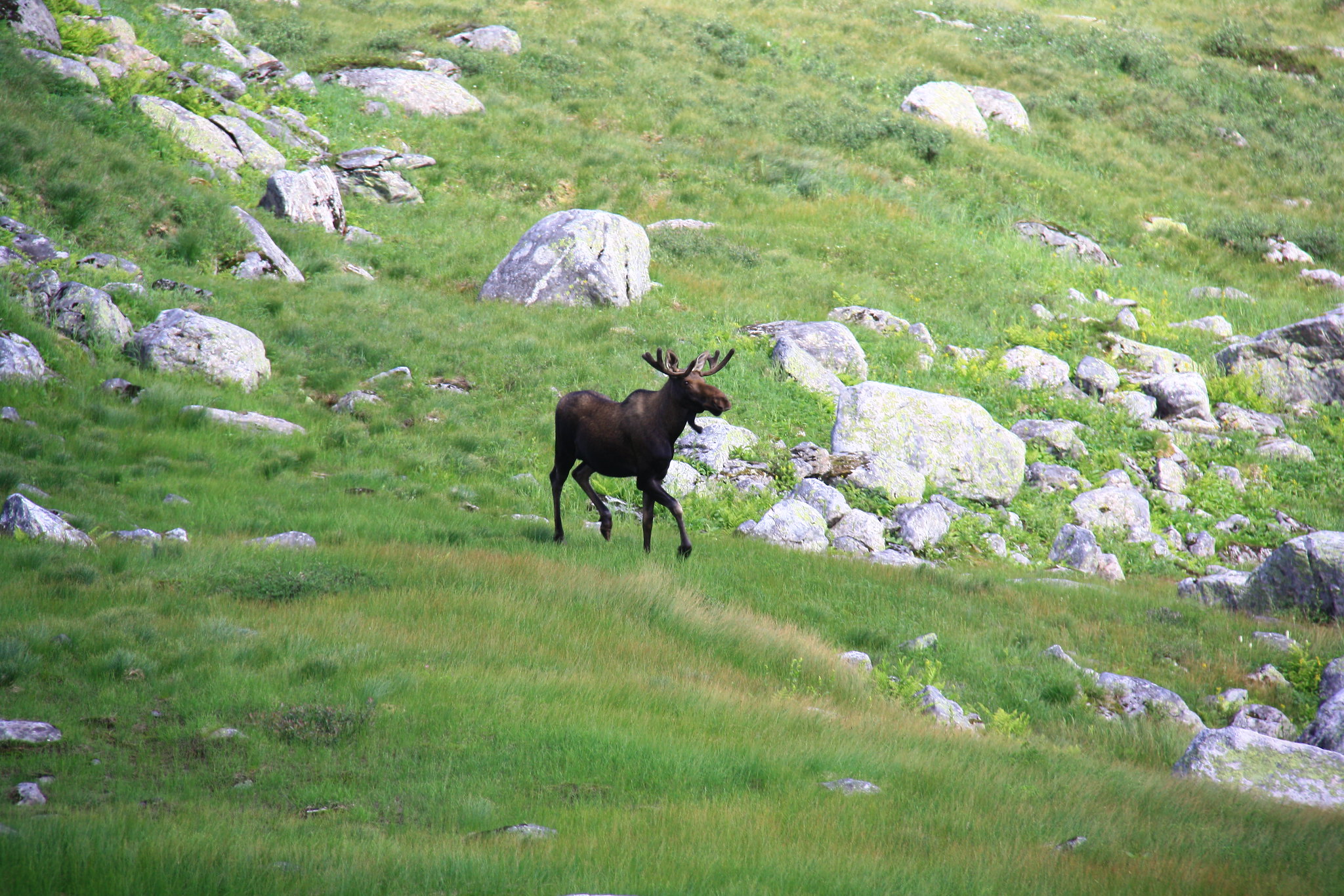 But look at this magnificent specimen! But look at this magnificent specimen! Note to readers: The park's suggested route is actually atop that big cliff. Note to readers: The park's suggested route is actually atop that big cliff.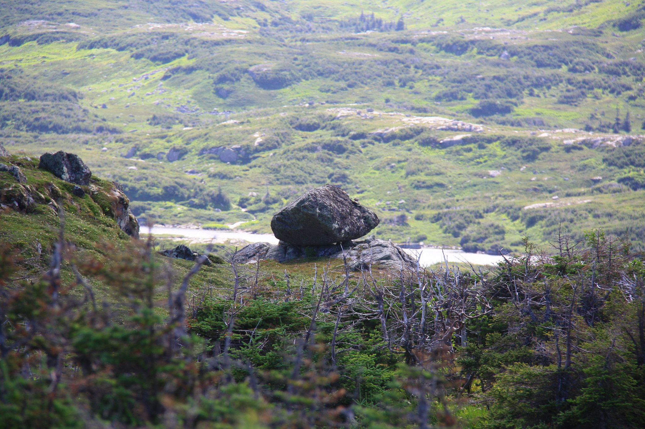 More balancing stones. More balancing stones.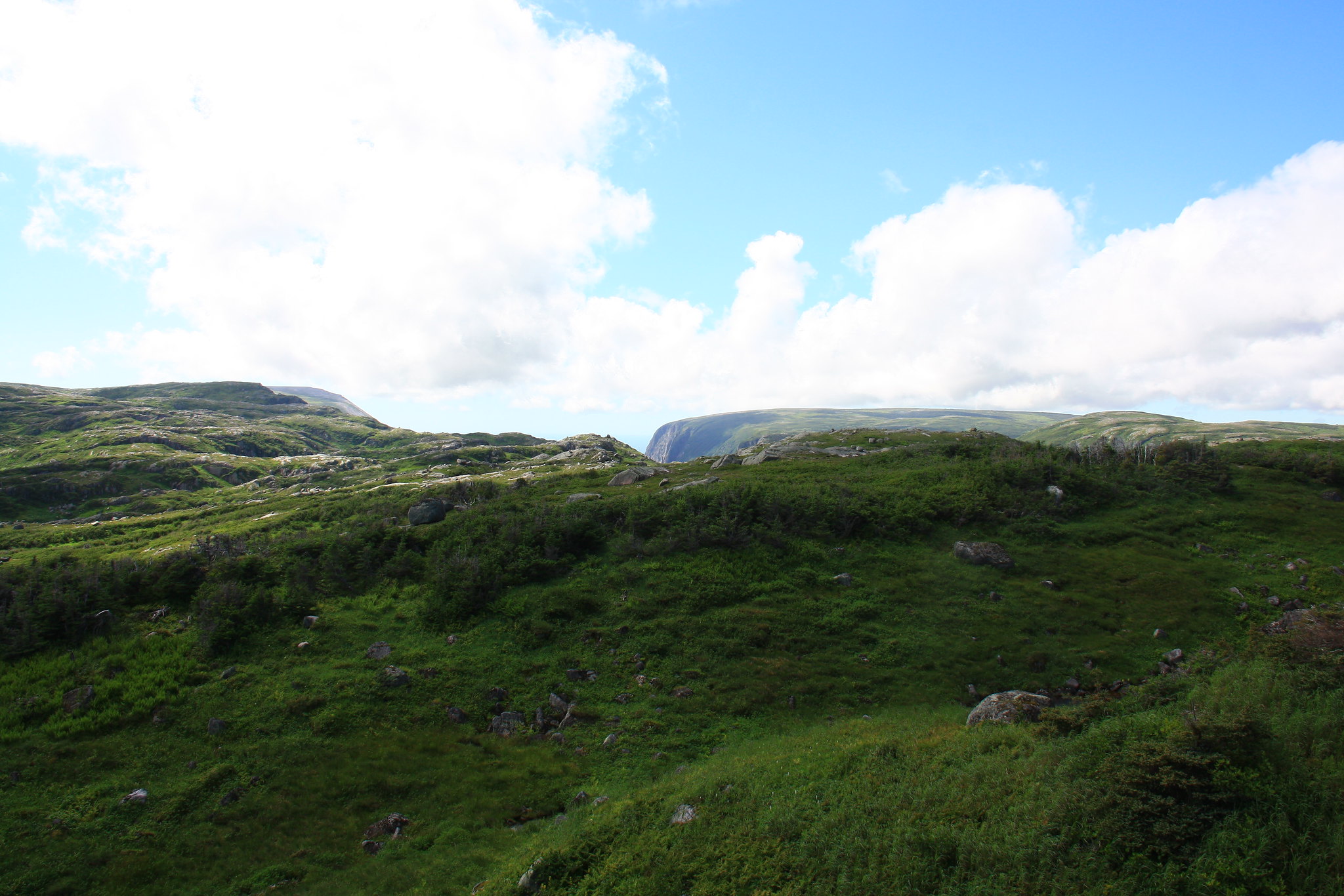 Ten Mile Pond gorge begins to open on the horizon. Ten Mile Pond gorge begins to open on the horizon. While the others take a rest, I start culling photos. While the others take a rest, I start culling photos.The only real challenge on this day, aside from another questionable descent, was both locating and enduring the high tent pads. The low tent pads are right on the route, right next to a river that eventually empties into the Ten Mile Pond gorge. We strode into camp reasonably early and elected to push on the extra couple hundred meters to the high camp. This required hopping rocks across the river, hiking up and over to a small pond, and then up onto the small plateau overlooking said pond. 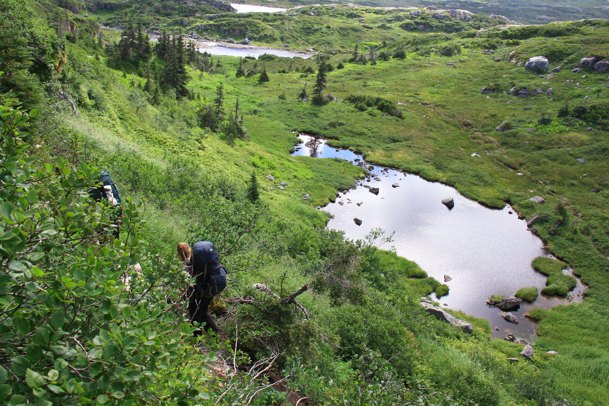 For every bit of ascending we do, we seem to do more descending. Which only leads to more ascending... For every bit of ascending we do, we seem to do more descending. Which only leads to more ascending...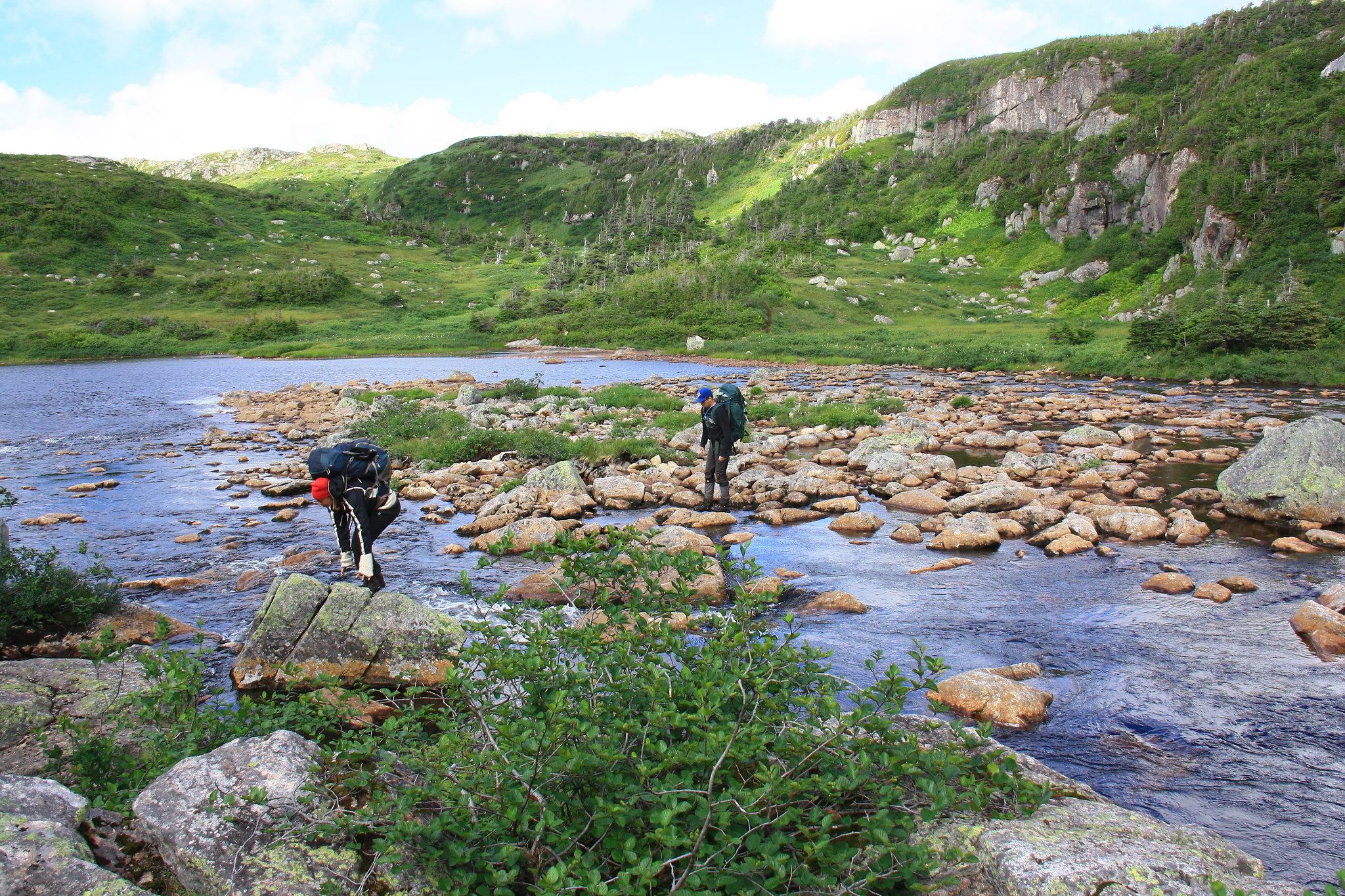 Rocking across the river. Rocking across the river.Here we eventually found the second set of tent pads and settled in. These three pads are not an ideal camp location, complete with a long climb up from the water, no lavatory, no bear-box, and extreme exposure to strong winds. Needless to say, we made use of all the tent’s useful tie-down points as well as all the spare paracord we had packed. The food was stashed beneath a neighbouring tent pad and 'sealed' in behind a half-ton of loose stones that had accumulated in the area thanks to previous campers. But there were no black flies; pick your battles, I guess. Dinner was prepared in the lee of the tent and the sleep was fraught with gusts of tent-flattening wind, beating against the tent walls and sounding a bit like an overhead freight train.  The camp area was eventually found on the plateau behind my two partners. The camp area was eventually found on the plateau behind my two partners.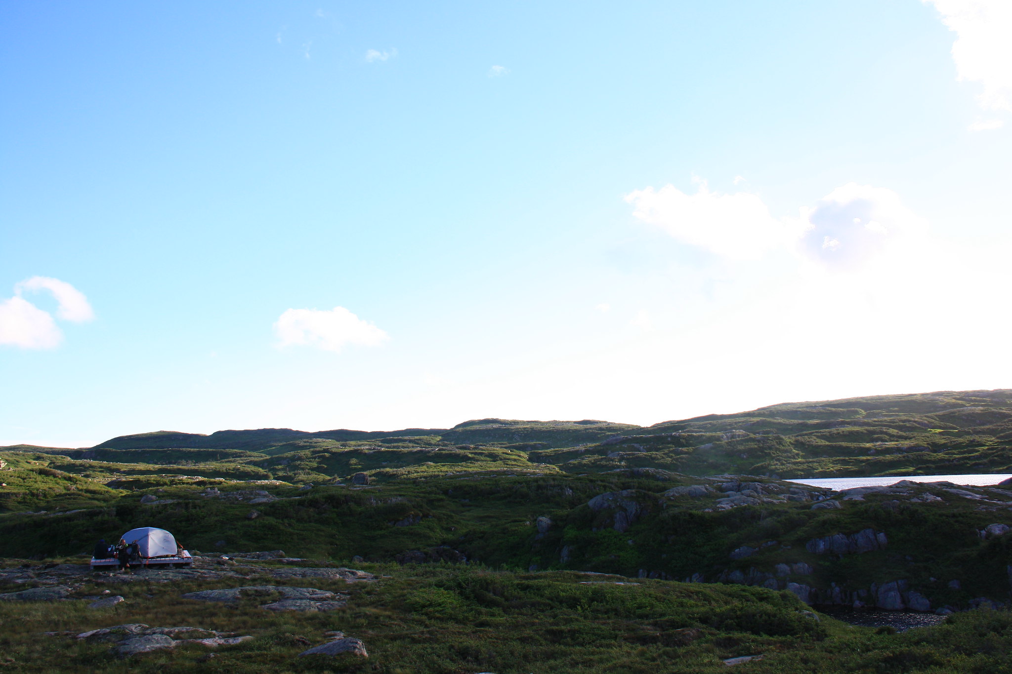 Pictured: unobstructed views in all directions. Not Pictured: unobstructed winds from all directions. Pictured: unobstructed views in all directions. Not Pictured: unobstructed winds from all directions.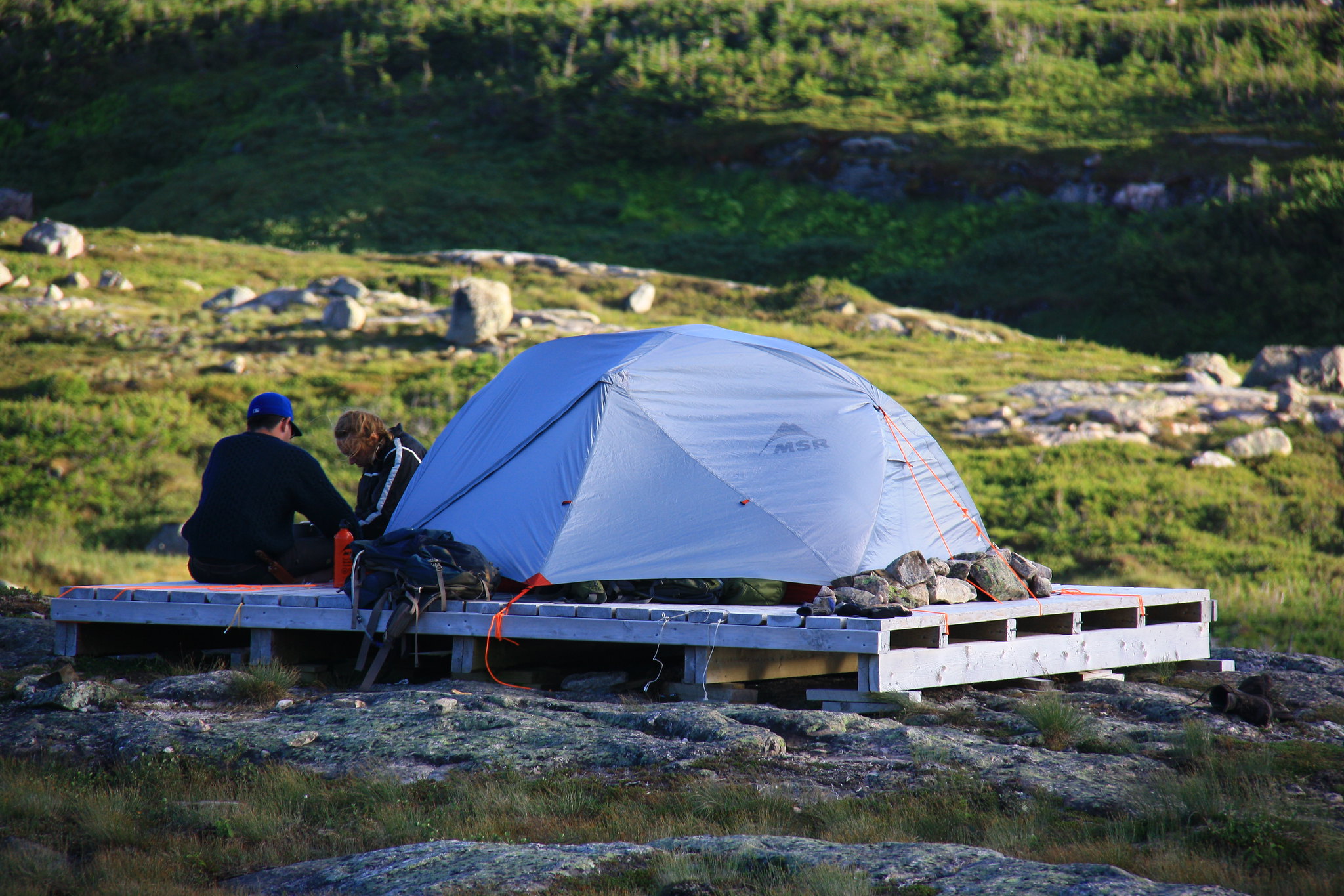 Our camp kitchen wall strains to not fly away. Our camp kitchen wall strains to not fly away.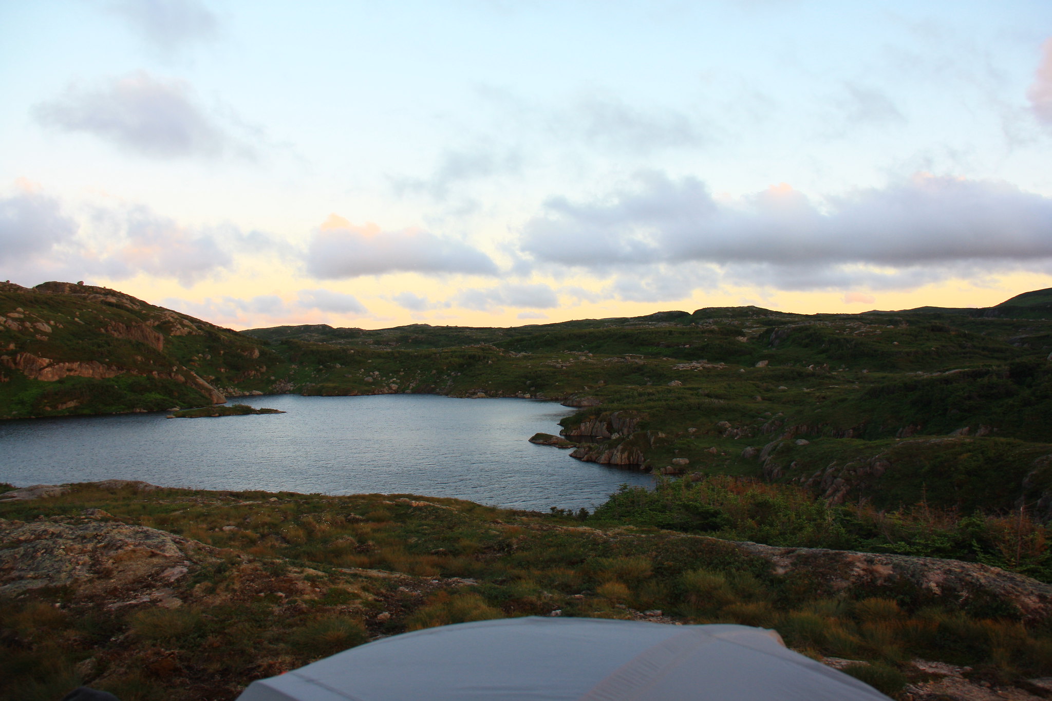 The evening sun casts a peaceful orange glow across the land. The evening sun casts a peaceful orange glow across the land.
|
|
amaruq
Trail Wise!
Call me Little Spoon
Posts: 1,264
|
Post by amaruq on Sept 26, 2016 12:40:43 GMT -8
August 13th, our final trail day, started as most days had: threateningly overcast. We had a long day ahead of us, not only because we were to finish the trek, but also because we intended to climb Gros Morne mountain. Though campsite to Kia was approximately 13 kilometers without the added distance and elevation gain of the mountain, we once again found the hiking to be easy.  And our (read: my) spirits lifted, in no small part thanks to this fella. And our (read: my) spirits lifted, in no small part thanks to this fella.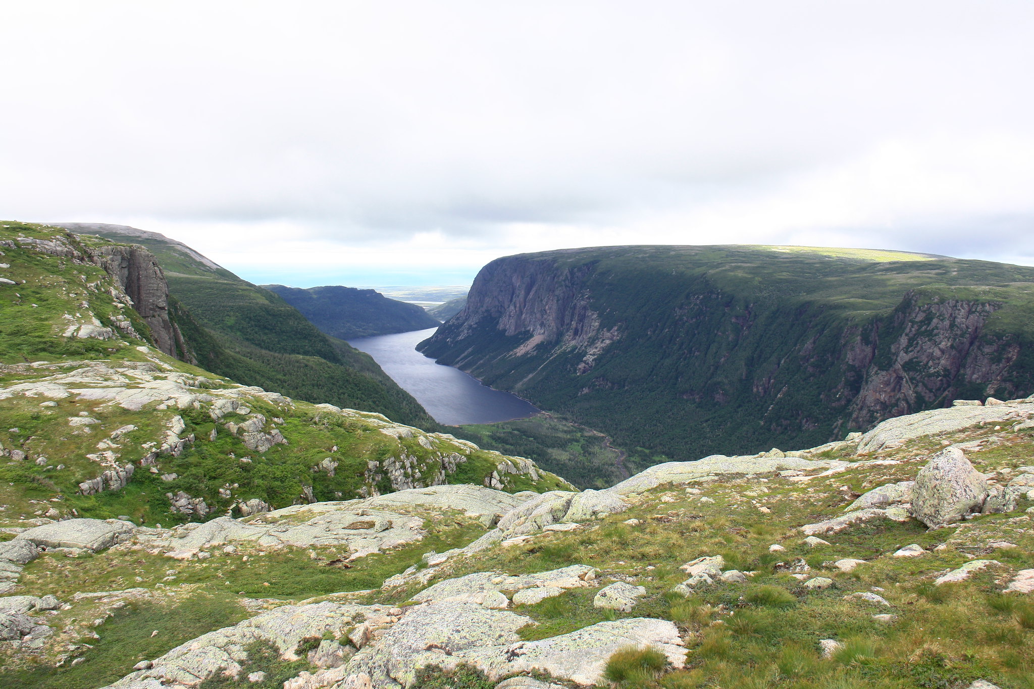 Ten Mile Pond gorge finally shows itself. Ten Mile Pond gorge finally shows itself.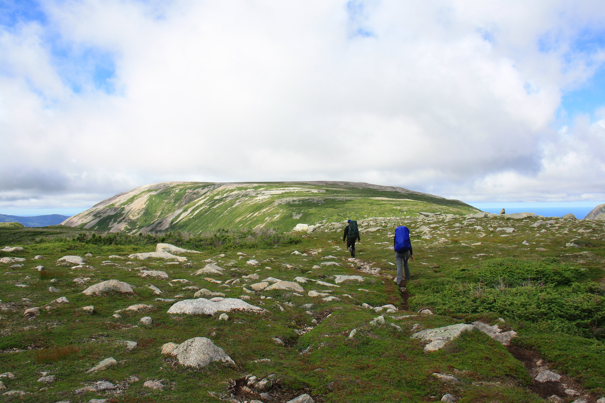 Gros Morne mountain finally shows itself, just ahead of those two. Gros Morne mountain finally shows itself, just ahead of those two.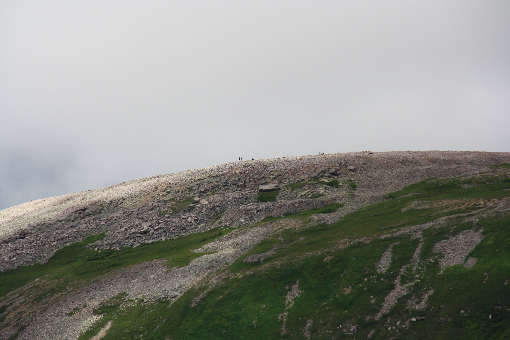 I spy with my little camera some folk checking out the top of the mountain. I spy with my little camera some folk checking out the top of the mountain.So easy that we had unintentionally cruised beyond the proper game path off the ridge – deemed the safest route down to the pass – and found ourselves contenting with another dubious descent. Grasping at vegetation and making generous use of our bottoms, we eventually stumbled back onto the clearly defined route and were well on our way to meeting up with the mountain descent trail. 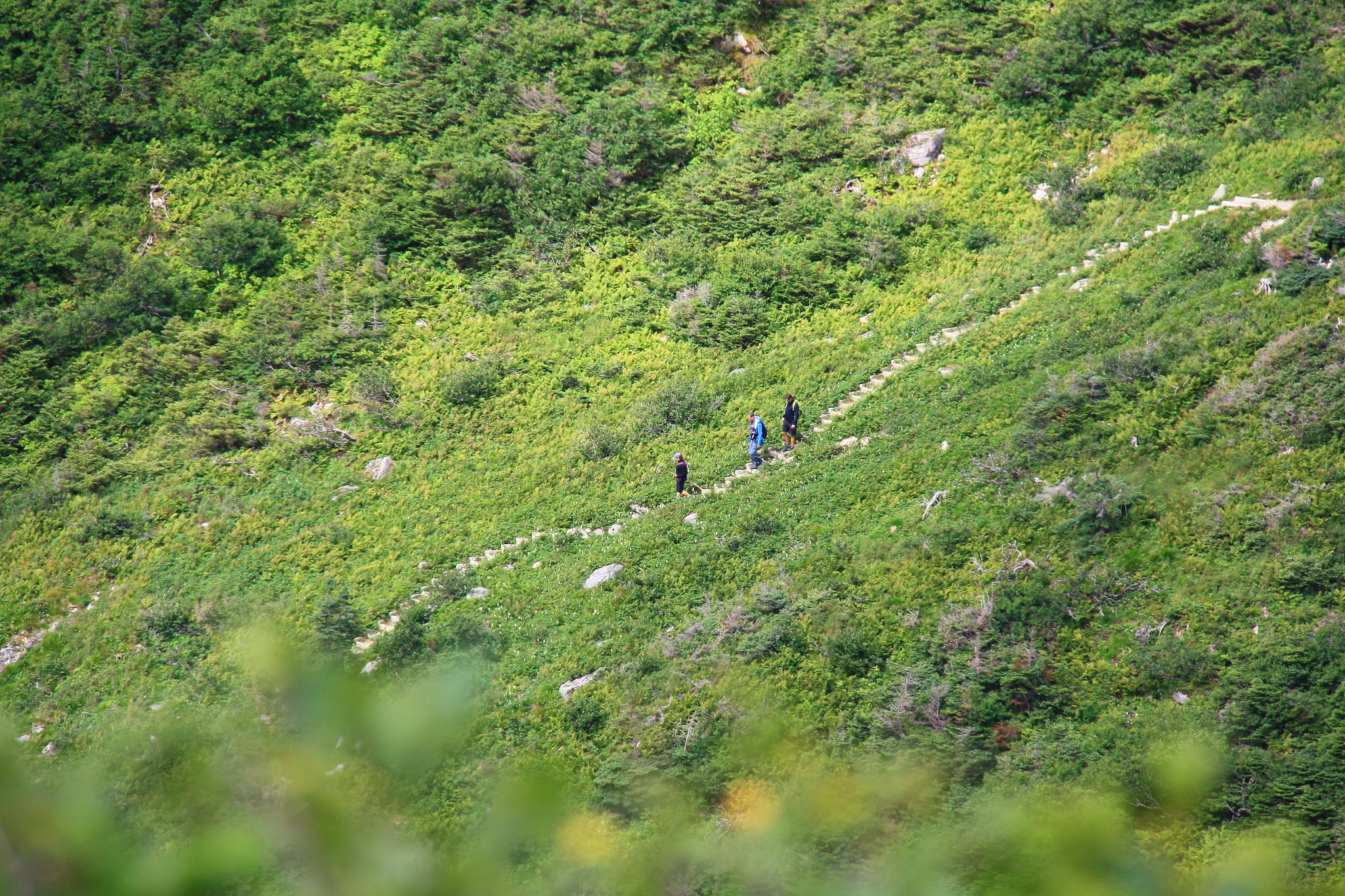 I spy with my little camera a group of people descend from the Gros Morne mountain. I spy with my little camera a group of people descend from the Gros Morne mountain.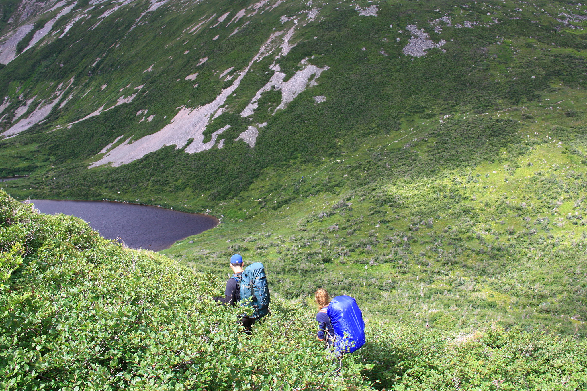 Working our way down to the mountain trail on the pass between the plateau and the mountain. Working our way down to the mountain trail on the pass between the plateau and the mountain.The proper day-route up the mountain has folk climbing a scree filled gash in the southern face and then traversing across the broad, flat top before descending down a heavily improved trail on the north side (it has stairs!). Given our position on the day-trail – most of the way up the descent route – we ditched our packs in the bush and climbed up the improved north-side trail, stopping to talk with many groups who were curious as to why we were going at it backwards. Tourists ‘ from away’ didn’t appear to quite understand what these Northern and Long Range traverses were all about, but the local folk seemed to genuinely enjoy hearing about our escapade on the Northern Traverse route. 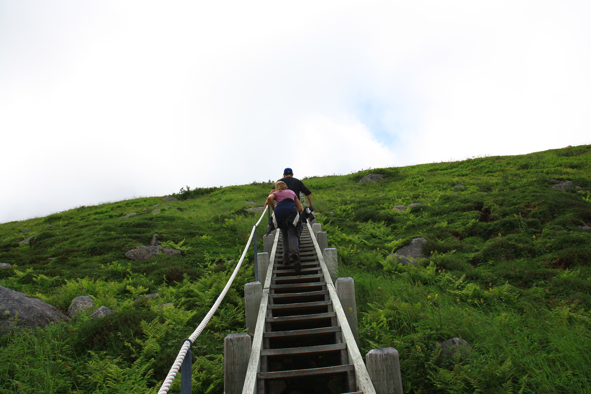 I was even last up the stairs. I was even last up the stairs.The top of the mountain offers vast views in all directions with particularly brilliant views up and down Ten Mile Pond’s gorge. Though a seemingly inhospitable pile of loose scree, some rock ptarmigans with chicks flittered about the summit area. 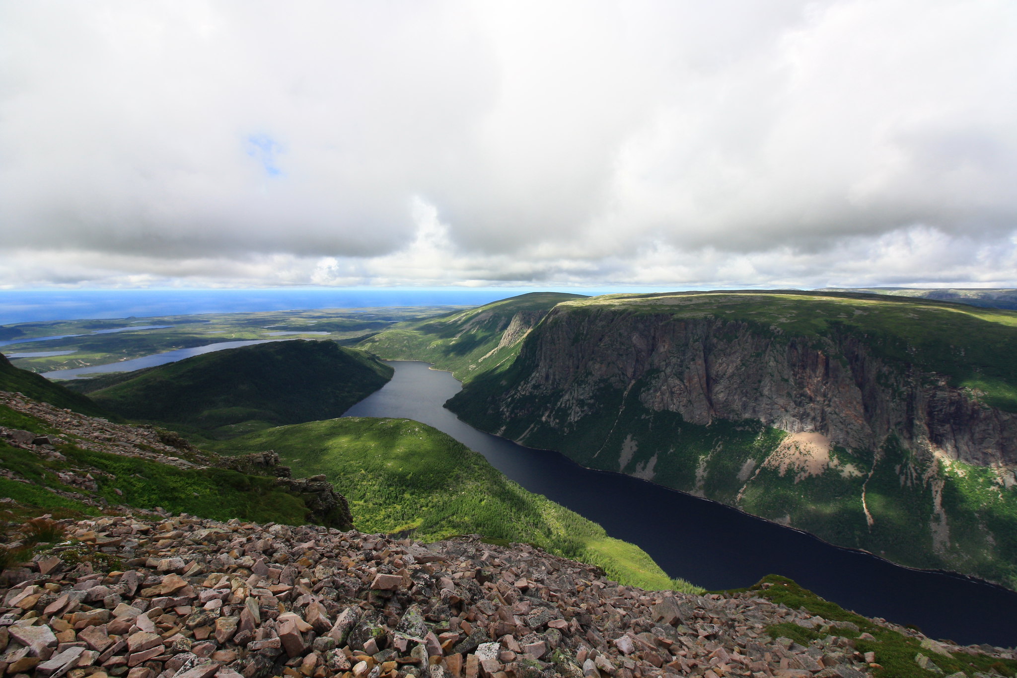 Ten Mile Pond gorge and out to sea. Ten Mile Pond gorge and out to sea.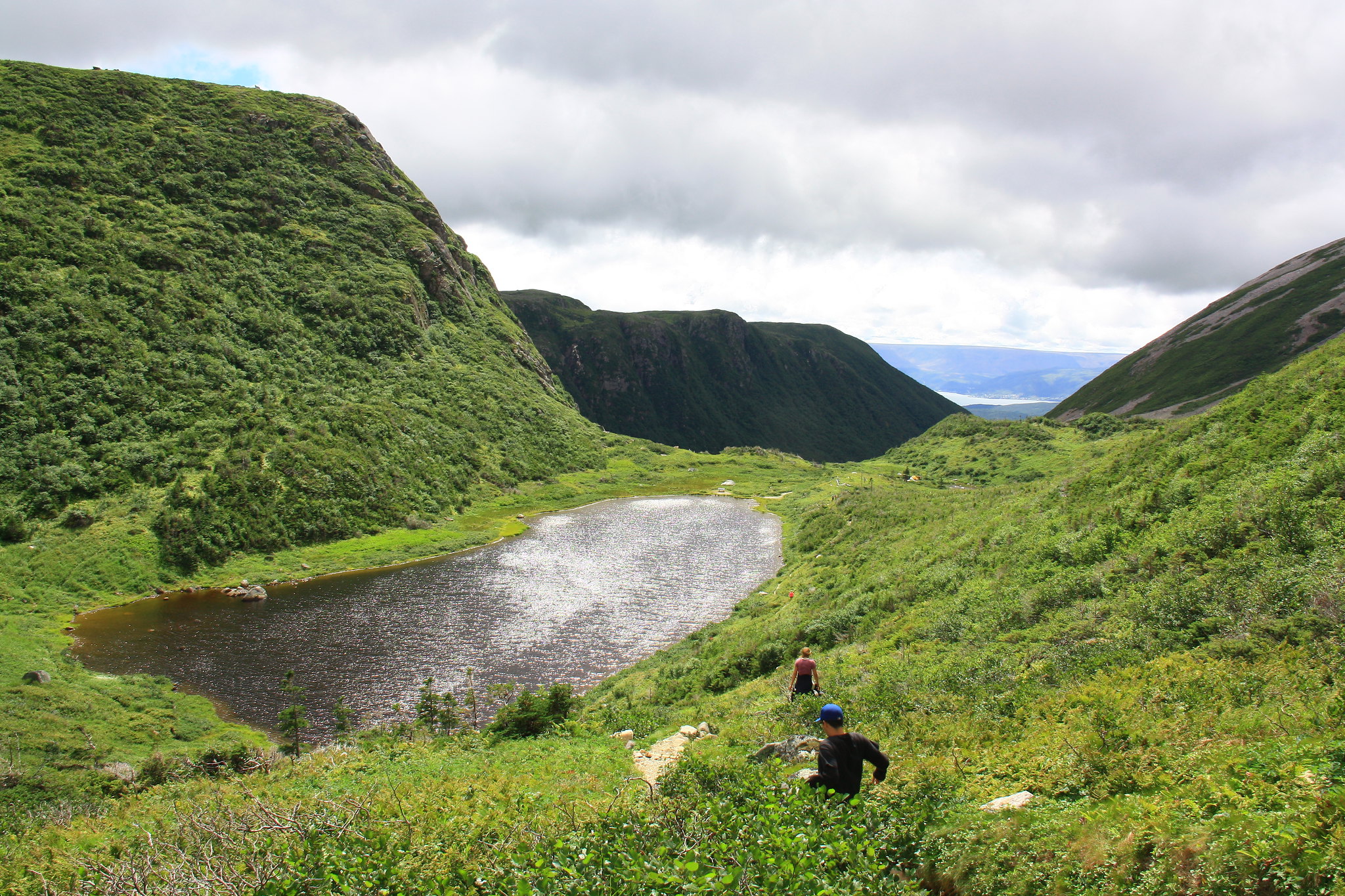 Dropping back down to the pass to begin making our way out. Dropping back down to the pass to begin making our way out.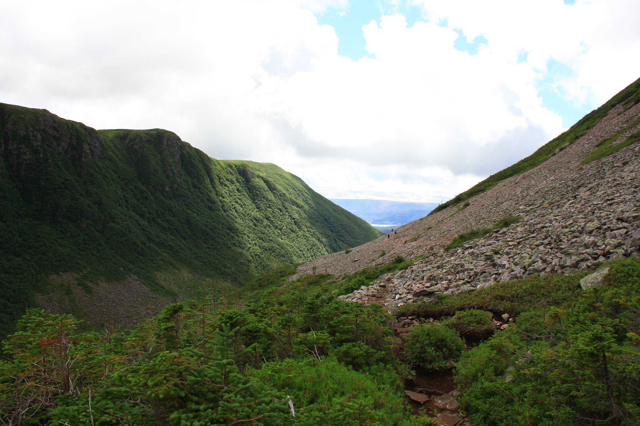 The trail makes great use of the scree to avoid the tuckamore. Too bad my hiking buds didn't much care for scree. The trail makes great use of the scree to avoid the tuckamore. Too bad my hiking buds didn't much care for scree.The drop back down the north face was fast and forthright. We hitched our packs and meandered a little ways down to the hike-in camping area at the southern end of the Ferry Gulch pond to break for lunch. After that, it was a matter of simply following the day trail as it wound around the Gros Morne mountain, across its scree slopes, and down into the lush forest beneath it. Two of us, egged onward by the promise of moose pizza, raced out the final 4 kilometers from the base of the mountain to the parking lot. Before long we were once again in sight of our plucky Kia. 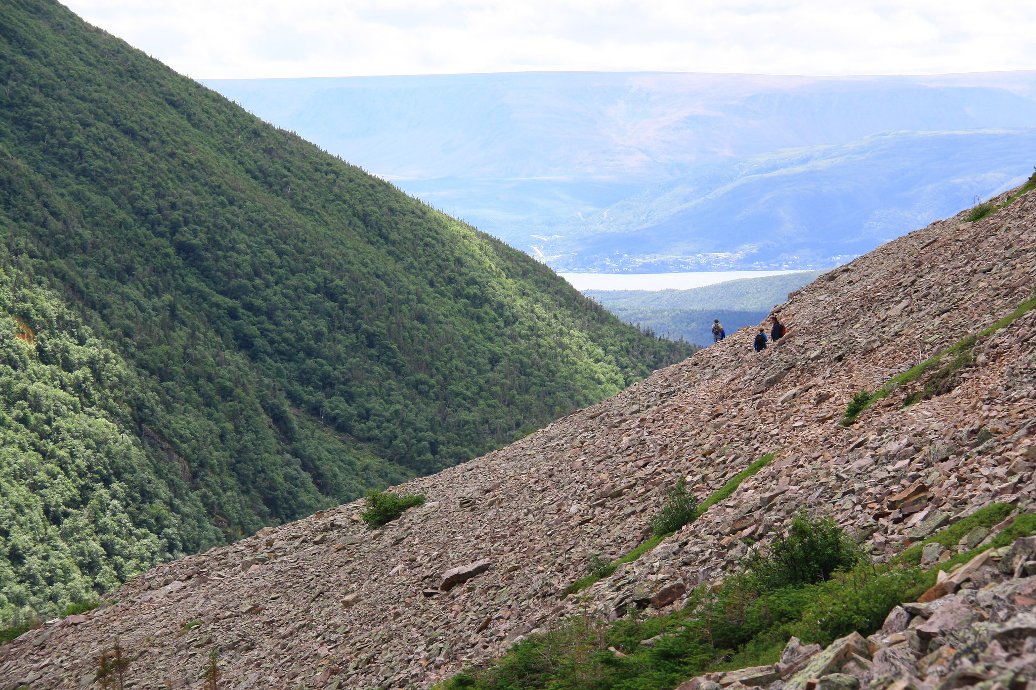 Given the choice between tuckamore and scree, I'm thinking even wet-behind-the-ears hikers will choose the scree. Given the choice between tuckamore and scree, I'm thinking even wet-behind-the-ears hikers will choose the scree.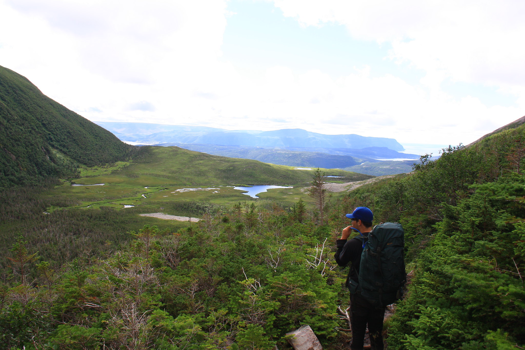 One last view (of the seaside cliffs) before dropping into the lush forest. One last view (of the seaside cliffs) before dropping into the lush forest.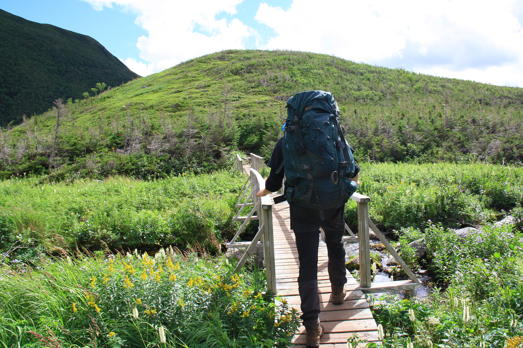 The hiking got significantly easier. The hiking got significantly easier.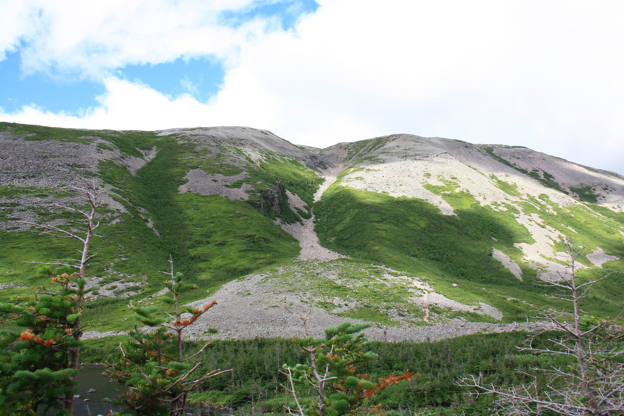 The south side of Gros Morne mountain showing the scree-filled gash that constitutes the normal way up. It's hard to imagine, but people had their young children up there (not including the 100% uphill 4km trek to get to this point). The south side of Gros Morne mountain showing the scree-filled gash that constitutes the normal way up. It's hard to imagine, but people had their young children up there (not including the 100% uphill 4km trek to get to this point).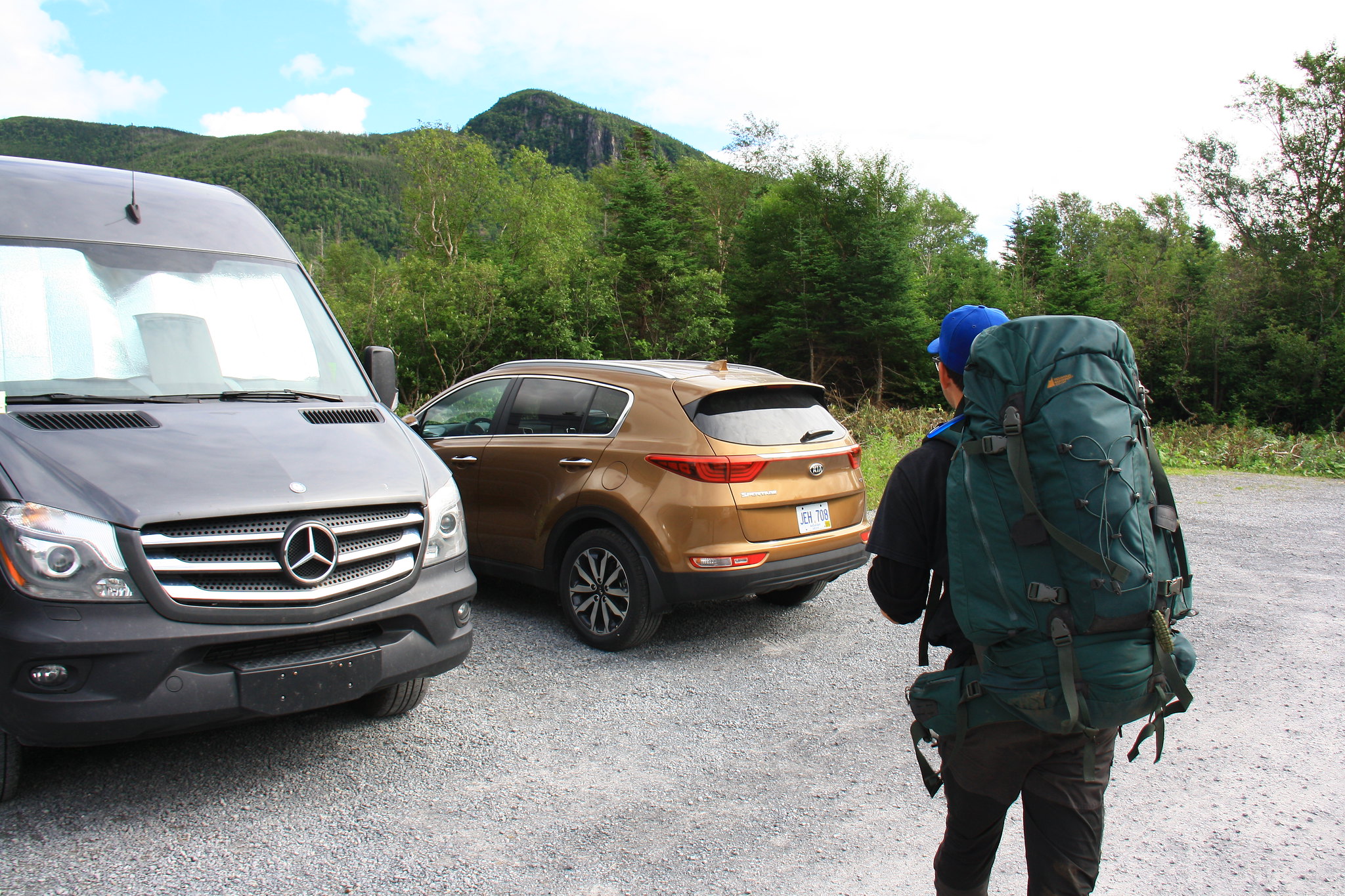 Reunited at last. Reunited at last.Pizza, beer, and sleep ensued. 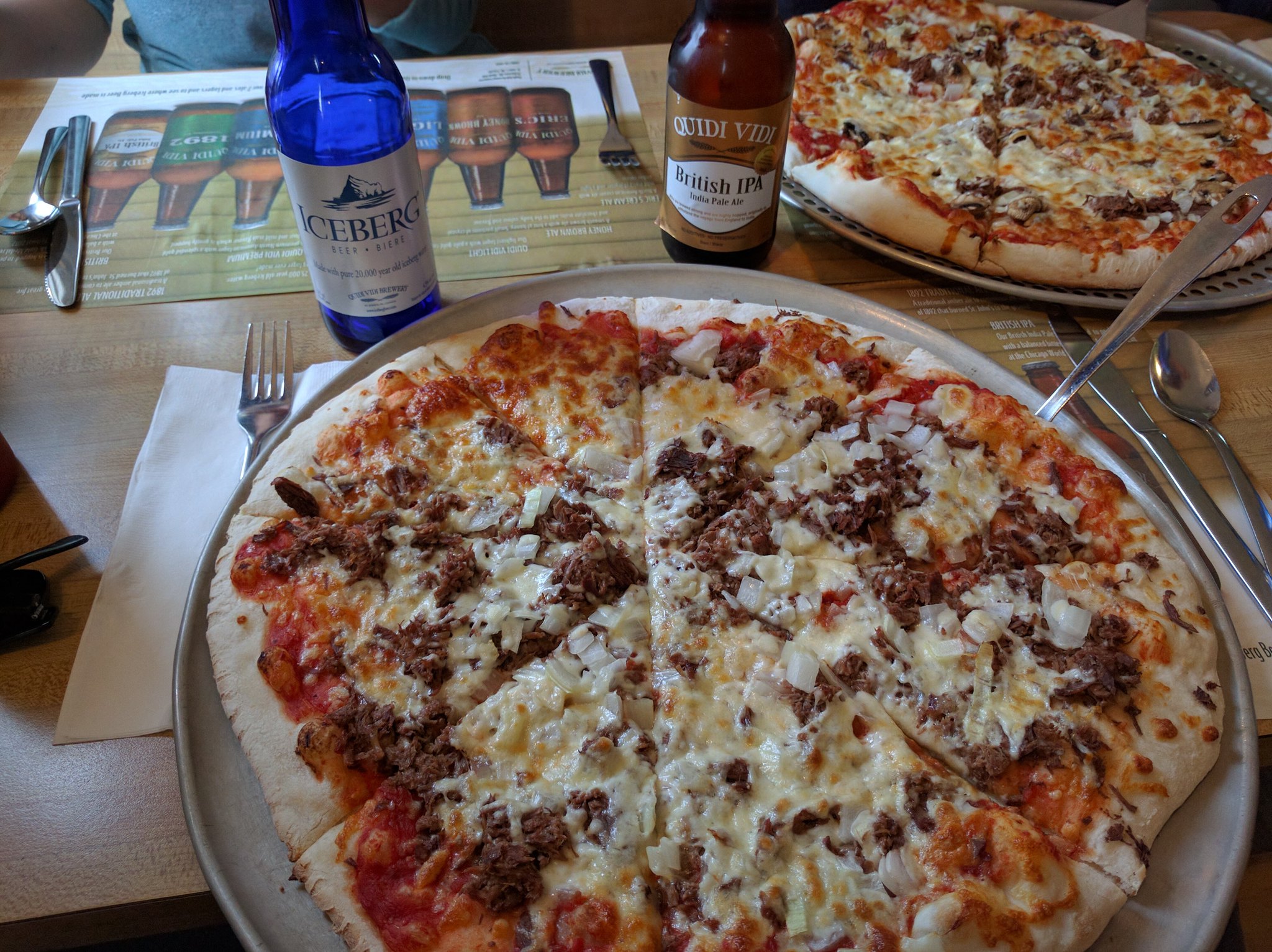 Quidi Vidi and moose pizza, a true Newfie meal. Quidi Vidi and moose pizza, a true Newfie meal.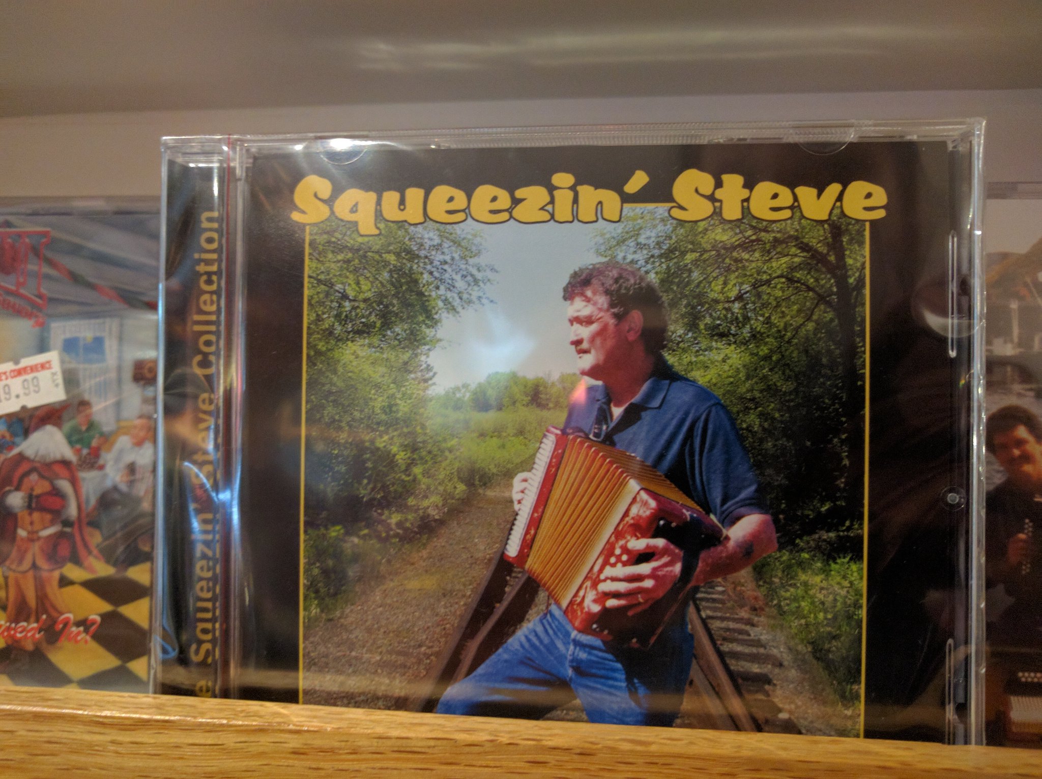 And some quality Newfie tunes to boot. And some quality Newfie tunes to boot.
|
|
amaruq
Trail Wise!
Call me Little Spoon
Posts: 1,264
|
Post by amaruq on Sept 26, 2016 12:51:14 GMT -8
Our last full day in the area, August 14th, had us make the hour drive out to the Gros Morne Tablelands. An impressively brown and red gorge sitting in stark contrast to the green-forested gorges we’d been eyeing up over the past six days. More than a sight, the Tablelands offer hikers the option to climb to the end (and top) of the gorge, however one of ours had been injured on the LRT and was feeling it particularly awful that morning. 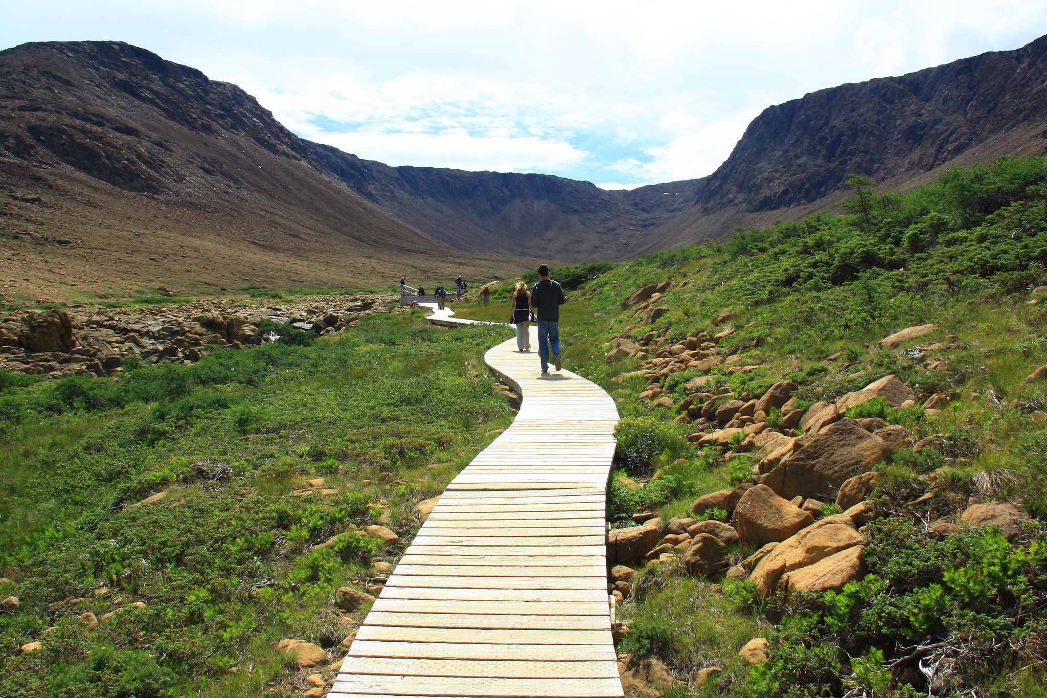 The long and winding boardwalk to the viewing platform. The long and winding boardwalk to the viewing platform.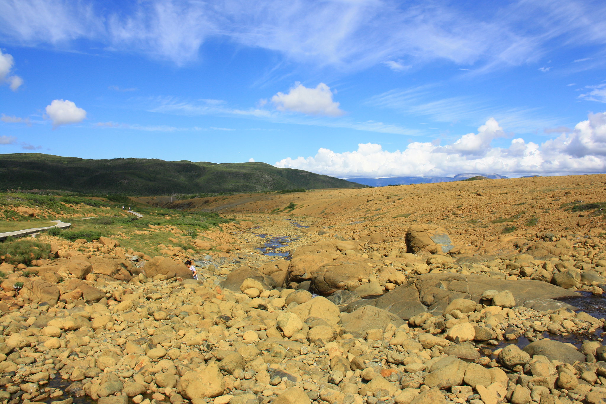 The stark contrast. The stark contrast.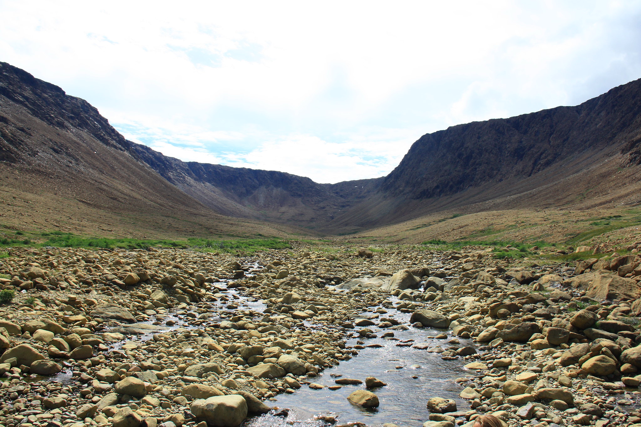 The view from (or near) the viewing platform. One is free to wander into and up the gorge at their leisure. The view from (or near) the viewing platform. One is free to wander into and up the gorge at their leisure.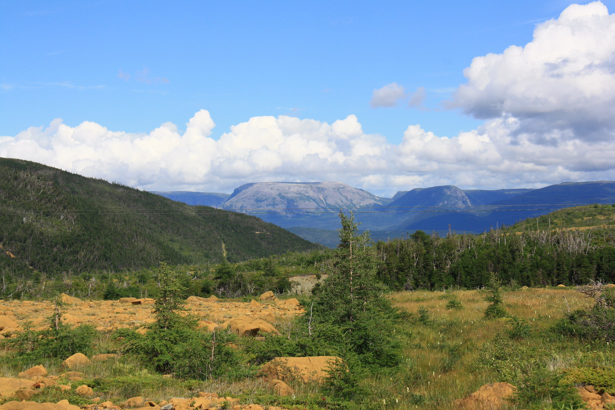 Gros Morne mountain can be seen in the distance. Gros Morne mountain can be seen in the distance.Instead we headed over to the Gros Morne Discovery Centre where we learned all about the park’s ecology, geology, biology, and several other -ologies. This also included a well-produced short-film about the park backed by some great local music and a small thoughtful art gallery in the basement. A side trip out to Bonne Bay on the return trip yielded several quaint little shops on the water as well as a throng of urban backpackers waiting to catch the ferry over to the youth hostel in Norris Point. 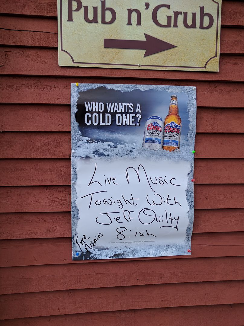 "8:ish" sums up the enviable Newfie outlook on life. "8:ish" sums up the enviable Newfie outlook on life.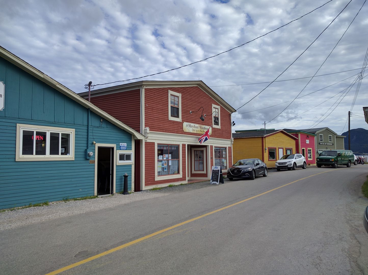 What much of Canada thinks Newfoundland looks like. What much of Canada thinks Newfoundland looks like.The day was finished with another trip to the Ocean View Hotel’s bar to enjoy a similar show to the one we had witnessed only a week prior, though much livelier thanks to an influx of youths. Thankfully, we got to sit out of the "Screech in" ceremony this time. To conclude, I'll state that my thorough bemoaning is entirely of a facetious nature. It's hard to have any sour temperament in such a beautiful locale populated by such friendly folk. The backpacking routes were challenging and engaging, and we all had high spirits throughout the trek; invigorated by the wondrous nature surrounding us, even. I should also note that any photos I'm in, save for the group photo, were not taken by me. This goes double for any photos of both me and my camera. If you made it this far in the trip report, congrats on completing a small novella's worth of reading and thanks for reading :-) |
|
|
|
Post by autumnmist on Sept 26, 2016 14:18:53 GMT -8
"Cod kissing"? I'm guessing that ritual has an interesting background?
The photo of the tour boat dwarfed by the massive cliffs is quite impressive.
In the "south side of Gros Morne mountain" photo, there are some orangish spots - are they berries? I noticed some orange "growth" in an earlier photo as well.
The moose was magnificent, hoof raised as if he was prancing for show. Quite a beautiful animal.
All in all, quite beautiful, stunning, and dramatic photos of a similarly described landscape, coupled with stark contrasts and very rugged terrain. The "rock highway" was stunning; I'm sure your ankles got a good workout traversing that area.
Thanks for the time you spent sharing your experiences.
|
|
GaliWalker
Trail Wise!
Have camera, will use.
Posts: 3,694
|
Post by GaliWalker on Sept 26, 2016 16:03:11 GMT -8
Really enjoyed your reported! Great trip, and great looking terrain. Just lovely.
|
|
amaruq
Trail Wise!
Call me Little Spoon
Posts: 1,264
|
Post by amaruq on Sept 27, 2016 4:53:57 GMT -8
"Cod kissing"? I'm guessing that ritual has an interesting background? I'm not entirely sure on the background and Wiki doesn't provide much of an answer. As far as anyone has been able to tell me, it's mostly so the locals can get a good-natured laugh at the expense of the mainlanders, who typically laugh at Newfies (in Canada, Newfie jokes are as prevalent as blonde jokes elsewhere). In the "south side of Gros Morne mountain" photo, there are some orangish spots - are they berries? I noticed some orange "growth" in an earlier photo as well. I think in that particular photo the orange is just dead, or dying, conifer boughs. Though the berries do tend to take up tracts of land, they don't grow in close bunches, so they don't really appear as anything more than orange specks. All in all, quite beautiful, stunning, and dramatic photos of a similarly described landscape, coupled with stark contrasts and very rugged terrain. The "rock highway" was stunning; I'm sure your ankles got a good workout traversing that area. Thanks for the time you spent sharing your experiences. My alpine experience kept me pretty steady on the boulder fields, but the other two were not fans. The one who injured themselves (ankle) did so on similarly rocky terrain. Thanks for reading :-) Really enjoyed your reported! Great trip, and great looking terrain. Just lovely. Thanks :-) It's fairly verbose and photo-dense, so I'm glad to see a couple people stuck it out to the end. |
|
rpcv
Trail Wise!
Posts: 120
|
Post by rpcv on Sept 27, 2016 5:24:54 GMT -8
Looks like you had a great hike! Your photos are stunning and the timing is perfect because we've been kicking around the idea of some type of trip up there. It just made me want to go more  |
|
toejam
Trail Wise!
Hiking to raise awareness
Posts: 1,795
|
Post by toejam on Sept 27, 2016 6:39:31 GMT -8
Excellent story! Sounds better than kick in the head with a frozen boot.
|
|
|
|
Post by autumnmist on Sept 27, 2016 6:41:40 GMT -8
It's fairly verbose and photo-dense, so I'm glad to see a couple people stuck it out to the end. Reading and admiring the photos was the easy part - I wasn't doing the climbing and crawling through the tuck! And sometimes I like to imagine myself on the trip right along with the poster, inhaling the fresh air, admiring the scenery, taking time out to just be one with nature. But when you got to that heavily rocky highway, I decided to just sit down and study the rocks and ponder where they came from, where they had been, and what they could see or experience if rocks had that capability. |
|
rebeccad
Trail Wise!
Writing like a maniac
Posts: 12,666 
|
Post by rebeccad on Sept 27, 2016 9:06:58 GMT -8
Nice report. I knew nothing about the area, and now I do...looks like a tough, but rewarding hike. Thanks for sharing.
|
|