

Yukon - Summer 2017 (Photo Heavy)
Oct 22, 2018 10:13:10 GMT -8
reuben, MTalpine, and 11 more like this
Post by amaruq on Oct 22, 2018 10:13:10 GMT -8
Been lurking here off and on for the past few months, not posting so much. Figured I should put together a short trip report on my adventure to Canada's Yukon territory last summer. I'm also going to include photos and information on our urban escapades on the trip as these locales are a bit unique in their own ways.
On Canada Day 2017 a trio of us departed from Southern Ontario for the wilds of Canada’s Yukon Territory. We would spend two weeks bouncing around the territory spending time in and around Whitehorse, Kluane National Park, Dawson City, Tombstone Territorial Park, and places in between.
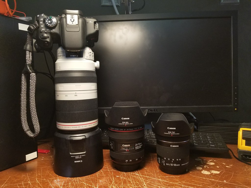
Photography questions tend to be common among backpackers (what do you carry? how do you carry? etc.) so I’ll just touch on this a little bit here. On this trip I packed my Canon Rebel T6i with the following glass: an EF-S 10-18mm f/4.5-5.6 IS STM; an EF 24-70mm f/4L IS USM; and an EF 100-400mm f/4.5-5.6L IS II USM. The majority of the photos were taken using the 24-70mm, whereas the 10-18mm was used (honestly, sparingly) for some vast landscape photos, and the 100-400mm for wildlife photos. I generally hiked with the 100-400mm mounted to the body and ready to go on a PD CaptureClip clamped to my pack shoulder strap. I carried two pouches on my pack hip belt to protect the non-weather-proof camera on rainy days, or just in general: one sized large/long enough to fit the 100-400mm mounted on the T6i, and another to fit both other lenses.
Day 1 – July 1st
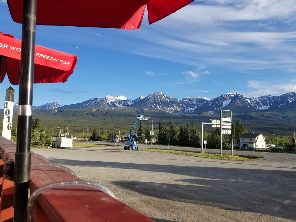
Whitehorse is a city not unlike most cities centered on outdoor tourism and natural-resource industries. It has a quiet local character underlying the bustling activity found during the tourism season. What appealed to us most were the food (particularly the local game), drink (ubiquitous Yukon Brewing options), and art (all three of us are patrons of the arts).
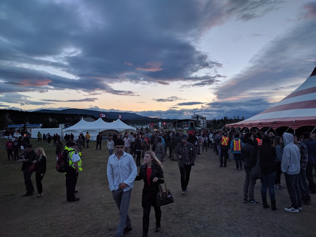
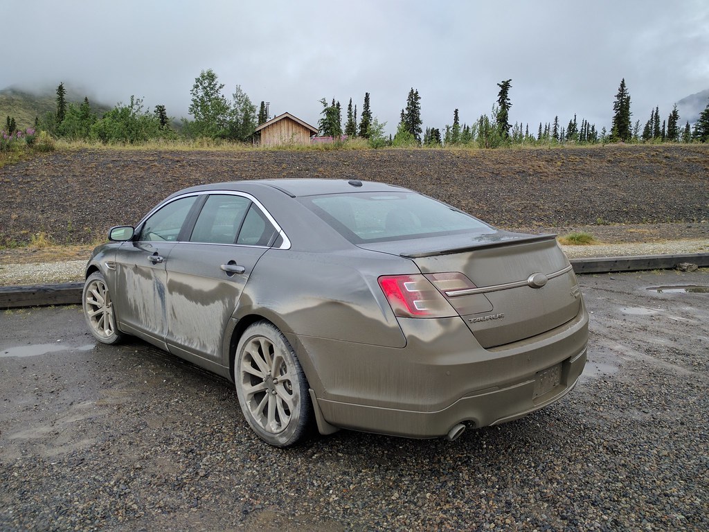
Our first stop – after getting our rental Ford Taurus but before dropping our gear at the hotel – was to the Yukon Brewing storefront. I picked up a bottle of Two Brewers Single Malt Whiskey whose quality was pleasantly surprising and was thus found packed into an emptied water bottle during each backpacking outing. After dumping our stuff and Taurus at the hotel we set off to take part in the Canada Day Festivities.
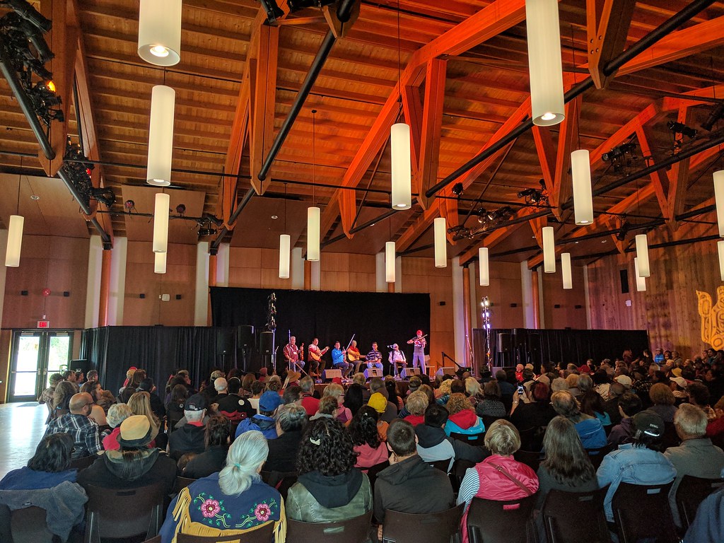
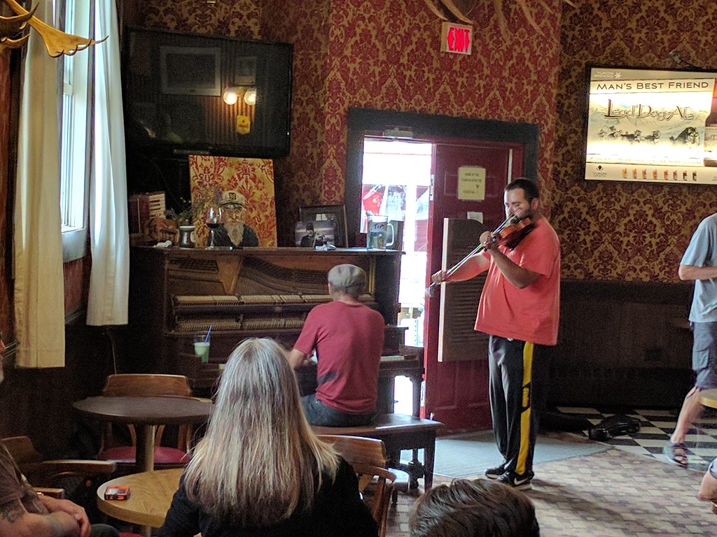
We found ourselves audience to a fiddle showdown featuring a number of talented musicians, many from Old Crow in the far reaches of Yukon’s North. They joked that sometimes the only pastime available was to practice their fiddling and that was why Old Crow produced so many talented fiddlers. After that, we caught the contemporary group July Talk – headlining the Canada Day festivities – and then took in a bit of the midnight sun.
Fiddle Showdown
Midnight Sun in Whitehorse
Day 2 – July 2nd
After breakfast we packed up the Taurus and set a course for Haines Junction, nearly two hours due west of Whitehorse. The drive begins relatively uneventfully with little to see beyond the dense boreal forest; however as you move westward the peaks of Kluane National Park begin to peer over the forest crown. By Haines Junction, Mount Martha Black and the Auriol range command your attention, jutting out from the surrounding taiga.
Enroute to Haines Junction, we caught our first glimpse of wildlife: an adolescent-sized grizzly bear bumbling across the highway. This was the first of two grizzly bears encountered throughout the trip. Unfortunately, I couldn’t get my camera out in time for a snapshot.
Haines Junction is where the Da Ku Cultural and Kluane National Park Visitor Centre is located. As we discussed our route plan with the park staff we learned that the area we intended to hike – the A’ay Chu (Slims River) West trail – was closed due to increased grizzly activity. So instead, after much deliberation, we opted to use the much shorter Auriol trail as an access to the Auriol range where we would set up a base camp and make daily excursions into the range over the course of the week.
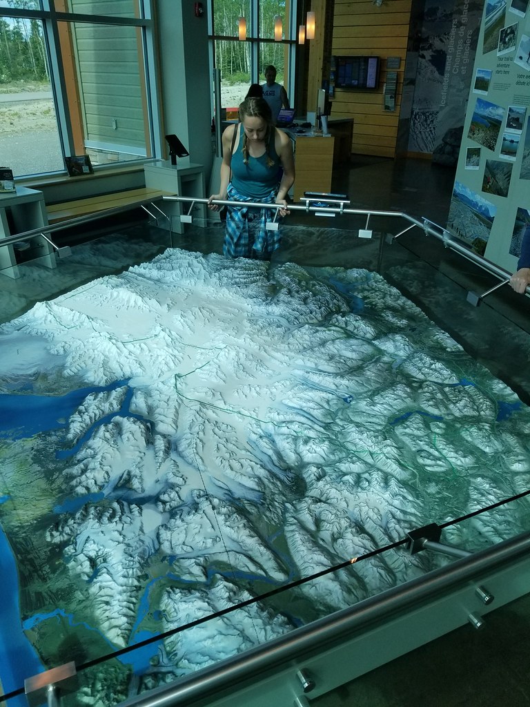
Poring over trail, route, and 3D (shown) maps of Kluane National Park
That evening we packed our bags and relished some quality time in the adjacent bar.
View from the bar patio, Haines Junction
Day 3 – July 3rd
We had a quick breakfast at the Village Bakery (quite popular with outdoors folk of all stripes) before setting off to the trail head. The trailhead is relatively close to Haines Junction – compared to the Slims West or Donjek starting points – and well marked, with plenty of parking. We found the Auriol trail to be fairly straight forward with little in the way of challenge. It was well worn, well blazed, and the camp area towards the end quite obvious. There is an outhouse for when nature calls, a fire pit area, and a nearby stream supplying water.
Just starting out on the Auriol trail
Thankfully the woodland creatures we happened by were of smaller stature, at least though the dense Boreal forest
I should note that the park rents out bear canisters for those who do not have their own. These are a requirement.
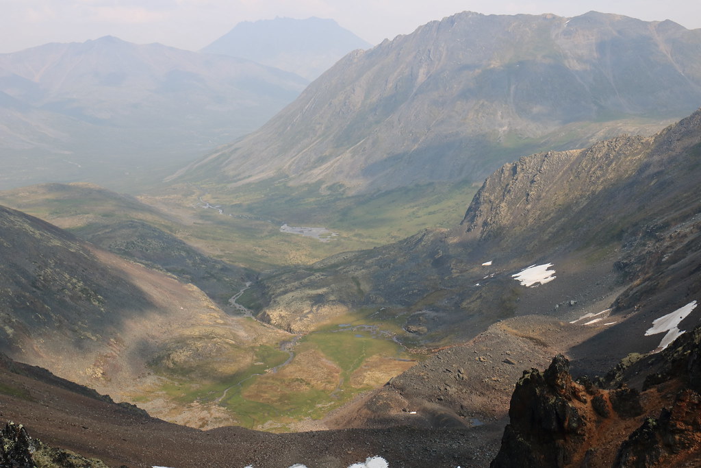
With our tent pitched and our gear stashed away, we decided to kill time by plugging further up the moraine, unburdened, to see if we could not locate a suitable base camp to move up to tomorrow. We followed the trail as far west as it would go and then broke off to follow a game trail that wound along the glacial stream running out the range.
This eventually led us to the base of a large moraine. Unfortunately, we spent too much time wandering along the rocky moraine (including locating a pair of ponds) to take notice of any softer base camp locations, so we returned to camp eager to blindly plunge forth the next morning.
Studying the map on the edge of the moraine

Overlooking a pair of alpine ponds before sauntering down for a refill
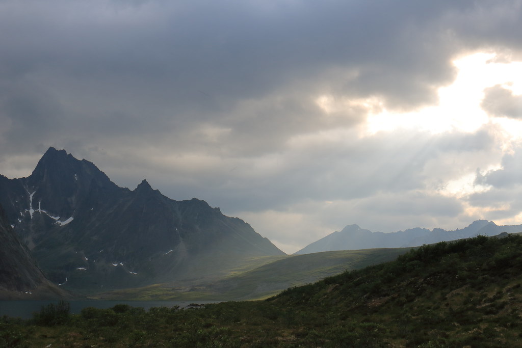
Heading back to the campsite as clouds roll in
Day 4 – July 4th
The morning began with a low ceiling and some light rain. We ate our breakfast in the comfort of the tent and then broke camp quickly during a precipitation intermission. Following the same route through the scrub that we had taken the evening before to get to the base of the moraine, we pushed a little further westward until we came across greener pastures (literally) before mounting the hill.
At this point the low ceiling closed on us halting any progress. After taking a moment for reorientation, we climbed higher up the mountainside and pushed our way above the cloud cover. We had found a couple well-sheltered locations to pitch the tent, but locating accessible water proved more difficult. It was with a bit of luck that a small well of water was found next to the relatively flat and level pad of greenery to which we affixed our tent.
Putting their orientation skills to use
Getting a better sense of direction above the clouds
A place to put down some roots, however temporary
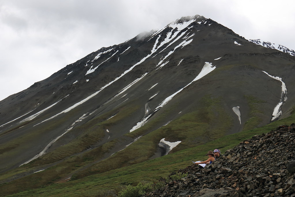
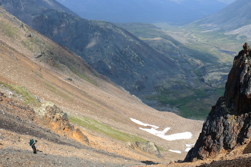
Once camp had been established, one of the group took the opportunity for a nap while the other two of us set off further up the scree to spy some simple routes for tomorrow. This took us up the rocky moraine to the beginning of the alpine ascent proper, where we stopped to take in the easy climbs and short peaks.
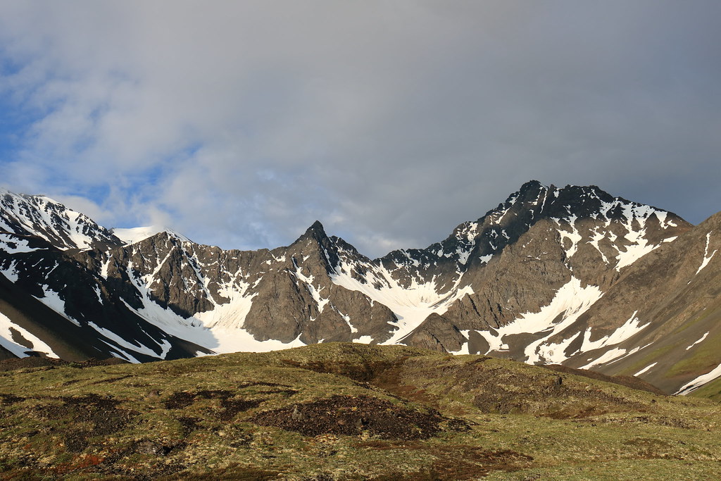
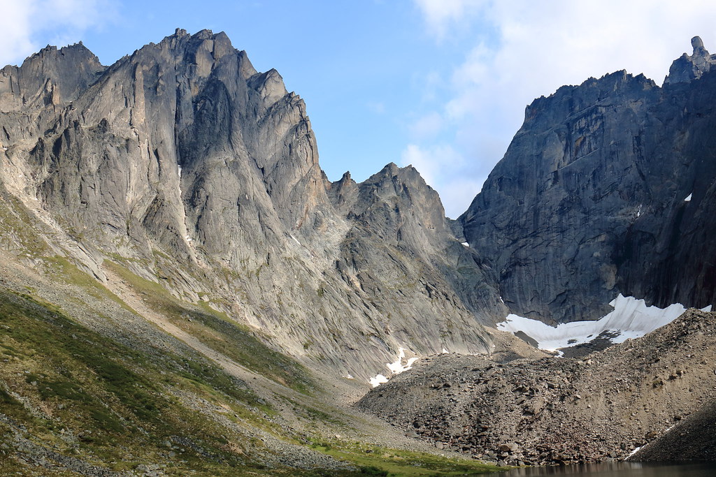
Setting out towards the jagged stone giants

Crossing the hills above the clouds
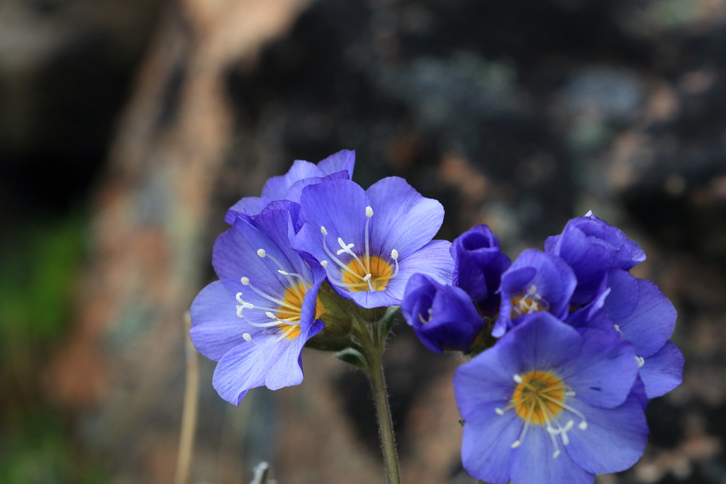
The alpine flora left me wanting for my proper macro lens (the 24-70mm has a macro setting, however it is clunky compared to the real deal)
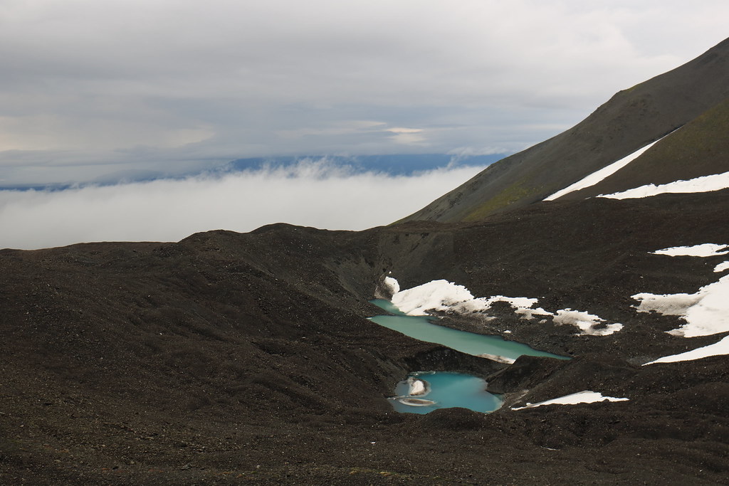
Working our way above the moraine ponds
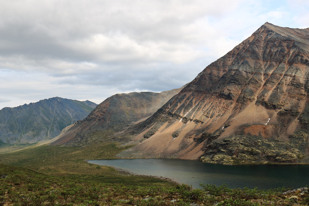
We noted the end of a rocky ridge which would offer good views back down as well as a lower traverse around another peak. The plan would be to give both of these a try the following day.
Day 5 – July 5th
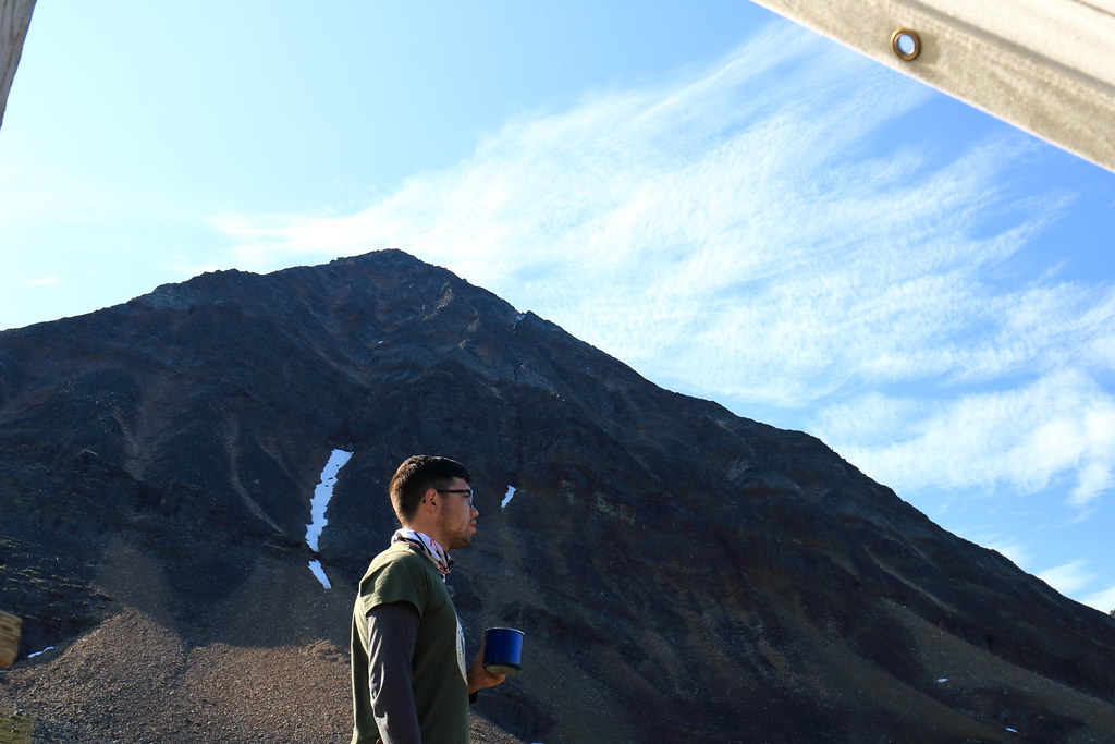
Breakfast was paired with overcast skies, both above and below. Sunlight filtered through the upper ceiling creating stunning views of the cloudy white sea laid before us on our mountainside perch.
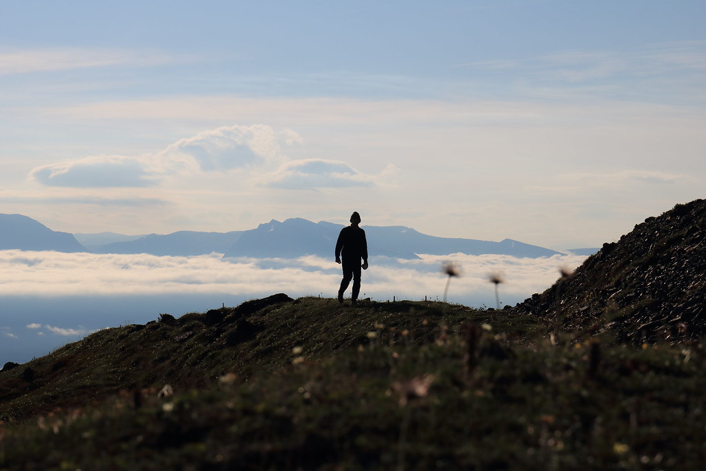
Returning from the, uh, ‘morning walk’
In a land scorched by sunlight 24-hours a day, heavy cloud cover was a blessing at times
With camp secured against unwanted visitors, we departed following the route determined the day prior. Rather than describe the routes and views, I’ll simply post a mass of photos.
Now making our way well above the two ponds
Time and effort found the group atop the ridge’s small end peak
Haines Junction at 400mm
Working her way around the traverse

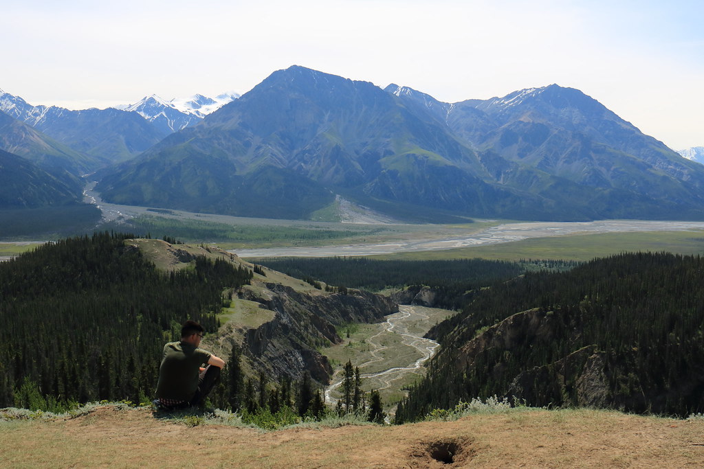
Stopping for a rest (Haines Junction in background)
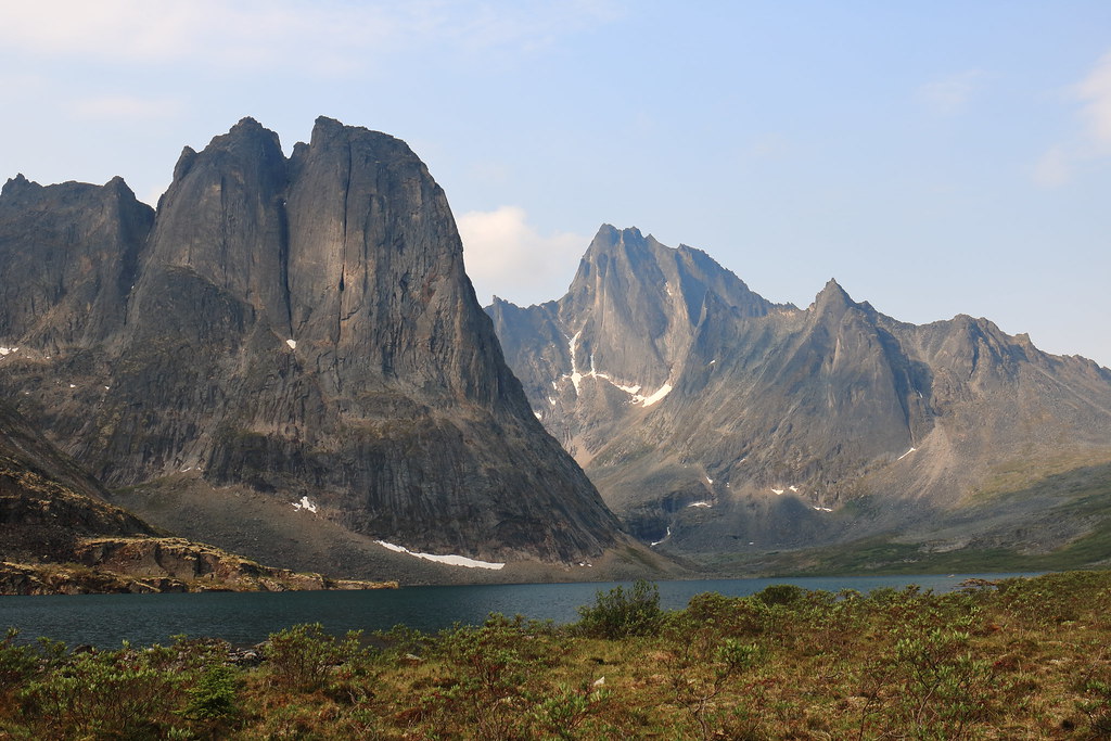
Not quite able to see Mt Martha Black from this vantage point (just behind the slope)
The azure allure of those distant formations
Although some time was spent scanning for further routes to hike on the following day – before hiking out on Friday – it was determined that there were none that either did not require the use of proper mountaineering tools or were within the skill range of all group members. To this end, we decided to end our stay here earlier than originally expected by hiking out on the following day.
Day 6 – July 6th
The day was largely uneventful. Camp was broken and we hiked out much the same way we had hiked in. Upon depositing the bear canister back at the park office and signing out of the park, we once again took up the task of finding a trail to hike as a day hike the next day. Slims River west was selected, or at least a short side trail thereof known as the Sheep Creek trail.
The remainder of the day was the typical post-backpacking ritual: showers all around, hearty meals, plentiful drinks, inventories of gear (both backpacking and travelling), etc.
Day 7 – July 7th
This day began with DIY breakfast from the Little Green Apple Grocery store, where snacks for the day hike were also purchased.
The drive to the Tachal Dhal Visitor Centre at the southern tip of Kluane Lake was about 45 minutes and provided beautiful scenery. The centre was informative and had interactive exhibits including field glasses for observing the Dahl sheep grazing on the impossibly steep mountainside.
The trailhead was further down a single lane bush road that would have been trouble had a vehicle from the opposite direction crossed our path. Fortunately, we managed to get in and found the trail well marked and easy to follow. Given that two us were feeling a little ‘slow’ from the night prior, our pace was relaxed and easy going.
View down Slims River from the Sheep Creek trail
Views from the rest area part way up the trail
From here, we drove straight back to Whitehorse where we would spend the night before heading to Dawson City the next morning.
After getting ourselves established at the hotel and getting some grub, we headed out to the Takhini Hot Springs to soak away our aches and pains in preparation for the upcoming jaunt through Tombstone Territorial Park. To get there, you follow what feels like an unassumed backroad until you’re sure you must have passed a turn-off somewhere, then you go a little further until the establishment’s packed parking lot comes into view (it’s a pretty popular place). It was a great experience that I would recommend to anyone who finds themselves with a spare evening in Whitehorse.
Day 8 – July 8th
Our first Tim Horton’s breakfast of the trip. A quick stop at Canadian Tire to pick up a jerry can (just in case). And then we were off on the 6-ish hour trip up the Klondike highway. The highway condition varies between well paved and gravel, though it is quite well kept. I forgot to mention earlier, but a solid percentage of the traffic in this region consists of RVs. Many of which heading up the Klondike are likely enroute to the Dempster highway (or Top of the World highway, or both). These tend to move slow and the highway can get fairly windy, so pass with caution. There are ample opportunities for fuel, at least for a Taurus-sized/type vehicle (the jerry can was returned, unused).
Landscape-wise, the boreal forest slowly shrinks in height and thins as pockets of scrubby tundra creep in amongst the trees. However, the area around Dawson City still exhibits a forest rife with stubborn trees. It is not until the final approach to the Tombstone Interpretive Centre along the Dempster highway that tundra shrubbery begins to overtake trees as the primary vegetation.
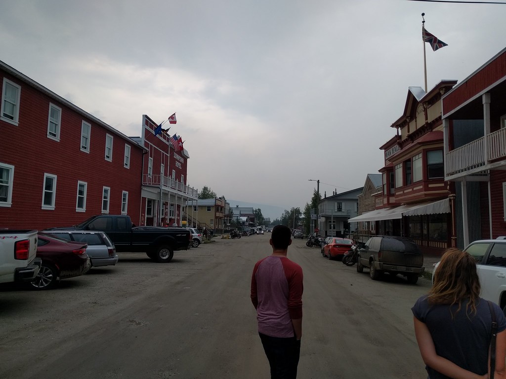
The first thing we did upon arriving in Dawson City is drop our gear and our Taurus at our inn. The downtown area of Dawson is quaintly small and easily walkable. The entire town seemingly pays homage to its goldrush roots. This rarely feels gimmicky, likely due to the authenticity of its claim to this schtick. Note that any slight sepia tone (and going forward, generally haziness) of the photos is due to forest fire haze, not because the town exudes that much old-timey-ness.
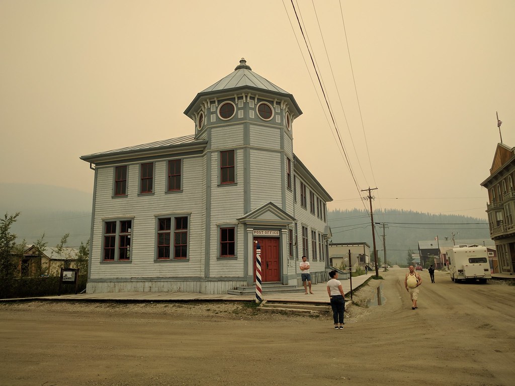
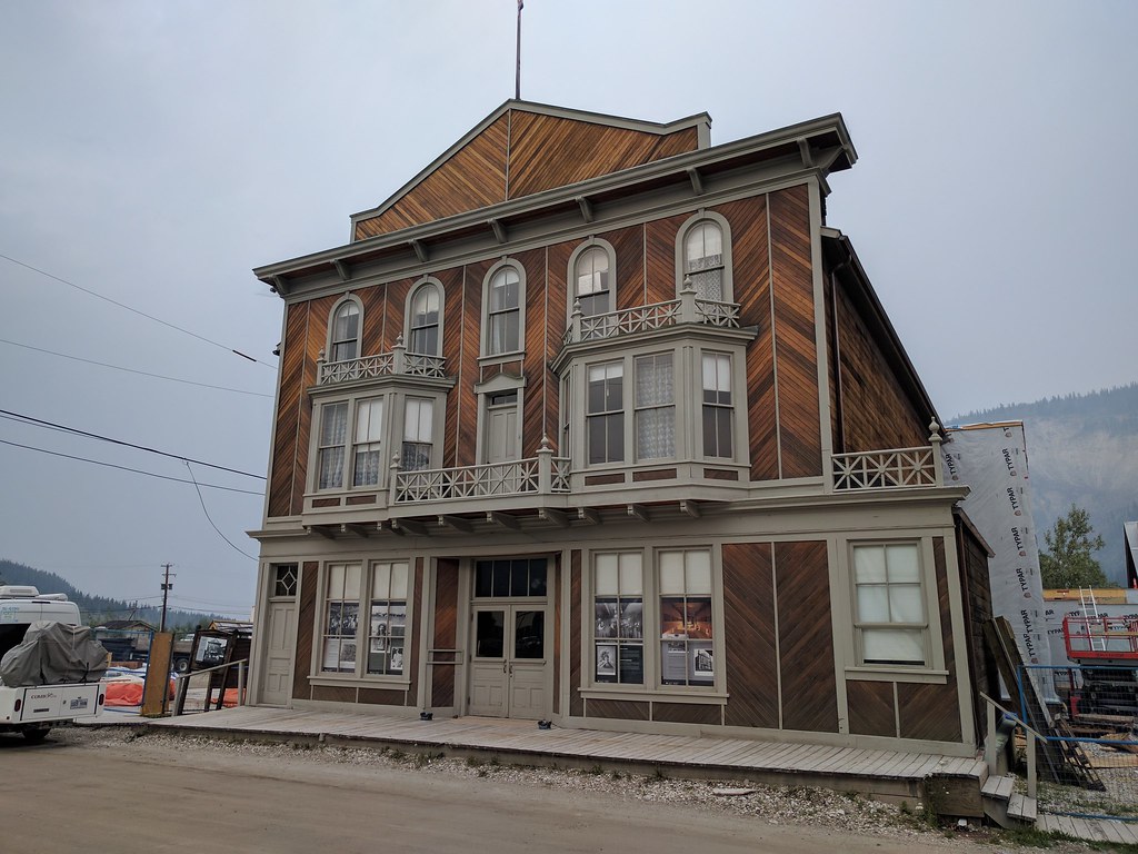
The old-timey, gold-rush aesthetic: clapboard, boardwalks, and muddy streets
The food and drink here, much like Whitehorse, is superb. At least for short enough stays (quality and quantity of options are good, quantity of establishments is as expected of a smaller town).

Klondike Kate’s patio was quite relaxing and the food fantastic.
Our first night in town saw us find our way to the Downtown Hotel bar. If you’ve heard anything about the drinks in Dawson City, surely it’s of the Sour Toe Cocktail. At a certain time, for a certain fee, and under the watchful eye of a certain Captain, patrons can ‘enjoy’ a shot of alcohol (typically Yukon Jack whisky) garnished with a mummified human toe. As they say: “you can drink it fast, you can drink it slow, but your lips must touch the toe!” Those who complete the ritual are inducted into the Sour Toe Cocktail Club. Anyone curious about the finer details (history, etc.) can find more information here:
dawsoncity.ca/attraction/sourtoe-cocktail-club/
Piano man is a regular nightly fixture, however the violinist was a tourist ‘sitting in’ with him
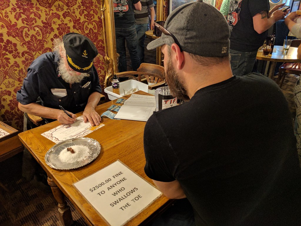
Preparing to join the Sour Toe Cocktail club. The toe sits atop a mound of salt
Day 9 – July 9th
A spare day to explore in and around Dawson City. We kicked off the day with a walk about the town. Took in the sight of the SS Keno; an old paddle boat sitting atop the riverbank turned into a National Historic Site (I assume this means it’s now a museum).
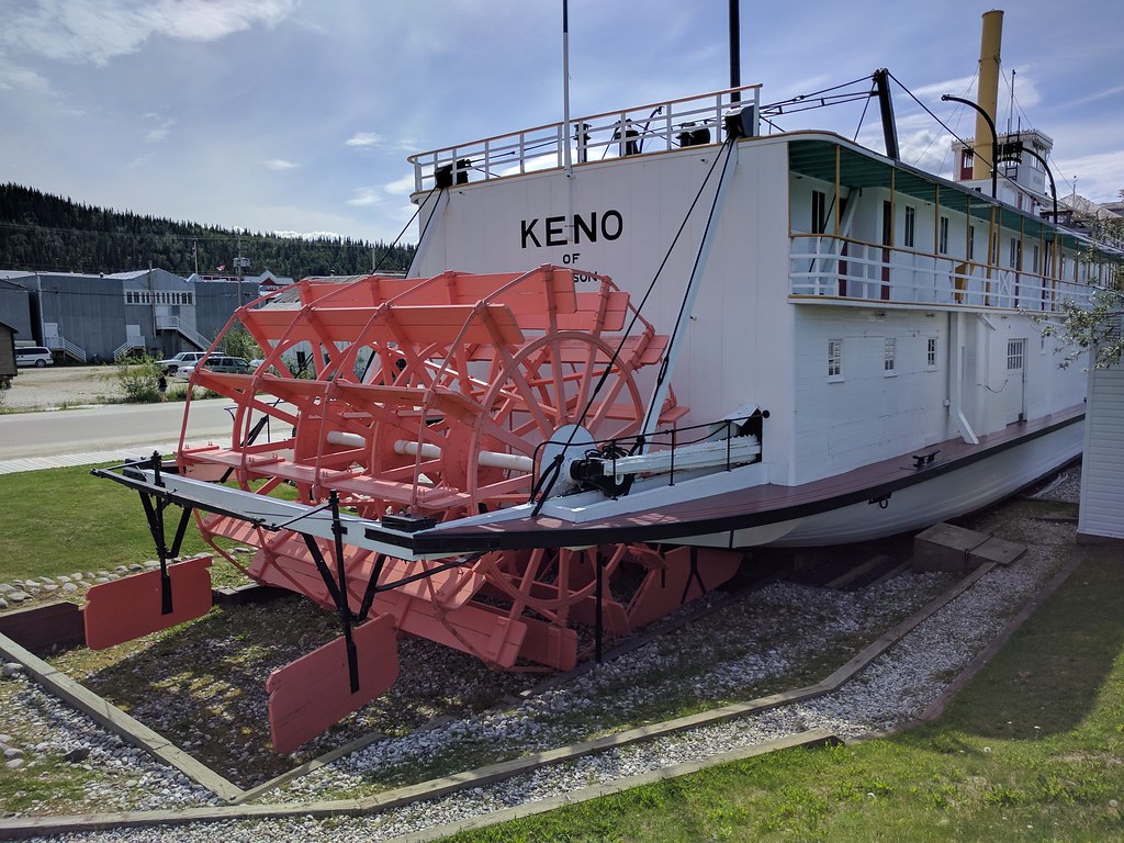
SS Keno National Historic Site
At the Klondike Information Centre, we learned that our Canada Parks pass would permit us to visit one historic site for free, so we grabbed tickets to check out Dredge No.4. Throughout the tour we learned that massive dredges like these were the reason for the worm-like tailings formations throughout the valley bottom leading up to Dawson City (Google Maps Satellite view shows these well); that placer mining tailings are as clean as they had been before being dredged up and so it was possible to build atop these formations without significant remediation processes; that due to the massive power requirement of these machines (electrically powered!), Dawson City was among the first cities in North America wired for electricity; and that the placer miner dredges were designed to sift out gold flakes, however nuggets would go straight through and may to this day lie somewhere among the tailings.
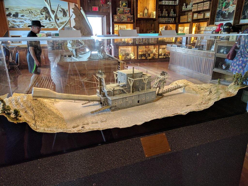
Model of Dredge No.4 in the visitor centre
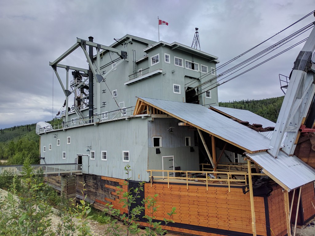
The massive Dredge No.4 in the flesh
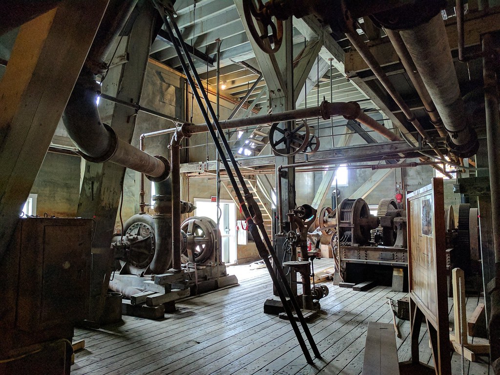
Some inner workings of the dredge
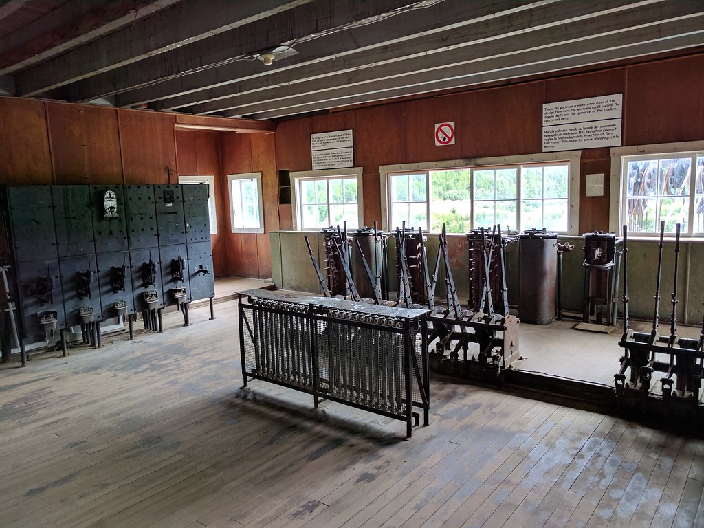
Dredge control room at the peak of the timber and steel structure
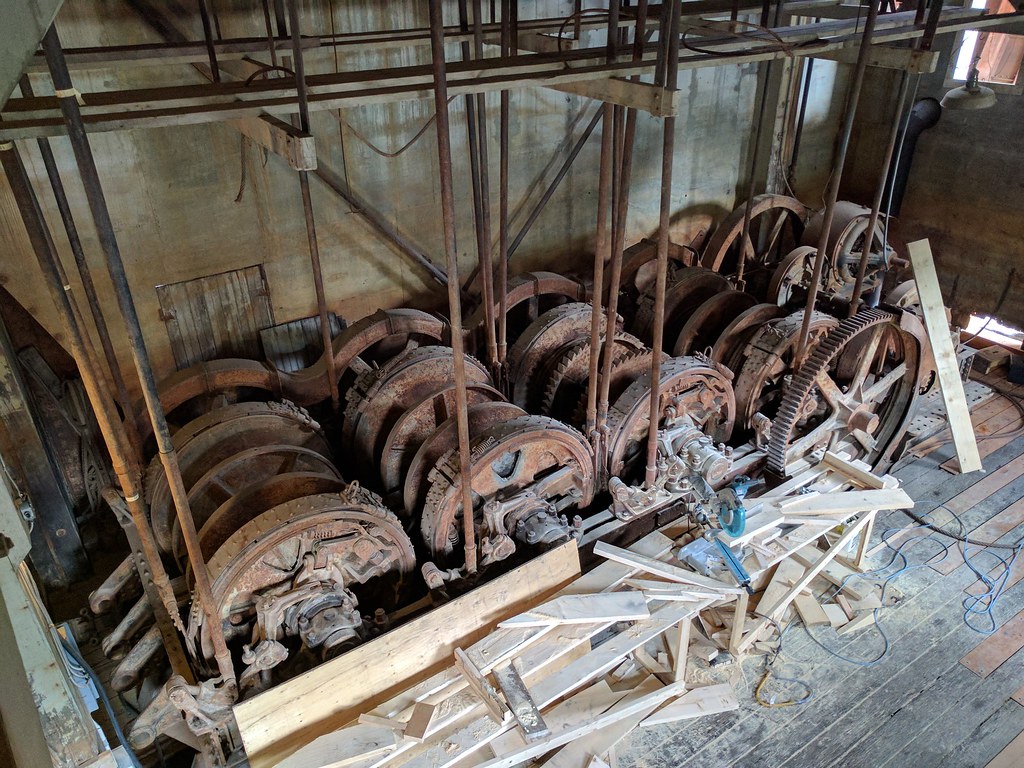
The series of winches, controlled by the levers above, which control the dredge’s positioning and operations
We drove up to the Midnight Dome lookout after this to take in the sight of Dawson City and the Yukon River.
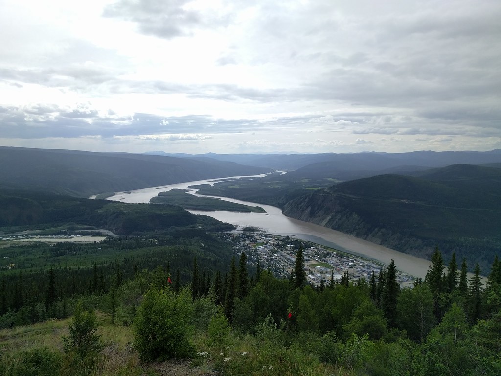
Across the river you can see the beginning of the Top of the World highway as it winds around the hill
After dinner, we bought our way into Diamond Tooth Gertie’s Gambling Hall to catch the can-can shows and enjoy some more of the Klondike aesthetic. Of everything we had experienced in Dawson thus far, this was perhaps the one I’d describe as being closest to kitsch. Regardless, it was an enjoyable time, though we were probably the youngest of the patrons.
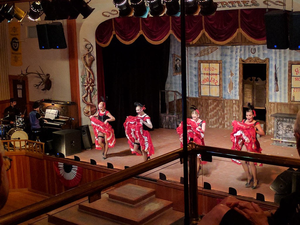
Can-can show at Diamond Tooth Gertie’s Gambling Hall
Day 10 – July 10th
With a quick inn breakfast, we headed off to the Tombstone Territorial Park Interpretive Centre to begin our journey into said park. The two-hour drive took us up the first 70km of the Dempster highway, known for its rugged and lonely existence. A small winding path of dirt cutting through a massive open landscape. I’d love to go back and drive its 880km length all the way up to Tuktoyaktuk, Northwest Territories (69+ degrees North!).
As promised, the road was rugged and the rental companies all made sure to inform renters that damage incurred on the Dempster would not be covered by their standard damage converge, only their extended coverages. The Taurus handled the drive well and we made good time to Tombstone.
We took some of the Dempster with us to Tombstone and then back to Whitehorse
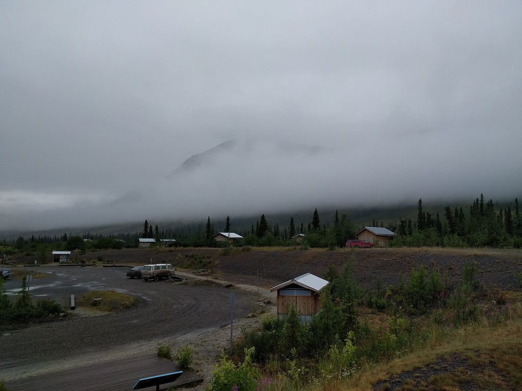
Our views of Tombstone obscured by fog
The relatively new interpretive centre
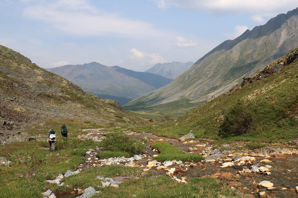
We signed into the park, received a quick orientation as well as a pair of bear canisters, and then departed for the trailhead a short ways back towards Dawson.
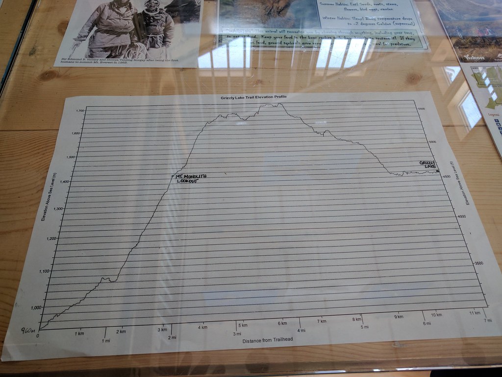
The most popular portion of the hike (in to Grizzly Lake), but only our first day
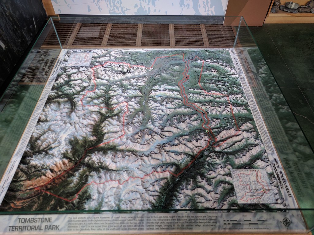
Another 3D map
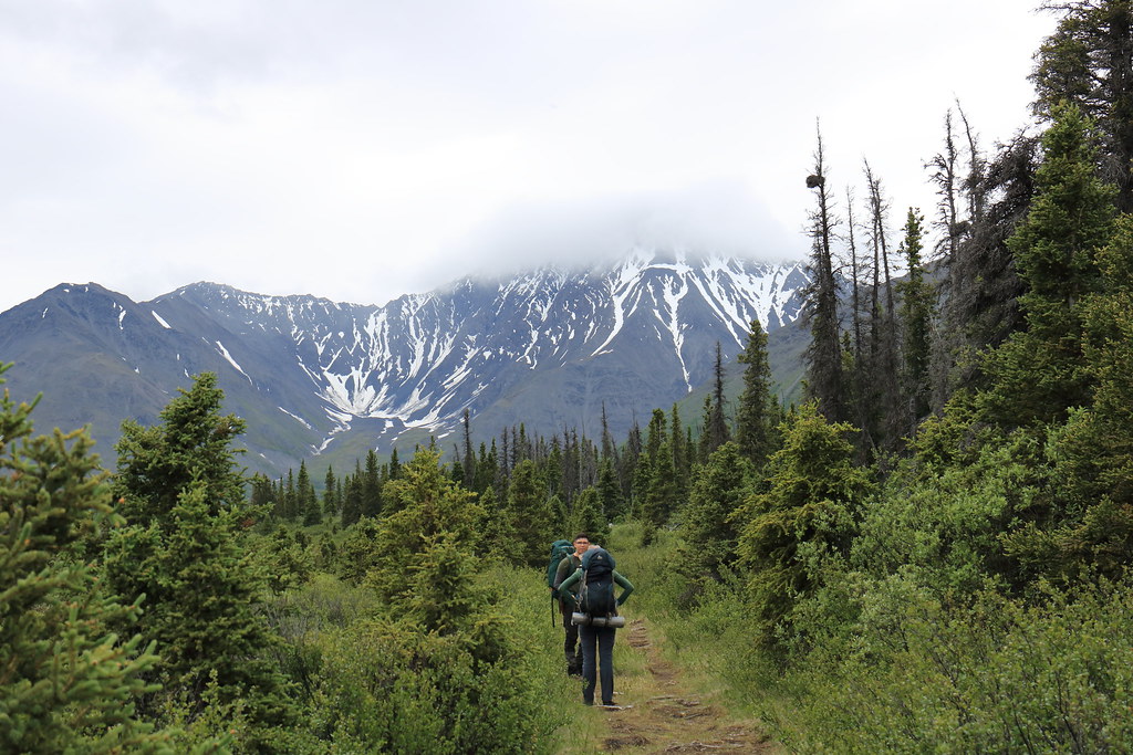
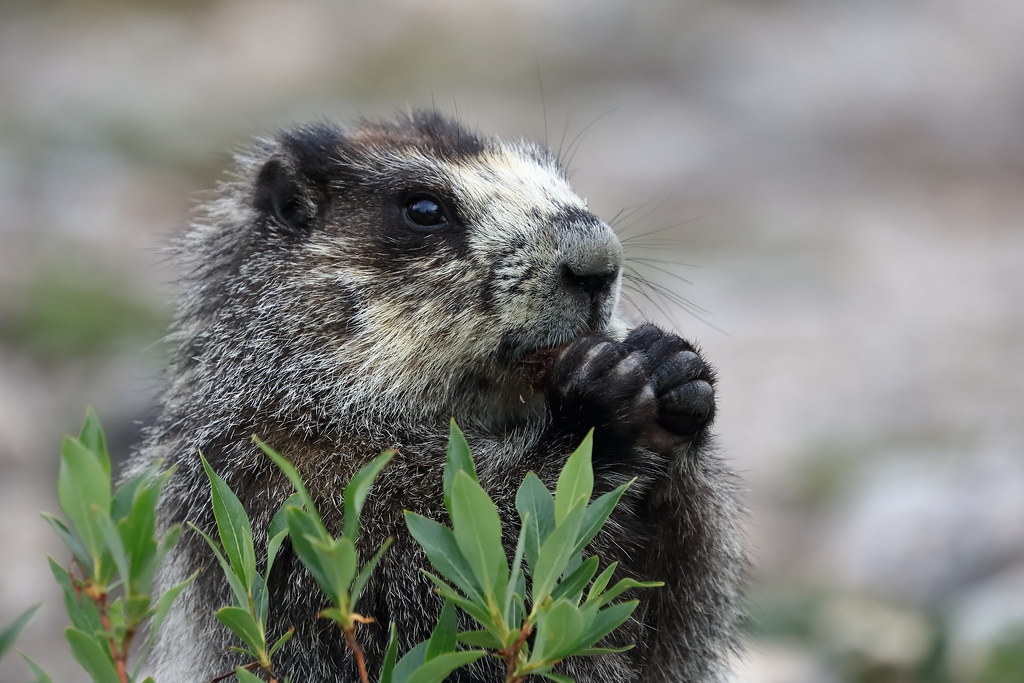
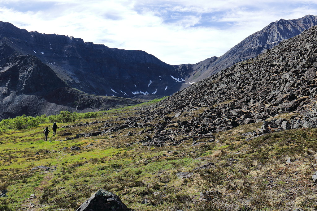
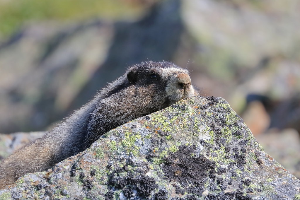
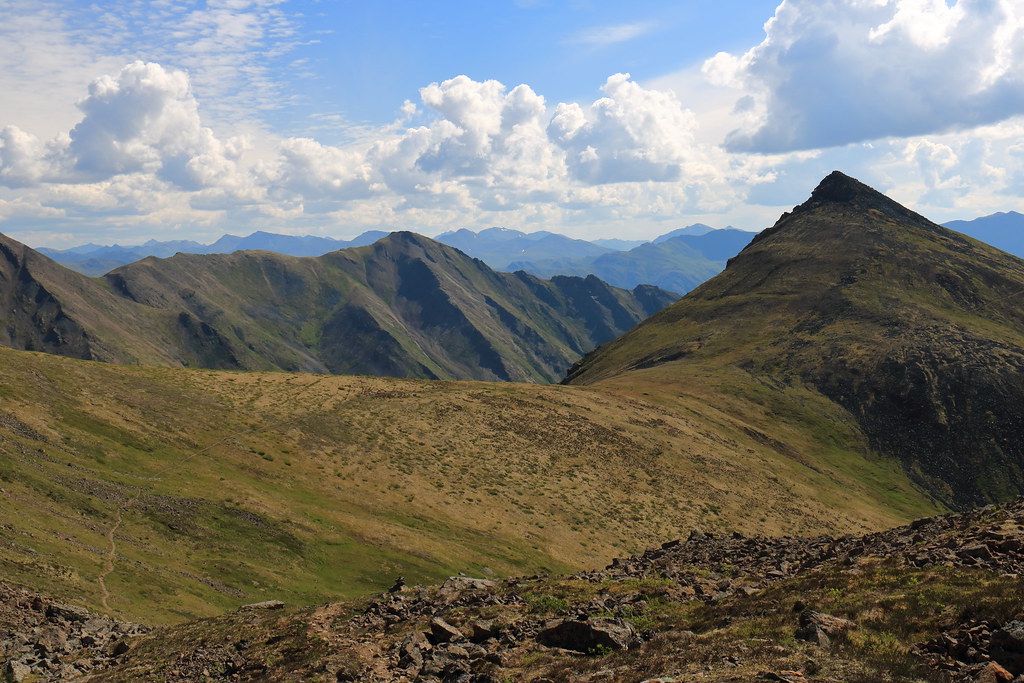
From the trailhead, the path winds through a sub-tundra boreal forest replete with babbling streams and surprising humidity given the latitude. Through this length of trail it is important to keep eyes and ears open for bears. After an hour or so of weaving through the trees the ascent begins in earnest. The trail starts to form large switchbacks as it breaks through the overhead canopy and into head-high shrubbery. This continues for what seems like ages until both the switchbacks and the shrubs are left behind in a direct dash for the Mt Monolith lookout. This is where we (finally) stopped for a rest and I managed to snap some photos. This is as far as many groups get and comprises the majority of the day trail. As such, the ground squirrels in this area are aware of the connection between humans and food and are not too shy to chitter in hopes of a snack.
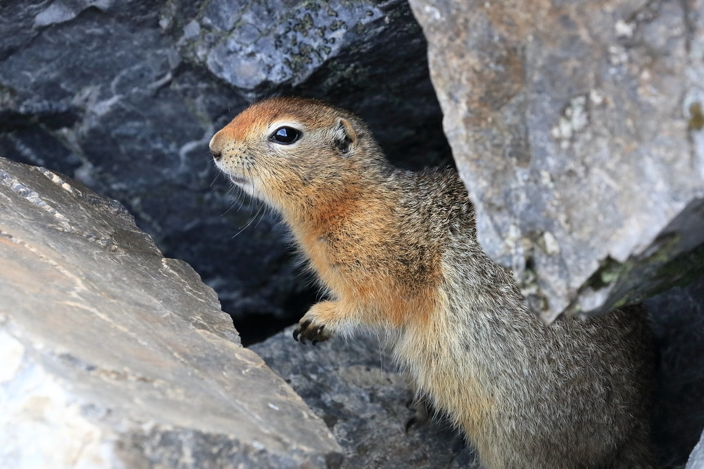
Ground squirrel hoping to snag some food

Easy going at this point
The caveat with stopping for photography is that it often leads to the others getting much further ahead
A rest with a view

A squirrel’s eye view too
Generic hiking shot #23
Posing for me
As did this fella
Impressive views just beyond the next crest
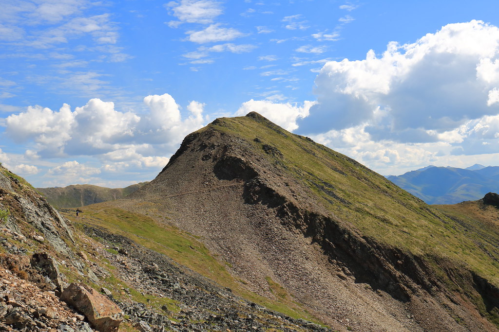
Plenty of scree-filled swaths for the discerning mountain-going connoisseur
Generic hiking shot #36

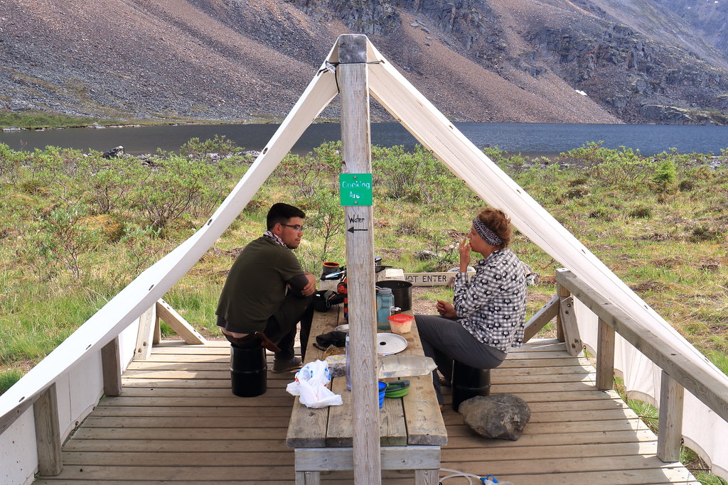
Descending towards the Grizzly Lake campsite. The white dot on the near shore is the cooking tent
The campsite is well organized with w e l l – s p a c e d tent pads, a pair of outhouses, two cooking tents, a grey-water barrel, and food lockers. There are also demarcated pathways – not unlike roads – leading between all these locations. This is all to protect the fragile tundra environment as much as possible.
This campground is often fully-booked and frequented by park wardens, but outside of dinner time, it hardly feels crowded at all. At dinner time, it pays to be friendly, where different groups are generally happy to swap interesting stories and bits of information pertaining to further up the trail (if they are regulars or just on their way back).
Washing up and/or soaking and/or collecting water
Day 11 – July 11th
This day brought with it decent, if not hot, weather for the passage from Grizzly Lake to Divide Lake just over Glissade Pass. We were warned about Glissade Pass by the park staff and countless Tombstone trip reports prior. Our side – the Grizzly Lake side – is supposed to be the easy side, but it was a fairly tough slog that felt much steeper than I’m sure it was.
But before any of that, we woke up to this envious view:

An morning view to be envious of
And then found that there was a bit of traffic jam for these:
A less envious view?
However, in good time we found ourselves at the base of Glissade pass looking up and began our ascent.
A couple views from part way up, depending on which direction you were looking
And when we finally crested the pass, one of the party looks back to me (I’m slow) and asks, “where the heck did you bring us?!”

Peering over the ‘backside’ of Glissade Pass
Yeah, sure, it was steep, but descending is always steeper than ascending. Of course, we weren’t thinking of having to ascend it again yet.
The view from up there was pretty, though
In the end, there was a slight trail we could follow where prior boots had beat in a primitive switchback. It was not as bad as it had looked from above. Especially once we began to employ some glissading.

Starting down
Continuing down
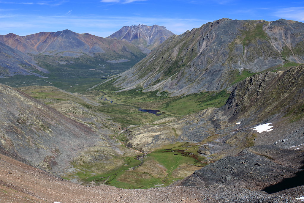
Eventually, the trail takes you off the scree and into a meadow where the descent continues. There are a handful of boulder patches to traverse through this section, but eventually you work around a hill and Mount Frank Rae rises up before you. Mt Frank Rae is the tallest peak in the park and looms over the Divide Lake camp site. From this point, the hiking is easy traversing across the hills and eventually right down into the camp site.
Meadows below Glissade Pass
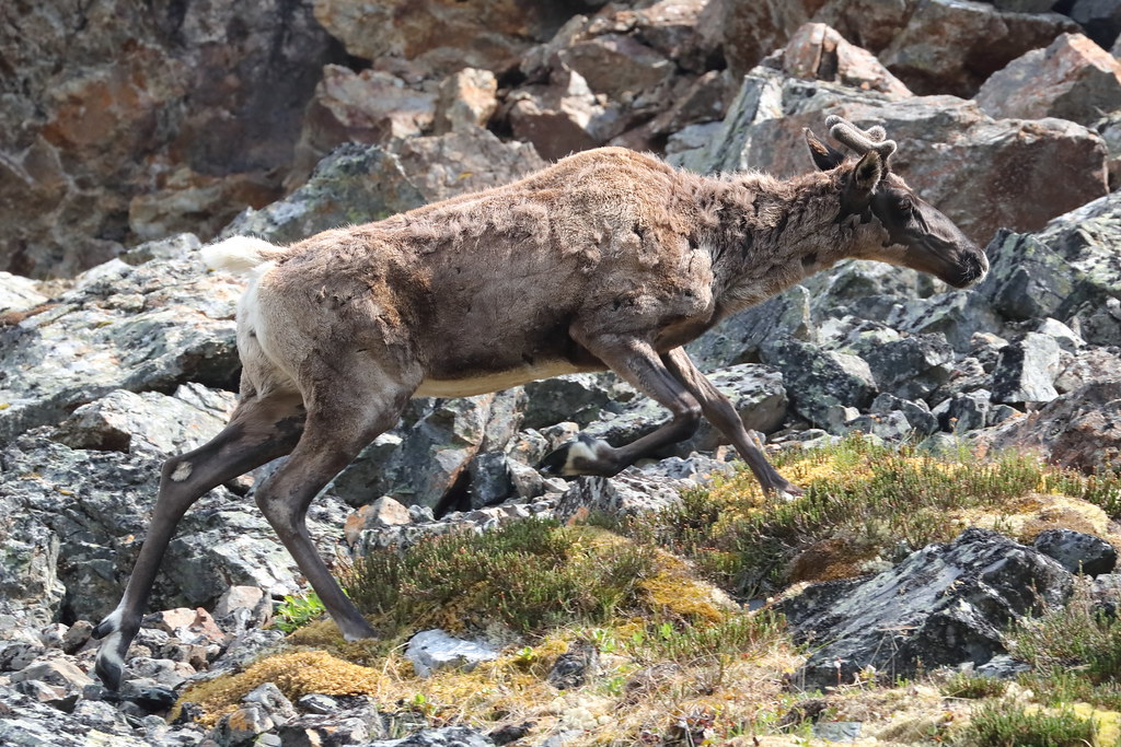
This majestic beast was grazing in the meadows before we inadvertently spooked it
Generic Scenery Photo #94
Mount Frank Rae looms large
Dinner in the cooking tent at Divide Lake
Mother nature provides some dramatic lighting to go with dinner
Day 12 – July 12th
The sun began to burn away the cloud cover of yesterday and rewarded our efforts with a gorgeous day.
The morning view of Mount Monolith
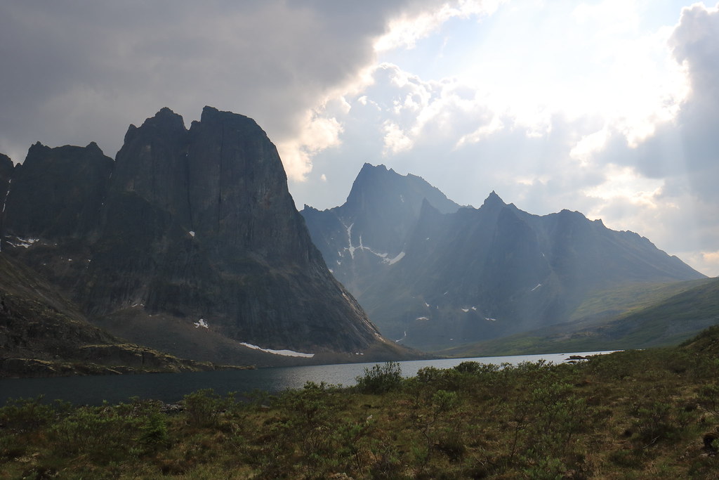
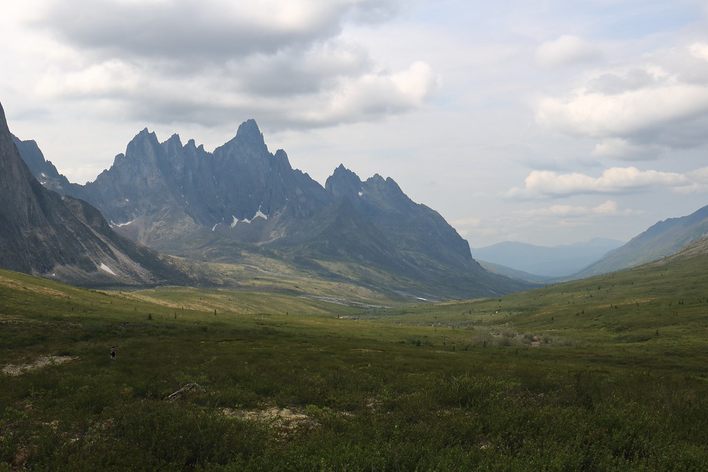
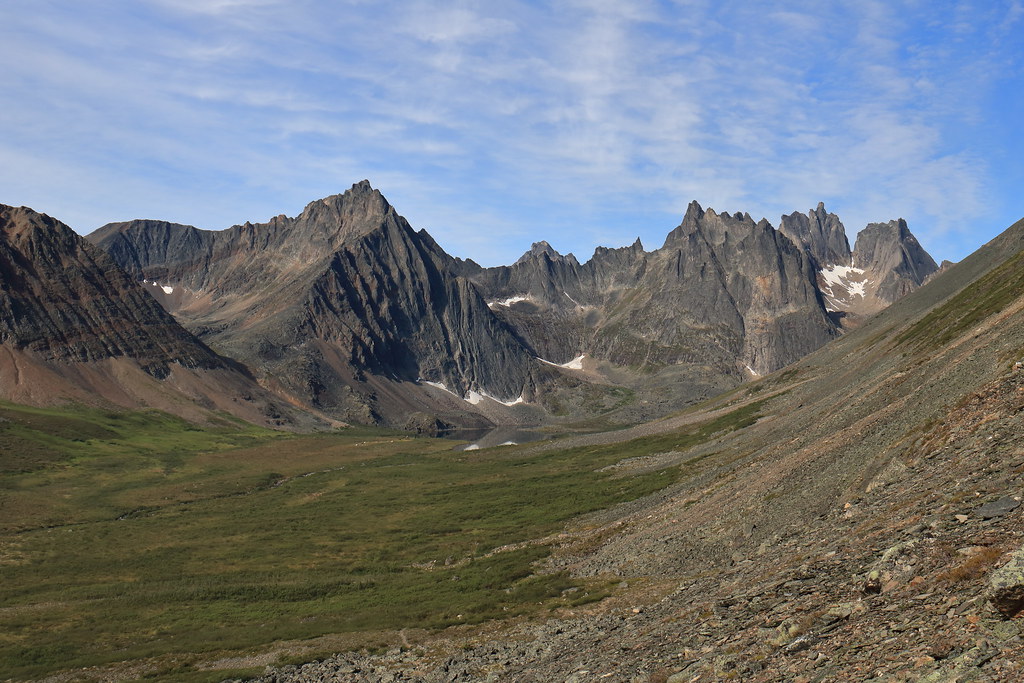
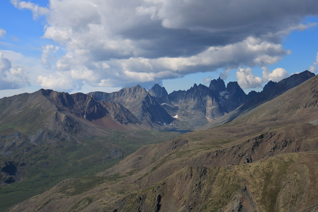
This was our spare day. No backpacks and freedom to roam wherever. We decided to head further west to the next camp site at Talus Lake and then beyond to get a view of the park’s namesake Tombstone mountain. The trail lazes along in the bottom of the valley and so with few exceptions it is fairly easy going.
The day’s hike doesn’t go very far before Tombstone peeks out to greet us.
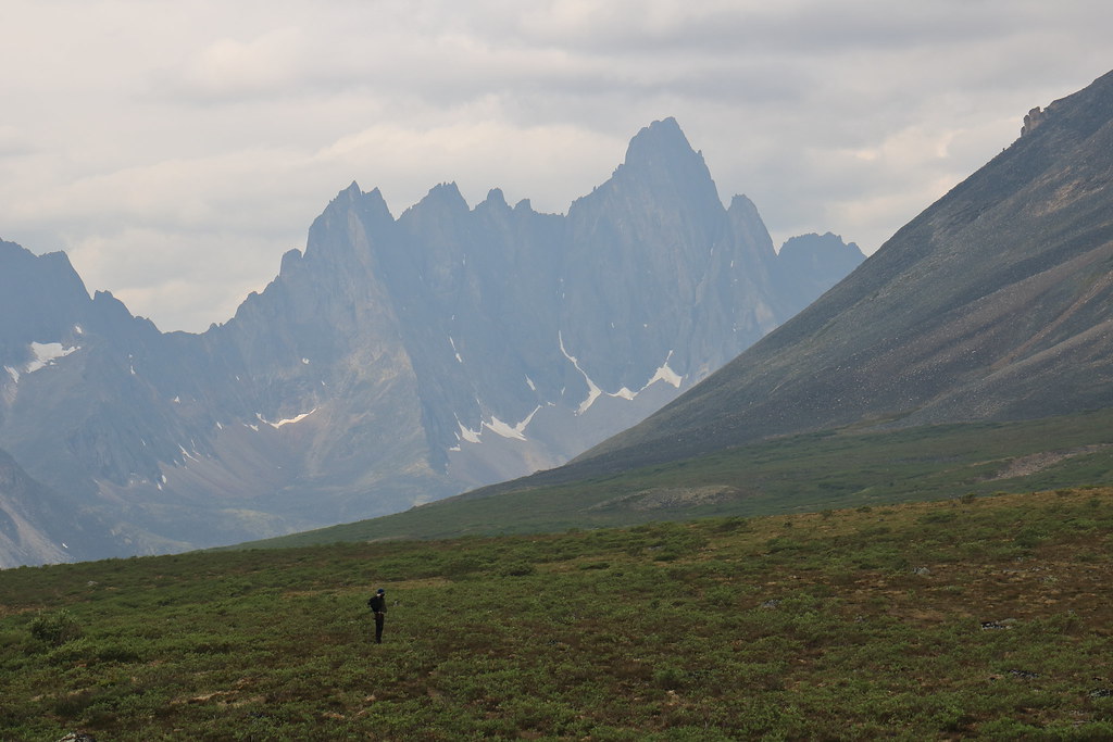
Tombstone mountain way a ways away
Of course, there is plenty of scenery to enjoy enroute
And critters
The view down the valley next to the Tombstone
Once in the shadow of Tombstone mountain, we began hunting for the unknown grave marker to get that classic Tombstone park photo. It took awhile and we only really found it by chance. For any budding Yukon explorers, when you’re down in the scrub you will see a large hill to the south. The unknown grave marker is up on that hill.
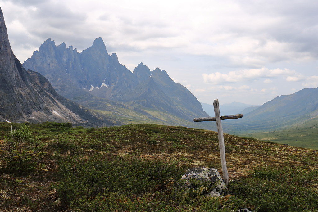
Unknown grave marker. The ruins of an old encampment are a short distance back from this location
The return hike was as easy. However, the changing sun offered new lighting on the massive rocky protrusions.
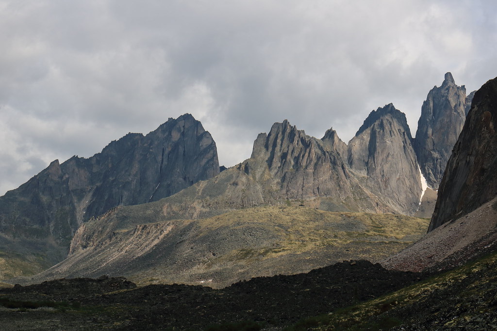
Jagged rocky peaks
Generic Landscape Photo #132
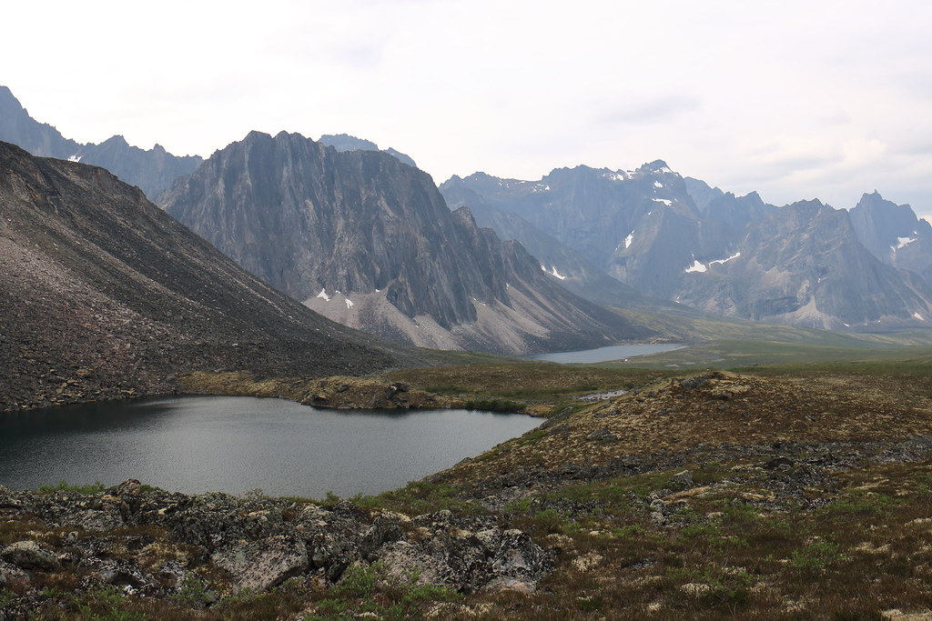
The two white dots towards the end of the lake are the cooking tents
Day 13 – July 13th
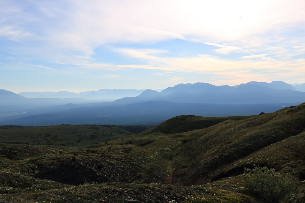
A proper bluebird morning and the haze of forest fire seems to begin lifting (a little too late in my opinion).
The best part of waking up is the view of millions of years of hard geologic formations left behind after softer deposits have eroded away. And possibly Folgers in your cup…
This day marked the beginning of the return trip to the trailhead with the goal of getting back over Glissade pass and down to Grizzly Lake. The blue skies and haze reduction allowed for some better photos.
The approach to Glissade pass, which is that little dip in the ridge, through the lower meadows
Tackling the ‘backside’ of the pass in an upward fashion proved exhausting with every two steps upward mired by one step sinking back downward. It is possible, though, if you just keep at it. As always, try not to kick rocks at those below you whilst also trying not to be below anyone kicking rocks.
Working our way up Glissade pass. No trails here, just unadulterated sink-up-to-your-shin, muddy, scree slope
Proof that we did make it to the top

Grizzly Lake looking much less dreary with some summer sun glistening off it (well it would have been glistening, except I tamped that down with a polarizer)
Day 14 – July 14th
Lucky us, we were graced with another beautiful day. The last leg of the return journey. Back to the trailhead. We spent the day leapfrogging with a pair of park wardens who were in doing spot checks and trail maintenance. They were very friendly.
Another fully-booked night/morning at Grizzly Lake
Saying goodbye to Grizzly Lake as we make the ascent back up onto the ridge
Caught basking in the warm sunlight
Not much had changed in the few days since we had last been on the trail and there was no particular change in difficulty. That being said, a slow ascent in a gusty valley versus a quick ascent through a humid forest; I know which I prefer.
Generic Scenery Photo #1043
Putting footsteps and kilometers between us and Mt Monolith
Generic Hiking Photo #938
The final plunge back down towards the boreal forest
One thing that we did notice is that the portion of the trail through the forest seemed to go on for much longer than it originally had. Chalk that up to beginning of hike vs end of hike mentality, or maybe House of Leaves (literally?) style reality shifting.
Back at the interpretive centre, we signed out of the park, received some complimentary Yukon Parks stickers, and helped ourselves to some free tea before departing for Dawson City.

Free tea steeping on their wood stove
After a hearty dinner and quality drinks, sleep came easy that night.
Day 15 – July 15th
But did not last particularly long. Our flight was shortly after noon from Whitehorse and so we departed from the inn in Dawson City at around 3am.
Fueling the Taurus at 3am in Dawson City
It was a very quiet drive back, both within the vehicle and on the roads. What seemed out of place, however, were the rabbits. Hundreds of rabbits had taken to the highway for whatever reason. Until about day break proper, we would only get a handful of kilometers before more bunches of rabbits. It was strange.
Final thoughts
Each of us wished we could have stayed longer. The rugged, untamed wilderness is like nothing we have here in Ontario. The tundra alpine environment makes for incredible hiking and to that end I would say we each preferred Tombstone to Kluane. That being said, if we had been able to hike Slims River West, maybe the experiences would have been better matched.
The midnight sun is cool and all until it's time to sleep. Then you find your tent is bright as day and thoroughly heated. I would like to return in the autumn, when the darkness begins to return, the temperatures cool off, and the colours become stupendous.
On Canada Day 2017 a trio of us departed from Southern Ontario for the wilds of Canada’s Yukon Territory. We would spend two weeks bouncing around the territory spending time in and around Whitehorse, Kluane National Park, Dawson City, Tombstone Territorial Park, and places in between.
Photography questions tend to be common among backpackers (what do you carry? how do you carry? etc.) so I’ll just touch on this a little bit here. On this trip I packed my Canon Rebel T6i with the following glass: an EF-S 10-18mm f/4.5-5.6 IS STM; an EF 24-70mm f/4L IS USM; and an EF 100-400mm f/4.5-5.6L IS II USM. The majority of the photos were taken using the 24-70mm, whereas the 10-18mm was used (honestly, sparingly) for some vast landscape photos, and the 100-400mm for wildlife photos. I generally hiked with the 100-400mm mounted to the body and ready to go on a PD CaptureClip clamped to my pack shoulder strap. I carried two pouches on my pack hip belt to protect the non-weather-proof camera on rainy days, or just in general: one sized large/long enough to fit the 100-400mm mounted on the T6i, and another to fit both other lenses.
Day 1 – July 1st
Whitehorse is a city not unlike most cities centered on outdoor tourism and natural-resource industries. It has a quiet local character underlying the bustling activity found during the tourism season. What appealed to us most were the food (particularly the local game), drink (ubiquitous Yukon Brewing options), and art (all three of us are patrons of the arts).
Our first stop – after getting our rental Ford Taurus but before dropping our gear at the hotel – was to the Yukon Brewing storefront. I picked up a bottle of Two Brewers Single Malt Whiskey whose quality was pleasantly surprising and was thus found packed into an emptied water bottle during each backpacking outing. After dumping our stuff and Taurus at the hotel we set off to take part in the Canada Day Festivities.
We found ourselves audience to a fiddle showdown featuring a number of talented musicians, many from Old Crow in the far reaches of Yukon’s North. They joked that sometimes the only pastime available was to practice their fiddling and that was why Old Crow produced so many talented fiddlers. After that, we caught the contemporary group July Talk – headlining the Canada Day festivities – and then took in a bit of the midnight sun.
Fiddle Showdown
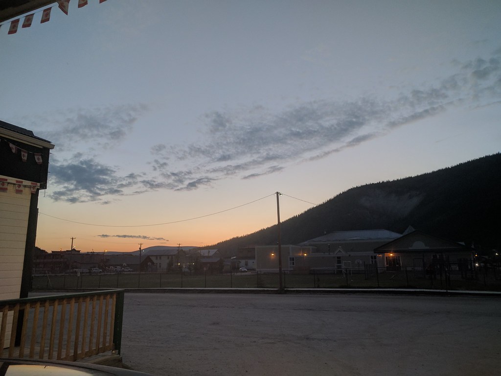
Midnight Sun in Whitehorse
Day 2 – July 2nd
After breakfast we packed up the Taurus and set a course for Haines Junction, nearly two hours due west of Whitehorse. The drive begins relatively uneventfully with little to see beyond the dense boreal forest; however as you move westward the peaks of Kluane National Park begin to peer over the forest crown. By Haines Junction, Mount Martha Black and the Auriol range command your attention, jutting out from the surrounding taiga.
Enroute to Haines Junction, we caught our first glimpse of wildlife: an adolescent-sized grizzly bear bumbling across the highway. This was the first of two grizzly bears encountered throughout the trip. Unfortunately, I couldn’t get my camera out in time for a snapshot.
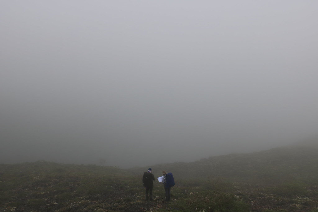
Haines Junction is where the Da Ku Cultural and Kluane National Park Visitor Centre is located. As we discussed our route plan with the park staff we learned that the area we intended to hike – the A’ay Chu (Slims River) West trail – was closed due to increased grizzly activity. So instead, after much deliberation, we opted to use the much shorter Auriol trail as an access to the Auriol range where we would set up a base camp and make daily excursions into the range over the course of the week.
Poring over trail, route, and 3D (shown) maps of Kluane National Park
That evening we packed our bags and relished some quality time in the adjacent bar.
View from the bar patio, Haines Junction
Day 3 – July 3rd
We had a quick breakfast at the Village Bakery (quite popular with outdoors folk of all stripes) before setting off to the trail head. The trailhead is relatively close to Haines Junction – compared to the Slims West or Donjek starting points – and well marked, with plenty of parking. We found the Auriol trail to be fairly straight forward with little in the way of challenge. It was well worn, well blazed, and the camp area towards the end quite obvious. There is an outhouse for when nature calls, a fire pit area, and a nearby stream supplying water.
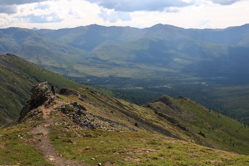
Just starting out on the Auriol trail
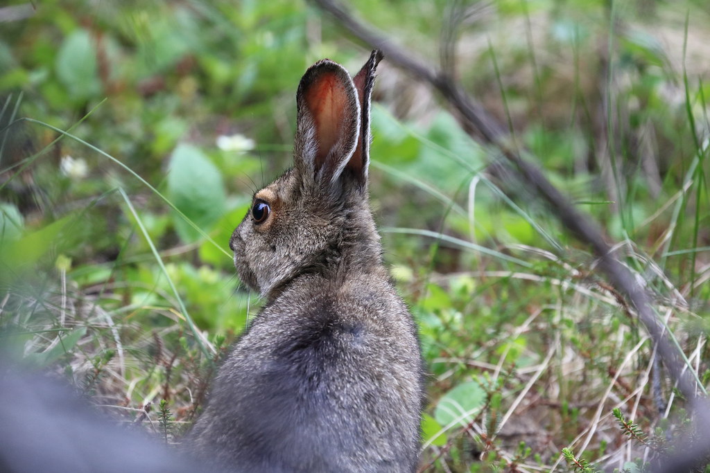
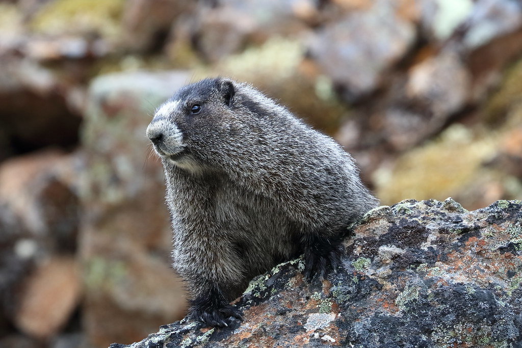
Thankfully the woodland creatures we happened by were of smaller stature, at least though the dense Boreal forest
I should note that the park rents out bear canisters for those who do not have their own. These are a requirement.
With our tent pitched and our gear stashed away, we decided to kill time by plugging further up the moraine, unburdened, to see if we could not locate a suitable base camp to move up to tomorrow. We followed the trail as far west as it would go and then broke off to follow a game trail that wound along the glacial stream running out the range.
This eventually led us to the base of a large moraine. Unfortunately, we spent too much time wandering along the rocky moraine (including locating a pair of ponds) to take notice of any softer base camp locations, so we returned to camp eager to blindly plunge forth the next morning.
Studying the map on the edge of the moraine
Overlooking a pair of alpine ponds before sauntering down for a refill
Heading back to the campsite as clouds roll in
Day 4 – July 4th
The morning began with a low ceiling and some light rain. We ate our breakfast in the comfort of the tent and then broke camp quickly during a precipitation intermission. Following the same route through the scrub that we had taken the evening before to get to the base of the moraine, we pushed a little further westward until we came across greener pastures (literally) before mounting the hill.
At this point the low ceiling closed on us halting any progress. After taking a moment for reorientation, we climbed higher up the mountainside and pushed our way above the cloud cover. We had found a couple well-sheltered locations to pitch the tent, but locating accessible water proved more difficult. It was with a bit of luck that a small well of water was found next to the relatively flat and level pad of greenery to which we affixed our tent.
Putting their orientation skills to use
Getting a better sense of direction above the clouds
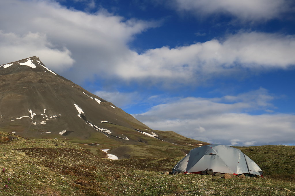
A place to put down some roots, however temporary
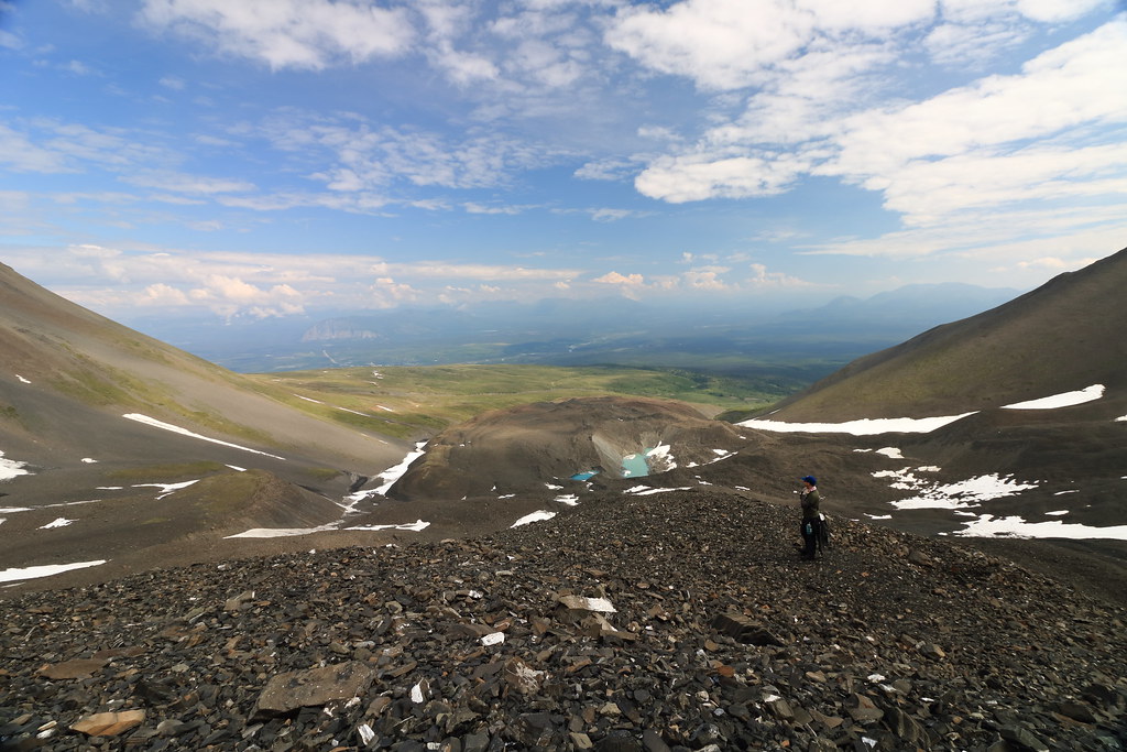
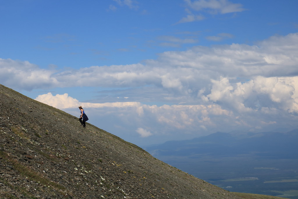
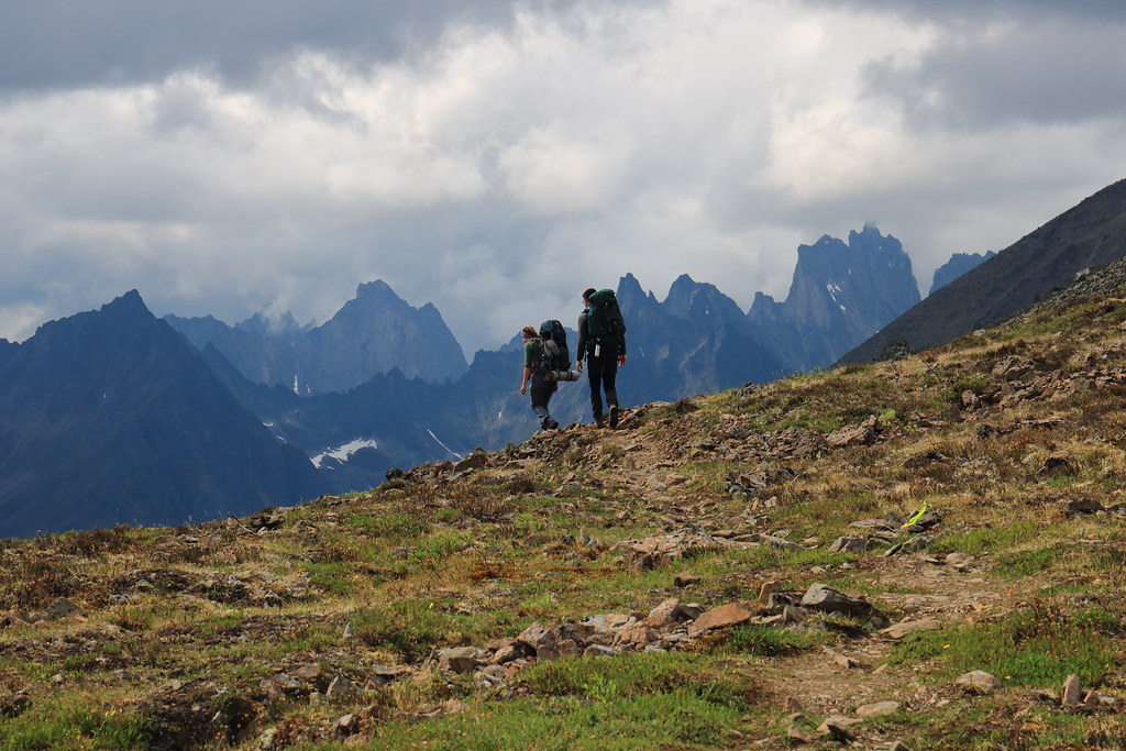
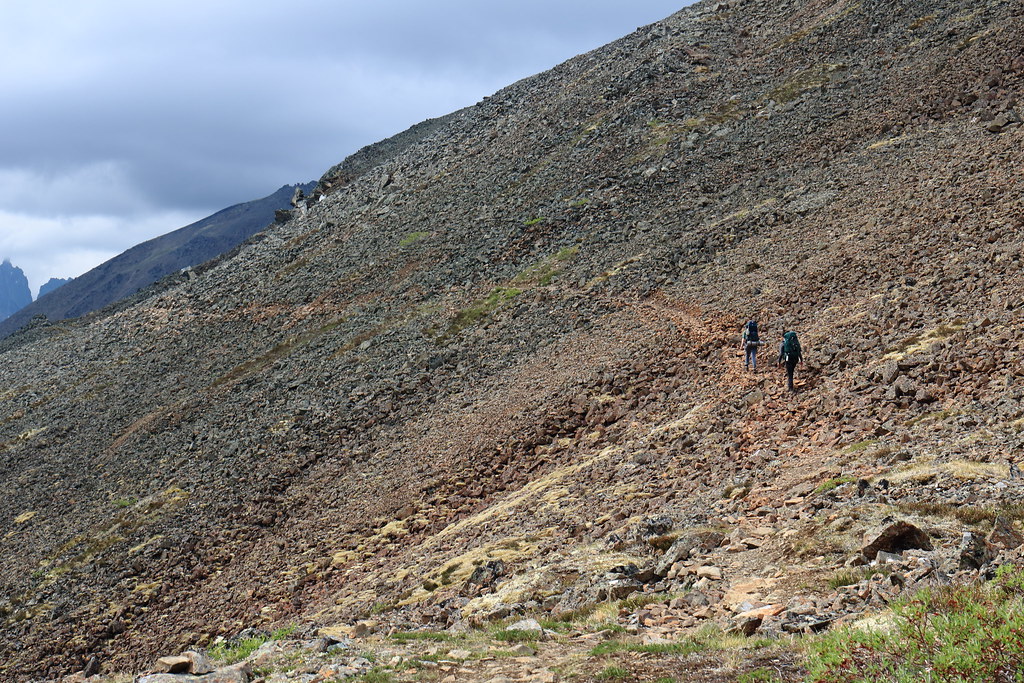
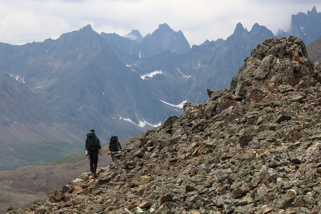
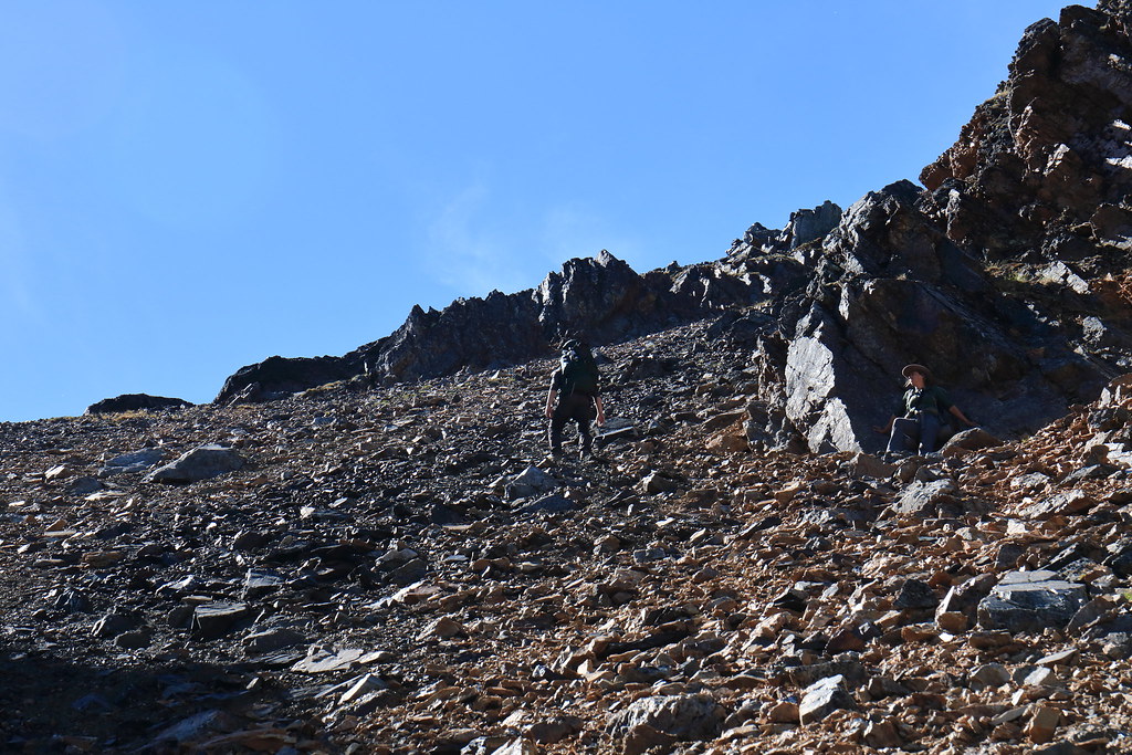
Once camp had been established, one of the group took the opportunity for a nap while the other two of us set off further up the scree to spy some simple routes for tomorrow. This took us up the rocky moraine to the beginning of the alpine ascent proper, where we stopped to take in the easy climbs and short peaks.
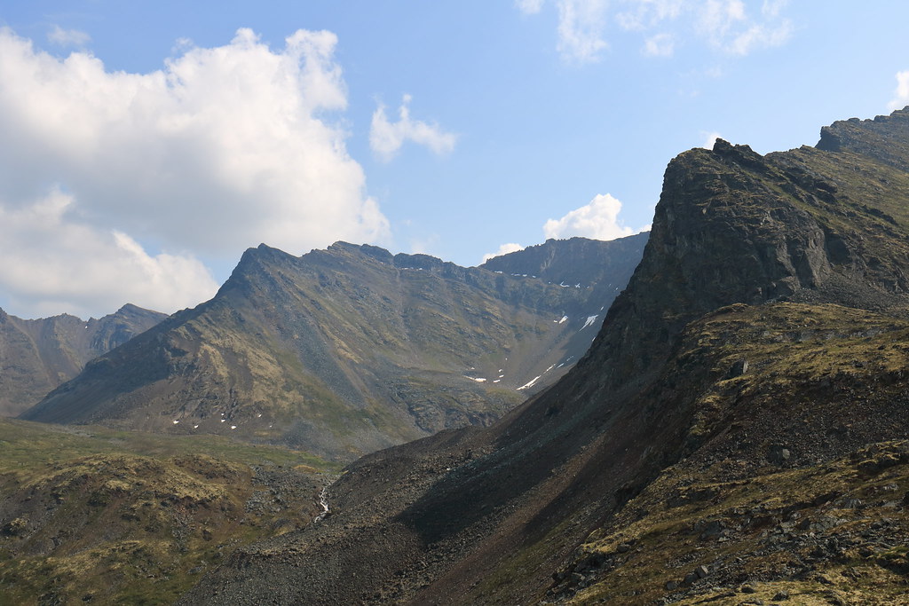
Setting out towards the jagged stone giants
Crossing the hills above the clouds
The alpine flora left me wanting for my proper macro lens (the 24-70mm has a macro setting, however it is clunky compared to the real deal)
Working our way above the moraine ponds
We noted the end of a rocky ridge which would offer good views back down as well as a lower traverse around another peak. The plan would be to give both of these a try the following day.
Day 5 – July 5th
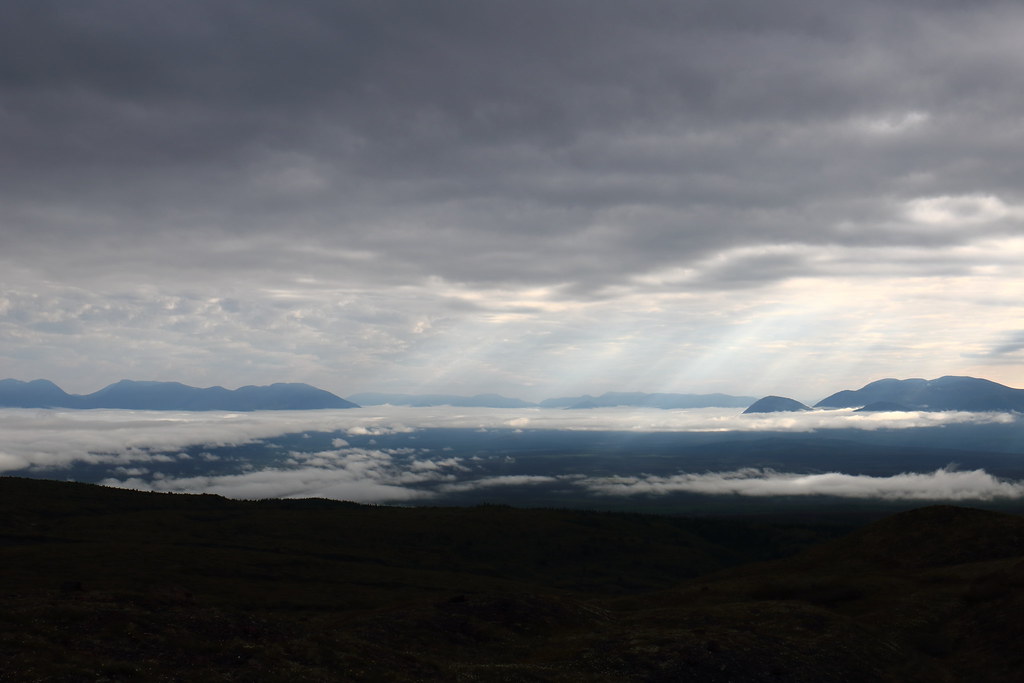
Breakfast was paired with overcast skies, both above and below. Sunlight filtered through the upper ceiling creating stunning views of the cloudy white sea laid before us on our mountainside perch.
Returning from the, uh, ‘morning walk’
In a land scorched by sunlight 24-hours a day, heavy cloud cover was a blessing at times
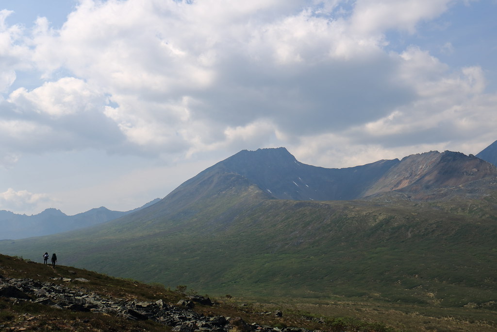
With camp secured against unwanted visitors, we departed following the route determined the day prior. Rather than describe the routes and views, I’ll simply post a mass of photos.
Now making our way well above the two ponds
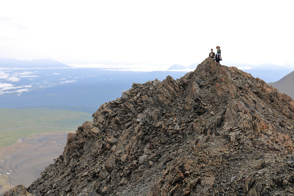
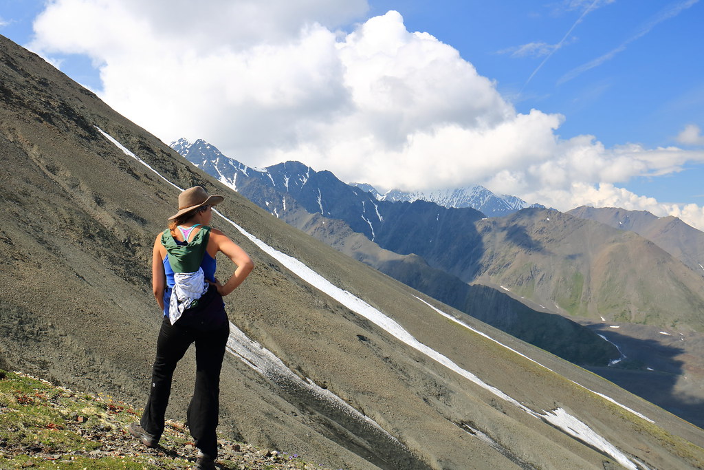
Time and effort found the group atop the ridge’s small end peak
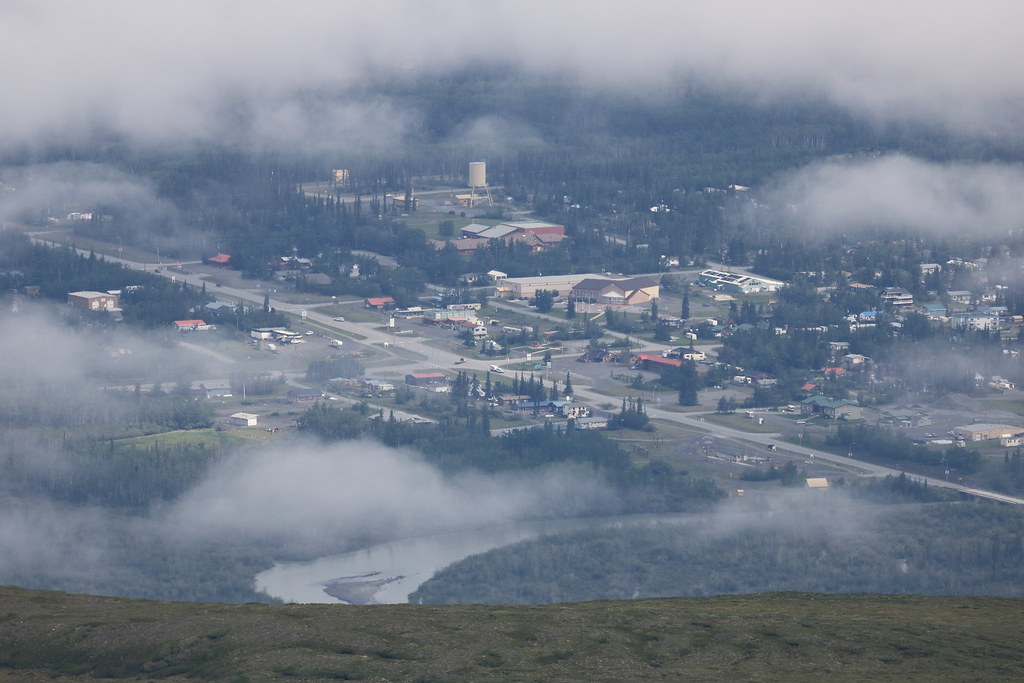
Haines Junction at 400mm
Working her way around the traverse
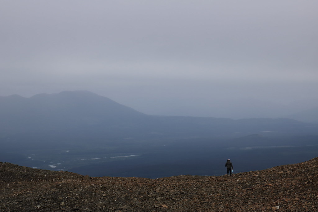
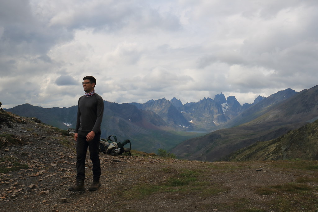
Stopping for a rest (Haines Junction in background)
Not quite able to see Mt Martha Black from this vantage point (just behind the slope)
The azure allure of those distant formations
Although some time was spent scanning for further routes to hike on the following day – before hiking out on Friday – it was determined that there were none that either did not require the use of proper mountaineering tools or were within the skill range of all group members. To this end, we decided to end our stay here earlier than originally expected by hiking out on the following day.
Day 6 – July 6th
The day was largely uneventful. Camp was broken and we hiked out much the same way we had hiked in. Upon depositing the bear canister back at the park office and signing out of the park, we once again took up the task of finding a trail to hike as a day hike the next day. Slims River west was selected, or at least a short side trail thereof known as the Sheep Creek trail.
The remainder of the day was the typical post-backpacking ritual: showers all around, hearty meals, plentiful drinks, inventories of gear (both backpacking and travelling), etc.
Day 7 – July 7th
This day began with DIY breakfast from the Little Green Apple Grocery store, where snacks for the day hike were also purchased.
The drive to the Tachal Dhal Visitor Centre at the southern tip of Kluane Lake was about 45 minutes and provided beautiful scenery. The centre was informative and had interactive exhibits including field glasses for observing the Dahl sheep grazing on the impossibly steep mountainside.
The trailhead was further down a single lane bush road that would have been trouble had a vehicle from the opposite direction crossed our path. Fortunately, we managed to get in and found the trail well marked and easy to follow. Given that two us were feeling a little ‘slow’ from the night prior, our pace was relaxed and easy going.
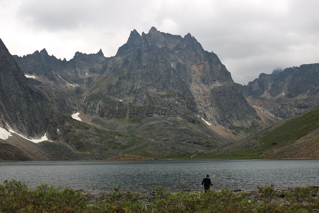
View down Slims River from the Sheep Creek trail
Views from the rest area part way up the trail
From here, we drove straight back to Whitehorse where we would spend the night before heading to Dawson City the next morning.
After getting ourselves established at the hotel and getting some grub, we headed out to the Takhini Hot Springs to soak away our aches and pains in preparation for the upcoming jaunt through Tombstone Territorial Park. To get there, you follow what feels like an unassumed backroad until you’re sure you must have passed a turn-off somewhere, then you go a little further until the establishment’s packed parking lot comes into view (it’s a pretty popular place). It was a great experience that I would recommend to anyone who finds themselves with a spare evening in Whitehorse.
Day 8 – July 8th
Our first Tim Horton’s breakfast of the trip. A quick stop at Canadian Tire to pick up a jerry can (just in case). And then we were off on the 6-ish hour trip up the Klondike highway. The highway condition varies between well paved and gravel, though it is quite well kept. I forgot to mention earlier, but a solid percentage of the traffic in this region consists of RVs. Many of which heading up the Klondike are likely enroute to the Dempster highway (or Top of the World highway, or both). These tend to move slow and the highway can get fairly windy, so pass with caution. There are ample opportunities for fuel, at least for a Taurus-sized/type vehicle (the jerry can was returned, unused).
Landscape-wise, the boreal forest slowly shrinks in height and thins as pockets of scrubby tundra creep in amongst the trees. However, the area around Dawson City still exhibits a forest rife with stubborn trees. It is not until the final approach to the Tombstone Interpretive Centre along the Dempster highway that tundra shrubbery begins to overtake trees as the primary vegetation.
The first thing we did upon arriving in Dawson City is drop our gear and our Taurus at our inn. The downtown area of Dawson is quaintly small and easily walkable. The entire town seemingly pays homage to its goldrush roots. This rarely feels gimmicky, likely due to the authenticity of its claim to this schtick. Note that any slight sepia tone (and going forward, generally haziness) of the photos is due to forest fire haze, not because the town exudes that much old-timey-ness.
The old-timey, gold-rush aesthetic: clapboard, boardwalks, and muddy streets
The food and drink here, much like Whitehorse, is superb. At least for short enough stays (quality and quantity of options are good, quantity of establishments is as expected of a smaller town).
Klondike Kate’s patio was quite relaxing and the food fantastic.
Our first night in town saw us find our way to the Downtown Hotel bar. If you’ve heard anything about the drinks in Dawson City, surely it’s of the Sour Toe Cocktail. At a certain time, for a certain fee, and under the watchful eye of a certain Captain, patrons can ‘enjoy’ a shot of alcohol (typically Yukon Jack whisky) garnished with a mummified human toe. As they say: “you can drink it fast, you can drink it slow, but your lips must touch the toe!” Those who complete the ritual are inducted into the Sour Toe Cocktail Club. Anyone curious about the finer details (history, etc.) can find more information here:
dawsoncity.ca/attraction/sourtoe-cocktail-club/
Piano man is a regular nightly fixture, however the violinist was a tourist ‘sitting in’ with him
Preparing to join the Sour Toe Cocktail club. The toe sits atop a mound of salt
Day 9 – July 9th
A spare day to explore in and around Dawson City. We kicked off the day with a walk about the town. Took in the sight of the SS Keno; an old paddle boat sitting atop the riverbank turned into a National Historic Site (I assume this means it’s now a museum).
SS Keno National Historic Site
At the Klondike Information Centre, we learned that our Canada Parks pass would permit us to visit one historic site for free, so we grabbed tickets to check out Dredge No.4. Throughout the tour we learned that massive dredges like these were the reason for the worm-like tailings formations throughout the valley bottom leading up to Dawson City (Google Maps Satellite view shows these well); that placer mining tailings are as clean as they had been before being dredged up and so it was possible to build atop these formations without significant remediation processes; that due to the massive power requirement of these machines (electrically powered!), Dawson City was among the first cities in North America wired for electricity; and that the placer miner dredges were designed to sift out gold flakes, however nuggets would go straight through and may to this day lie somewhere among the tailings.
Model of Dredge No.4 in the visitor centre
The massive Dredge No.4 in the flesh
Some inner workings of the dredge
Dredge control room at the peak of the timber and steel structure
The series of winches, controlled by the levers above, which control the dredge’s positioning and operations
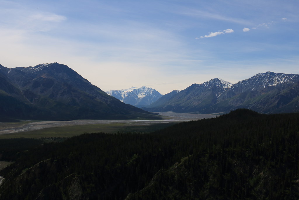
We drove up to the Midnight Dome lookout after this to take in the sight of Dawson City and the Yukon River.
Across the river you can see the beginning of the Top of the World highway as it winds around the hill
After dinner, we bought our way into Diamond Tooth Gertie’s Gambling Hall to catch the can-can shows and enjoy some more of the Klondike aesthetic. Of everything we had experienced in Dawson thus far, this was perhaps the one I’d describe as being closest to kitsch. Regardless, it was an enjoyable time, though we were probably the youngest of the patrons.
Can-can show at Diamond Tooth Gertie’s Gambling Hall
Day 10 – July 10th
With a quick inn breakfast, we headed off to the Tombstone Territorial Park Interpretive Centre to begin our journey into said park. The two-hour drive took us up the first 70km of the Dempster highway, known for its rugged and lonely existence. A small winding path of dirt cutting through a massive open landscape. I’d love to go back and drive its 880km length all the way up to Tuktoyaktuk, Northwest Territories (69+ degrees North!).
As promised, the road was rugged and the rental companies all made sure to inform renters that damage incurred on the Dempster would not be covered by their standard damage converge, only their extended coverages. The Taurus handled the drive well and we made good time to Tombstone.
We took some of the Dempster with us to Tombstone and then back to Whitehorse
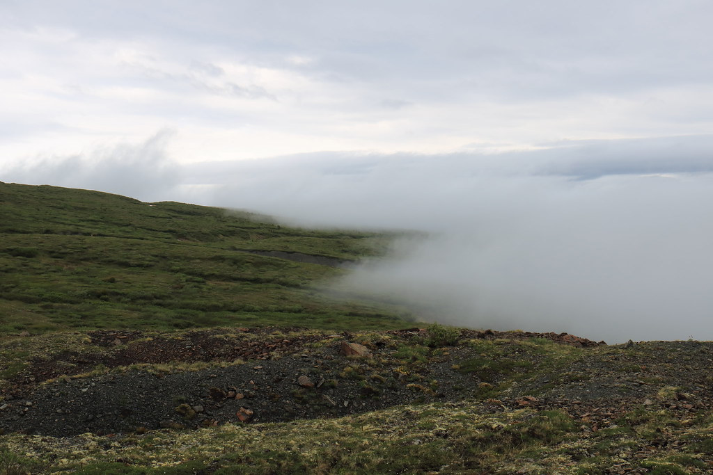
Our views of Tombstone obscured by fog
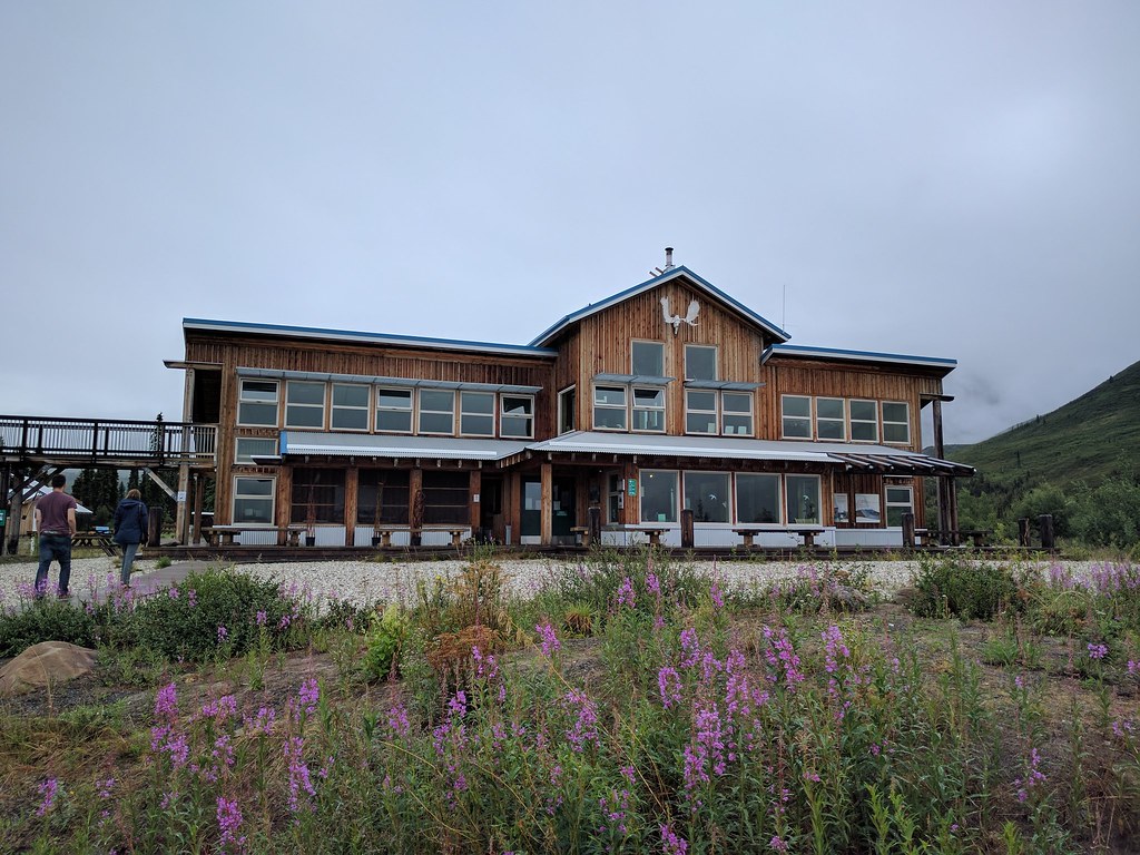
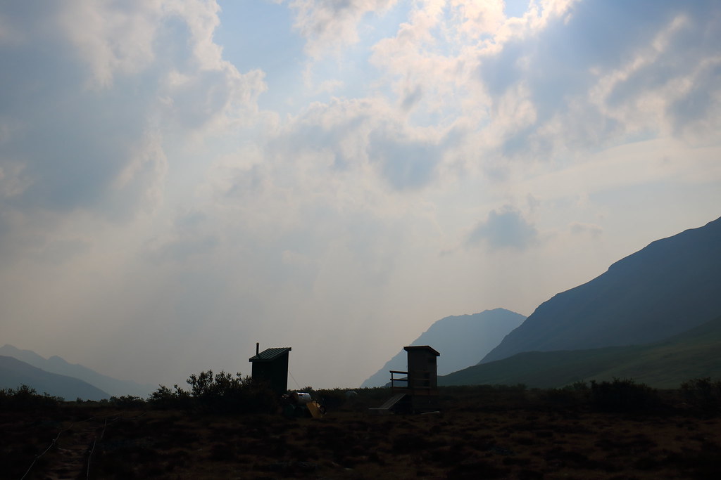
The relatively new interpretive centre
We signed into the park, received a quick orientation as well as a pair of bear canisters, and then departed for the trailhead a short ways back towards Dawson.
The most popular portion of the hike (in to Grizzly Lake), but only our first day
Another 3D map
From the trailhead, the path winds through a sub-tundra boreal forest replete with babbling streams and surprising humidity given the latitude. Through this length of trail it is important to keep eyes and ears open for bears. After an hour or so of weaving through the trees the ascent begins in earnest. The trail starts to form large switchbacks as it breaks through the overhead canopy and into head-high shrubbery. This continues for what seems like ages until both the switchbacks and the shrubs are left behind in a direct dash for the Mt Monolith lookout. This is where we (finally) stopped for a rest and I managed to snap some photos. This is as far as many groups get and comprises the majority of the day trail. As such, the ground squirrels in this area are aware of the connection between humans and food and are not too shy to chitter in hopes of a snack.
Ground squirrel hoping to snag some food
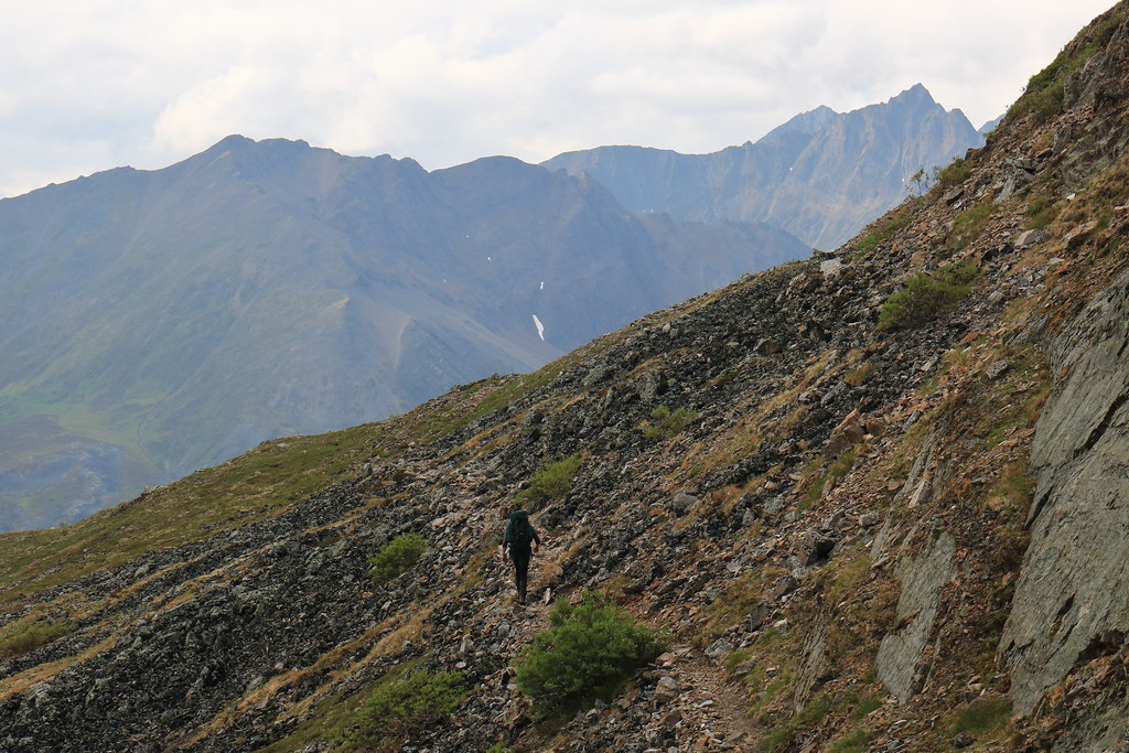
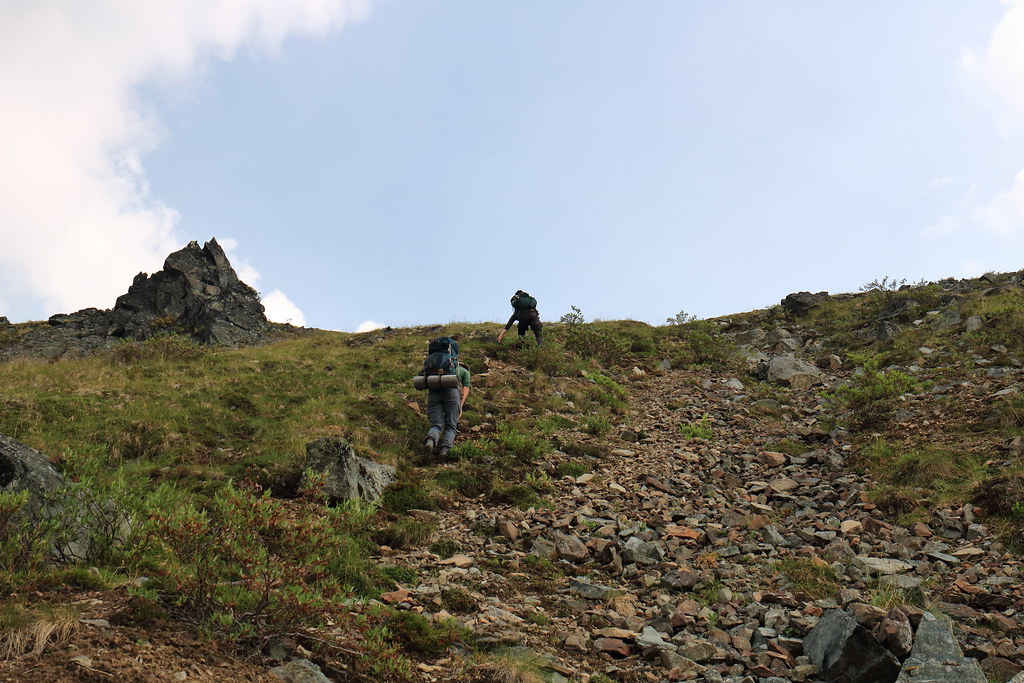
Easy going at this point
The caveat with stopping for photography is that it often leads to the others getting much further ahead
A rest with a view
A squirrel’s eye view too
Generic hiking shot #23
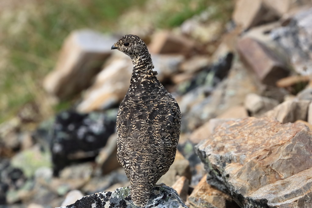
Posing for me
As did this fella
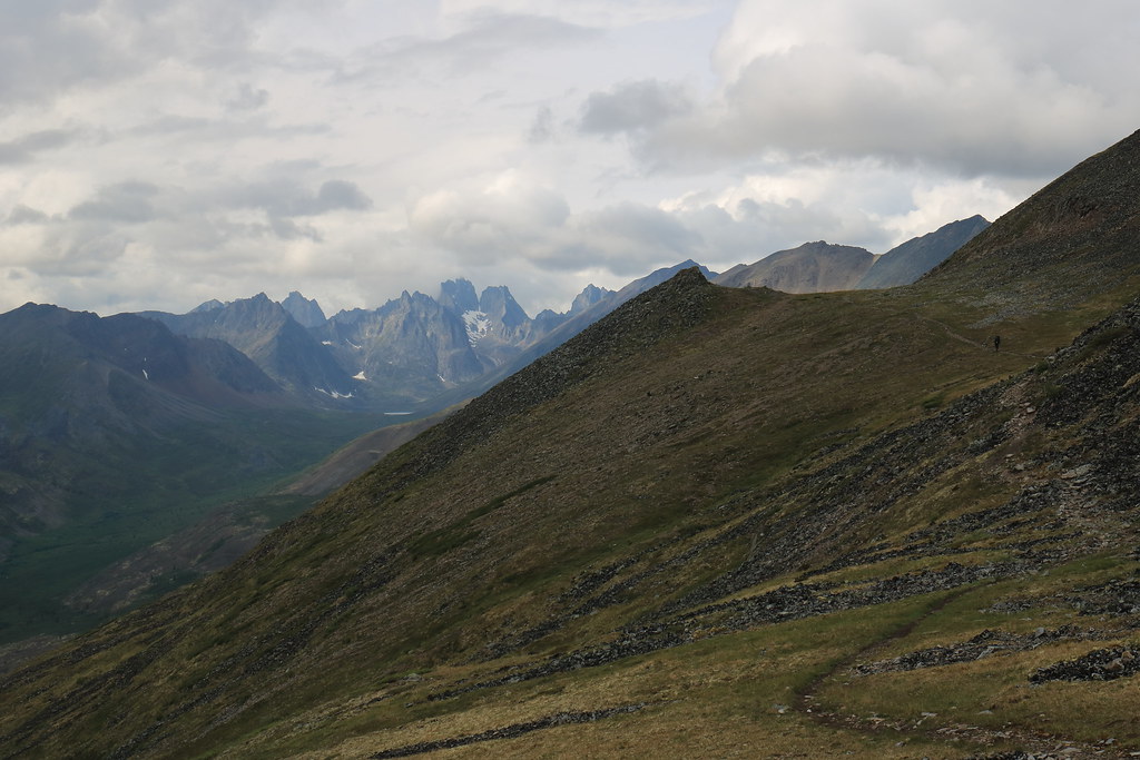
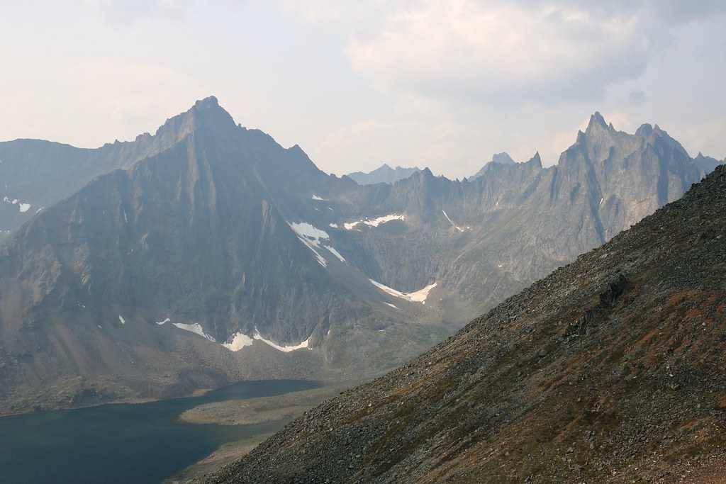
Impressive views just beyond the next crest
Plenty of scree-filled swaths for the discerning mountain-going connoisseur
Generic hiking shot #36
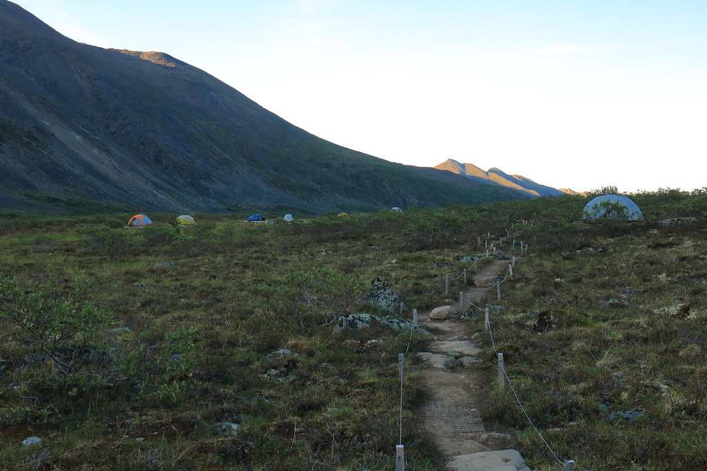
Descending towards the Grizzly Lake campsite. The white dot on the near shore is the cooking tent
The campsite is well organized with w e l l – s p a c e d tent pads, a pair of outhouses, two cooking tents, a grey-water barrel, and food lockers. There are also demarcated pathways – not unlike roads – leading between all these locations. This is all to protect the fragile tundra environment as much as possible.
This campground is often fully-booked and frequented by park wardens, but outside of dinner time, it hardly feels crowded at all. At dinner time, it pays to be friendly, where different groups are generally happy to swap interesting stories and bits of information pertaining to further up the trail (if they are regulars or just on their way back).
Washing up and/or soaking and/or collecting water
Day 11 – July 11th
This day brought with it decent, if not hot, weather for the passage from Grizzly Lake to Divide Lake just over Glissade Pass. We were warned about Glissade Pass by the park staff and countless Tombstone trip reports prior. Our side – the Grizzly Lake side – is supposed to be the easy side, but it was a fairly tough slog that felt much steeper than I’m sure it was.
But before any of that, we woke up to this envious view:
An morning view to be envious of
And then found that there was a bit of traffic jam for these:
A less envious view?
However, in good time we found ourselves at the base of Glissade pass looking up and began our ascent.
A couple views from part way up, depending on which direction you were looking
And when we finally crested the pass, one of the party looks back to me (I’m slow) and asks, “where the heck did you bring us?!”
Peering over the ‘backside’ of Glissade Pass
Yeah, sure, it was steep, but descending is always steeper than ascending. Of course, we weren’t thinking of having to ascend it again yet.
The view from up there was pretty, though
In the end, there was a slight trail we could follow where prior boots had beat in a primitive switchback. It was not as bad as it had looked from above. Especially once we began to employ some glissading.
Starting down
Continuing down
Eventually, the trail takes you off the scree and into a meadow where the descent continues. There are a handful of boulder patches to traverse through this section, but eventually you work around a hill and Mount Frank Rae rises up before you. Mt Frank Rae is the tallest peak in the park and looms over the Divide Lake camp site. From this point, the hiking is easy traversing across the hills and eventually right down into the camp site.
Meadows below Glissade Pass
This majestic beast was grazing in the meadows before we inadvertently spooked it
Generic Scenery Photo #94
Mount Frank Rae looms large
Dinner in the cooking tent at Divide Lake
Mother nature provides some dramatic lighting to go with dinner
Day 12 – July 12th
The sun began to burn away the cloud cover of yesterday and rewarded our efforts with a gorgeous day.
The morning view of Mount Monolith
This was our spare day. No backpacks and freedom to roam wherever. We decided to head further west to the next camp site at Talus Lake and then beyond to get a view of the park’s namesake Tombstone mountain. The trail lazes along in the bottom of the valley and so with few exceptions it is fairly easy going.
The day’s hike doesn’t go very far before Tombstone peeks out to greet us.
Tombstone mountain way a ways away
Of course, there is plenty of scenery to enjoy enroute
And critters
The view down the valley next to the Tombstone
Once in the shadow of Tombstone mountain, we began hunting for the unknown grave marker to get that classic Tombstone park photo. It took awhile and we only really found it by chance. For any budding Yukon explorers, when you’re down in the scrub you will see a large hill to the south. The unknown grave marker is up on that hill.
Unknown grave marker. The ruins of an old encampment are a short distance back from this location
The return hike was as easy. However, the changing sun offered new lighting on the massive rocky protrusions.
Jagged rocky peaks
Generic Landscape Photo #132
The two white dots towards the end of the lake are the cooking tents
Day 13 – July 13th
A proper bluebird morning and the haze of forest fire seems to begin lifting (a little too late in my opinion).
The best part of waking up is the view of millions of years of hard geologic formations left behind after softer deposits have eroded away. And possibly Folgers in your cup…
This day marked the beginning of the return trip to the trailhead with the goal of getting back over Glissade pass and down to Grizzly Lake. The blue skies and haze reduction allowed for some better photos.
The approach to Glissade pass, which is that little dip in the ridge, through the lower meadows
Tackling the ‘backside’ of the pass in an upward fashion proved exhausting with every two steps upward mired by one step sinking back downward. It is possible, though, if you just keep at it. As always, try not to kick rocks at those below you whilst also trying not to be below anyone kicking rocks.
Working our way up Glissade pass. No trails here, just unadulterated sink-up-to-your-shin, muddy, scree slope
Proof that we did make it to the top
Grizzly Lake looking much less dreary with some summer sun glistening off it (well it would have been glistening, except I tamped that down with a polarizer)
Day 14 – July 14th
Lucky us, we were graced with another beautiful day. The last leg of the return journey. Back to the trailhead. We spent the day leapfrogging with a pair of park wardens who were in doing spot checks and trail maintenance. They were very friendly.
Another fully-booked night/morning at Grizzly Lake
Saying goodbye to Grizzly Lake as we make the ascent back up onto the ridge
Caught basking in the warm sunlight
Not much had changed in the few days since we had last been on the trail and there was no particular change in difficulty. That being said, a slow ascent in a gusty valley versus a quick ascent through a humid forest; I know which I prefer.
Generic Scenery Photo #1043
Putting footsteps and kilometers between us and Mt Monolith
Generic Hiking Photo #938
The final plunge back down towards the boreal forest
One thing that we did notice is that the portion of the trail through the forest seemed to go on for much longer than it originally had. Chalk that up to beginning of hike vs end of hike mentality, or maybe House of Leaves (literally?) style reality shifting.
Back at the interpretive centre, we signed out of the park, received some complimentary Yukon Parks stickers, and helped ourselves to some free tea before departing for Dawson City.
Free tea steeping on their wood stove
After a hearty dinner and quality drinks, sleep came easy that night.
Day 15 – July 15th
But did not last particularly long. Our flight was shortly after noon from Whitehorse and so we departed from the inn in Dawson City at around 3am.
Fueling the Taurus at 3am in Dawson City
It was a very quiet drive back, both within the vehicle and on the roads. What seemed out of place, however, were the rabbits. Hundreds of rabbits had taken to the highway for whatever reason. Until about day break proper, we would only get a handful of kilometers before more bunches of rabbits. It was strange.
Final thoughts
Each of us wished we could have stayed longer. The rugged, untamed wilderness is like nothing we have here in Ontario. The tundra alpine environment makes for incredible hiking and to that end I would say we each preferred Tombstone to Kluane. That being said, if we had been able to hike Slims River West, maybe the experiences would have been better matched.
The midnight sun is cool and all until it's time to sleep. Then you find your tent is bright as day and thoroughly heated. I would like to return in the autumn, when the darkness begins to return, the temperatures cool off, and the colours become stupendous.


